Kitaaiki, Nagano
| Kitaaiki 北相木村 | |||
|---|---|---|---|
| Village | |||
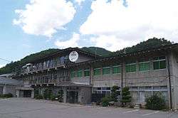 Kitaaiki Town Hall | |||
| |||
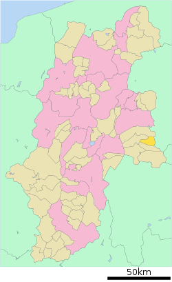 Location of Kitaaiki in Nagano Prefecture | |||
 Kitaaiki | |||
| Coordinates: 36°3′33.1″N 138°33′4.2″E / 36.059194°N 138.551167°ECoordinates: 36°3′33.1″N 138°33′4.2″E / 36.059194°N 138.551167°E | |||
| Country | Japan | ||
| Region | Chūbu (Kōshin'etsu) | ||
| Prefecture | Nagano | ||
| District | Minamisaku | ||
| Area | |||
| • Total | 56.32 km2 (21.75 sq mi) | ||
| Population (October 2016) | |||
| • Total | 852 | ||
| • Density | 15.1/km2 (39/sq mi) | ||
| Time zone | UTC+9 (Japan Standard Time) | ||
| Symbols | |||
| • Tree | Larch | ||
| • Flower | Rhododendron | ||
| • Bird | Copper pheasant | ||
| Phone number | 0267-77-2111 | ||
| Address | 2774 Kitaaiki-mura, Minamisaku-gun, Nagano-ken 384-1201 | ||
| Website | http://vill.kitaaiki.nagano.jp/ | ||


Kitaaiki (北相木村 Kitaaiki-mura) is a village located in Nagano Prefecture, Japan. As of 1 October 2016, the village had an estimated population of 852, and a population density of 15.1 persons per km². Its total area is 56.32 square kilometres (21.75 sq mi).
Geography
Kitaaiki is located in mountainous eastern Nagano Prefecture, bordered by Gunma Prefecture to the east. More than 90% of the village area is covered by mountains and forest. Mout Ogura (2,112 meters) is the highest point in the village.
Surrounding municipalities
History
The area of present-day Kataaiki was part of ancient Shinano Province, and was mentioned in Muromachi period records. The modern village of Kitaaiki was created with the establishment of the municipalities system on April 1, 1889.
Education
Kitaaiki has one public elementary school operated by the village government. The village shares a public middle school with neighboring Minamiaika. The village does not have a high school.
Transportation
Railway
- The village does not have any passenger rail service.
Highway
- The village is not served by any national highways
External links

- Official Website (in Japanese)
| Core city | |
|---|---|
| Special city | |
| Cities | |
| Districts | |