Issyk-Kul District
| Issyk-Kul District Ысык-Көл району Иссык-кульский район | |
|---|---|
| District | |
| Ысык-Көл району | |
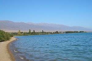 Lake Issyk Kul shoreline at Tamchy, Issyk Kul district | |
 | |
| Country | Kyrgyzstan |
| Region | Issyk Kul Region |
| Area | |
| • Total | 3,603 km2 (1,391 sq mi) |
| Population (2009) | |
| • Total | 75,533 |
| • Density | 21/km2 (54/sq mi) |
| Time zone | UTC+5 (GMT +5) |
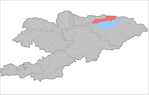
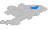
Issyk-Kul District (Kyrgyz: Ысык-Көл району, Isıq-Köl rayonu, ىسىق-كۅل رايونۇ; Russian: Иссык-кульский район, Issyk-kuljskij rajon) is a raion (district) of Issyk-Kul Region in north-eastern Kyrgyzstan. The capital lies at Cholpon-Ata.[1] Its area is 3,603 square kilometres (1,391 sq mi), and its resident population was 75,533 in 2009.[2]
The district is located on the northern shore of Issyk Kul and on the southern slopes of the Küngöy Ala-Too Range, which dominate much of the landscape.
Populated places
In total, Issyk-Kul District include 1 town and 30 settlements in 12 rural communities (aiyl okmotus). Each rural community may include one or several villages. The rural communities and settlements in the Issyk-Kul District are:[3]
- town of district significance Cholpon-Ata
- Anan'yevo aiyl okmotu (3: center - village: Anan'yevo, and also villages Kök-Döbö, and Chet-Baysoorun)
- Bosteri aiyl okmotu (2: center - village: Bosteri; and also village Baktuu-Dolonotu)
- Sadyr Ake aiyl okmotu (2: center - village: Grigor'yevka; and also village Grigor'yevskaya Pristan')
- Kara-Oy aiyl okmotu (1: center - village: Kara-Oy)
- Kum-Bel' aiyl okmotu (2: center - village: Korumdu; and also village Bulan-Segettu)
- Semyonovka aiyl okmotu (2: center - village: Semyonovka; and also village Kojoyar)
- Tamchy aiyl okmotu (3: center - village: Tamchy; and also villages Koshkol' and Chyrpykty)
- Abdrakhmanov aiyl okmotu (2: center - village: Jarkynbaevo; and also village Karool-Döbö)
- Temirov aiyl okmotu (2: center - village: Temirovka; and also village Kashat)
- Toru-Aygyr aiyl okmotu (3: center - village: Toru-Aygyr; and also villages Kyzyl-Oruk and Sary-Kamysh)
- Örüktü aiyl okmotu (3: center - village: Chong-Örüktü; and also villages Orto-Örüktü and Örüktü-Khutor)
- Chong Sary Oy aiyl okmotu (5: center - village: Chong-Sary-Oy; and also villages Baetovka, Örnök, Sary-Oy and Chok-Tal)
Gallery
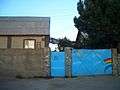 Guesthouse at Tamchy
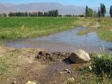 Irrigation
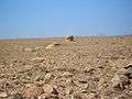 Desert above Tamchy
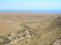 In the desert above Tamchy. Choktal peninsula in the background.
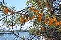 Sea buckthorn shrubs on the lake shore east of Kosh Köl
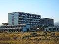 An abandoned resort at Kosh Köl.
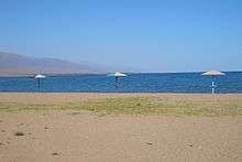 On the beach at Kosh Köl.
See also
References
- ↑ Enrin.grida.no Archived 2009-08-02 at the Wayback Machine.
- ↑ "2009 population census of the Kyrgyz Republic: Issyk-Kul Region" (PDF). Archived from the original on 10 August 2011. Retrieved 2017-01-04.
- ↑ List of Rural Communities of Kyrgyzstan Archived 2010-02-09 at the Wayback Machine.
| North Krygyzstan |
|  | ||||||||||
|---|---|---|---|---|---|---|---|---|---|---|---|---|
| South Krygyzstan |
| |||||||||||
This article is issued from
Wikipedia.
The text is licensed under Creative Commons - Attribution - Sharealike.
Additional terms may apply for the media files.