Moskva District, Kyrgyzstan
| Moskva | |
|---|---|
| Raion | |
 The Ak-Suu River flowing from the Narzan valley into the south end of Jardy-Suu village. | |
 | |
| Country | Kyrgyzstan |
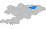
| Region | Chuy Region |
| Stalin District | 1930 |
| Area | |
| • Total | 2,056 km2 (794 sq mi) |
| Population (2009)[1] | |
| • Total | 84,443 |
| • Density | 41/km2 (110/sq mi) |
| Time zone | UTC+5 (GMT +5) |
Moskva (Kyrgyz: Москва району) is a raion (district) of Chuy Region in northern Kyrgyzstan. Its area is 2,056 square kilometres (794 sq mi), and its resident population was 84,443 in 2009.[1] The capital lies at Belovodskoye.[2]
History
Moskva District was established as Stalin District on July 23, 1930. In 1961, it was renamed into Moskva District, after the city of Moscow.
Rural communities and villages
In total, Moskva District includes 28 settlements in 12 rural communities (aiyl okmotus). Each rural community can include one or several villages. The rural communities and settlements in the Moskva District are:[3]
- Ak-Suu aiyl okmotu (7: center - village: Temen-Suu; and also villages Ak-Bashat, Ak-Torpok, Bala-Ayylchi, Keper-Aryk, Murake and Chong-Aryk)
- Aleksandrovka aiyl okmotu (3: center - village: Aleksandrovka; and also villages Besh-Örük and Krupskoye)
- Besh-Terek aiyl okmotu (1: center - village: Besh-Terek)
- Belovodskoye aiyl okmotu (2: center - village: Belovodskoye; and also village Kosh-Döbö)
- Petrovka aiyl okmotu (3: center - village: Petrovka; and also villages Zavodskoye and Kyzyl-Tuu)
- Pervomay aiyl okmotu (1: center - village: Ak-Suu)
- Predtechenka aiyl okmotu (2: center - village: Predtechenka; and also village Ang-Aryk)
- Sadovsky aiyl okmotu (1: center - village: Sadovoye)
- Sretenka aiyl okmotu (3: center - village: Sretenka; and also villages Bolshevik and Zarya)
- Tölök aiyl okmotu (1: center - village: Tölök)
- Tselinny aiyl okmotu (1: center - village: Kyz-Molo)
- Chapaev aiyl okmotu (3: center - village: Spartak; and also villages Ak-Söök and Malovodnoye)
References
- 1 2 "2009 population census of the Kyrgyz Republic: Chuy Region" (PDF). Archived from the original (PDF) on 10 August 2011. Retrieved 2011-08-10.
- ↑ Enrin.grida.no
- ↑ List of Rural Communities of Kyrgyzstan Archived 2010-02-09 at the Wayback Machine.
| North Krygyzstan |
|  | ||||||||||
|---|---|---|---|---|---|---|---|---|---|---|---|---|
| South Krygyzstan |
| |||||||||||
Coordinates: 42°49′44″N 74°07′24″E / 42.829006°N 74.123346°E
This article is issued from
Wikipedia.
The text is licensed under Creative Commons - Attribution - Sharealike.
Additional terms may apply for the media files.