Kyzyl-Kiya
| Kyzyl-Kiya Кызылкыя | |
|---|---|
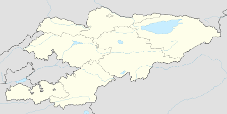 Kyzyl-Kiya Location in Kyrgyzstan | |
| Coordinates: 40°16′N 72°3′E / 40.267°N 72.050°ECoordinates: 40°16′N 72°3′E / 40.267°N 72.050°E | |
| Country |
|
| Region | Batken Region |
| Founded | 1898 |
| City status | 1938 |
| Government | |
| • Mayor | Matraimov Chubak |
| Area | |
| • City | 78 km2 (30 sq mi) |
| Elevation | 1,058 m (3,471 ft) |
| Population (2009) | |
| • City | 44,144 |
| • Density | 570/km2 (1,500/sq mi) |
| • Urban | 31,727 |
| Postal code | 715200 |
| Area code(s) | +996 3657 |
| Website |
www |
Kyzyl-Kiya (Kyrgyz: Кызылкыя, Russian: Кызыл-Кия) is a city in Batken Region, in southwestern Kyrgyzstan. Its area is 78 square kilometres (30 sq mi), and its resident population was 44,144 in 2009 (both including the villages Karavan, Ak-Bulak and Jin-Jigen).[1] It is situated on the southern edge of the Fergana Valley, 32 km southeast of Fergana, and 65 km southwest of Osh. The town is one of the oldest centers of the coal mining industry in Kyrgyzstan.
Geography
Climate
The Köppen Climate Classification sub-type for Kyzyl-Kiya is "BSk" or a Tropical and Subtropical Steppe Climate. The average annual temperature is 11.7°C (53.1°F). The warmest month is July with an average temperature of 24.7°C (76.5°F) and the coolest month is January with an average temperature of -3.4°C (25.9°F). The average annual precipitation is 295.8mm (11.64") and has an average of 68.6 days with precipitation. The wettest month is March with an average of 44.9mm (1.8") of precipitation and the driest month is August with an average of 4.1mm (0.2") of precipitation.[2]
| Climate data for Kyzyl-Kiya | |||||||||||||
|---|---|---|---|---|---|---|---|---|---|---|---|---|---|
| Month | Jan | Feb | Mar | Apr | May | Jun | Jul | Aug | Sep | Oct | Nov | Dec | Year |
| Daily mean °C (°F) | −3.4 (25.9) |
−0.9 (30.4) |
6.4 (43.5) |
14 (57) |
18.7 (65.7) |
22.8 (73) |
24.7 (76.5) |
23.1 (73.6) |
18.3 (64.9) |
11.8 (53.2) |
5 (41) |
−0.6 (30.9) |
11.7 (53.1) |
| Average precipitation mm (inches) | 27.4 (1.079) |
33.2 (1.307) |
44.9 (1.768) |
40.1 (1.579) |
37.7 (1.484) |
16.2 (0.638) |
10.2 (0.402) |
4.1 (0.161) |
5 (0.2) |
27.6 (1.087) |
25.9 (1.02) |
23.5 (0.925) |
295.8 (11.646) |
| Average precipitation days (≥ 0.1 mm) | 7 | 7.5 | 8.8 | 8.1 | 8.3 | 5.2 | 3.4 | 2.1 | 2.2 | 4.7 | 5.3 | 6 | 68.6 |
| Average relative humidity (%) | 77.7 | 75.6 | 66.9 | 58.5 | 52 | 43.4 | 44.9 | 49.4 | 52.3 | 60.3 | 69 | 77.4 | 60.6 |
| Source: "The Climate of Kyzyl-Kiya". Weatherbase. Retrieved 1 August 2014. | |||||||||||||
External links
- Портале Кызыл-Кийского Землячества (in Russian)
- Баткенская область (in Russian)
- WELCOME TO THE CITY OF KYZYL KIA
References
- ↑ "2009 population census of the Kyrgyz Republic: Batken Region" (PDF). Archived from the original (PDF) on 10 August 2011. Retrieved 2013-05-16.
- ↑ "Weatherbase". weatherbase.com. Retrieved 1 August 2014.