Tong District
| Tong Тоң району | |
|---|---|
| Raion | |
 | |
| Country | Kyrgyzstan |
| Region | Issyk-Kul Region |
| Area | |
| • Total | 7,230 km2 (2,790 sq mi) |
| Population (2009) | |
| • Total | 49,130 |
| • Density | 6.8/km2 (18/sq mi) |
| Time zone | UTC+5 (GMT +5) |
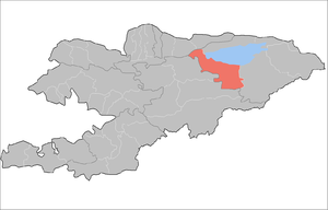
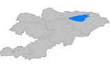
Tong is a raion (district) of Issyk-Kul Region in north-eastern Kyrgyzstan. The capital lies at Bokonbayevo.[1] Its area is 7,230 square kilometres (2,790 sq mi), and its resident population was 49,130 in 2009.[2] Tong District borders Issyk Kul District to the north-west, Jeti-Oguz District to the south and south-east, Kochkor District to the south-west, Naryn District to the south, Kemin District to the north-west, and Issyk Kul - to the north.
Populated places
In total, Tong District includes 30 villages located in 9 rural communities (aiyl okmotus). Each rural community can consist of one or several villages. The rural communities and settlements in the Tong District are:[3][4]
- Kaji-Say aiyl okmotu (1: center - village: Kadji Say)
- Ak-Terek aiyl okmotu (6: center - village: Kara-Koo; and also villages Ala-Bash, Bar-Bulak, Döng-Talaa, Kalkagar and Kyzyl-Tuu)
- Kel-Ter aiyl okmotu (3: center - village: Toguz-Bulak; and also villages Kel-Ter and Kongur-Ölöng)
- Kek-Moynok aiyl okmotu (3: center - village: Akulen; and also villages Kök-Moynok-1 and Kök-Moynok-2 )
- Eshperovo aiyl okmotu (4: center - village: Eshperovo; and also villages Ak-Say, Jer-Üy and Kok-Say)
- Kyun-Chygysh aiyl okmotu (2: center - village: Bokonbayevo; and also village Archaly)
- Tong aiyl okmotu (3: center - village: Ton; and also villages Kadji-Saz and Ak-Say)
- Tortkël' aiyl okmotu (3: center - village: Tört-Kül, and also villages Temir-Kanat and Tuura-Suu)
- Ulakol aiyl okmotu (5: center - village: Ottuk; and also villages Kara-Talaa, Kara-Shaar, Tuura-Suu and Shor-Bulak)
References
- ↑ Enrin.grida.no
- ↑ "2009 population census of the Kyrgyz Republic: Issyk-Kul Region" (PDF). Archived from the original (PDF) on 10 August 2011. Retrieved 2011-08-10.
- ↑ List of rural communities of Kyrgyzstan Archived 2010-02-09 at the Wayback Machine.
- ↑ 2012 Law on the transformation of individual urban settlements of the Kyrgyz Republic and relating them to the category of village or city
| North Krygyzstan |
|  | ||||||||||
|---|---|---|---|---|---|---|---|---|---|---|---|---|
| South Krygyzstan |
| |||||||||||
Coordinates: 42°06′52″N 76°59′36″E / 42.114391°N 76.993289°E
This article is issued from
Wikipedia.
The text is licensed under Creative Commons - Attribution - Sharealike.
Additional terms may apply for the media files.