Alberta Highway 16
| ||||
|---|---|---|---|---|
|
Yellowhead Highway Trans-Canada Highway | ||||
 Highway 16 highlighted in red | ||||
| Route information | ||||
| Length | 633.5 km[1] (393.6 mi) | |||
| Major junctions | ||||
| West end |
| |||
| East end |
| |||
| Location | ||||
| Specialized and rural municipalities | Jasper, I.D. No. 12, Yellowhead, Parkland, Strathcona, I.D. No. 13, Lamont, Minburn, Vermilion River | |||
| Major cities | Spruce Grove, Edmonton, Sherwood Park, Lloydminster | |||
| Towns | Hinton, Edson, Vegreville, Vermilion | |||
| Villages | Wabamun, Innisfree, Mannville, Kitscoty | |||
| Highway system | ||||
|
Provincial highways in Alberta
| ||||


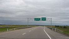
Alberta Provincial Highway No. 16, commonly referred to as Highway 16, is a major east–west highway in central Alberta, Canada, connecting Jasper to Lloydminster via Edmonton. It forms a portion of the Yellowhead Highway, a major interprovincial route of the Trans-Canada Highway system that stretches from Masset, British Columbia to Portage la Prairie, Manitoba, near Winnipeg. Highway 16 spans approximately 634 km (394 mi) from Alberta's border with British Columbia in the west to its border with Saskatchewan in the east.[2][3] As of 2010, all but less than 96 km (60 mi) of the route was divided, with a minimum of two lanes in each direction.[3] It is designated a core route in Canada's National Highway System.[4]
Route description
Jasper National Park
British Columbia Highway 16 becomes Alberta Highway 16 as it crosses the Continental Divide and Yellowhead Pass into Alberta, entering Jasper National Park. It travels in an easterly direction through the Municipality of Jasper until it reaches the intersection with Highway 93 (Icefields Parkway) and the west access to the Jasper townsite. East of Highway 93, the highway turns to the north, passes the east access to the Jasper townsite, and continues in a northeast direction along the Athabasca River through Improvement District No. 12. The segment of Highway 16 through Jasper National Park is maintained by the Government of Canada.[5]
Jasper National Park to Edmonton
Upon exiting Jasper National Park, Highway 16 is maintained by Alberta Transportation until it reaches the City of Edmonton and travels through the rural municipalities of Yellowhead County and Parkland County. The highway is a two lane, undivided highway for 19 km (12 mi) where it becomes a four lane, divided highway.[1] The highway continues in a northeast direction through the Town of Hinton until it reaches the locality of Obed, where it continues in an easterly direction and crosses Obed Summit, the highest point on the Yellowhead Highway.[6] The highway passes through the Town of Edson, where the highway splits into parallel one-streets, with eastbound traffic following 2 Avenue and westbound traffic following 4 Avenue.[1] It continues east where it passes by the Hamlets of Niton Junction, Wildwood, Evansburg and Entwistle; through the Hamlet of Gainford before passing; and north of Wabamun Lake where it passes by the Summer Village of Seba Beach, Hamlet of Fallis, Village of Wabamun, and Hamlet of Kapasiwin before intersecting Highway 43. The highway intersects Highway 16A (Parkland Highway), which prior to 1997 was part of Highway 16,[7] and passes through the Town of Stony Plain, City of Spruce Grove, and serves as an alternate route into Edmonton. The present alignment bypasses Stony Plain and serves as the northern boundary of Spruce Grove. Highway 16 is part of the CANAMEX Corridor between Highway 43 and its western intersection with Anthony Henday Drive.
Edmonton
Highway 16 passes through Edmonton as a major expressway called Yellowhead Trail, maintained by the City of Edmonton. Most sections of Yellowhead Trail are free-flowing, while numerous intersections between 156 Street and 50 Street are signalized.
Edmonton to Lloydminster
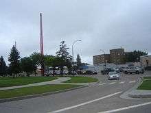
Highway 16 exits Edmonton and enters Strathcona County just west of its eastern intersection with Anthony Henday Drive (Highway 216). The highway travels east and serves as the division between Edmonton and the Urban Service Area of Sherwood Park. The highway continues east past the Hamlet of Ardrossan, through Elk Island National Park, and past the Ukrainian Cultural Heritage Village. The highway then passes through the rural municipalities of Lamont County, County of Minburn, and the County of Vermilion River. The highway continues in a general southeast direction by Town of Mundare and the Town of Vegreville, where Highway 16A passes directly through the Vegreville. The highway continues by Hamlet of Lavoy, Hamlet of Ranfurly, Village of Innisfree, Hamlet of Minburn, Village of Mannville, Town of Vermilion, Village of Kitscoty, and Hamlet of Blackfoot. The highway is maintained by Alberta Transportation, with the exception of the segment through Elk Island National Park which is maintained by the Government of Canada.[5] Highway 16 passes through the City of Lloydminster along Ray Nelson Drive (44 Street) and is maintained by the City of Lloydminster.[1][8] The highway is an arterial street and crosses into Saskatchewan at its intersection with Highway 17 (50 Avenue) where it becomes Saskatchewan Highway 16.
History
The Yellowhead Highway is named after the Yellowhead Pass in the Rocky Mountains. During the early 1800s, Pierre Bostonais, an Iroquois-Métis trapper with streaks of blonde in his hair, worked for the Hudson's Bay Company. Because of his hair colour, French-speaking voyageurs referred to him as "Tête Jaune", literally "Yellow Head". By 1819, Bostonais acted as a guide for the company and had explored a route down the Fraser River to the present city of Prince George.[9] Half a century later, the Grand Trunk Pacific (GTP) and Canadian Northern Railway (CNoR) constructed lines that the Yellowhead Highway later paralleled.[10] The two lines between Evansburg, Alberta, and Red Pass Junction were combined into a joint route in 1917, with portions of both lines abandoned. The GTP and CNoR both became part of the new Canadian National Railway (CNR) by 1924.
Following World War I, as automobile use increased exponentially, CNR surveyor Fred Driscoll and Edmonton Automobile and Good Roads Association president formed a committee lobbying for the creation of the Yellowhead Highway. Driscoll believed the abandoned railway bed would be an ideal base for a road. The Edmonton Automobile Association offered a gold medal to the first person to travel from Edmonton to Victoria through the gap. Charles Neiymer and Frank Silverthorne left in 4×4 on June 17, 1922. The following week, George Gordon and J. Sims departed Edmonton in a Ford Model T, following the same route. On July 4, both pairs arrived in Victoria and were each awarded gold medals.[10]
However, it would take until World War II for any improvements to be made this overland route. The displacement of many Japanese-Canadians from the Pacific coast to internment camps in the interior led to some developments. 30 km (19 mi) of road was constructed along the railway bed, and an additional 40 km (25 mi) through steep terrain. By 1944, the Tote Road was opened through Jasper and into the Fraser Valley.[10]
In August 1948, a motorcade was organized as a demonstration of the need for the highway. The Trans-Canada Highway Act was enacted in 1949, providing a 90% subsidy to upgrade selected routes to modern standards. However, the Tote Highway was not included under this subsidy.[10] During the same time frame, the Trans Mountain Oil Pipe Line Company began looking at the Tote Road as a potential route for a pipeline between Edmonton and Vancouver. Construction began in 1952, and largely resulted in the destruction of the road along the pipeline's path.[10]
Gradually, work progressed to reconstruct the highway. Elsewhere, the main route of the Trans-Canada Highway was completed in 1957. The Yellowhead Highway became eligible for federal funding soon thereafter.[11] By 1969, the Tote Road was generally rebuilt and paved. On August 15, 1970, British Columbia Premier W. A. C. Bennett officially opened the Yellowhead Highway.[12]
Future
Alberta Transportation has conducted long term studies to twin Highway 16 between Jasper National Park and Highway 40[13] and freeway upgrades both west and east of Edmonton.[14][15] Highway bypass alignments have also been planned for Hinton, Edson, and Lloydminster, all of which have been designated as Highway 16X.[2][15]
The City of Edmonton has plans for replacement of all signalized intersections with interchanges, flyovers and closures to bring Yellowhead Trail up to freeway standards by the year 2041.[16][17]
Major intersections
The following is a list of major intersections along Alberta Highway 16 from west to east, including exit numbers where applied.[2][3]
| Rural/specialized municipality | Location | km[1] | mi | Exit | Destinations | Notes |
|---|---|---|---|---|---|---|
| Municipality of Jasper (Jasper National Park) | Yellowhead Pass | 0.0 | 0.0 | Continuation into British Columbia | ||
| | 3.7 | 2.3 | West gate of Jasper National Park | |||
| Jasper | 24.6 | 15.3 | Traffic signals | |||
| 25.8 | 16.0 | |||||
| 28.8 | 17.9 | Connaught Drive / Cottonwood Creek Road | ||||
| | 30.7 | 19.1 | Maligne Lake Road – Jasper Park Lodge | Traffic signals | ||
| I.D. No. 12 (Jasper National Park) | 46.6 | 29.0 | Crosses Athabasca River | |||
| 69.4 | 43.1 | Miette Hot Springs Road – Pocahontas, Miette Hot Springs | ||||
| 76.4 | 47.5 | East gate of Jasper National Park | ||||
| Yellowhead County | | 95.7 | 59.5 | West extent of divided highway | ||
| 96.6 | 60.0 | West end of Hwy 40 concurrency | ||||
| Hinton | 98.5 | 61.2 | East end of Hwy 40 concurrency | |||
| 103.2 | 64.1 | Switzer Drive – Hinton Valley District | Traffic signals | |||
| | 125.2 | 77.8 | Obed Summit – 1,163.9 m (3,819 ft) | |||
| 179.5 | 111.5 | 177 | Eastbound grade separated; westbound at grade | |||
| Edson | 186.4 | 115.8 | West end of one-way pair | |||
| 189.7 | 117.9 | |||||
| 191.2 | 118.8 | East end of one-way pair | ||||
| | 196.5 | 122.1 | Crosses McLeod River | |||
| 221.7 | 137.8 | |||||
| Niton Junction | 235.0 | 146.0 | Range Road 130 | |||
| Nojack | 247.4 | 153.7 | ||||
| | 258.0 | 160.3 | ||||
| Wildwood | 270.7 | 168.2 | Range Road 92A | |||
| 272.3 | 169.2 | Service Road | Westbound exit | |||
| | 276.9 | 172.1 | ||||
| 279.5 | 173.7 | West end of Hwy 22 concurrency | ||||
| Evansburg | 285.2 | 177.2 | UAR 115 north (Range Road 75) | |||
| ↑ / ↓ | 286.5 | 178.0 | Crosses Pembina River | |||
| Parkland County | Entwistle | 287.5 | 178.6 | 289 | Interchange; east end of Hwy 22 concurrency | |
| | 296.0 | 183.9 | ||||
| Gainford | 301.1 | 187.1 | Range Road 62 | |||
| Seba Beach | 304.4 | 189.1 | 306 | Interchange | ||
| | 310.8 | 193.1 | Range Road 52 – Fallis | |||
| 314.0 | 195.1 | Interchange | ||||
| Wabamun | 322.7 | 200.5 | 324 | Range Road 40B | Interchange | |
| | 325.7 | 202.4 | 327 | Range Road 35 – Kapasiwin, Wabamun Lake Provincial Park | Interchange; former Hwy 30 | |
| 330.6 | 205.4 | Range Road 32 – Duffield | ||||
| 338.4 | 210.3 | |||||
| 338.8 | 210.5 | 340 | Interchange; west end of CANAMEX Corridor | |||
| 343.0 | 213.1 | 344 | Eastbound exit, westbound entrance | |||
| 353.5 | 219.7 | 355 | Interchange Fifth Meridian, 114° Longitude | |||
| Spruce Grove | 357.9 | 222.4 | 360 | Jennifer Heil Way / Range Road 274 | Interchange | |
| 359.4 | 223.3 | Former Hwy 788 (Calahoo Road) | Intersection closed | |||
| 361.1 | 224.4 | 363 | Century Road / Range Road 272 | Interchange | ||
| | 366.1 | 227.5 | 368 | Interchange | ||
| Acheson | 369.1 | 229.3 | 371 | Interchange; truck bypass to Hwy 2 south | ||
| City of Edmonton | 374.0 | 232.4 | 376 | Winterburn Road (215 Street) | Interchange | |
| 375.9 | 233.6 | 378 | Exit 25 on Hwy 216; west end of Hwy 2 hidden concurrency; east end of CANAMEX Corridor (follows Hwy 216 south) | |||
| 377.4 | 234.5 | 379 | 184 Street – St. Albert | Interchange | ||
| 379.0 | 235.5 | 381 | 170 Street – St. Albert, West Edmonton Mall | Interchange | ||
| 380.8 | 236.6 | 383 | 156 Street – St. Albert | Interchange | ||
| 381.6 | 237.1 | 149 Street | ||||
| 382.4 | 237.6 | 142 Street | ||||
| 383.0 | 238.0 | 381 | Interchange; east end of Hwy 2 hidden concurrency | |||
| 384.0 | 238.6 | 127 Street | ||||
| 384.4 | 238.9 | 124 Street | ||||
| 385.0 | 239.2 | 121 Street | ||||
| 386.4 | 240.1 | 107 Street | Traffic signals; no westbound exit | |||
| 387.3 | 240.7 | 389 | Interchange | |||
| 388.9 | 241.7 | 391 | 82 Street – Northlands | Interchange | ||
| 390.0 | 242.3 | 392 | Fort Road / Wayne Gretzky Drive – Northlands | Interchange | ||
| 390.7 | 242.8 | 66 Street | ||||
| 392.5 | 243.9 | 394 | Interchange | |||
| 395.0 | 245.4 | 397 | 118 Avenue / Victoria Trail | Interchange | ||
| 395.8 | 245.9 | Crosses North Saskatchewan River Beverly Bridge (eastbound) and Clover Bar Bridge (westbound) | ||||
| 396.4 | 246.3 | 399 | Hayter Road / 17 Street NW | Interchange | ||
| Strathcona County Edmonton[lower-alpha 1] | Sherwood Park | 397.7 | 247.1 | 400 | Interchange; Exit 54 on Hwy 216; westbound signed as exits 400A (south) and 400B (north) | |
| 399.4 | 248.2 | 401 | Broadmoor Boulevard / 17 Street NE | Interchange | ||
| 401.0 | 249.2 | 403 | Sherwood Drive / Range Road 232 | Interchange | ||
| Strathcona County | 402.6 | 250.2 | 405 | Clover Bar Road / Range Road 231 | Interchange | |
| 404.2 | 251.2 | 406 | Interchange Eastbound signed as exits 406A (south) and 406B (north) | |||
| Ardrossan | 410.7 | 255.2 | 413 | Interchange | ||
| | 415.6 | 258.2 | ||||
| I.D. No. 13 (Elk Island National Park) | | 423.7 | 263.3 | West end of Elk Island National Park | ||
| 431.1 | 267.9 | Elk Island Parkway to Hwy 831 north – Lamont | ||||
| 433.6 | 269.4 | East end of Elk Island National Park | ||||
| Lamont County | | 443.4 | 275.5 | |||
| Mundare | 464.5 | 288.6 | ||||
| County of Minburn No. 27 | | 475.3 | 295.3 | |||
| Vegreville | 479.2 | 297.8 | 481 | Eastbound exit, westbound entrance | ||
| 488.1 | 303.3 | |||||
| 490.0 | 304.5 | 492 | Westbound exit, Eastbound entrance | |||
| Lavoy | 500.6 | 311.1 | Range Road 134 | |||
| | 506.2 | 314.5 | Interchange proposed (no construction timeline)[18] | |||
| Ranfurly | 515.2 | 320.1 | UAR 199 north (Range Road 122A) | |||
| | 526.3 | 327.0 | ||||
| 539.6 | 335.3 | UAR 216 north (Range Road 102) – Minburn | ||||
| Mannville | 553.1 | 343.7 | ||||
| County of Vermilion River | Vermilion | 574.4 | 356.9 | 577 | Interchange | |
| | 595.0 | 369.7 | ||||
| Kitscoty | 610.7 | 379.5 | ||||
| Blackfoot | 623.8 | 387.6 | Range Road 20 | |||
| City of Lloydminster | 631.6 | 392.5 | 62 Avenue | Bypass route to Hwy 17 | ||
| 633.5 | 393.6 | |||||
| Continuation into Saskatchewan | ||||||
1.000 mi = 1.609 km; 1.000 km = 0.621 mi
| ||||||
Footnotes
- ↑ Highway 16 is within Strathcona County, Edmonton city limits are along the north right of way.
References
- 1 2 3 4 5 Google (2017-10-10). "Highway 16 in Alberta" (Map). Google Maps. Google. Retrieved 2017-10-10.
- 1 2 3 "2015 Provincial Highway 1-216 Progress Chart" (PDF). Alberta Transportation. March 2015. Archived (PDF) from the original on April 10, 2016. Retrieved October 31, 2016.
- 1 2 3 Alberta Official Road Map (Map) (2010 ed.). Alberta Tourism, Parks and Recreation. § J–2, J–3, I–3, I-4, I–5, I–6, I–7, J–7, I–8, and J–8.
- ↑ "National Highway System". Transport Canada. December 13, 2009. Archived from the original on July 6, 2011. Retrieved February 13, 2011.
- 1 2 "The Trans-Canada Highway: Backgrounder". Transport Canada. 2012-01-04. Retrieved 2016-04-11.
- ↑ "Obed Summit". Waymarking.com. 2010-01-27. Retrieved 2016-04-11.
- ↑ "Highways 16 and 16X Renumbered to Provide Greater Consistency". 2009-09-10. Government of Alberta. 1997-06-04.
- ↑ Gibson, Chad; Crawford, Murray (2010-09-24). "Lloydminster loses prominent figure". Lloydminster Meridian Booster. Retrieved 2016-04-12.
- ↑ "History of The Yellowhead Highway" (PDF). Trans Canada Yellowhead Highway Association. Retrieved 2016-04-11.
- 1 2 3 4 5 Waugh, Jeff. "Jasper National Park History: The Yellowhead Highway". Jasper National Park. Retrieved 2016-04-12.
- ↑ "Saskatchewan's Highway Network". Department of Highways. Saskatchewan Government. Archived from the original on February 14, 2007. Retrieved March 24, 2008.
- ↑ Anderson, Frank W. (1998). The Yellowhead Trail in Manitoba and Saskatchewan. Box 9055, Saskatoon, Saskatchewan: Frank W. Anderson. p. 105.
- ↑ "West Provincial Highway Projects". Highway 16. Government of Alberta. Retrieved 2016-04-11.
- ↑ "Edmonton & Area Provincial Highway Projects". Highway 16. Government of Alberta. Retrieved 2016-04-11.
- 1 2 "East Provincial Highway Projects". Highway 16. Government of Alberta. Retrieved 2016-04-11.
- ↑ "Yellowhead Freeway in 2041". 630 CHED. June 14, 2011. Retrieved June 14, 2011.
- ↑ R. Gibbard/R. Toohey (June 14, 2011). "Yellowhead Trail Strategic Plan" (PDF). Project Status Report. City of Edmonton. Archived from the original (PDF) on May 12, 2012. Retrieved June 15, 2011.
- ↑ "Highway 16 / Highway 36 Functional Plan Study" (PDF). Alberta Transportation. Al-Terra Engineering. Retrieved July 24, 2017.
External links
Route map:
| Wikimedia Commons has media related to Alberta Highway 16. |
- Trans-Canada Yellowhead Highway Association
- Yellowhead It—Travel Guide to help you plan your next trip along ...
| Yellowhead Highway | ||
|---|---|---|
| Previous province: British Columbia |
Alberta | Next province: Saskatchewan |
| British Columbia | ||
|---|---|---|
| Alberta | ||
| Saskatchewan | ||
| Manitoba | ||
| Ontario | ||
| Quebec | ||
| New Brunswick | ||
| Prince Edward Island | ||
| Nova Scotia | ||
| Newfoundland | ||
| ||