Sangudo
| Sangudo | |
|---|---|
| Hamlet | |
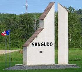 Sundial at the highway entrance of Sangudo. | |
 Sangudo Location of Sangudo | |
| Coordinates: 53°53′21″N 114°54′15″W / 53.88917°N 114.90417°WCoordinates: 53°53′21″N 114°54′15″W / 53.88917°N 114.90417°W | |
| Country |
|
| Province |
|
| Region | Northern Alberta |
| Census Division | No. 13 |
| Municipal district | Lac Ste. Anne County |
| Government | |
| • Mayor | William Hegy |
| • Governing body |
Lac Ste. Anne County Council
|
| Area (2011)[1] | |
| • Total | 3.15 km2 (1.22 sq mi) |
| Elevation[2] | 680 m (2,230 ft) |
| Population (2011)[1] | |
| • Total | 320 |
| • Density | 101.6/km2 (263/sq mi) |
| Demonym(s) | Sangudoite |
| Time zone | UTC-7 (MST) |
| Highways |
43 757 |
| Waterways | Pembina River |
Sangudo is a hamlet in Alberta, Canada within Lac Ste. Anne County.[3] It is located on Highway 43 and the Pembina River, approximately 99 kilometres (62 mi) northwest of Edmonton.
Sangudo was formerly incorporated as a village on April 12, 1937, but dissolved and reverted to hamlet status effective September 16, 2007.[4]
-with-Cowboys.jpg)
Demographics
As a designated place in the 2016 Census of Population conducted by Statistics Canada, Sangudo recorded a population of 299 living in 137 of its 171 total private dwellings, a change of −6.6% from its 2011 population of 320. With a land area of 2.72 km2 (1.05 sq mi), it had a population density of 109.9/km2 (284.7/sq mi) in 2016.[5]
In the 2011 Census, Sangudo had a population of 320 living in 149 of its 177 total dwellings, a -12.1% change from its 2006 population of 364. With a land area of 3.15 km2 (1.22 sq mi), it had a population density of 101.6/km2 (263/sq mi) in 2011.[1]
Industry
The main sources of revenue for the hamlet are tourism from traffic along Highway 43, oil production, and agriculture (mostly cattle ranching).
Attractions
The hamlet is the home to Sangudo Speedway – a high-banked dirt oval that is a quarter mile in length. Sangudo also features a sundial tourist monument that can be seen from Highway 43.
See also
References
- 1 2 3 "Census Profile - Sangudo, Village, Alberta (Dissolved census subdivision)". Statistics Canada. 2012-11-02. Retrieved 2012-12-02.
- ↑ "Alberta Private Sewage Systems 2009 Standard of Practice Handbook: Appendix A.3 Alberta Design Data (A.3.A. Alberta Climate Design Data by Town)" (PDF) (PDF). Safety Codes Council. January 2012. pp. 212–215 (PDF pages 226–229). Retrieved October 9, 2013.
- ↑ Alberta Municipal Affairs (2010-04-01). "Specialized and Rural Municipalities and Their Communities" (PDF). Retrieved 2010-06-28.
- ↑ Province of Alberta (2007). "Order in Council (O.C.) 395/2007". Retrieved 2009-11-11.
- ↑ "Population and dwelling counts, for Canada, provinces and territories, and designated places, 2016 and 2011 censuses – 100% data (Alberta)". Statistics Canada. February 8, 2017. Retrieved February 13, 2017.