Kinsella, Alberta
| Kinsella | |
|---|---|
| Hamlet | |
 | |
 Kinsella Location of Kinsella in Alberta | |
| Coordinates: 53°00′01″N 111°31′26″W / 53.00028°N 111.52389°WCoordinates: 53°00′01″N 111°31′26″W / 53.00028°N 111.52389°W | |
| Country |
|
| Province |
|
| Census division | No. 10 |
| Municipal district | Beaver County |
| Government | |
| • Type | Unincorporated |
| • Governing body | Beaver County Council |
| Elevation | 695 m (2,280 ft) |
| Population (2009) | |
| • Total | 40 |
| Time zone | UTC-7 (MST) |
| • Summer (DST) | UTC-6 (MDT) |
| Area code(s) | T0B 2N0 |
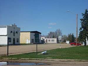
Kinsella is a hamlet in Alberta, Canada within Beaver County.[1] It is located along Highway 14 and the CN Railway and has an elevation of 695 metres (2,280 ft).
The hamlet is located in census division No. 10 and in the federal riding of Vegreville-Wainwright.
Demographics
Statistics Canada has not recently published a population for Kinsella.
However, Industry Canada shows that Kinsella's greater rural area had a total population of 451 living in 128 dwellings in 2001. With a land area of 486.9 km2 (188.0 sq mi), its greater rural area has a population density of 7.0/km2 (18/sq mi).[2]
According to the 2009 Beaver County census, Kinsella had a population of 40.[3]
Research Station
The Roy Berg Kinsella Research Station is located directly northwest of the community. Founded in 1960, it is run by the University of Alberta.[4] It covers a total area of 4,856 hectares (12,000 acres).[5]
Climate
| Climate data for Kinsella | |||||||||||||
|---|---|---|---|---|---|---|---|---|---|---|---|---|---|
| Month | Jan | Feb | Mar | Apr | May | Jun | Jul | Aug | Sep | Oct | Nov | Dec | Year |
| Record high °C (°F) | 11.1 (52) |
12.5 (54.5) |
18.9 (66) |
30.6 (87.1) |
33.5 (92.3) |
33.9 (93) |
35.6 (96.1) |
37 (99) |
34.5 (94.1) |
28.5 (83.3) |
20.6 (69.1) |
13.5 (56.3) |
37 (99) |
| Average high °C (°F) | −9.2 (15.4) |
−5.2 (22.6) |
0.1 (32.2) |
10.5 (50.9) |
17.3 (63.1) |
20.8 (69.4) |
22.5 (72.5) |
22.5 (72.5) |
16.6 (61.9) |
10.1 (50.2) |
−1.6 (29.1) |
−7.1 (19.2) |
8.1 (46.6) |
| Average low °C (°F) | −18.4 (−1.1) |
−15 (5) |
−9.4 (15.1) |
−1.3 (29.7) |
4.5 (40.1) |
8.7 (47.7) |
10.7 (51.3) |
9.6 (49.3) |
4.5 (40.1) |
−1.1 (30) |
−10 (14) |
−16.1 (3) |
−2.8 (27) |
| Record low °C (°F) | −46.1 (−51) |
−45.6 (−50.1) |
−37.8 (−36) |
−26.1 (−15) |
−7 (19) |
−2.8 (27) |
2.2 (36) |
−2 (28) |
−8.3 (17.1) |
−23 (−9) |
−33.5 (−28.3) |
−45 (−49) |
−46.1 (−51) |
| Average precipitation mm (inches) | 22.7 (0.894) |
12.7 (0.5) |
20.9 (0.823) |
24 (0.94) |
43.7 (1.72) |
82.9 (3.264) |
73.8 (2.906) |
58.6 (2.307) |
35.2 (1.386) |
17.1 (0.673) |
18.2 (0.717) |
21.5 (0.846) |
431.2 (16.976) |
| Source: Environment Canada[6] | |||||||||||||
See also
References
- ↑ Alberta Municipal Affairs (1 April 2010). "Specialized and Rural Municipalities and Their Communities" (PDF). Archived from the original (PDF) on 29 February 2012. Retrieved 2010-06-20.
- ↑ Industry Canada/Web Archive (4 November 2006). "Kinsella - Community demographics (2001 census)". Archived from the original on 4 November 2006. Retrieved 2010-02-07.
- ↑ Beaver County (2009). "Municipal Census Highlights" (PDF). Archived from the original (PDF) on 6 July 2011. Retrieved 2010-07-29.
- ↑ "Research Stations - Agricultural and Environmental Research Stations". University of Alberta. University of Alberta. Archived from the original on 27 January 2016. Retrieved 6 June 2016.
- ↑ Kienlen, Alexis (September 3, 2014). "The fearless researcher who revolutionized cattle breeding". FBC Communications LP. Alberta Farm Express. Retrieved June 6, 2016.
- ↑ Environment Canada—Canadian Climate Normals 1971–2000, accessed 6 April 2010
Places adjacent to Kinsella, Alberta | |
|---|---|