Redan, Georgia
| Redan, Georgia | |
|---|---|
| CDP | |
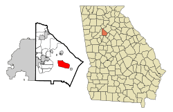 Location in DeKalb County and the state of Georgia | |
 Redan, Georgia Location in the United States | |
| Coordinates: 33°44′21″N 84°9′57″W / 33.73917°N 84.16583°WCoordinates: 33°44′21″N 84°9′57″W / 33.73917°N 84.16583°W | |
| Country | United States |
| State | Georgia |
| County | DeKalb |
| Area | |
| • Total | 9.6 sq mi (24.8 km2) |
| • Land | 9.6 sq mi (24.7 km2) |
| • Water | 0 sq mi (0.1 km2) |
| Elevation | 981 ft (299 m) |
| Population (2010) | |
| • Total | 33,015 |
| • Density | 3,400/sq mi (1,300/km2) |
| Time zone | UTC-5 (Eastern (EST)) |
| • Summer (DST) | UTC-4 (EDT) |
| ZIP code | 30074 |
| Area code(s) | 770 |
| FIPS code | 13-63952[1] |
| GNIS feature ID | 0332813[2] |
Redan is a census-designated place (CDP) in DeKalb County, Georgia, United States. As of the 2010 census, the CDP had a total population of 33,015.[3] It is a predominantly African American community in eastern DeKalb County, and is a suburb of Atlanta.
Redan was probably named after the numerous redans built during the Atlanta Campaign of the American Civil War. Redan High School is located here.
Geography
Redan is located at 33°44′21″N 84°9′57″W / 33.73917°N 84.16583°W (33.739256, -84.165781).[4]
According to the United States Census Bureau, the CDP has a total area of 9.6 square miles (25 km2), of which 0.1 square miles (0.26 km2), or 0.52%, is water.
Demographics
| Historical population | |||
|---|---|---|---|
| Census | Pop. | %± | |
| 1990 | 24,376 | — | |
| 2000 | 33,841 | 38.8% | |
| 2010 | 33,015 | −2.4% | |
| source:[5] | |||
As of the census[1] of 2000, there were 33,841 people, 11,748 households, and 8,517 families residing in the CDP. The population density was 3,542.0 people per square mile (1,368.2/km²). There were 12,106 housing units at an average density of 1,267.1/sq mi (489.4/km²). The racial makeup of the CDP was 5.68% White, 91.27% African American, 0.12% Native American, 0.70% Asian, 0.03% Pacific Islander, 0.75% from other races, and 1.44% from two or more races. Hispanic or Latino of any race were 1.78% of the population.
There were 11,748 households out of which 44.6% had children under the age of 18 living with them, 42.4% were married couples living together, 24.9% had a female householder with no husband present, and 27.5% were non-families. 21.4% of all households were made up of individuals and 1.3% had someone living alone who was 65 years of age or older. The average household size was 2.88 and the average family size was 3.35.
In the CDP, the population was spread out with 31.8% under the age of 18, 8.9% from 18 to 24, 38.1% from 25 to 44, 18.1% from 45 to 64, and 3.1% who were 65 years of age or older. The median age was 30 years. For every 100 females, there were 85.5 males. For every 100 females age 18 and over, there were 77.2 males.
The median income for a household in the CDP is $51,564, and the median income for a family is $56,021. Males have a median income of $36,115 versus $31,166 for females. The per capita income for the CDP is $20,316. 5.5% of the population and 4.1% of families are below the poverty line. Out of the total population, 6.2% of those under the age of 18 and 7.4% of those 65 and older are living below the poverty line.
Education
DeKalb County School District serves the CDP.[6]
Elementary schools serving parts of Redan CDP:[7]
- Redan Elementary School
- Panola Way Elementary School (Redan)
- Stoneview Elementary School
- Woodridge Elementary School
- E. L. Miller Elementary School
- Shadow Rock Elementary School
Middle schools serving parts of Redan CDP:[8]
- Redan Middle School (Redan)
- Lithonia Middle School
- Miller Grove Middle School
There are two public high schools in its boundaries: Redan High School and Lithonia High School.[9] They, along with Miller Grove High School, serve portions of the CDP.[10]
References
- 1 2 "American FactFinder". United States Census Bureau. Retrieved 2008-01-31.
- ↑ "US Board on Geographic Names". United States Geological Survey. 2007-10-25. Retrieved 2008-01-31.
- ↑ "Race, Hispanic or Latino, Age, and Housing Occupancy: 2010 Census Redistricting Data (Public Law 94-171) Summary File (QT-PL), Redan CDP, Georgia". U.S. Census Bureau, American FactFinder 2. Retrieved October 28, 2011.
- ↑ "US Gazetteer files: 2010, 2000, and 1990". United States Census Bureau. 2011-02-12. Retrieved 2011-04-23.
- ↑ "CENSUS OF POPULATION AND HOUSING (1790-2000)". U.S. Census Bureau. Retrieved 2010-07-17.
- ↑ "2010 CENSUS - CENSUS BLOCK MAP: Redan CDP GA. US Census Bureau. Retrieved on May 30, 2017.
- ↑ "Elementary School Attendance Areas 2016 - 2017 School Year." DeKalb County School System. Retrieved on June 1, 2017.
- ↑ "Middle School Attendance Areas 2016 - 2017 School Year." DeKalb County School System. Retrieved on June 1, 2017.
- ↑ Home. Lithonia High School. Retrieved on May 31, 2017. "Lithonia High School 2440 Phillips Road Lithonia, Georgia 30058"
- ↑ "High School Attendance Areas 2016 - 2017 School Year." DeKalb County School System. Retrieved on June 1, 2017.
External links
- Redan, Georgia, Hometown, USA website
|  | |||||
|
| ||||||
| ||||||
Municipalities and communities of DeKalb County, Georgia, United States | ||
|---|---|---|
| Cities | 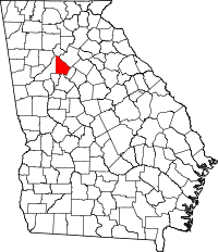 | |
| CDPs | ||
| Neighborhoods and unincorporated communities | ||
| Ghost town | ||
| Footnotes | ‡This populated place also has portions in an adjacent county or counties | |