Acworth, Georgia
| Acworth, Georgia | |
|---|---|
| City | |
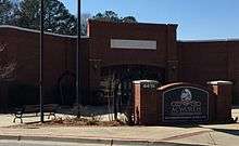 Acworth City Hall | |
| Motto(s): The Lake City | |
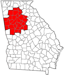
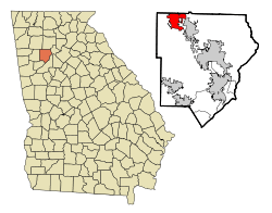 Location in Cobb County and the state of Georgia | |
| Coordinates: 34°03′46″N 84°40′12″W / 34.06278°N 84.67000°WCoordinates: 34°03′46″N 84°40′12″W / 34.06278°N 84.67000°W | |
| Country | United States |
| State | Georgia |
| County | Cobb |
| Incorporated | 1840 |
| Government | |
| • Mayor | Tommy Allegood |
| Area | |
| • Total | 8.8 sq mi (22.7 km2) |
| • Land | 8.3 sq mi (21.4 km2) |
| • Water | 0.5 sq mi (1.4 km2) |
| Population (2010) | |
| • Total | 20,425 |
| • Estimate (2016)[1] | 22,418 |
| • Density | 2,478/sq mi (956.6/km2) |
| Time zone | UTC-5 (EST) |
| • Summer (DST) | UTC-4 (EDT) |
| ZIP code | 30101, 30102 |
| Area code(s) | 770/678/470 |
| Website |
www |
Acworth is a city in Cobb County Georgia, United States. It is part of the Atlanta metropolitan area. The 2016 estimate for Acworth's population is 28,502. As of the 2010 census, this city had a population of 20,425,[2] up from 13,422 in 2000. Acworth is located in the foothills of the North Georgia mountains along the southeastern banks of Lake Acworth and Lake Allatoona on the Etowah River. Unincorporated areas known as Acworth extend into Bartow, Cherokee and Paulding counties respectively.
Acworth's nickname is "The Lake City".[3] Acworth Beach is located on nearby Lake Allatoona and Lake Acworth.
History
Like the rest of Cobb County, the area now containing Acworth was carved out of the former Cherokee Nation in 1831, after expelling the natives.[4]
The Western and Atlantic Railroad was completed through town in 1840. A watering station for the locomotives was established there.[5]
The town received its current name in 1843 from Western & Atlantic Railroad engineer Joseph L. Gregg, who named it for his hometown of Acworth, New Hampshire, which was named for the former Royal Navy Surveyor Sir Jacob Acworth.[6]
Telegraph lines reached the town in 1851.
A private school was opened for white students in 1852. A newer private school operated from 1899 to 1935, when they integrated with the Cobb County School District. Until 1935, high school students from Acworth paid tuition to attend. Students outside the town were subsidized by the Cobb County School Board. Black students were educated separately in a grammar school. The closest black high school was in Atlanta. Later, students were bused by the county to a segregated school in Marietta.[7]
Acworth was incorporated on December 1, 1860.
Volunteers to fight in the Civil War enlisted in what became Company A ("Acworth Infantry") in the 18th Georgia Volunteer Infantry and Company C ("Invincibles") in the 41st Georgia Volunteer Infantry.[8]
The town was captured by the Union June 6, 1864. The city was called "Little Shanty" by the Union troops, to contrast it with the next town south, "Big Shanty", since renamed Kennesaw. The town was under martial law during the six months of occupation. On November 13, 1864, the town was burned down by the army of General W. T. Sherman, sparing twelve homes and one church; its citizens were left destitute.
The town had nearly recovered by the 1880s. Cotton farming in the area peaked from the 1890s through the 1920s. Low prices during the Great Depression resulted in a cessation of cotton farming in the area and throughout Cobb County.[9]
During segregation, the railroad tracks served as a racial divide, with African Americans living to the northeast of the tracks and the whites to the southwest. There were few common public events. When a movie theater was erected in the 1930s, blacks were allowed to access the balcony from a separate entrance. Whites sat on the main floor.[10]
Volunteers formed a fire department in 1907.[11]
There were eventually a total of three textile mills in town from 1905 through the 1980s. They employed about 800 workers at their peak.[12]
In 1926, Main Street was paved. When the entire Dixie Highway (old U.S. Route 41 and part of the Cherokee Peachtree Trail) was paved in 1929, over 800 tourist vehicles entered the city daily.[13]
When the Etowah River was dammed, forming Lake Allatoona, citizens feared that land near the town would become a swamp. They successfully petitioned for a second dam, resulting in Lake Acworth in the 1950s. This became a tourist attraction.[14]
The town made a major improvement in its water and sewage lines in the late 1940s.[15]
The city elected its first woman mayor, Mary McCall, in 1956 and 1961-6.[16]
African-American students were schooled separately from white children until 1967.[7]
In 2011, the filming of several scenes for the Footloose remake took place in downtown Acworth. The Acworth Presbyterian Church was used as the primary church, and the house of Mayor Tommy Allegood was used as Julianne Hough's character's home.[17]
In 2017, the city was the site of the WWA Wakeboarding National Championship.[16]
Geography
Acworth is located in the foothills of the North Georgia mountains along the southeastern banks of Lake Acworth and Lake Allatoona on the Etowah River. It is bordered by the city of Kennesaw to the southeast and by Bartow and Cherokee counties to the north.
According to the United States Census Bureau, the city has a total area of 8.8 square miles (22.7 km2), of which 8.3 square miles (21.4 km2) is land and 0.54 square miles (1.4 km2), or 6.05%, is water.[2]
Unincorporated areas considered Acworth for mailing purposes extend into southeast Bartow County, southwest Cherokee County, and northeast Paulding County. Some of the incorporated portions of Acworth east of Nance Road and Acworth Due West Road have a Kennesaw mailing address.
Transportation
Major roads
The main route through the center of Acworth is Main Street, a two-lane road. It is known as "Old 41" as it was formerly the route for US 41. State Route 92 and the new Highway 41 pass through the southern part of the city. Interstate 75 runs just north of the city's northern border, with access from exits 277 and 278. The newly built Seven Hills Connector connects South Acworth to its faster growing areas in Paulding County.
Pedestrians and cycling
- Acworth Trail
- Graves Path
Demographics
| Historical population | |||
|---|---|---|---|
| Census | Pop. | %± | |
| 1880 | 633 | — | |
| 1890 | 815 | 28.8% | |
| 1900 | 937 | 15.0% | |
| 1910 | 1,043 | 11.3% | |
| 1920 | 1,117 | 7.1% | |
| 1930 | 1,163 | 4.1% | |
| 1940 | 1,267 | 8.9% | |
| 1950 | 1,466 | 15.7% | |
| 1960 | 2,359 | 60.9% | |
| 1970 | 3,929 | 66.6% | |
| 1980 | 3,648 | −7.2% | |
| 1990 | 4,519 | 23.9% | |
| 2000 | 13,422 | 197.0% | |
| 2010 | 20,425 | 52.2% | |
| Est. 2016 | 22,418 | [1] | 9.8% |
| U.S. Decennial Census[18] | |||
As of the census[19] of 2000, there were 13,422 people, 5,194 households, and 3,589 families residing in the city. The population density was 1,896.9 inhabitants per square mile (732.4/km2). There were 5,453 housing units at an average density of 770.7 per square mile (297.4/km²). The racial makeup of the city was 79.7% White, 12.6% African American, 0.2% Native American, 2.3% Asian, 0.02% Pacific Islander, 3.2% from other races, and 2.00% from two or more races. Hispanic or Latino of any race were 6.05% of the population.
There were 5,194 households out of which 37.7% had children under the age of 18 living with them, 54.9% were married couples living together, 10.8% had a female householder with no husband present, and 30.9% were non-families. 23.5% of all households were made up of individuals and 5.4% had someone living alone who was 65 years of age or older. The average household size was 2.58 and the average family size was 3.08.
In the city, the population was spread out with 27.0% under the age of 18, 9.0% from 18 to 24, 41.0% from 25 to 44, 15.7% from 45 to 64, and 7.2% who were 65 years of age or older. The median age was 31 years. For every 100 females, there were 95.4 males. For every 100 females age 18 and over, there were 92.6 males.
Government
The city is governed by a five-member Board of Aldermen, who serve staggered four-year terms. The mayor is elected to four-year terms.[20]
An unusual ordinance once required all citizens to own a rake.[21] This ordinance was enacted shortly after the neighboring city of Kennesaw ordered every homeowner to own a gun in 1982. The requirement to own a rake is no longer in effect.[22]
The city maintains eleven public parks: Acworth Sports Complex, Baker Plantation, Dallas Landing, East Lakeshore, Frana Brown, Logan Farm, Newberry, Overlook, Proctor Landing, and South Shore.
The Cobb County Public Library System maintains a library in the city.
Education
Public education in Acworth is handled by the Cobb County School District.[23]
Public schools include:
- Acworth Elementary School [24]
- Baker Elementary School [25]
- Ford Elementary School [26]
- Frey Elementary School [27]
- Pickett's Mill Elementary School [28]
- Pitner Elementary School [29]
- Barber Middle School [30]
- Durham Middle School [31]
- Allatoona High School [32]
Private schools include:
- Sunbrook Academy at Governors Towne Club [33]
Notable people
- Warren Creavalle, professional soccer player[34]
- Musa Smith, former NFL running back.[35]
References
- 1 2 "Population and Housing Unit Estimates". Retrieved June 9, 2017.
- 1 2 "Geographic Identifiers: 2010 Demographic Profile Data (G001): Acworth city, Georgia". U.S. Census Bureau, American Factfinder. Retrieved July 29, 2014.
- ↑ Geocities.com Retrieved on February 10, 2008 Archived 2009-10-24.
- ↑ "New Georgia Encyclopedia: Cobb County". Georgiaencyclopedia.org. 2011-11-15. Retrieved 2012-12-22.
- ↑ Acworth Society for Historic Preservation (2006). Images of Acworth. Charleston, SC: Arcadia Publishing. p. 7. ISBN 0-7385-1479-9.
- ↑ Krakow, Kenneth K. (1975). Georgia Place-Names: Their History and Origins (PDF). Macon, GA: Winship Press. p. 1. ISBN 0-915430-00-2.
- 1 2 Acworth Society for Historic Preservation (2006). Images of Acworth. Charleston, SC: Arcadia Publishing. p. 85. ISBN 0-7385-1479-9.
- ↑ Acworth Society for Historic Preservation (2006). Images of Acworth. Charleston, SC: Arcadia Publishing. p. 41. ISBN 0-7385-1479-9.
- ↑ Acworth Society for Historic Preservation (2006). Images of Acworth. Charleston, SC: Arcadia Publishing. p. 56. ISBN 0-7385-1479-9.
- ↑ Acworth Society for Historic Preservation (2006). Images of Acworth. Charleston, SC: Arcadia Publishing. p. 59. ISBN 0-7385-1479-9.
- ↑ Acworth Society for Historic Preservation (2006). Images of Acworth. Charleston, SC: Arcadia Publishing. p. 73. ISBN 0-7385-1479-9.
- ↑ Acworth Society for Historic Preservation (2006). Images of Acworth. Charleston, SC: Arcadia Publishing. pp. 77, 78. ISBN 0-7385-1479-9.
- ↑ Acworth Society for Historic Preservation (2006). Images of Acworth. Charleston, SC: Arcadia Publishing. p. 2. ISBN 0-7385-1479-9.
- ↑ Acworth Society for Historic Preservation (2006). Images of Acworth. Charleston, SC: Arcadia Publishing. p. 111. ISBN 0-7385-1479-9.
- ↑ Acworth Society for Historic Preservation (2006). Images of Acworth. Charleston, SC: Arcadia Publishing. p. 72. ISBN 0-7385-1479-9.
- 1 2 Caldwell, Carla (August 2017). "From the Editor". Around Acworth. p. 4.
- ↑ "The Marietta Daily Journal - '80s remake has Cobb ties". Mdjonline.com. Archived from the original on 2013-01-28. Retrieved 2012-11-07.
- ↑ "Census of Population and Housing". Census.gov. Archived from the original on May 12, 2015. Retrieved June 4, 2015.
- ↑ "American FactFinder". United States Census Bureau. Archived from the original on 2013-09-11. Retrieved 2008-01-31.
- ↑ Archived October 3, 2011, at the Wayback Machine.
- ↑ "Funtrivia.com". Retrieved February 10, 2008.
- ↑ "Archived copy" (PDF). Archived from the original (PDF) on 2011-07-24. Retrieved 2011-01-18.
- ↑ "Cobb County School District". www.cobbk12.org.
- ↑ "Acworth Elementary School". www.cobbk12.org.
- ↑ "Baker Elementary School". www.cobbk12.org.
- ↑ "Ford Elementary School". www.cobbk12.org.
- ↑ "Frey Elementary School". www.cobbk12.org.
- ↑ "Pickett's Mill Elementary School". www.cobbk12.org.
- ↑ "Pitner Elementary School". www.cobbk12.org.
- ↑ "Barber Middle School". www.cobbk12.org.
- ↑ "Durham Middle School Home Page". www.cobbk12.org.
- ↑ "Allatoona High School".
- ↑ "Child Care in Acworth, GA - Sunbrook Academy at Governors Towne Club".
- ↑ "Warren Creavalle - MLSsoccer.com".
- ↑ "Throwback: 'Southern hospitality' steered Musa Smith to UGA". 10 September 2015.
External links
- City of Acworth official website
- Acworth.Net - All about Acworth
Municipalities and communities of Cobb County, Georgia, United States | ||
|---|---|---|
| Cities | 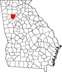 | |
| CDPs | ||
| Unincorporated communities | ||
| Footnotes | ‡This populated place also has portions in an adjacent county or counties | |
|  | |||||
|
| ||||||
| ||||||