Gangapur Dam
| Gangapur Dam | |
|---|---|
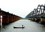
 The canal tower of Gangapur Dam in 1956 | |
 Location of Gangapur Dam in Maharashtra | |
| Official name | Gangapur Dam D01034 |
| Location | Nasik |
| Coordinates | 20°01′34″N 73°40′02″E / 20.0260565°N 73.6671498°ECoordinates: 20°01′34″N 73°40′02″E / 20.0260565°N 73.6671498°E |
| Opening date | 1965[1] |
| Owner(s) | Government of Maharashtra, India |
| Dam and spillways | |
| Type of dam | Earthfill |
| Impounds | Godavari river |
| Height | 36.59 m (120.0 ft) |
| Length | 3,902 m (12,802 ft) |
| Dam volume | 4,612 km3 (1,106 cu mi) |
| Reservoir | |
| Total capacity | 203,880 km3 (48,910 cu mi) |
| Surface area | 22,860 km2 (8,830 sq mi) |
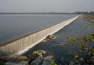
Gangapur Dam, is an earthfill dam on Godavari river near Nashik in the state of Maharashtra in India.
Specifications
The height of the dam above lowest foundation is 36.59 m (120.0 ft) while the length is 3,902 m (12,802 ft). The volume content is 4,612 km3 (1,106 cu mi) and gross storage capacity is 215,880.00 km3 (51,792.37 cu mi).[2]
Due to silt deposition in the reservoir area, the storage capacity of the dam has gradually reduced. The right side canal running towards Nashik is also closed due to the high civilization in the area. For these two reasons, an upstream dam, Kashypi Dam, is constructed which opened in 1998.[3]
Purpose
- Irrigation
one of the earthen dam having emergency spillway
See also
References
- ↑ "Gangapur D01034". Retrieved March 1, 2013.
- ↑ Specifications of large dams in India Archived July 21, 2011, at the Wayback Machine.
- ↑ "Dams Under NID »» Gangapur Dam". Archived from the original on March 13, 2013. Retrieved March 1, 2013.
|
This article is issued from
Wikipedia.
The text is licensed under Creative Commons - Attribution - Sharealike.
Additional terms may apply for the media files.