Étalans
| Étalans | ||
|---|---|---|
| Commune | ||
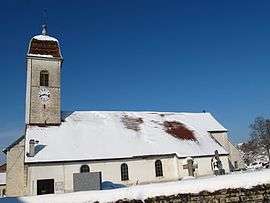 St. Nicholas' Church | ||
| ||
 Étalans Location within Bourgogne-Franche-Comté region  Étalans | ||
| Coordinates: 47°09′07″N 6°16′09″E / 47.1519°N 6.2692°ECoordinates: 47°09′07″N 6°16′09″E / 47.1519°N 6.2692°E | ||
| Country | France | |
| Region | Bourgogne-Franche-Comté | |
| Department | Doubs | |
| Arrondissement | Pontarlier | |
| Canton | Valdahon and Ornans | |
| Intercommunality | Pays de Pierrefontaine–Vercel | |
| Government | ||
| • Mayor (2008–2014) | Jean-Marie Roussel | |
| Area1 | 40.91 km2 (15.80 sq mi) | |
| Population (2014)2 | 1,464 | |
| • Density | 36/km2 (93/sq mi) | |
| Time zone | UTC+1 (CET) | |
| • Summer (DST) | UTC+2 (CEST) | |
| INSEE/Postal code | 25222 /25580 | |
| Elevation | 520–638 m (1,706–2,093 ft) | |
|
1 French Land Register data, which excludes lakes, ponds, glaciers > 1 km2 (0.386 sq mi or 247 acres) and river estuaries. 2 Population without double counting: residents of multiple communes (e.g., students and military personnel) only counted once. | ||

Étalans is a commune in the Doubs department in the Bourgogne-Franche-Comté region in eastern France. On 1 January 2017, the former communes of Charbonnières-les-Sapins and Verrières-du-Grosbois were merged into Étalans.[1]
Population
| Historical population | ||
|---|---|---|
| Year | Pop. | ±% |
| 1962 | 634 | — |
| 1968 | 706 | +11.4% |
| 1975 | 844 | +19.5% |
| 1982 | 771 | −8.6% |
| 1990 | 904 | +17.3% |
| 1999 | 925 | +2.3% |
| 2008 | 1,111 | +20.1% |
| 2012 | 1,201 | +8.1% |
See also
References
- ↑ Arrêté préfectoral 12 August 2016 (in French)
| Wikimedia Commons has media related to Étalans. |
This article is issued from
Wikipedia.
The text is licensed under Creative Commons - Attribution - Sharealike.
Additional terms may apply for the media files.