Portland, Indiana
| Portland, Indiana | |
|---|---|
| City | |
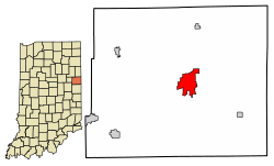 Location of Portland in Jay County, Indiana | |
| Coordinates: 40°26′2″N 84°58′48″W / 40.43389°N 84.98000°WCoordinates: 40°26′2″N 84°58′48″W / 40.43389°N 84.98000°W | |
| Country | United States |
| State | Indiana |
| County | Jay |
| Township | Wayne |
| Government | |
| • Mayor | Randy Geesaman (D) |
| Area[1] | |
| • Total | 4.97 sq mi (12.88 km2) |
| • Land | 4.97 sq mi (12.88 km2) |
| • Water | 0.00 sq mi (0.01 km2) 0.24%% |
| Elevation | 909 ft (277 m) |
| Population (2010)[2] | |
| • Total | 6,223 |
| • Estimate (2016)[3] | 6,161 |
| • Density | 1,239.39/sq mi (478.52/km2) |
| Time zone | UTC-5 (EST) |
| • Summer (DST) | UTC-4 (EDT) |
| ZIP code | 47371 |
| Area code(s) | 260 |
| FIPS code | 18-61236[4] |
| GNIS feature ID | 0441471[5] |
| Website |
www |
Portland is a city in and the county seat of Jay County, Indiana, United States.[6] The population was 6,223 at the 2010 census,[7] and in 2016 the estimated population was 6,161.[3]
History
Portland was platted in 1837.[8] It was named after Portland, Maine.[9]
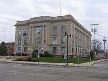
The Jay County Courthouse, Portland Commercial Historic District, and Jonas Votaw House are listed on the National Register of Historic Places.[10]
Geography
Portland is located in central Jay County at 40°26′2″N 84°58′48″W / 40.43389°N 84.98000°W (40.433884, -84.979914),[11] along the Salamonie River.[12] U.S. Route 27 (Meridian Street) runs through the center of the city, leading north 49 miles (79 km) to Fort Wayne and south 43 miles (69 km) to Richmond. Indiana State Road 26 enters Portland from the west on Votaw Street and from the east on Water Street; SR-26 leads west 21 miles (34 km) to Hartford City and east 10 miles (16 km) to the Ohio border near Fort Recovery. Indiana State Road 67 follows SR-26 west out of Portland, then leads southwest 29 miles (47 km) to Muncie.
According to the U.S. Census Bureau, Portland has a total area of 4.97 square miles (12.88 km2), of which 1.6 acres (6,524 m2), or 0.05%, are water.[1] The Salamonie River runs through the city just south of its center. The Salamonie is a west-flowing tributary of the Wabash River.
Demographics
| Historical population | |||
|---|---|---|---|
| Census | Pop. | %± | |
| 1870 | 462 | — | |
| 1880 | 1,694 | 266.7% | |
| 1890 | 3,725 | 119.9% | |
| 1900 | 4,798 | 28.8% | |
| 1910 | 5,130 | 6.9% | |
| 1920 | 5,958 | 16.1% | |
| 1930 | 5,276 | −11.4% | |
| 1940 | 6,362 | 20.6% | |
| 1950 | 7,064 | 11.0% | |
| 1960 | 6,999 | −0.9% | |
| 1970 | 7,115 | 1.7% | |
| 1980 | 7,074 | −0.6% | |
| 1990 | 6,483 | −8.4% | |
| 2000 | 6,437 | −0.7% | |
| 2010 | 6,223 | −3.3% | |
| Est. 2016 | 6,161 | [3] | −1.0% |
| U.S. Decennial Census[13] | |||
2010 census
As of the census[2] of 2010, there were 6,223 people, 2,607 households, and 1,620 families residing in the city. The population density was 1,338.3 inhabitants per square mile (516.7/km2). There were 3,005 housing units at an average density of 646.2 per square mile (249.5/km2). The racial makeup of the city was 94.5% White, 0.4% African American, 0.5% Asian, 3.1% from other races, and 1.5% from two or more races. Hispanic or Latino of any race were 5.8% of the population.
There were 2,607 households of which 30.4% had children under the age of 18 living with them, 42.7% were married couples living together, 14.0% single female householder, 5.4% single male householder, and 37.9% were non-families. 32.1% of all households were made up of individuals and 14.2% had someone living alone who was 65 years of age or older. The average household size was 2.32 and the average family size was 2.89.
The median age in the city was 39.4 years. 23.7% of residents were under the age of 18; 8.6% were between the ages of 18 and 24; 25.1% were from 25 to 44; 24.7% were from 45 to 64; and 17.9% were 65 years of age or older. The gender makeup of the city was 46.8% male and 53.2% female.
2000 census
As of the census[4] of 2000, there were 6,437 people, 2,739 households, and 1,750 families residing in the city. The population density was 1,566.8 people per square mile (604.7/km²). There were 2,928 housing units at an average density of 712.7 per square mile (275.1/km²). The racial makeup of the city was 96.49% White, 0.37% African American, 0.11% Native American, 0.34% Asian, 0.05% Pacific Islander 1.80% from other races, and 0.84% from two or more races. Hispanic or Latino of any race were 3.36% of the population.
There were 2,739 households out of which 27.2% had children under the age of 18 living with them, 47.9% were married couples living together, 12.1% had a female householder with no husband present, and 36.1% were non-families. 32.3% of all households were made up of individuals and 16.4% had someone living alone who was 65 years of age or older. The average household size was 2.28 and the average family size was 2.86.
In the city, the population was spread out with 23.1% under the age of 18, 9.0% from 18 to 24, 26.8% from 25 to 44, 22.2% from 45 to 64, and 18.8% who were 65 years of age or older. The median age was 38 years. For every 100 females, there were 87.9 males. For every 100 females age 18 and over, there were 83.3 males.
The median income for a household in the city was $31,045, and the median income for a family was $41,329. Males had a median income of $29,728 versus $21,134 for females. The per capita income for the city was $18,375. About 5.1% of families and 9.6% of the population were below the poverty line, including 11.9% of those under age 18 and 9.0% of those age 65 or over.
Education
The town has a lending library, the Jay County Public Library.[14]
Notable people
- Leon Ames, actor, founder of Screen Actors Guild in 1933
- Stephanie Arnold, competed in women's archery in the 2004 Olympics
- Pete Brewster, professional football player
- Pete Daily, musician
- Kevin A. Ford, astronaut, piloted NASA space shuttle mission to International Space Station in 2009
- Leslie Glasgow, professor, government administrator, and conservationist, born in Portland in 1914
- Elwood Haynes (born in Portland, 1857) invented the clutch-driven automobile in 1894
- Jack Imel, television producer, Lawrence Welk Show
- Richard T. James, Indiana lieutenant governor 1945-49
- Kenneth Dollins, actor, best known as Kenneth MacDonald; he worked for many years at Columbia Pictures in short features and in the Three Stooges movies
- Mary Meeker (born in Portland, 1960) investment banker, made Internet economically viable by promoting it to investors in the 1990s, (becoming known as the "Queen of the Internet")
- John P. C. Shanks, U.S. Representative from Indiana, Union Army major general
- Twyla Tharp, Emmy and Tony Award-winning choreographer
- Greg Williams, WNBA coach, college basketball player at Rice University
References
- 1 2 "2016 U.S. Gazetteer Files". United States Census Bureau. Retrieved Jul 28, 2017.
- 1 2 "American FactFinder". United States Census Bureau. Retrieved 2017-02-08.
- 1 2 3 "Population and Housing Unit Estimates". Retrieved June 9, 2017.
- 1 2 "American FactFinder". United States Census Bureau. Retrieved 2008-01-31.
- ↑ "US Board on Geographic Names". United States Geological Survey. 2007-10-25. Retrieved 2008-01-31.
- ↑ "Find a County". National Association of Counties. Retrieved 2011-06-07.
- ↑ "Geographic Identifiers: 2010 Census Summary File 1 (G001): Portland city, Indiana". American Factfinder. U.S. Census Bureau. Retrieved May 16, 2018.
- ↑ "Incorporated Cities and Towns". Jay County Historical Society. Retrieved 28 May 2014.
- ↑ Baker, Ronald L. (October 1995). From Needmore to Prosperity: Hoosier Place Names in Folklore and History. Indiana University Press. p. 269. ISBN 978-0-253-32866-3.
...named for his hometown, Portland, Maine.
- ↑ National Park Service (2010-07-09). "National Register Information System". National Register of Historic Places. National Park Service.
- ↑ "US Gazetteer files: 2010, 2000, and 1990". United States Census Bureau. 2011-02-12. Retrieved 2011-04-23.
- ↑ DeLorme (1998). Indiana Atlas & Gazetteer. Yarmouth, Maine: DeLorme. ISBN 0-89933-211-0
- ↑ "Census of Population and Housing". Census.gov. Retrieved June 4, 2015.
- ↑ "Indiana public library directory" (PDF). Indiana State Library. Retrieved 8 March 2018.
External links
| Wikimedia Commons has media related to Portland, Indiana. |
- City of Portland official website
- The Commercial Review

Municipalities and communities of Jay County, Indiana, United States | ||
|---|---|---|
| Cities | ||
| Towns | ||
| Townships | ||
| Unincorporated communities | ||
| Footnotes | ‡This populated place also has portions in an adjacent county or counties | |