Clay Township, Hendricks County, Indiana
| Clay Township | |
|---|---|
| Township | |
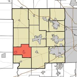 Location in Hendricks County | |
| Coordinates: 39°41′49″N 86°37′03″W / 39.69694°N 86.61750°WCoordinates: 39°41′49″N 86°37′03″W / 39.69694°N 86.61750°W | |
| Country | United States |
| State | Indiana |
| County | Hendricks |
| Government | |
| • Type | Indiana township |
| Area | |
| • Total | 26.51 sq mi (68.66 km2) |
| • Land | 26.51 sq mi (68.65 km2) |
| • Water | 0.01 sq mi (0.01 km2) 0.01% |
| Elevation | 863 ft (263 m) |
| Population (2010) | |
| • Total | 2,256 |
| • Density | 85.1/sq mi (32.9/km2) |
| GNIS feature ID | 0453210 |
Clay Township is one of twelve townships in Hendricks County, Indiana, United States. As of the 2010 census, its population was 2,256.[1]
History
Clay Township was organized in 1845.[2]
Geography
Clay Township covers an area of 26.51 square miles (68.7 km2); of this, 0.01 square miles (0.026 km2) or 0.01 percent is water.
Cities and towns
Unincorporated towns
(This list is based on USGS data and may include former settlements.)
Adjacent townships
- Marion Township (north)
- Center Township (northeast)
- Liberty Township (east)
- Franklin Township (south)
- Floyd Township, Putnam County (west)
- Marion Township, Putnam County (west)
Cemeteries
The township contains eight cemeteries: Amo, Bethel Lutheran, Coatesville, Hadley Friends, Moravian, Old Spring, Springtown Methodist and West Branch Friends.
Major highways
Airports and landing strips
- Marcidale Airport 8IN9
Education
Clay Township residents may obtain a free library card from the Coatesville-Clay Township Public Library in Coatesville.[3]
References
- "Clay Township, Hendricks County, Indiana". Geographic Names Information System. United States Geological Survey. Retrieved 2009-09-24.
- United States Census Bureau cartographic boundary files
- ↑ United States Census Bureau American FactFinder
- ↑ Hadley, John Vestal (1914). History of Hendricks County, Indiana: Her People, Industries and Institutions. B.F. Bowen. p. 65.
- ↑ "About". Coatesville-Clay Twp Public Library. Retrieved 7 March 2018.
External links
Municipalities and communities of Hendricks County, Indiana, United States | ||
|---|---|---|
| Towns | ||
| Townships | ||
| Unincorporated communities | ||
| Footnotes | ‡This populated place also has portions in an adjacent county or counties | |
This article is issued from
Wikipedia.
The text is licensed under Creative Commons - Attribution - Sharealike.
Additional terms may apply for the media files.