Rural Municipality of Cana No. 214
Cana No. 214 (2006 Population 850) is a rural municipality in south-eastern Saskatchewan, Canada encompassing 820.81 square kilometers in area. The rural municipality maintains its office in Melville, Saskatchewan.[1] The rural municipality in conjunction with the provincial government is in charge of maintenance of highways in its area. As well, the municipality provides policing, fire protection and municipal governance for the rural district, with a reeve as its administrator.
Statistics
| Canada census – Rural Municipality of Cana No. 214 community profile | |||
|---|---|---|---|
| 2011 | 2006 | ||
| Population: | 858 (0.9% from 2006) | 850 (-10.7% from 2001) | |
| Land area: | 820.91 km2 (316.96 sq mi) | 820.81 km2 (316.92 sq mi) | |
| Population density: | 1.0/km2 (2.6/sq mi) | 1.0/km2 (2.6/sq mi) | |
| Median age: | 46.0 (M: 46.8, F: 44.8) | 43.1 (M: 43.2, F: 43.0) | |
| Total private dwellings: | 358 | 346 | |
| Median household income: | $NA | $49,406 | |
| References: 2011[2] 2006[3] earlier[4] | |||
Heritage Properties
There is one historical site located within the rural municipality:
- Home Quarter of the Wotherspoon Farm - Constructed in 1905, this homestead is located 41⁄2 miles north of Melville on Highway No. 47. The homestead is being restored as a historical site.[5]
Transportation
Melville Municipal Airport is located within the rural municipality.
References
- ↑ Saskatchewan Municipal Database
- ↑ "2011 Community Profiles". Canada 2011 Census. Statistics Canada. July 5, 2013. Retrieved 2012-08-08.
- ↑ "2006 Community Profiles". Canada 2006 Census. Statistics Canada. March 30, 2011. Retrieved 2011-03-07.
- ↑ "2001 Community Profiles". Canada 2001 Census. Statistics Canada. February 17, 2012.
- ↑ Pheasant Forks Heritage Site
| Cities | 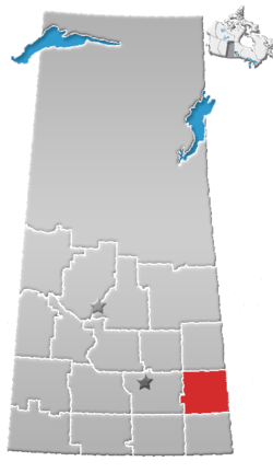 | ||
|---|---|---|---|
| Towns | |||
| Villages | |||
| Resort villages | |||
| Rural municipalities | |||
| First Nations | |||
| Indian reserves | |||
| Unincorporated communities |
| ||
Coordinates: 50°51′28″N 107°03′23″W / 50.85778°N 107.05639°W
This article is issued from
Wikipedia.
The text is licensed under Creative Commons - Attribution - Sharealike.
Additional terms may apply for the media files.