Battle Ground, Washington
| Battle Ground, Washington | |
|---|---|
| City | |
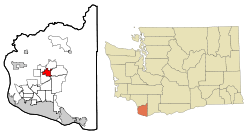 Location within Clark County and Washington | |
| Coordinates: 45°47′N 122°32′W / 45.783°N 122.533°WCoordinates: 45°47′N 122°32′W / 45.783°N 122.533°W | |
| Country | United States |
| State | Washington |
| County | Clark |
| Area[1] | |
| • Total | 7.16 sq mi (18.54 km2) |
| • Land | 7.16 sq mi (18.54 km2) |
| • Water | 0 sq mi (0 km2) |
| Elevation | 295 ft (90 m) |
| Population (2010)[2] | |
| • Total | 17,571 |
| • Estimate (2015)[3] | 19,407 |
| • Density | 2,454.1/sq mi (947.5/km2) |
| Time zone | UTC-8 (Pacific (PST)) |
| • Summer (DST) | UTC-7 (PDT) |
| ZIP code | 98604 |
| Area code | 360 |
| FIPS code | 53-04475 |
| GNIS feature ID | 1530801[4] |
| Website | cityofbg.org |
Battle Ground is a city in Clark County, Washington, United States. The population was 17,571 at the 2010 census.[5] Between 2000 and 2005, Battle Ground ranked fourth in the state for population growth, out of 279 eligible incorporated communities.[6] As of 2018, their population is over 20,000, with no exact data due to large suburban growth.
History
Name
Battle Ground got its name from a standoff between a group of the Klickitat peoples and a military force from the Vancouver Barracks, which had recently transitioned to a U.S. Army post.[7][8] In 1855, when this occurred, the Klickitat peoples had been imprisoned at the Vancouver Barracks. The hostile conditions of their detainment inspired some of the Klickitats to decamp.[7]
This group of Klickitat peoples headed North, led by Chief Umtuch, or Umtux according to some accounts.[7][9][10] When the community at Fort Vancouver realized, they assembled an armed contingent led by Captain William Strong to pursue the Klickitats. After great difficulty, Captain Strong's party found the Klickitats near the present-day location of downtown Battle Ground.[10]
Details of the standoff that occurred vary, however Chief Umtuch and Captain Strong engaged in some sort of negotiations which resulted in the Klickitats agreeing to return to the Barracks. After this decision though, at least one shot was fired because Chief Umtuch was murdered, likely by one of Captain Strong's soldiers.[10]
The Klickitat asked Captain Strong to leave them alone so they could properly bury their chief. After some deliberation, Captain Strong agreed as long as the Klickitats still promised to return to the Fort, which they did a couple of days later.[10]
As a result of this event, settlers at the fort began to refer to that site as "Strong's Battle Ground" which later shortened to "Battle Ground".
Early settlement
Battle Ground was first settled by white Europeans in 1886 by Augustus H. Richter, who platted the town in 1902.[11] Battle Ground was officially incorporated on June 18, 1951. During early settlement in the area, large numbers of people populated Fort Vancouver and locations closer to the Columbia River.
Geography
Battle Ground is located about 11 miles (18 km) north northeast of Vancouver, Washington, 32 miles (51 km) south southwest of Mount St. Helens.
According to the United States Census Bureau, the city has a total area of 7.16 square miles (18.54 km2), all of it land.[1]'
The battle of Captain Strong and Chief Umtuch was fought in Tukes Valley. Some schools in Battle Ground are named after Captain Strong, Chief Umtuch, and Tukes Valley.
Demographics
| Historical population | |||
|---|---|---|---|
| Census | Pop. | %± | |
| 1960 | 888 | — | |
| 1970 | 1,438 | 61.9% | |
| 1980 | 2,774 | 92.9% | |
| 1990 | 3,758 | 35.5% | |
| 2000 | 9,296 | 147.4% | |
| 2010 | 17,571 | 89.0% | |
| Est. 2016 | 20,110 | [12] | 14.4% |
| U.S. Decennial Census[13] (2015 estimate)[3] | |||
2010 census
As of the 2010 census, there were 17,571 people, 5,652 households, and 4,365 families residing in the city. The population density was 2,454.1 inhabitants per square mile (947.5/km2). There were 5,952 housing units at an average density of 831.3 per square mile (321.0/km2). The racial makeup of the city was 90.5% White, 0.8% African American, 0.8% Native American, 1.9% Asian, 0.3% Pacific Islander, 2.1% from other races, and 3.5% from two or more races. Hispanic or Latino of any race were 6.5% of the population. 15.0% were of German, 10.7% Irish, 9.9% English and 6.4% Ukrainian ancestry.[2]
There were 5,652 households of which 50.2% had children under the age of 18 living with them, 59.7% were married couples living together, 12.9% had a female householder with no husband present, 4.6% had a male householder with no wife present, and 22.8% were non-families. 17.9% of all households were made up of individuals and 7.1% had someone living alone who was 65 years of age or older. The average household size was 3.09 and the average family size was 3.53.
The median age in the city was 30 years. 34.5% of residents were under the age of 18; 9% were between the ages of 18 and 24; 29.4% were from 25 to 44; 19.2% were from 45 to 64, and 7.9% were 65 years of age or older. The gender makeup of the city was 49.0% male and 51.0% female.
2000 census
As of the census of 2000, there were 9,296 people, 3,071 households, and 2,346 families residing in the city. The population density was 2,552.6 people per square mile (986.0/km²). There were 3,196 housing units at an average density of 877.6 per square mile (339.0/km²). The racial makeup of the city was 93.81% White, 0.49% African American, 0.86% Native American, 0.72% Asian, 0.11% Pacific Islander, 1.72% from other races, and 2.28% from two or more races. Hispanic or Latino of any race were 4.14% of the population. 15.4% were of German, 11.5% United States or American, 9.4% English, 7.2% Irish, 6.1% Finnish, and 5.8% Norwegian ancestry. 94.0% spoke English, 3.9% Spanish and 1.6% Russian as their first language.
There were 3,071 households out of which 50.4% had children under the age of 18 living with them, 58.9% were married couples living together, 12.0% had a female householder with no husband present, and 23.6% were non-families. 18.2% of all households were made up of individuals and 7.7% had someone living alone who was 65 years of age or older. The average household size was 2.99 and the average family size was 3.43.
In the city, the age distribution of the population shows 36.2% under the age of 18, 10.0% from 18 to 24, 32.9% from 25 to 44, 13.5% from 45 to 64, and 7.3% who were 65 years of age or older. The median age was 27 years. For every 100 females, there were 95.8 males. For every 100 females age 18 and over, there were 90.5 males.
The median income for a household in the city was $45,070, and the median income for a family was $49,876. Males had a median income of $41,133 versus $25,215 for females. The per capita income for the city was $17,139. About 7.3% of families and 9.3% of the population were below the poverty line, including 11.1% of those under age 18 and 8.4% of those age 65 or over.
Events
Every year in the summer Battle Ground puts on Harvest Days. There are a number of community events including parades, street dances, a carnival and chili cook-off. Battle Ground is an almost yearly winner for the Float Best Exemplifying Community Or Civic Involvement And Pride in the Portland Rose Festival's Grand Floral Parade. In 2006, however, it received the Sweepstakes Award for Most Outstanding Float In The Parade.
Civic improvements
In June 2007, the City of Battle Ground opened a 25,000 square foot skate park downtown, and in 2009, a new 13,000 square foot library.[14]
Economy
Battle Ground is also at the epicenter of the growing Clark County wine industry with three wineries and one tasting room.
Education
Battle Ground is served by the Battle Ground School District, which includes (as of 2018):
- Amboy Middle School (Grades 5-8)
- Battle Ground High School (Grades 9-12)
- Captain Strong Elementary School (Grades 1-4)
- Chief Umtuch Middle School (Grades 5-8)
- Daybreak Primary School (Grades 1-4)
- Daybreak Middle School (Grades 5-8)
- Glenwood Heights Primary School (Grades 1-4)
- Laurin Middle School (Grades 5-8)
- Maple Grove Middle School (Grades 5-8)
- Maple Grove Primary School (Grades 1-4)
- Pleasant Valley Middle School (Grades 5-8)
- Pleasant Vally Primary School (Grades 1-4)
- Prairie High School (Vancouver, Washington) (Grades 9-12)
- Tukes Valley Primary School (Grades 1-4)
- Tukes Valley Middle School (Grades 5-8)
- Yacolt Primary School (Grades 1-4)
Alternative Schools:
- CASEE (Admin and Summit View) (Summit View – Grades 9-12)
- Community Education
- Homelink/CAM Academy (Homelink – Grades 1-12) (CAM – Grades 3-12)
Chief Umtuch Primary School, the city's oldest primary school, was demolished in 2007. Lewisville Middle School was closed in 2007 but is still used for its gym, parking lot, and meetings.
School Name Relations
Captain Strong was named after Captain William Strong (See Origin of the name "Battle Ground"). Chief Umtuch was named after Chief Umtuch (See Origin of the name "Battle Ground").
Transportation
Battle Ground is accessed from Interstate 5 at exits 9 and 11 and Interstate 205 at exit 32.
Bus services are provided by the local transit authority, C-Tran, to Downtown Vancouver, Delta Park/Vanport MAX Station, Clark College, Hazel Dell, Yacolt, and the Vancouver Mall.
Battle Ground is 18.5 miles from Portland International Airport, the closest large commercial airport.
Battle Ground is 25.5 miles from Portland, Oregon and 161 miles from Seattle, Washington.
Battle Ground has 2 different highways running in it WA 503 (Lewisville Highway/NE 117th Ave), and WA 502 (NE 219th St).
Notable people
Rob Hotchkiss, the founding member of the Grammy Award-winning band Train, lived in Battle Ground.
Former MLB slugger Richie Sexson hails from neighboring Brush Prairie, and continues to reside in the Battle Ground area. Former MLB pitcher Gerry Staley, also born in Brush Prairie, went to Battle Ground High School.
Before 2012, actress and singer Bethany Joy Galeotti, a star of the TV series One Tree Hill, resided in Battle Ground with her husband, Enation drummer Michael Galeotti, when she was not filming in Wilmington, North Carolina.
Tonya Harding, figure skater, lived near Battle Ground after she retired from competitive skating and was arrested by Battle Ground police in 2002 for drunken driving and crashing her pickup in a ditch.
Jonathan Jackson, an actor from the television shows General Hospital and Nashville, among others, was raised in Battle Ground, along with his brother, fellow actor Richard Lee Jackson.[15]
Former NBA basketball player Richie Frahm attended Battle Ground High School, before going on to play for the Gonzaga Bulldogs men's basketball team.
References
- 1 2 "US Gazetteer files 2010". United States Census Bureau. Archived from the original on 2012-01-24. Retrieved 2012-12-19.
- 1 2 "American FactFinder". United States Census Bureau. Retrieved 2012-12-19.
- 1 2 "Population Estimates". United States Census Bureau. Retrieved June 19, 2016.
- ↑ "US Board on Geographic Names". United States Geological Survey. 2007-10-25. Retrieved 2008-01-31.
- ↑ "2010 Census Redistricting Data (Public Law 94-171) Summary File". American FactFinder. United States Census Bureau. Archived from the original on 21 July 2011. Retrieved 16 September 2012.
- ↑ OFM | April 1 official population estimates
- 1 2 3 Deur, Douglas (2012). "An Ethnohistorical Overview of Groups with Ties to Fort Vancouver National Historic Site" (PDF). National Park Service.
- ↑ "Vancouver Barracks Military Association". Vancouver Barracks Military Association.
- ↑ "Proud Past: Battle Ground: City Without a Battle (1855)". Clark County Washington. 2017.
- 1 2 3 4 Strong, Thomas Nelson (1906). Cathlamet on the Columbia. The Holy Press. pp. 82–93.
- ↑ Meany, Edmond S. (1923). Origin of Washington geographic names. Seattle: University of Washington Press. p. 15.
- ↑ "Population and Housing Unit Estimates". Retrieved June 9, 2017.
- ↑ United States Census Bureau. "Census of Population and Housing". Archived from the original on May 12, 2015. Retrieved September 19, 2013.
- ↑ Harshman, Marissa. "Big Changes in Small-town Battle Ground." The Columbian. Columbian Publishing Company, 27 Feb. 2011. Web. 03 Jan. 2012. <http://www.columbian.com/news/2011/feb/27/big-changes-in-small-town-battle-ground/>.
- ↑ "Jonathan Jackson + Enation Release New Single". Guitar World. June 9, 2014. Retrieved 2018-09-19.
Further reading
- Strong, Harry M., The Adventures of a Pioneer Judge & His Family, COLUMBIA Magazine: Winter 2002-03; Vol. 16, No. 4. http://www.wshs.org/wshs/columbia/articles/0402-a1.htm
- Tucker, Louise M., Battle Ground . . . In and Around, 2006. http://www.battlegroundhistorybook.com/Battle_Ground..._In_and_Around/Home.html
External links
- Official website
- History of Battle Ground at HistoryLink
- Battle Ground Businesses and Community Groups
- Battle Ground Chamber of Commerce
- The Reflector Battle Ground's weekly newspaper
- Battle Ground Public Schools
Municipalities and communities of Clark County, Washington, United States | ||
|---|---|---|
| Cities |  | |
| Town | ||
| CDPs | ||
| Other unincorporated communities | ||
| Footnotes | ‡This populated place also has portions in an adjacent county or counties | |
