Duluth, Washington
| Duluth, Washington | |
|---|---|
| Census-designated place | |
 Duluth Location of Duluth, Washington | |
| Coordinates: 45°46′47″N 122°38′28″W / 45.77972°N 122.64111°WCoordinates: 45°46′47″N 122°38′28″W / 45.77972°N 122.64111°W | |
| Country | United States |
| State | Washington |
| County | Clark |
| Area | |
| • Total | 6.0 sq mi (15.5 km2) |
| • Land | 6.0 sq mi (15.5 km2) |
| • Water | 0.0 sq mi (0.0 km2) |
| Elevation | 281 ft (86 m) |
| Population (2010) | |
| • Total | 1,544 |
| • Density | 258/sq mi (99.8/km2) |
| Time zone | UTC-8 (Pacific (PST)) |
| • Summer (DST) | UTC-7 (PDT) |
| FIPS code | 53-18775 |
| GNIS feature ID | 2629757 |
Duluth is a census-designated place (CDP) in Clark County, Washington, United States. The population was 1,544 at the 2010 census.[1]
It is located 11 miles (18 km) north of downtown Vancouver, Washington, with access from Exit 11 on Interstate 5.
References
- ↑ "Geographic Identifiers: 2010 Demographic Profile Data (G001): Duluth CDP, Washington". U.S. Census Bureau, American Factfinder. Retrieved August 28, 2015.
Municipalities and communities of Clark County, Washington, United States | ||
|---|---|---|
| Cities | 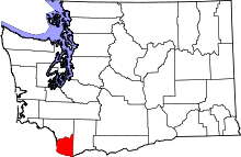 | |
| Town | ||
| CDPs | ||
| Other unincorporated communities | ||
| Footnotes | ‡This populated place also has portions in an adjacent county or counties | |
This article is issued from
Wikipedia.
The text is licensed under Creative Commons - Attribution - Sharealike.
Additional terms may apply for the media files.