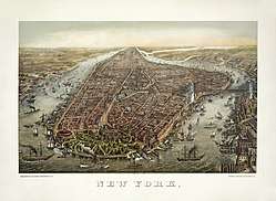
Manhattan
Manhattan New York County, New York | |
|---|---|
Borough and county | |
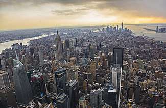 Midtown Manhattan facing south toward Lower Manhattan | |
 Flag | |
| Etymology: Lenape: Manaháhtaan (the place where we get bows) | |
| Nickname(s): The City[1] | |
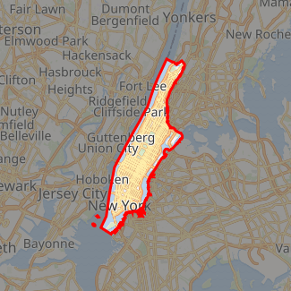
Interactive map outlining Manhattan | |
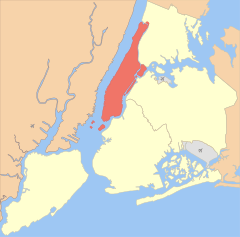
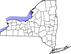 Location within the state of New York | |
| Coordinates: 40°47′N 73°58′W | |
| Country | United States |
| State | New York |
| County | New York County (coterminous) |
| City | New York City |
| Settled | 1624 |
| Government | |
| • Type | Borough (New York City) |
| • Borough President | Gale Brewer (D) — (Borough of Manhattan) |
| • District Attorney | Cyrus Vance Jr. (D) — (New York County) |
| Area | |
| • Total | 33.58 sq mi (87.0 km2) |
| • Land | 22.83 sq mi (59.1 km2) |
| • Water | 10.76 sq mi (27.9 km2) 32% |
| Population (2019) | |
| • Total | 1,628,706 |
| • Density | 69,467.5/sq mi (26,821.6/km2) |
| • Demonym | Manhattanite[3] |
| Time zone | UTC−05:00 (EST) |
| • Summer (DST) | UTC−04:00 (EDT) |
| ZIP Code format | 100xx, 101xx, 102xx |
| Area code | 212/646/332, 917[lower-alpha 1] |
| GDP (2018) | US$600.2 billion[4] · 2nd by U.S. county; 1st per capita |
| Website | Manhattan Borough President |
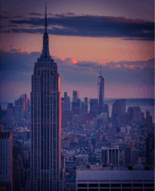
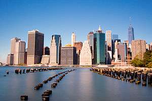
Manhattan (/mænˈhætən, mən-/), often referred to by residents of the New York City area as the City, is the most densely populated of the five boroughs of New York City, and coextensive with the County of New York, one of the original counties of the U.S. state of New York. Manhattan serves as the city's economic and administrative center, cultural identifier,[5] and historical birthplace.[6] The borough consists mostly of Manhattan Island, bounded by the Hudson, East, and Harlem rivers; as well as several small adjacent islands. Manhattan additionally contains Marble Hill, a small neighborhood now on the U.S. mainland, that was connected using landfill to the Bronx and separated from the rest of Manhattan by the Harlem River. Manhattan Island is divided into three informally bounded components, each aligned with the borough's long axis: Lower, Midtown, and Upper Manhattan.
Manhattan has been described as the cultural, financial, media, and entertainment capital of the world,[7][8][9][10] and the borough hosts the United Nations Headquarters.[11] Anchored by Wall Street in the Financial District of Lower Manhattan, New York City has been called both the most economically powerful city and the leading financial center of the world,[12][13][14][15] and Manhattan is home to the world's two largest stock exchanges by total market capitalization: the New York Stock Exchange and NASDAQ.[16][17] Many multinational media conglomerates are based in Manhattan, and the borough has been the setting for numerous books, films, and television shows. Manhattan real estate has since become among the most expensive in the world, with the value of Manhattan Island, including real estate, estimated to exceed US$3 trillion in 2013;[6][18] median residential property sale prices in Manhattan approximated US$1,600 per square foot ($17,000/m2) as of 2018,[19] with Fifth Avenue in Midtown Manhattan commanding the highest retail rents in the world, at US$3,000 per square foot ($32,000/m2) per year in 2017.[20]
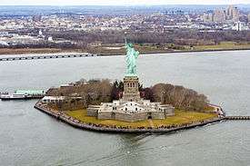
Manhattan traces its origins to a trading post founded by colonists from the Dutch Republic in 1624 on Lower Manhattan; the post was named New Amsterdam in 1626. Manhattan is historically documented to have been purchased by Dutch colonists from Native Americans in 1626 for 60 guilders, which equals roughly $1059 in current terms.[21][22][23] The territory and its surroundings came under English control in 1664[23] and were renamed New York after King Charles II of England granted the lands to his brother, the Duke of York.[24] New York, based in present-day Manhattan, served as the capital of the United States from 1785 until 1790.[25] The Statue of Liberty greeted millions of immigrants as they came to America by ship in the late 19th century[26] and is a world symbol of the United States and its ideals of liberty and peace.[27] Manhattan became a borough during the consolidation of New York City in 1898.
New York County is the United States' second-smallest county by land area (larger only than Kalawao County, Hawaii), and is also the most densely populated U.S. county.[28] It is also one of the most densely populated areas in the world, with a census-estimated 2019 population of 1,628,706[29][30] living in a land area of 22.83 square miles (59.13 km2),[31] or 72,918 residents per square mile (28,154/km2), higher than the density of any individual U.S. city.[32] On business days, the influx of commuters increases this number to over 3.9 million,[33] or more than 170,000 people per square mile (65,600/km2). Manhattan has the third-largest population of New York City's five boroughs, after Brooklyn and Queens, and is the smallest borough in terms of land area.[34] If each borough were ranked as a city, Manhattan would rank as the sixth-most populous in the U.S.
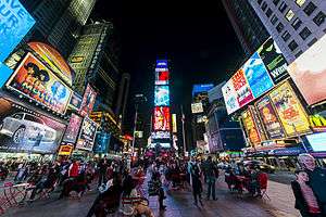
Many districts and landmarks in Manhattan are well known, as New York City received a record 62.8 million tourists in 2017,[35] and Manhattan hosts three of the world's 10 most-visited tourist attractions in 2013: Times Square, Central Park, and Grand Central Terminal.[36] The borough hosts many prominent bridges, such as the Brooklyn, Manhattan, Williamsburg, Queensboro, Triborough, and George Washington Bridges; tunnels such as the Holland and Lincoln Tunnels; skyscrapers such as the Empire State Building, Chrysler Building, and One World Trade Center;[37] and parks, such as Central Park. Chinatown incorporates the highest concentration of Chinese people in the Western Hemisphere,[38] and the Stonewall Inn in Greenwich Village, part of the Stonewall National Monument, is considered the birthplace of the modern gay rights movement.[39][40] The City of New York was founded at the southern tip of Manhattan,[6] and the borough houses New York City Hall, the seat of the city's government.[41] Numerous colleges and universities are located in Manhattan,[42] including Columbia University, New York University, Cornell Tech, Weill Cornell Medical College, and Rockefeller University, which have been ranked among the top 40 in the world.[43][44]
New York City's five boroughs | ||||||||
|---|---|---|---|---|---|---|---|---|
| Jurisdiction | Population | Gross Domestic Product | Land area | Density | ||||
| Borough | County | Estimate (2018)[45] | billions (US$)[46] | per capita (US$) | square miles | square km | persons / sq. mi | persons / km2 |
Bronx |
1,432,132 | 42.695 | 29,200 | 42.10 | 109.04 | 34,653 | 13,231 | |
Kings |
2,582,830 | 91.559 | 34,600 | 70.82 | 183.42 | 37,137 | 14,649 | |
New York |
1,628,701 | 600.244 | 360,900 | 22.83 | 59.13 | 72,033 | 27,826 | |
Queens |
2,278,906 | 93.310 | 39,600 | 108.53 | 281.09 | 21,460 | 8,354 | |
Richmond |
476,179 | 14.514 | 30,300 | 58.37 | 151.18 | 8,112 | 3,132 | |
| 8,398,748 | 842.343 | 97,700 | 302.64 | 783.83 | 28,188 | 10,947 | ||
| 19,745,289 | 1,701.399 | 85,700 | 47,214 | 122,284 | 416.4 | 159 | ||
Sources:[47] and see individual borough articles | ||||||||
Etymology
The name Manhattan derives from the Munsee Lenape language term manaháhtaan (where manah- means "gather", -aht- means "bow", and -aan is an abstract element used to form verb stems). The Lenape word has been translated as "the place where we get bows" or "place for gathering the (wood to make) bows". According to a Munsee tradition recorded in the 19th century, the island was named so for a grove of hickory trees at the lower end that was considered ideal for the making of bows. It was first recorded in writing as Manna-hata, in the 1609 logbook of Robert Juet, an officer on Henry Hudson's yacht Halve Maen (Half Moon).[48] A 1610 map depicts the name as Manna-hata, twice, on both the west and east sides of the Mauritius River (later named the Hudson River). Alternative folk etymologies include "island of many hills",[49] "the island where we all became intoxicated" and simply "island", as well as a phrase descriptive of the whirlpool at Hell Gate.[50]
History
| History of New York City |
|---|
|
Lenape and New Netherland, to 1664 New Amsterdam British and Revolution, 1665–1783 Federal and early American, 1784–1854 Tammany and Consolidation, 1855–1897 (Civil War, 1861–1865) Early 20th century, 1898–1945 Post–World War II, 1946–1977 Modern and post-9/11, 1978– |
| See also |
|
Timelines: NYC • Bronx • Brooklyn • Queens • Staten Island Category |
Colonial era
The area that is now Manhattan was long inhabited by the Lenape Native Americans. In 1524, Florentine explorer Giovanni da Verrazzano – sailing in service of King Francis I of France – became the first documented European to visit the area that would become New York City. He entered the tidal strait now known as The Narrows and named the land around Upper New York Harbor New Angoulême, in reference to the family name of King Francis I that was derived from Angoulême in France; he sailed far enough into the harbor to sight the Hudson River, which he referred to in his report to the French king as a "very big river"; and he named the Bay of Santa Margarita – what is now Upper New York Bay – after Marguerite de Navarre, the elder sister of the king.[51][52]
It was not until the voyage of Henry Hudson, an Englishman who worked for the Dutch East India Company, that the area was mapped.[53] Hudson came across Manhattan Island and the native people living there in 1609, and continued up the river that would later bear his name, the Hudson River, until he arrived at the site of present-day Albany.[54]
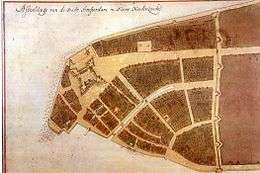
A permanent European presence in New Netherland began in 1624, with the founding of a Dutch fur trading settlement on Governors Island. In 1625, construction was started on the citadel of Fort Amsterdam on Manhattan Island, later called New Amsterdam (Nieuw Amsterdam), in what is now Lower Manhattan.[55][56] The 1625 establishment of Fort Amsterdam at the southern tip of Manhattan Island is recognized as the birth of New York City.[57]
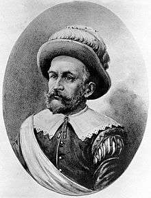
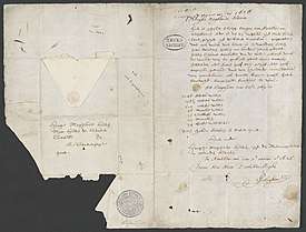
According to a letter by Pieter Janszoon Schagen, Peter Minuit and Dutch colonists acquired Manhattan on May 24, 1626, from unnamed Native American people, who are believed to have been Canarsee Indians of the Lenape,[58] in exchange for traded goods worth 60 guilders,[22] often said to be worth US$24. The figure of 60 guilders comes from a letter by a representative of the Dutch Estates General and member of the board of the Dutch West India Company, Pieter Janszoon Schagen, to the Estates General in November 1626.[59] In 1846, New York historian John Romeyn Brodhead converted the figure of Fl 60 (or 60 guilders) to US$24 (because 24 = 60/2.5, 1 dollar = confused with rijksdaalder = 2.5 guilders).[60] "[A] variable-rate myth being a contradiction in terms, the purchase price remains forever frozen at twenty-four dollars," as Edwin G. Burrows and Mike Wallace remarked in their history of New York.[61] Sixty guilders in 1626 was valued at approximately $1,000 in 2006, according to the Institute for Social History of Amsterdam.[62] Based on the price of silver, Straight Dope author Cecil Adams calculated an equivalent of $72 in 1992.[63] Historians James and Michelle Nevius revisited the issue in 2014, suggesting that using the prices of beer and brandy as monetary equivalencies, the price Minuit paid would have the purchasing power of somewhere between $2,600 and $15,600 in current dollars.[64] According to the writer Nathaniel Benchley, Minuit conducted the transaction with Seyseys, chief of the Canarsee Native Americans, who were willing to accept valuable merchandise in exchange for the island that was mostly controlled by the Weckquaesgeeks, a band of the Wappinger.[65]
In 1647, Peter Stuyvesant was appointed as the last Dutch Director-General of the colony.[66] New Amsterdam was formally incorporated as a city on February 2, 1653.[67] In 1664, the English conquered New Netherland and renamed it "New York" after the English Duke of York and Albany, the future King James II.[68] The Dutch, under Director General Stuyvesant, successfully negotiated with the English to produce 24 articles of provisional transfer, which sought to retain for the extant citizens of New Netherland their previously attained liberties (including freedom of religion) under new colonial English rulers.[69][56]
The Dutch Republic regained the city in August 1673, renaming it "New Orange". New Netherland was ultimately ceded to the English in November 1674 through the Treaty of Westminster.[70]
American Revolution and the early United States
Manhattan was at the heart of the New York Campaign, a series of major battles in the early American Revolutionary War. The Continental Army was forced to abandon Manhattan after the Battle of Fort Washington on November 16, 1776. The city, greatly damaged by the Great Fire of New York during the campaign, became the British military and political center of operations in North America for the remainder of the war.[72] The military center for the colonists was established in New Jersey.[73][74] British occupation lasted until November 25, 1783, when George Washington returned to Manhattan, as the last British forces left the city.[75]
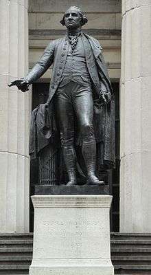
From January 11, 1785, to the fall of 1788, New York City was the fifth of five capitals of the United States under the Articles of Confederation, with the Continental Congress meeting at New York City Hall (then at Fraunces Tavern). New York was the first capital under the newly enacted Constitution of the United States, from March 4, 1789, to August 12, 1790, at Federal Hall.[76] Federal Hall was also the site where the United States Supreme Court met for the first time,[77] the United States Bill of Rights were drafted and ratified,[78] and where the Northwest Ordinance was adopted, establishing measures for adding new states to the Union.[79]
19th century
New York grew as an economic center, first as a result of Alexander Hamilton's policies and practices as the first Secretary of the Treasury and, later, with the opening of the Erie Canal in 1825, which connected the Atlantic port to the vast agricultural markets of the Midwestern United States and Canada.[80][81] By 1810, New York City, then confined to Manhattan, had surpassed Philadelphia as the largest city in the United States.[82]
Tammany Hall, a Democratic Party political machine, began to grow in influence with the support of many of the immigrant Irish, culminating in the election of the first Tammany mayor, Fernando Wood, in 1854. Tammany Hall dominated local politics for decades. Central Park, which opened to the public in 1858, became the first landscaped public park in an American city.[83][84]
New York City played a complex role in the American Civil War. The city's strong commercial ties to the southern United States existed for many reasons, including the industrial power of the Hudson River, which allowed trade with stops such as the West Point Foundry, one of the great manufacturing operations in the early United States; and the city's Atlantic Ocean ports, rendering New York City the American powerhouse in terms of industrial trade between the northern and southern United States. New York's growing immigrant population, which had originated largely from Germany and Ireland, began in the late 1850s to include waves of Italians and Central and Eastern European Jews flowing in en masse. Anger arose about conscription, with resentment at those who could afford to pay $300 to avoid service leading to resentment against Lincoln's war policies and fomenting paranoia about free Blacks taking the poor immigrants' jobs,[85] culminating in the three-day-long New York Draft Riots of July 1863. These intense war-time riots are counted among the worst incidents of civil disorder in American history, with an estimated 119 participants and passersby massacred.[86]
The rate of immigration from Europe grew steeply after the Civil War, and Manhattan became the first stop for millions seeking a new life in the United States, a role acknowledged by the dedication of the Statue of Liberty on October 28, 1886, a gift from the people of France.[87][88] The new European immigration brought further social upheaval. In a city of tenements packed with poorly paid laborers from dozens of nations, the city became a hotbed of revolution (including anarchists and communists among others), syndicalism, racketeering, and unionization.
In 1883, the opening of the Brooklyn Bridge established a road connection to Brooklyn, across the East River. In 1874 the western portion of the present Bronx County was transferred to New York County from Westchester County, and in 1895 the remainder of the present Bronx County was annexed.[89] In 1898, when New York City consolidated with three neighboring counties to form "the City of Greater New York", Manhattan and the Bronx, though still one county, were established as two separate boroughs. On January 1, 1914, the New York State Legislature created Bronx County and New York County was reduced to its present boundaries.[90]
20th century

The construction of the New York City Subway, which opened in 1904, helped bind the new city together, as did additional bridges to Brooklyn. In the 1920s Manhattan experienced large arrivals of African-Americans as part of the Great Migration from the southern United States, and the Harlem Renaissance, part of a larger boom time in the Prohibition era that included new skyscrapers competing for the skyline. New York City became the most populous city in the world in 1925, overtaking London, which had reigned for a century.[91] Manhattan's majority white ethnic group declined from 98.7% in 1900 to 58.3% by 1990.[92]
On March 25, 1911, the Triangle Shirtwaist Factory fire in Greenwich Village killed 146 garment workers. The disaster eventually led to overhauls of the city's fire department, building codes, and workplace regulations.[93]
The period between the World Wars saw the election of reformist mayor Fiorello La Guardia and the fall of Tammany Hall after 80 years of political dominance.[94] As the city's demographics stabilized, labor unionization brought new protections and affluence to the working class, the city's government and infrastructure underwent a dramatic overhaul under La Guardia. Despite the Great Depression, some of the world's tallest skyscrapers were completed in Manhattan during the 1930s, including numerous Art Deco masterpieces that are still part of the city's skyline, most notably the Empire State Building, the Chrysler Building, and the 30 Rockefeller Plaza.[95]
Returning World War II veterans created a postwar economic boom, which led to the development of huge housing developments targeted at returning veterans, the largest being Peter Cooper Village-Stuyvesant Town, which opened in 1947.[96] In 1951–1952, the United Nations relocated to a new headquarters the East Side of Manhattan.[97][98]
The Stonewall riots were a series of spontaneous, violent demonstrations by members of the gay community against a police raid that took place in the early morning hours of June 28, 1969, at the Stonewall Inn in the Greenwich Village neighborhood of Lower Manhattan. They are widely considered to constitute the single most important event leading to the gay liberation movement[99][100] and the modern fight for LGBT rights.[101][102]
In the 1970s, job losses due to industrial restructuring caused New York City, including Manhattan, to suffer from economic problems and rising crime rates.[103] While a resurgence in the financial industry greatly improved the city's economic health in the 1980s, New York's crime rate continued to increase through the decade and into the beginning of the 1990s.[104]
The 1980s saw a rebirth of Wall Street, and Manhattan reclaimed its role at the center of the worldwide financial industry. The 1980s also saw Manhattan at the heart of the AIDS crisis, with Greenwich Village at its epicenter. The organizations Gay Men's Health Crisis (GMHC) and AIDS Coalition to Unleash Power (ACT UP) were founded to advocate on behalf of those stricken with the disease.
By the 1990s crime rates started to drop dramatically due to revised police strategies, improving economic opportunities, gentrification, and new residents, both American transplants and new immigrants from Asia and Latin America. Murder rates that had reached 2,245 in 1990 plummeted to 537 by 2008, and the crack epidemic and its associated drug-related violence came under greater control.[105] The outflow of population turned around, as the city once again became the destination of immigrants from around the world, joining with low interest rates and Wall Street bonuses to fuel the growth of the real estate market.[106] Important new sectors, such as Silicon Alley, emerged in Manhattan's economy.
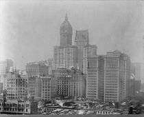 The newly completed Singer Building towering above the city, 1909
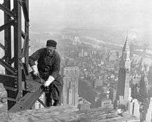 A construction worker atop the Empire State Building as it was being built in 1930; to the right is the Chrysler Building.
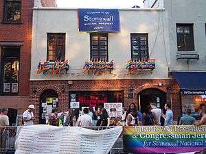 The Stonewall Inn in Greenwich Village, a designated U.S. National Historic Landmark and National Monument, as the site of the June 1969 Stonewall riots and the cradle of the modern gay rights movement.[99][107][108]
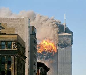 United Airlines Flight 175 hits the South Tower of the first World Trade Center on September 11, 2001.
21st century
On September 11, 2001, two of four hijacked planes were flown into the Twin Towers of the original World Trade Center, and the towers subsequently collapsed. 7 World Trade Center collapsed due to fires and structural damage caused by heavy debris falling from the collapse of the Twin Towers. The other buildings within the World Trade Center complex were damaged beyond repair and soon after demolished. The collapse of the Twin Towers caused extensive damage to other surrounding buildings and skyscrapers in Lower Manhattan, and resulted in the deaths of 2,606 people, in addition to those on the planes. Since 2001, most of Lower Manhattan has been restored, although there has been controversy surrounding the rebuilding. Many rescue workers and residents of the area developed several life-threatening illnesses that have led to some of their subsequent deaths.[110] A memorial at the site was opened to the public on September 11, 2011, and the museum opened in 2014. In 2014, the new One World Trade Center, at 1,776 feet (541 m) and formerly known as the Freedom Tower, became the tallest building in the Western Hemisphere,[111] while other skyscrapers were under construction at the site.
The Occupy Wall Street protests in Zuccotti Park in the Financial District of Lower Manhattan began on September 17, 2011, receiving global attention and spawning the Occupy movement against social and economic inequality worldwide.[112]
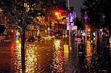
On October 29 and 30, 2012, Hurricane Sandy caused extensive destruction in the borough, ravaging portions of Lower Manhattan with record-high storm surge from New York Harbor,[113] severe flooding, and high winds, causing power outages for hundreds of thousands of city residents[114] and leading to gasoline shortages[115] and disruption of mass transit systems.[116][117][118][119] The storm and its profound impacts have prompted the discussion of constructing seawalls and other coastal barriers around the shorelines of the borough and the metropolitan area to minimize the risk of destructive consequences from another such event in the future.[120] Around 15 percent of the borough is considered to be in flood-risk zones.[121]
On October 31, 2017, a terrorist took a rental pickup truck and deliberately drove down a bike path alongside the West Side Highway in Lower Manhattan, killing eight people and injuring a dozen others before crashing into a school bus.[122]
Geography
Components
The borough consists of Manhattan Island, Marble Hill, and several small islands, including Randalls Island and Wards Island, and Roosevelt Island in the East River, and Governors Island and Liberty Island to the south in New York Harbor.[123]
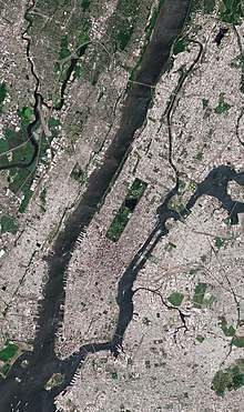
According to the United States Census Bureau, New York County has a total area of 33.6 square miles (87 km2), of which 22.8 square miles (59 km2) is land and 10.8 square miles (28 km2) (32%) is water.[2] The northern segment of Upper Manhattan represents a geographic panhandle. Manhattan Island is 22.7 square miles (59 km2) in area, 13.4 miles (21.6 km) long and 2.3 miles (3.7 km) wide, at its widest (near 14th Street).[124] Icebergs are often compared in size to the area of Manhattan.[125][126][127]
Manhattan Island
Manhattan Island is loosely divided into Downtown (Lower Manhattan), Midtown (Midtown Manhattan), and Uptown (Upper Manhattan), with Fifth Avenue dividing Manhattan lengthwise into its East Side and West Side. Manhattan Island is bounded by the Hudson River to the west and the East River to the east. To the north, the Harlem River divides Manhattan Island from the Bronx and the mainland United States.
Early in the 19th century, landfill was used to expand Lower Manhattan from the natural Hudson shoreline at Greenwich Street to West Street.[128] When building the World Trade Center in 1968, 1.2 million cubic yards (917,000 m3) of material was excavated from the site.[129] Rather than dumping the spoil at sea or in landfills, the fill material was used to expand the Manhattan shoreline across West Street, creating Battery Park City,[130] The result was a 700-foot (210-m) extension into the river, running six blocks or 1,484 feet (452 m), covering 92 acres (37 ha), providing a 1.2-mile (1.9 km) riverfront esplanade and over 30 acres (12 ha) of parks;[131] Hudson River Park was subsequently opened in stages beginning in 1998.[132]
Marble Hill
One neighborhood of New York County, Marble Hill, is contiguous with the U.S. mainland. Marble Hill at one time was part of Manhattan Island, but the Harlem River Ship Canal, dug in 1895 to improve navigation on the Harlem River, separated it from the remainder of Manhattan as an island between the Bronx and the remainder of Manhattan.[133] Before World War I, the section of the original Harlem River channel separating Marble Hill from The Bronx was filled in, and Marble Hill became part of the mainland.[134]
Marble Hill is one example of how Manhattan's land has been considerably altered by human intervention. The borough has seen substantial land reclamation along its waterfronts since Dutch colonial times, and much of the natural variation in its topography has been evened out.[49]
Smaller islands
In New York Harbor, there are three smaller islands:
- Ellis Island, shared with New Jersey
- Governors Island
- Liberty Island
Other smaller islands, in the East River, include (from north to south):
- Randalls and Wards Islands, joined by landfill
- Mill Rock
- Roosevelt Island
- U Thant Island (legally Belmont Island)
Geology
Bedrock
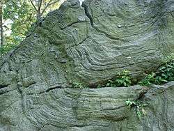
The bedrock underlying much of Manhattan is a mica schist known as Manhattan schist[135] of the Manhattan Prong physiographic region. It is a strong, competent metamorphic rock that was created when Pangaea formed. It is well suited for the foundations of tall buildings. In Central Park, outcrops of Manhattan schist occur and Rat Rock is one rather large example.[136][137][138]
Geologically, a predominant feature of the substrata of Manhattan is that the underlying bedrock base of the island rises considerably closer to the surface near Midtown Manhattan, dips down lower between 29th Street and Canal Street, then rises toward the surface again in Lower Manhattan. It has been widely believed that the depth to bedrock was the primary underlying reason for the clustering of skyscrapers in the Midtown and Financial District areas, and their absence over the intervening territory between these two areas.[139][140] However, research has shown that economic factors played a bigger part in the locations of these skyscrapers.[141][142][143]
Updated seismic analysis
According to the United States Geological Survey, an updated analysis of seismic hazard in July 2014 revealed a "slightly lower hazard for tall buildings" in Manhattan than previously assessed. Scientists estimated this lessened risk based upon a lower likelihood than previously thought of slow shaking near New York City, which would be more likely to cause damage to taller structures from an earthquake in the vicinity of the city.[144]
Locations
Adjacent counties
- Bergen County, New Jersey—west and northwest
- Hudson County, New Jersey—west and southwest
- Bronx County (The Bronx)—north and northeast
- Queens County (Queens)—east
- Kings County (Brooklyn)—south and southeast
- Richmond County (Staten Island)—southwest
National protected areas
- African Burial Ground National Monument
- Castle Clinton National Monument
- Federal Hall National Memorial
- General Grant National Memorial
- Governors Island National Monument
- Hamilton Grange National Memorial
- Lower East Side Tenement National Historic Site
- Statue of Liberty National Monument (part)
- Theodore Roosevelt Birthplace National Historic Site
Neighborhoods
Manhattan's many neighborhoods are not named according to any particular convention. Some are geographical (the Upper East Side), or ethnically descriptive (Little Italy). Others are acronyms, such as TriBeCa (for "TRIangle BElow CAnal Street") or SoHo ("SOuth of HOuston"), or the far more recent vintages NoLIta ("NOrth of Little ITAly").[145][146] and NoMad ("NOrth of MADison Square Park").[147][148][149] Harlem is a name from the Dutch colonial era after Haarlem, a city in the Netherlands.[150] Alphabet City comprises Avenues A, B, C, and D, to which its name refers. Some have simple folkloric names, such as Hell's Kitchen, alongside their more official but lesser used title (in this case, Clinton).
Some neighborhoods, such as SoHo, which is mixed use, are known for upscale shopping as well as residential use. Others, such as Greenwich Village, the Lower East Side, Alphabet City and the East Village, have long been associated with the Bohemian subculture.[151] Chelsea is one of several Manhattan neighborhoods with large gay populations and has become a center of both the international art industry and New York's nightlife.[152] Washington Heights is a primary destination for immigrants from the Dominican Republic. Chinatown has the highest concentration of people of Chinese descent outside of Asia.[153][154] Koreatown is roughly bounded by 6th and Madison Avenues,[155][156][157] between 31st and 33rd Streets, where Hangul (한글) signage is ubiquitous. Rose Hill features a growing number of Indian restaurants and spice shops along a stretch of Lexington Avenue between 25th and 30th Streets which has become known as Curry Hill.[158] Since 2010, a Little Australia has emerged and is growing in Nolita, Lower Manhattan.[159]
In Manhattan, uptown means north (more precisely north-northeast, which is the direction the island and its street grid system are oriented) and downtown means south (south-southwest).[160] This usage differs from that of most American cities, where downtown refers to the central business district. Manhattan has two central business districts, the Financial District at the southern tip of the island, and Midtown Manhattan. The term uptown also refers to the northern part of Manhattan above 72nd Street and downtown to the southern portion below 14th Street,[161] with Midtown covering the area in between, though definitions can be rather fluid depending on the situation.
Fifth Avenue roughly bisects Manhattan Island and acts as the demarcation line for east/west designations (e.g., East 27th Street, West 42nd Street); street addresses start at Fifth Avenue and increase heading away from Fifth Avenue, at a rate of 100 per block on most streets.[161] South of Waverly Place, Fifth Avenue terminates and Broadway becomes the east/west demarcation line. Although the grid does start with 1st Street, just north of Houston Street (the southernmost street divided in west and east portions; pronounced HOW-stin), the grid does not fully take hold until north of 14th Street, where nearly all east-west streets are numerically identified, which increase from south to north to 220th Street, the highest numbered street on the island. Streets in Midtown are usually one-way, with the few exceptions generally being the busiest cross-town thoroughfares (14th, 23rd, 34th, and 42nd Streets, for example), which are bidirectional across the width of Manhattan Island. The rule of thumb is that odd-numbered streets run west, while even-numbered streets run east.[124]
Climate
Under the Köppen climate classification, using the 0 °C (32 °F) isotherm, New York City features a humid subtropical climate (Cfa), and is thus the northernmost major city on the North American continent with this categorization.[162][163] The suburbs to the immediate north and west lie in the transitional zone between humid subtropical and humid continental climates (Dfa).[162][163] The city averages 234 days with at least some sunshine annually.[164] The city lies in the USDA 7b plant hardiness zone.[165]
Winters are cold and damp, and prevailing wind patterns that blow offshore temper the moderating effects of the Atlantic Ocean; yet the Atlantic and the partial shielding from colder air by the Appalachians keep the city warmer in the winter than inland North American cities at similar or lesser latitudes such as Pittsburgh, Cincinnati, and Indianapolis. The daily mean temperature in January, the area's coldest month, is 32.6 °F (0.3 °C);[166] temperatures usually drop to 10 °F (−12 °C) several times per winter,[166][167] and reach 60 °F (16 °C) several days in the coldest winter month.[166] Spring and autumn are unpredictable and can range from chilly to warm, although they are usually mild with low humidity. Summers are typically warm to hot and humid, with a daily mean temperature of 76.5 °F (24.7 °C) in July.[166] Nighttime conditions are often exacerbated by the urban heat island phenomenon, while daytime temperatures exceed 90 °F (32 °C) on average of 17 days each summer[168] and in some years exceed 100 °F (38 °C). Extreme temperatures have ranged from −15 °F (−26 °C), recorded on February 9, 1934, up to 106 °F (41 °C) on July 9, 1936.[168]
Summer evening temperatures are elevated by the urban heat island effect, which causes heat absorbed during the day to be radiated back at night, raising temperatures by as much as 7 °F (4 °C) when winds are slow.[169] Manhattan receives 49.9 inches (1,270 mm) of precipitation annually, which is relatively evenly spread throughout the year. Average winter snowfall between 1981 and 2010 has been 25.8 inches (66 cm); this varies considerably from year to year.[168]
Climate data for New York (Belvedere Castle, Central Park), 1981–2010 normals,[lower-alpha 2] extremes 1869–present[lower-alpha 3] | |||||||||||||
|---|---|---|---|---|---|---|---|---|---|---|---|---|---|
| Month | Jan | Feb | Mar | Apr | May | Jun | Jul | Aug | Sep | Oct | Nov | Dec | Year |
| Record high °F (°C) | 72 (22) |
78 (26) |
86 (30) |
96 (36) |
99 (37) |
101 (38) |
106 (41) |
104 (40) |
102 (39) |
94 (34) |
84 (29) |
75 (24) |
106 (41) |
| Mean maximum °F (°C) | 59.6 (15.3) |
60.7 (15.9) |
71.5 (21.9) |
83.0 (28.3) |
88.0 (31.1) |
92.3 (33.5) |
95.4 (35.2) |
93.7 (34.3) |
88.5 (31.4) |
78.8 (26.0) |
71.3 (21.8) |
62.2 (16.8) |
97.0 (36.1) |
| Average high °F (°C) | 38.3 (3.5) |
41.6 (5.3) |
49.7 (9.8) |
61.2 (16.2) |
70.8 (21.6) |
79.3 (26.3) |
84.1 (28.9) |
82.6 (28.1) |
75.2 (24.0) |
63.8 (17.7) |
53.8 (12.1) |
43.0 (6.1) |
62.0 (16.7) |
| Daily mean °F (°C) | 32.6 (0.3) |
35.3 (1.8) |
42.5 (5.8) |
53.0 (11.7) |
62.4 (16.9) |
71.5 (21.9) |
76.5 (24.7) |
75.2 (24.0) |
68.0 (20.0) |
56.9 (13.8) |
47.7 (8.7) |
37.5 (3.1) |
55.0 (12.8) |
| Average low °F (°C) | 26.9 (−2.8) |
28.9 (−1.7) |
35.2 (1.8) |
44.8 (7.1) |
54.0 (12.2) |
63.6 (17.6) |
68.8 (20.4) |
67.8 (19.9) |
60.8 (16.0) |
50.0 (10.0) |
41.6 (5.3) |
32.0 (0.0) |
48.0 (8.9) |
| Mean minimum °F (°C) | 9.2 (−12.7) |
12.8 (−10.7) |
18.5 (−7.5) |
32.3 (0.2) |
43.5 (6.4) |
52.9 (11.6) |
60.3 (15.7) |
58.8 (14.9) |
48.6 (9.2) |
38.0 (3.3) |
27.7 (−2.4) |
15.6 (−9.1) |
7.0 (−13.9) |
| Record low °F (°C) | −6 (−21) |
−15 (−26) |
3 (−16) |
12 (−11) |
32 (0) |
44 (7) |
52 (11) |
50 (10) |
39 (4) |
28 (−2) |
5 (−15) |
−13 (−25) |
−15 (−26) |
| Average precipitation inches (mm) | 3.65 (93) |
3.09 (78) |
4.36 (111) |
4.50 (114) |
4.19 (106) |
4.41 (112) |
4.60 (117) |
4.44 (113) |
4.28 (109) |
4.40 (112) |
4.02 (102) |
4.00 (102) |
49.94 (1,268) |
| Average snowfall inches (cm) | 7.0 (18) |
9.2 (23) |
3.9 (9.9) |
0.6 (1.5) |
0 (0) |
0 (0) |
0 (0) |
0 (0) |
0 (0) |
0 (0) |
0.3 (0.76) |
4.8 (12) |
25.8 (66) |
| Average precipitation days (≥ 0.01 in) | 10.4 | 9.2 | 10.9 | 11.5 | 11.1 | 11.2 | 10.4 | 9.5 | 8.7 | 8.9 | 9.6 | 10.6 | 122.0 |
| Average snowy days (≥ 0.1 in) | 4.0 | 2.8 | 1.8 | 0.3 | 0 | 0 | 0 | 0 | 0 | 0 | 0.2 | 2.3 | 11.4 |
| Average relative humidity (%) | 61.5 | 60.2 | 58.5 | 55.3 | 62.7 | 65.2 | 64.2 | 66.0 | 67.8 | 65.6 | 64.6 | 64.1 | 63.0 |
| Mean monthly sunshine hours | 162.7 | 163.1 | 212.5 | 225.6 | 256.6 | 257.3 | 268.2 | 268.2 | 219.3 | 211.2 | 151.0 | 139.0 | 2,534.7 |
| Percent possible sunshine | 54 | 55 | 57 | 57 | 57 | 57 | 59 | 63 | 59 | 61 | 51 | 48 | 57 |
| Average ultraviolet index | 2 | 3 | 4 | 6 | 7 | 8 | 8 | 8 | 6 | 4 | 2 | 1 | 5 |
| Source #1: NOAA (relative humidity and sun 1961–1990)[168][166][164][171] | |||||||||||||
| Source #2: Weather Atlas[172]
See Geography of New York City for additional climate information from the outer boroughs. | |||||||||||||
| Climate data for New York | |||||||||||||
|---|---|---|---|---|---|---|---|---|---|---|---|---|---|
| Month | Jan | Feb | Mar | Apr | May | Jun | Jul | Aug | Sep | Oct | Nov | Dec | Year |
| Average sea temperature °F (°C) | 41.7 (5.4) |
39.7 (4.3) |
40.2 (4.5) |
45.1 (7.3) |
52.5 (11.4) |
64.5 (18.1) |
72.1 (22.3) |
74.1 (23.4) |
70.1 (21.2) |
63.0 (17.3) |
54.3 (12.4) |
47.2 (8.4) |
55.4 (13.0) |
| Source: Weather Atlas[172] | |||||||||||||
Boroughscape
Demographics
| Historical population | ||
|---|---|---|
| Year | Pop. | ±% |
| 1656 | 1,000 | — |
| 1698 | 6,788 | +578.8% |
| 1711 | 10,538 | +55.2% |
| 1730 | 11,963 | +13.5% |
| 1731 | 8,628 | −27.9% |
| 1756 | 15,710 | +82.1% |
| 1773 | 21,876 | +39.2% |
| 1774 | 23,600 | +7.9% |
| 1782 | 29,363 | +24.4% |
| 1790 | 33,131 | +12.8% |
| 1800 | 60,489 | +82.6% |
| 1810 | 96,373 | +59.3% |
| 1820 | 123,706 | +28.4% |
| 1830 | 202,589 | +63.8% |
| 1840 | 312,710 | +54.4% |
| 1850 | 515,547 | +64.9% |
| 1860 | 813,669 | +57.8% |
| 1870 | 942,292 | +15.8% |
| 1880 | 1,164,674 | +23.6% |
| 1890 | 1,441,216 | +23.7% |
| 1900 | 1,850,093 | +28.4% |
| 1910 | 2,331,542 | +26.0% |
| 1920 | 2,284,103 | −2.0% |
| 1930 | 1,867,312 | −18.2% |
| 1940 | 1,889,924 | +1.2% |
| 1950 | 1,960,101 | +3.7% |
| 1960 | 1,698,281 | −13.4% |
| 1970 | 1,539,233 | −9.4% |
| 1980 | 1,428,285 | −7.2% |
| 1990 | 1,487,536 | +4.1% |
| 2000 | 1,537,195 | +3.3% |
| 2010 | 1,585,873 | +3.2% |
| 2019 | 1,628,706 | +2.7% |
| Sources:[29][173][30] Source: U.S. Decennial Census[174] | ||
| Racial composition | 2018[175] | 2010[176] | 1990[177] | 1950[177] | 1900[177] |
|---|---|---|---|---|---|
| White | 64.5% | 57.4% | 58.3% | 79.4% | 97.8% |
| —Non-Hispanic | 47% | 48% | 48.9% | n/a | n/a |
| Black or African American | 17.9% | 15.6% | 22.0% | 19.6% | 2.0% |
| Hispanic or Latino (of any race) | 25.9% | 25.4% | 26.0% | n/a | n/a |
| Asian | 12.8% | 11.3% | 7.4% | 0.8% | 0.3% |
At the 2010 Census, there were 1,585,873 people living in Manhattan, an increase of 3.2% since 2000. Since 2010, Manhattan's population was estimated by the Census Bureau to have increased 2.7% to 1,628,706 as of 2018, representing 19.5% of New York City's population of 8,336,817 and 8.4% of New York State's population of 19,745,289.[29][178] As of the 2017 Census estimates, the population density of New York County was around 72,918 people per square mile (28,154/km²), the highest population density of any county in the United States.[29] In 1910, at the height of European immigration to New York, Manhattan's population density reached a peak of 101,548 people per square mile (39,208/km²).[29][178]
In 2006, the New York City Department of City Planning projected that Manhattan's population would increase by 289,000 people between 2000 and 2030, an increase of 18.8% over the period.[179] However, since then, Lower Manhattan has been experiencing a baby boom, well above the overall birth rate in Manhattan, with the area south of Canal Street witnessing 1,086 births in 2010, 12% greater than 2009 and over twice the number born in 2001.[180] The Financial District alone has witnessed growth in its population to approximately 43,000 as of 2014, nearly double the 23,000 recorded at the 2000 Census.[181] The southern tip of Manhattan became the fastest growing part of New York City between 1990 and 2014.[182]
According to the 2009 American Community Survey,[183] the average household size was 2.11, and the average family size was 3.21. Approximately 59.4% of the population over the age of 25 have a bachelor's degree or higher. Approximately 27.0% of the population is foreign-born, and 61.7% of the population over the age of 5 speak only English at home. People of Irish ancestry make up 7.8% of the population, while Italian Americans make up 6.8% of the population. German Americans and Russian Americans make up 7.2% and 6.2% of the population respectively.[184]
Manhattan is one of the highest-income places in the United States with a population greater than one million. As of 2012, Manhattan's cost of living was the highest in the United States,[185] but the borough also contained the country's most profound level of income inequality.[186] Manhattan is also the United States county with the highest per capita income, being the sole county whose per capita income exceeded $100,000 in 2010.[187] However, from 2011–2015 Census data of New York County, the per capita income was recorded in 2015 dollars as $64,993, with the median household income at $72,871, and poverty at 17.6%.[188] In 2012, The New York Times reported that inequality was higher than in most developing countries, stating, "The wealthiest fifth of Manhattanites made more than 40 times what the lowest fifth reported, a widening gap (it was 38 times, the year before) surpassed by only a few developing countries".[189]
Religion
In 2010 statistics, the largest religious group in Manhattan was the Archdiocese of New York, with 323,325 Catholics worshipping at 109 parishes, followed by 64,000 Orthodox Jews with 77 congregations, an estimated 42,545 Muslims with 21 congregations, 42,502 non-denominational adherents with 54 congregations, 26,178 TEC Episcopalians with 46 congregations, 25,048 ABC-USA Baptists with 41 congregations, 24,536 Reform Jews with 10 congregations, 23,982 Mahayana Buddhists with 35 congregations, 10,503 PC-USA Presbyterians with 30 congregations, and 10,268 RCA Presbyterians with 10 congregations. Altogether, 44.0% of the population was claimed as members by religious congregations, although members of historically African-American denominations were underrepresented due to incomplete information.[190] In 2014, Manhattan had 703 religious organizations, the seventeenth most out of all US counties.[191]
Languages
As of 2010, 59.98% (902,267) of Manhattan residents, aged five and older, spoke only English at home, while 23.07% (347,033) spoke Spanish, 5.33% (80,240) Chinese, 2.03% (30,567) French, 0.78% (11,776) Japanese, 0.77% (11,517) Russian, 0.72% (10,788) Korean, 0.70% (10,496) German, 0.66% (9,868) Italian, 0.64% (9,555) Hebrew, and 0.48% (7,158) spoke African languages at home. In total, 40.02% (602,058) of Manhattan's population, aged five and older, spoke a language other than English at home.[192]
Landmarks and architecture
Points of interest on Manhattan Island include the American Museum of Natural History, Broadway and the Theater District, Bryant Park, Central Park, Chinatown, the Chrysler Building, Columbia University, the Empire State Building, Flatiron Building, Fulton Center, Grand Central Terminal, Harlem and Spanish Harlem, the High Line, Koreatown, Lincoln Center for the Performing Arts, Little Italy, Madison Square Garden, Museum Mile on Fifth Avenue, including the Metropolitan Museum of Art, the New York Stock Exchange on Wall Street, New York University and the Washington Square Arch in Greenwich Village, Penn Station, Port Authority Bus Terminal, Rockefeller Center (including Radio City Music Hall), South Street Seaport, Stonewall Inn, The Battery, Times Square, Trump Tower, World Trade Center, including the National September 11 Museum and One World Trade Center.
There are also numerous iconic bridges across rivers that connect to Manhattan Island, as well as an emerging number of supertall skyscrapers. The Statue of Liberty rests on a pedestal on Liberty Island, an exclave of Manhattan, and part of Ellis Island is also an exclave of Manhattan. The borough has many energy-efficient green office buildings, such as the Hearst Tower, the rebuilt 7 World Trade Center,[193] and the Bank of America Tower—the first skyscraper designed to attain a Platinum LEED Certification.[194][195]
Architectural history
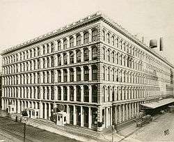
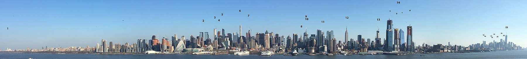
The skyscraper, which has shaped Manhattan's distinctive skyline, has been closely associated with New York City's identity since the end of the 19th century. From 1890 to 1973, the title of world's tallest building resided continually in Manhattan (with a gap between 1901 and 1908, when the title was held by Philadelphia City Hall), with nine different buildings holding the title.[196] The New York World Building on Park Row, was the first to take the title in 1890, standing 309 feet (94 m) until 1955, when it was demolished to construct a new ramp to the Brooklyn Bridge.[197] The nearby Park Row Building, with its 29 stories standing 391 feet (119 m) high took the title in 1899.[198] The 41-story Singer Building, constructed in 1908 as the headquarters of the eponymous sewing machine manufacturer, stood 612 feet (187 m) high until 1967, when it became the tallest building ever demolished.[199] The Metropolitan Life Insurance Company Tower, standing 700 feet (210 m) at the foot of Madison Avenue, wrested the title in 1909, with a tower reminiscent of St Mark's Campanile in Venice.[200] The Woolworth Building, and its distinctive Gothic architecture, took the title in 1913, topping off at 792 feet (241 m).[201] Structures such as the Equitable Building of 1915, which rises vertically forty stories from the sidewalk, prompted the passage of the 1916 Zoning Resolution, requiring new buildings to contain setbacks withdrawing progressively at a defined angle from the street as they rose, in order to preserve a view of the sky at street level.
The Roaring Twenties saw a race to the sky, with three separate buildings pursuing the world's tallest title in the span of a year. As the stock market soared in the days before the Wall Street Crash of 1929, two developers publicly competed for the crown.[202] At 927 feet (283 m), 40 Wall Street, completed in May 1930 in only eleven months as the headquarters of the Bank of Manhattan, seemed to have secured the title.[203] At Lexington Avenue and 42nd Street, auto executive Walter Chrysler and his architect William Van Alen developed plans to build the structure's trademark 185-foot (56 m) spire in secret, pushing the Chrysler Building to 1,046 feet (319 m) and making it the tallest in the world when it was completed in 1929.[204] Both buildings were soon surpassed with the May 1931 completion of the 102-story Empire State Building with its Art Deco tower reaching 1,250 feet (380 m) at the top of the building. The 203-foot (62 m) high pinnacle was later added bringing the total height of the building to 1,453 ft (443 m).[205][206]
The former Twin Towers of the World Trade Center were located in Lower Manhattan. At 1,368 and 1,362 feet (417 and 415 m), the 110-story buildings were the world's tallest from 1972 until they were surpassed by the construction of the Willis Tower in 1974 (formerly known as the Sears Tower, located in Chicago).[207] One World Trade Center, a replacement for the Twin Towers of the World Trade Center, is currently the tallest building in the Western Hemisphere.[208]
In 1961, the Pennsylvania Railroad unveiled plans to tear down the old Penn Station and replace it with a new Madison Square Garden and office building complex. Organized protests were aimed at preserving the McKim, Mead & White-designed structure completed in 1910, widely considered a masterpiece of the Beaux-Arts style and one of the architectural jewels of New York City.[209] Despite these efforts, demolition of the structure began in October 1963. The loss of Penn Station—called "an act of irresponsible public vandalism" by historian Lewis Mumford—led directly to the enactment in 1965 of a local law establishing the New York City Landmarks Preservation Commission, which is responsible for preserving the "city's historic, aesthetic, and cultural heritage".[210] The historic preservation movement triggered by Penn Station's demise has been credited with the retention of some one million structures nationwide, including nearly 1,000 in New York City.[211] In 2017, a multibillion-dollar rebuilding plan was unveiled to restore the historic grandeur of Penn Station, in the process of upgrading the landmark's status as a critical transportation hub.[212]
Parkland
Parkland composes 17.8% of the borough, covering a total of 2,686 acres (10.87 km2). The 843-acre (3.41 km2) Central Park, the largest park comprising 30% of Manhattan's parkland, is bordered on the north by West 110th Street (Central Park North), on the west by Eighth Avenue (Central Park West), on the south by West 59th Street (Central Park South), and on the east by Fifth Avenue. Central Park, designed by Frederick Law Olmsted and Calvert Vaux, offers extensive walking tracks, two ice-skating rinks, a wildlife sanctuary, and several lawns and sporting areas, as well as 21 playgrounds and a 6-mile (9.7 km) road from which automobile traffic is banned.[213] While much of the park looks natural, it is almost entirely landscaped , and the construction of Central Park in the 1850s was one of the era's most massive public works projects, with some 20,000 workers crafting the topography to create the English-style pastoral landscape Olmsted and Vaux sought to create.[214]
The remaining 70% of Manhattan's parkland includes 204 playgrounds, 251 Greenstreets, 371 basketball courts, and many other amenities.[215] The next-largest park in Manhattan is the Hudson River Park, stretches 4.5 miles (7.2 km) on the Hudson River and comprises 550 acres (220 ha).[216] Other major parks include:[217]
- Bowling Green
- Bryant Park
- City Hall Park
- DeWitt Clinton Park
- East River Greenway
- Fort Tryon Park
- Fort Washington Park
- Harlem River Park
- Holcombe Rucker Park
- Imagination Playground
- Inwood Hill Park
- Isham Park
- J. Hood Wright Park
- Jackie Robinson Park
- Madison Square Park
- Marcus Garvey Park
- Morningside Park
- Randall's Island Park
- Riverside Park
- Sara D. Roosevelt Park
- Seward Park
- St. Nicholas Park
- Stuyvesant Square
- The Battery
- The High Line
- Thomas Jefferson Park
- Tompkins Square Park
- Union Square Park
- Washington Square Park
Economy
Manhattan is the economic engine of New York City, with its 2.3 million workers in 2007 drawn from the entire New York metropolitan area accounting for almost two-thirds of all jobs in New York City.[221] In the first quarter of 2014, the average weekly wage in Manhattan (New York County) was $2,749, representing the highest total among large counties in the United States.[222] Manhattan's workforce is overwhelmingly focused on white collar professions, with manufacturing nearly extinct. Manhattan also has the highest per capita income of any county in the United States.
In 2010, Manhattan's daytime population was swelling to 3.94 million, with commuters adding a net 1.48 million people to the population, along with visitors, tourists, and commuting students. The commuter influx of 1.61 million workers coming into Manhattan was the largest of any county or city in the country,[223] and was more than triple the 480,000 commuters who headed into second-ranked Washington, D.C.[224]
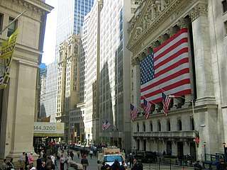
Financial sector
Manhattan's most important economic sector lies in its role as the headquarters for the U.S. financial industry, metonymously known as Wall Street. The borough's securities industry, enumerating 163,400 jobs in August 2013, continues to form the largest segment of the city's financial sector and an important economic engine for Manhattan, accounting in 2012 for 5 percent of private sector jobs in New York City, 8.5 percent (US$3.8 billion) of the city's tax revenue, and 22 percent of the city's total wages, including an average salary of US$360,700.[225] Wall Street investment banking fees in 2012 totaled approximately US$40 billion,[226] while in 2013, senior New York City bank officers who manage risk and compliance functions earned as much as US$324,000 annually.[227]
Lower Manhattan is home to the New York Stock Exchange (NYSE), on Wall Street, and the NASDAQ, at 165 Broadway, representing the world's largest and second largest stock exchanges, respectively, when measured both by overall share trading value and by total market capitalization of their listed companies in 2013.[17] The NYSE American (formerly the American Stock Exchange, AMEX), New York Board of Trade, and the New York Mercantile Exchange (NYMEX) are also located downtown. In July 2013, NYSE Euronext, the operator of the New York Stock Exchange, took over the administration of the London interbank offered rate from the British Bankers Association.[228]
Corporate sector
New York City is home to the most corporate headquarters of any city in the United States, the overwhelming majority based in Manhattan.[229] Manhattan contained over 500 million square feet (46.5 million m2) of office space in 2018,[230] making it the largest office market in the United States,[231] while Midtown Manhattan, with 400 million square feet (37.2 million m2) in 2018,[230] is the largest central business district in the world.[232] New York City's role as the top global center for the advertising industry is metonymously reflected as "Madison Avenue".
Tech and biotech
Silicon Alley, centered in Manhattan, has evolved into a metonym for the sphere encompassing the New York City metropolitan region's high tech industries,[233] including the Internet, new media, telecommunications, digital media, software development, biotechnology, game design, financial technology (fintech), and other fields within information technology that are supported by the area's entrepreneurship ecosystem and venture capital investments. As of 2014, New York City hosted 300,000 employees in the tech sector.[234][235] In 2015, Silicon Alley generated over US$7.3 billion in venture capital investment,[236] most based in Manhattan, as well as in Brooklyn, Queens, and elsewhere in the region. High technology startup companies and employment are growing in Manhattan and across New York City, bolstered by the city's emergence as a global node of creativity and entrepreneurship,[236] social tolerance,[237] and environmental sustainability,[238][239] as well as New York's position as the leading Internet hub and telecommunications center in North America, including its vicinity to several transatlantic fiber optic trunk lines, the city's intellectual capital, and its extensive outdoor wireless connectivity.[240] Verizon Communications, headquartered at 140 West Street in Lower Manhattan, was at the final stages in 2014 of completing a US$3 billion fiberoptic telecommunications upgrade throughout New York City.[241] As of October 2014, New York City hosted 300,000 employees in the tech sector,[235] with a significant proportion in Manhattan. The technology sector has been expanding across Manhattan since 2010.[242]
The biotechnology sector is also growing in Manhattan based upon the city's strength in academic scientific research and public and commercial financial support. By mid-2014, Accelerator, a biotech investment firm, had raised more than US$30 million from investors, including Eli Lilly and Company, Pfizer, and Johnson & Johnson, for initial funding to create biotechnology startups at the Alexandria Center for Life Science, which encompasses more than 700,000 square feet (65,000 m2) on East 29th Street and promotes collaboration among scientists and entrepreneurs at the center and with nearby academic, medical, and research institutions. The New York City Economic Development Corporation's Early Stage Life Sciences Funding Initiative and venture capital partners, including Celgene, General Electric Ventures, and Eli Lilly, committed a minimum of US$100 million to help launch 15 to 20 ventures in life sciences and biotechnology.[243] In 2011, Mayor Michael R. Bloomberg had announced his choice of Cornell University and Technion-Israel Institute of Technology to build a US$2 billion graduate school of applied sciences on Roosevelt Island, Manhattan, with the goal of transforming New York City into the world's premier technology capital.[244][245]
Tourism
Tourism is vital to Manhattan's economy, and the landmarks of Manhattan are the focus of New York City's tourists, enumerating an eighth consecutive annual record of approximately 62.8 million visitors in 2017.[35] According to The Broadway League, shows on Broadway sold approximately US$1.27 billion worth of tickets in the 2013–2014 season, an increase of 11.4% from US$1.139 billion in the 2012–2013 season; attendance in 2013–2014 stood at 12.21 million, representing a 5.5% increase from the 2012–2013 season's 11.57 million.[246] As of June 2016, Manhattan had nearly 91,500 hotel rooms, a 26% increase from 2010.[247]
Real estate
Real estate is a major force in Manhattan's economy, and indeed the city's, as the total value of all New York City property was assessed at US$914.8 billion for the 2015 fiscal year.[248] Manhattan has perennially been home to some of the nation's, as well as the world's, most valuable real estate, including the Time Warner Center, which had the highest-listed market value in the city in 2006 at US$1.1 billion,[249] to be subsequently surpassed in October 2014 by the Waldorf Astoria New York, which became the most expensive hotel ever sold after being purchased by the Anbang Insurance Group, based in China, for US$1.95 billion.[250] When 450 Park Avenue was sold on July 2, 2007, for US$510 million, about US$1,589 per square foot (US$17,104/m²), it broke the barely month-old record for an American office building of US$1,476 per square foot (US$15,887/m²) based on the sale of 660 Madison Avenue.[251] In 2014, Manhattan was home to six of the top ten zip codes in the United States by median housing price.[252] In 2019, the most expensive home sale ever in the United States occurred in Manhattan, at a selling price of US$238 million, for a 24,000 square feet (2,200 m2) penthouse apartment overlooking Central Park.[253]
Manhattan had approximately 520 million square feet (48.1 million m²) of office space in 2013,[254] making it the largest office market in the United States.[255] Midtown Manhattan is the largest central business district in the nation based on office space,[256] while Lower Manhattan is the third-largest (after Chicago's Loop).[257][258]
Media
News
Manhattan is served by the major New York City daily news publications, including The New York Times, New York Daily News, and New York Post, which are all headquartered in the borough. The nation's largest newspaper by circulation, The Wall Street Journal, is also based there. Other daily newspapers include AM New York and The Villager. The New York Amsterdam News, based in Harlem, is one of the leading African American weekly newspapers in the United States. The Village Voice, historically the largest alternative newspaper in the United States, announced in 2017 that it would cease publication of its print edition and convert to a fully digital venture.[259]
Television, radio, film
The television industry developed in Manhattan and is a significant employer in the borough's economy. The four major American broadcast networks, ABC, CBS, NBC, and Fox, as well as Univision, are all headquartered in Manhattan, as are many cable channels, including MSNBC, MTV, Fox News, HBO, and Comedy Central. In 1971, WLIB became New York City's first black-owned radio station and began broadcasts geared toward the African-American community in 1949. WQHT, also known as Hot 97, claims to be the premier hip-hop station in the United States. WNYC, comprising an AM and FM signal, has the largest public radio audience in the nation and is the most-listened to commercial or non-commercial radio station in Manhattan.[260] WBAI, with news and information programming, is one of the few socialist radio stations operating in the United States.
The oldest public-access television cable TV channel in the United States is the Manhattan Neighborhood Network, founded in 1971, offers eclectic local programming that ranges from a jazz hour to discussion of labor issues to foreign language and religious programming.[261] NY1, Time Warner Cable's local news channel, is known for its beat coverage of City Hall and state politics.
Education

Education in Manhattan is provided by a vast number of public and private institutions. Public schools in the borough are operated by the New York City Department of Education, the largest public school system in the United States.[263] Charter schools include Success Academy Harlem 1 through 5, Success Academy Upper West, and Public Prep.
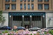
Some notable New York City public high schools are located in Manhattan, including Beacon High School, Stuyvesant High School, Fiorello H. LaGuardia High School, High School of Fashion Industries, Eleanor Roosevelt High School, NYC Lab School, Manhattan Center for Science and Mathematics, Hunter College High School, and High School for Math, Science and Engineering at City College. Bard High School Early College, a hybrid school created by Bard College, serves students from around the city.
Many private preparatory schools are also situated in Manhattan, including the Upper East Side's Brearley School, Dalton School, Browning School, Spence School, Chapin School, Nightingale-Bamford School, Convent of the Sacred Heart, Hewitt School, Saint David's School, Loyola School, and Regis High School. The Upper West Side is home to the Collegiate School and Trinity School. The borough is also home to Manhattan Country School, Trevor Day School, and the United Nations International School.
Based on data from the 2011–2015 American Community Survey, 59.9% of Manhattan residents over age 25 have a bachelor's degree.[265] As of 2005, about 60% of residents were college graduates and some 25% had earned advanced degrees, giving Manhattan one of the nation's densest concentrations of highly educated people.[266]
Manhattan has various colleges and universities, including Columbia University (and its affiliate Barnard College), Cooper Union, Marymount Manhattan College, New York Institute of Technology, New York University (NYU), The Juilliard School, Pace University, Berkeley College, The New School, Yeshiva University, and a campus of Fordham University. Other schools include Bank Street College of Education, Boricua College, Jewish Theological Seminary of America, Manhattan School of Music, Metropolitan College of New York, Parsons School of Design, School of Visual Arts, Touro College, and Union Theological Seminary. Several other private institutions maintain a Manhattan presence, among them Mercy College, St. John's University, The College of New Rochelle, The King's College, and Pratt Institute. Cornell Tech is developing on Roosevelt Island.
The City University of New York (CUNY), the municipal college system of New York City, is the largest urban university system in the United States, serving more than 226,000 degree students and a roughly equal number of adult, continuing and professional education students.[267] A third of college graduates in New York City graduate from CUNY, with the institution enrolling about half of all college students in New York City. CUNY senior colleges located in Manhattan include: Baruch College, City College of New York, Hunter College, John Jay College of Criminal Justice, and the CUNY Graduate Center (graduate studies and doctorate granting institution). The only CUNY community college located in Manhattan is the Borough of Manhattan Community College. The State University of New York is represented by the Fashion Institute of Technology, State University of New York State College of Optometry, and Stony Brook University – Manhattan.
Manhattan is a world center for training and education in medicine and the life sciences.[268] The city as a whole receives the second-highest amount of annual funding from the National Institutes of Health among all U.S. cities,[269] the bulk of which goes to Manhattan's research institutions, including Memorial Sloan-Kettering Cancer Center, Rockefeller University, Mount Sinai School of Medicine, Columbia University College of Physicians and Surgeons, Weill Cornell Medical College, and New York University School of Medicine.
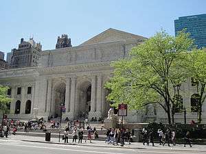
Manhattan is served by the New York Public Library, which has the largest collection of any public library system in the country.[270] The five units of the Central Library—Mid-Manhattan Library, Donnell Library Center, The New York Public Library for the Performing Arts, Andrew Heiskell Braille and Talking Book Library, and the Science, Industry and Business Library—are all located in Manhattan.[271] More than 35 other branch libraries are located in the borough.[272]
Culture and contemporary life

Manhattan is the borough most closely associated with New York City by non-residents; regionally, residents within the New York City metropolitan area, including natives of New York City's boroughs outside Manhattan, will often describe a trip to Manhattan as "going to the City".[275] Journalist Walt Whitman characterized the streets of Manhattan as being traversed by "hurrying, feverish, electric crowds".[276]
Manhattan has been the scene of many important American cultural movements. In 1912, about 20,000 workers, a quarter of them women, marched upon Washington Square Park to commemorate the Triangle Shirtwaist Factory fire, which killed 146 workers on March 25, 1911. Many of the women wore fitted tucked-front blouses like those manufactured by the Triangle Shirtwaist Company, a clothing style that became the working woman's uniform and a symbol of women's liberation, reflecting the alliance of labor and suffrage movements.[277]
The Harlem Renaissance in the 1920s established the African-American literary canon in the United States and introduced writers Langston Hughes and Zora Neale Hurston. Manhattan's vibrant visual art scene in the 1950s and 1960s was a center of the American pop art movement, which gave birth to such giants as Jasper Johns and Roy Lichtenstein. The downtown pop art movement of the late 1970s included artist Andy Warhol and clubs like Serendipity 3 and Studio 54, where he socialized.
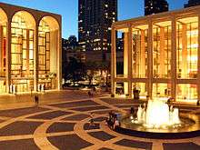
Broadway theatre is often considered the highest professional form of theatre in the United States. Plays and musicals are staged in one of the 39 larger professional theatres with at least 500 seats, almost all in and around Times Square.[278] Off-Broadway theatres feature productions in venues with 100–500 seats.[279] Lincoln Center for the Performing Arts, anchoring Lincoln Square on the Upper West Side of Manhattan, is home to 12 influential arts organizations, including the Metropolitan Opera, New York City Opera, New York Philharmonic, and New York City Ballet, as well as the Vivian Beaumont Theater, the Juilliard School, Jazz at Lincoln Center, and Alice Tully Hall. Performance artists displaying diverse skills are ubiquitous on the streets of Manhattan.
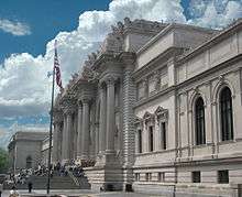
Manhattan is also home to some of the most extensive art collections in the world, both contemporary and classical art, including the Metropolitan Museum of Art, the Museum of Modern Art (MoMA), the Frick Collection, the Whitney Museum of American Art, and the Frank Lloyd Wright-designed Guggenheim Museum. The Upper East Side has many art galleries,[280][281] and the downtown neighborhood of Chelsea is known for its more than 200 art galleries that are home to modern art from both upcoming and established artists.[282][283] Many of the world's most lucrative art auctions are held in Manhattan.[284][285]
Manhattan is the center of LGBT culture in New York City. The borough is widely acclaimed as the cradle of the modern LGBTQ rights movement, with its inception at the June 1969 Stonewall Riots in Greenwich Village, Lower Manhattan – widely considered to constitute the single most important event leading to the gay liberation movement[100][286][287] and the modern fight for LGBT rights in the United States.[101][288] Multiple gay villages have developed, spanning the length of the borough from the Lower East Side, East Village, and Greenwich Village, through Chelsea and Hell's Kitchen, uptown to Morningside Heights. The annual New York City Pride March (or gay pride parade) traverses southward down Fifth Avenue and ends at Greenwich Village; the Manhattan parade rivals the Sao Paulo Gay Pride Parade as the largest pride parade in the world, attracting tens of thousands of participants and millions of sidewalk spectators each June.[274][273] Stonewall 50 – WorldPride NYC 2019 was the largest international Pride celebration in history, produced by Heritage of Pride and enhanced through a partnership with the I ❤ NY program's LGBT division, commemorating the 50th anniversary of the Stonewall uprising, with 150,000 participants and five million spectators attending in Manhattan alone.[289]
.jpg)
.jpg)

The borough has a place in several American idioms. The phrase New York minute is meant to convey an extremely short time such as an instant,[291] sometimes in hyperbolic form, as in "perhaps faster than you would believe is possible," referring to the rapid pace of life in Manhattan.[292][293] The expression "melting pot" was first popularly coined to describe the densely populated immigrant neighborhoods on the Lower East Side in Israel Zangwill's play The Melting Pot, which was an adaptation of William Shakespeare's Romeo and Juliet set by Zangwill in New York City in 1908.[294] The iconic Flatiron Building is said to have been the source of the phrase "23 skidoo" or scram, from what cops would shout at men who tried to get glimpses of women's dresses being blown up by the winds created by the triangular building.[295] The "Big Apple" dates back to the 1920s, when a reporter heard the term used by New Orleans stablehands to refer to New York City's horse racetracks and named his racing column "Around The Big Apple." Jazz musicians adopted the term to refer to the city as the world's jazz capital, and a 1970s ad campaign by the New York Convention and Visitors Bureau helped popularize the term.[296] Manhattan, Kansas, a city of 53,000 people,[297] was named by New York investors after the borough and is nicknamed the "little apple".[298]
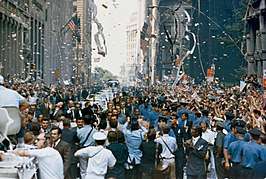
Manhattan is well known for its street parades, which celebrate a broad array of themes, including holidays, nationalities, human rights, and major league sports team championship victories. The majority of higher profile parades in New York City are held in Manhattan. The primary orientation of the annual street parades is typically from north to south, marching along major avenues. The annual Macy's Thanksgiving Day Parade is the world's largest parade,[290] beginning alongside Central Park and processing southward to the flagship Macy's Herald Square store;[299] the parade is viewed on telecasts worldwide and draws millions of spectators in person.[290] Other notable parades including the annual St. Patrick's Day Parade in March, the New York City Pride Parade in June, the Greenwich Village Halloween Parade in October, and numerous parades commemorating the independence days of many nations. Ticker-tape parades celebrating championships won by sports teams as well as other heroic accomplishments march northward along the Canyon of Heroes on Broadway from Bowling Green to City Hall Park in Lower Manhattan. New York Fashion Week, held at various locations in Manhattan, is a high-profile semiannual event featuring models displaying the latest wardrobes created by prominent fashion designers worldwide in advance of these fashions proceeding to the retail marketplace.
Sports
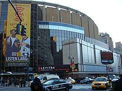
Manhattan is home to the NBA's New York Knicks and the NHL's New York Rangers, both of which play their home games at Madison Square Garden, the only major professional sports arena in the borough. The Garden was also home to the WNBA's New York Liberty through the 2017 season, but that team's primary home is now the Westchester County Center in White Plains, New York. The New York Jets proposed a West Side Stadium for their home field, but the proposal was eventually defeated in June 2005, and they now play at MetLife Stadium in East Rutherford, New Jersey.[300]
Manhattan is the only borough in New York City that does not have a professional baseball franchise. The Bronx has the Yankees (American League) and Queens has the Mets (National League) of Major League Baseball. The Minor League Baseball Brooklyn Cyclones, affiliated with the Mets, play in Brooklyn, while the Staten Island Yankees, affiliated with the Yankees, play in Staten Island. However, three of the four major league baseball teams to play in New York City played in Manhattan. The original New York Giants baseball team played in the various incarnations of the Polo Grounds at 155th Street and Eighth Avenue from their inception in 1883—except for 1889, when they split their time between Jersey City and Staten Island, and when they played in Hilltop Park in 1911—until they headed to California with the Brooklyn Dodgers after the 1957 season.[301] The New York Yankees began their franchise as the Highlanders, named for Hilltop Park, where they played from their creation in 1903 until 1912. The team moved to the Polo Grounds with the 1913 season, where they were officially christened the New York Yankees, remaining there until they moved across the Harlem River in 1923 to Yankee Stadium.[302] The New York Mets played in the Polo Grounds in 1962 and 1963, their first two seasons, before Shea Stadium was completed in 1964.[303] After the Mets departed, the Polo Grounds was demolished in April 1964, replaced by public housing.[304][305]
The first national college-level basketball championship, the National Invitation Tournament, was held in New York in 1938 and remains in the city.[306] The New York Knicks started play in 1946 as one of the National Basketball Association's original teams, playing their first home games at the 69th Regiment Armory, before making Madison Square Garden their permanent home.[307] The New York Liberty of the WNBA shared the Garden with the Knicks from their creation in 1997 as one of the league's original eight teams through the 2017 season,[308] after which the team moved nearly all of its home schedule to White Plains in Westchester County.[309] Rucker Park in Harlem is a playground court, famed for its streetball style of play, where many NBA athletes have played in the summer league.[310]
Although both of New York City's football teams play today across the Hudson River in MetLife Stadium in East Rutherford, New Jersey, both teams started out playing in the Polo Grounds. The New York Giants played side-by-side with their baseball namesakes from the time they entered the National Football League in 1925, until crossing over to Yankee Stadium in 1956.[311] The New York Jets, originally known as the Titans of New York, started out in 1960 at the Polo Grounds, staying there for four seasons before joining the Mets in Queens at Shea Stadium in 1964.[312]
The New York Rangers of the National Hockey League have played in the various locations of Madison Square Garden since the team's founding in the 1926–1927 season. The Rangers were predated by the New York Americans, who started play in the Garden the previous season, lasting until the team folded after the 1941–1942 NHL season, a season it played in the Garden as the Brooklyn Americans.[313]
The New York Cosmos of the North American Soccer League played their home games at Downing Stadium for two seasons, starting in 1974. The playing pitch and facilities at Downing Stadium were in unsatisfactory condition, however, and as the team's popularity grew they too left for Yankee Stadium, and then Giants Stadium. The stadium was demolished in 2002 to make way for the $45 million, 4,754-seat Icahn Stadium, which includes an Olympic-standard 400-meter running track and, as part of Pelé's and the Cosmos' legacy, includes a FIFA-approved floodlit soccer stadium that hosts matches between the 48 youth teams of a Manhattan soccer club.[314][315]
Government
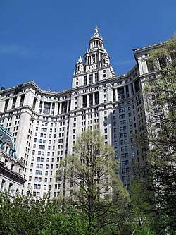
Since New York City's consolidation in 1898, Manhattan has been governed by the New York City Charter, which has provided for a strong mayor–council system since its revision in 1989.[316] The centralized New York City government is responsible for public education, correctional institutions, libraries, public safety, recreational facilities, sanitation, water supply, and welfare services in Manhattan.
The office of Borough President was created in the consolidation of 1898 to balance centralization with local authority. Each borough president had a powerful administrative role derived from having a vote on the New York City Board of Estimate, which was responsible for creating and approving the city's budget and proposals for land use. In 1989, the Supreme Court of the United States declared the Board of Estimate unconstitutional because Brooklyn, the most populous borough, had no greater effective representation on the Board than Staten Island, the least populous borough, a violation of the Fourteenth Amendment's Equal Protection Clause pursuant to the high court's 1964 "one man, one vote" decision.[317]
Since 1990, the largely powerless Borough President has acted as an advocate for the borough at the mayoral agencies, the City Council, the New York state government, and corporations. Manhattan's current Borough President is Gale Brewer, elected as a Democrat in November 2013 with 82.9% of the vote.[318] Brewer replaced Scott Stringer, who went on to become New York City Comptroller.
Cyrus Vance Jr., a Democrat, has been the District Attorney of New York County since 2010.[319] Manhattan has ten City Council members, the third largest contingent among the five boroughs. It also has twelve administrative districts, each served by a local Community Board. Community Boards are representative bodies that field complaints and serve as advocates for local residents.
As the host of the United Nations, the borough is home to the world's largest international consular corps, comprising 105 consulates, consulates general and honorary consulates.[320] It is also the home of New York City Hall, the seat of New York City government housing the Mayor of New York City and the New York City Council. The mayor's staff and thirteen municipal agencies are located in the nearby Manhattan Municipal Building, completed in 1914, one of the largest governmental buildings in the world.[321]
| Presidential elections results by party affiliation[322] | ||||||||||||||||||||||||||||||||||||||||||||||||||||||||||||||||||||||||||||||||||||||||||||||||||||||||||||||||||||||||||||||||||||||||||||
|---|---|---|---|---|---|---|---|---|---|---|---|---|---|---|---|---|---|---|---|---|---|---|---|---|---|---|---|---|---|---|---|---|---|---|---|---|---|---|---|---|---|---|---|---|---|---|---|---|---|---|---|---|---|---|---|---|---|---|---|---|---|---|---|---|---|---|---|---|---|---|---|---|---|---|---|---|---|---|---|---|---|---|---|---|---|---|---|---|---|---|---|---|---|---|---|---|---|---|---|---|---|---|---|---|---|---|---|---|---|---|---|---|---|---|---|---|---|---|---|---|---|---|---|---|---|---|---|---|---|---|---|---|---|---|---|---|---|---|---|---|
|
Politics
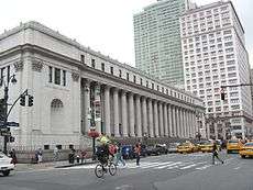
The Democratic Party holds most public offices. Registered Republicans are a minority in the borough, constituting 9.88% of the electorate as of April 2016. Registered Republicans are more than 20% of the electorate only in the neighborhoods of the Upper East Side and the Financial District as of 2016. Democrats accounted for 68.41% of those registered to vote, while 17.94% of voters were unaffiliated.[323][324]
No Republican has won the presidential election in Manhattan since 1924, when Calvin Coolidge won a plurality of the New York County vote over Democrat John W. Davis, 41.20%–39.55%. Warren G. Harding was the most recent Republican presidential candidate to win a majority of the Manhattan vote, with 59.22% of the 1920 vote.[325] In the 2004 presidential election, Democrat John Kerry received 82.1% of the vote in Manhattan and Republican George W. Bush received 16.7%.[326] The borough is the most important source of funding for presidential campaigns in the United States; in 2004, it was home to six of the top seven ZIP codes in the nation for political contributions.[327] The top ZIP code, 10021 on the Upper East Side, generated the most money for the United States presidential election for all presidential candidates, including both Kerry and Bush during the 2004 election.[328]
Representatives in the U.S. Congress
In 2018, four Democrats represented Manhattan in the United States House of Representatives.[329]
- Nydia Velázquez (first elected in 1992) represents New York's 7th congressional district, which includes the Lower East Side and Alphabet City. The district also covers central and western Brooklyn and a small part of Queens.[329][330][331]
- Jerrold Nadler (first elected in 1992) represents New York's 10th congressional district, which includes the West Side neighborhoods of Battery Park City, Chelsea, Chinatown, the Financial District, Greenwich Village, Hell's Kitchen, SoHo, Tribeca, and the Upper West Side. The district also covers southwestern Brooklyn.[329][332][333]
- Carolyn Maloney (first elected in 1992) represents New York's 12th congressional district, which includes the East Side neighborhoods of Gramercy Park, Kips Bay, Midtown Manhattan, Murray Hill, Roosevelt Island, Turtle Bay, Upper East Side, and most of the Lower East Side and the East Village. The district also covers western Queens.[329][334][335]
- Adriano Espaillat (first elected in 2016) represents New York's 13th congressional district, which includes the Upper Manhattan neighborhoods of East Harlem, Harlem, Inwood, Marble Hill, Washington Heights, and portions of Morningside Heights, as well as part of the northwest Bronx.[329][336][337]
Federal offices
The United States Postal Service operates post offices in Manhattan. The James Farley Post Office at 421 Eighth Avenue in Midtown Manhattan, between 31st Street and 33rd Street, is New York City's main post office.[338] Both the United States District Court for the Southern District of New York and United States Court of Appeals for the Second Circuit are located in Lower Manhattan's Foley Square, and the U.S. Attorney and other federal offices and agencies maintain locations in that area.
Crime and public safety
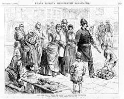
Starting in the mid-19th century, the United States became a magnet for immigrants seeking to escape poverty in their home countries. After arriving in New York, many new arrivals ended up living in squalor in the slums of the Five Points neighborhood, an area between Broadway and the Bowery, northeast of New York City Hall. By the 1820s, the area was home to many gambling dens and brothels, and was known as a dangerous place to go. In 1842, Charles Dickens visited the area and was appalled at the horrendous living conditions he had seen.[339] The area was so notorious that it even caught the attention of Abraham Lincoln, who visited the area before his Cooper Union speech in 1860.[340] The predominantly Irish Five Points Gang was one of the country's first major organized crime entities.
As Italian immigration grew in the early 20th century many joined ethnic gangs, including Al Capone, who got his start in crime with the Five Points Gang.[341] The Mafia (also known as Cosa Nostra) first developed in the mid-19th century in Sicily and spread to the East Coast of the United States during the late 19th century following waves of Sicilian and Southern Italian emigration. Lucky Luciano established Cosa Nostra in Manhattan, forming alliances with other criminal enterprises, including the Jewish mob, led by Meyer Lansky, the leading Jewish gangster of that period.[342] From 1920–1933, Prohibition helped create a thriving black market in liquor, upon which the Mafia was quick to capitalize.[342]
As in the whole of New York City, Manhattan experienced a sharp increase in crime during the 1960s and 1970s.[343] Since 1990, crime in Manhattan has plummeted in all categories tracked by the CompStat profile. A borough that saw 503 murders in 1990 has seen a drop of nearly 88% to 62 in 2008 and has continued to decline since then. Robbery and burglary are down by more than 80% during the period, and auto theft has been reduced by more than 93%. In the seven major crime categories tracked by the system, overall crime has declined by more than 75% since 1990, and year-to-date statistics through May 2009 show continuing declines.[344] Based on 2005 data, New York City has the lowest crime rate among the ten largest cities in the United States.[345]
Housing
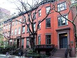
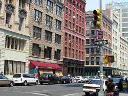
During Manhattan's early history, wood construction and poor access to water supplies left the city vulnerable to fires. In 1776, shortly after the Continental Army evacuated Manhattan and left it to the British, a massive fire broke out destroying one-third of the city and some 500 houses.[346]
The rise of immigration near the turn of the 20th century left major portions of Manhattan, especially the Lower East Side, densely packed with recent arrivals, crammed into unhealthy and unsanitary housing. Tenements were usually five stories high, constructed on the then-typical 25 by 100 feet (7.6 by 30.5 m) lots, with "cockroach landlords" exploiting the new immigrants.[347][348] By 1929, stricter fire codes and the increased use of elevators in residential buildings, were the impetus behind a new housing code that effectively ended the tenement as a form of new construction, though many tenement buildings survive today on the East Side of the borough.[348]
Manhattan offers a wide array of public and private housing options. There were 852,575 housing units in 2013[29] at an average density of 37,345 per square mile (14,419/km²). As of 2003, only 20.3% of Manhattan residents lived in owner-occupied housing, the second-lowest rate of all counties in the nation, behind the Bronx.[349] Although the city of New York has the highest average cost for rent in the United States, it simultaneously hosts a higher average of income per capita. Because of this, rent is a lower percentage of annual income than in several other American cities.[350]
Manhattan's real estate market for luxury housing continues to be among the most expensive in the world,[351] and Manhattan residential property continues to have the highest sale price per square foot in the United States.[19] Manhattan's apartments cost $$1,773 per square foot ($19,080/m2), compared to San Francisco housing at $$1,185 per square foot ($12,760/m2), Boston housing at $751 per square foot ($8,080/m2), and Los Angeles housing at $$451 per square foot ($4,850/m2).[352]
Infrastructure
Transportation
Public transportation
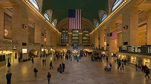
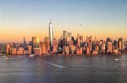
Manhattan is unique in the U.S. for intense use of public transportation and lack of private car ownership. While 88% of Americans nationwide drive to their jobs, with only 5% using public transport, mass transit is the dominant form of travel for residents of Manhattan, with 72% of borough residents using public transport to get to work, while only 18% drove.[353][354] According to the 2000 United States Census, 77.5% of Manhattan households do not own a car.[355]
In 2008, Mayor Michael Bloomberg proposed a congestion pricing system to regulate entering Manhattan south of 60th Street. The state legislature rejected the proposal in June 2008.[356]
The New York City Subway, the largest subway system in the world by number of stations, is the primary means of travel within the city, linking every borough except Staten Island. There are 151 subway stations in Manhattan, out of the 472 stations.[357] A second subway, the PATH system, connects six stations in Manhattan to northern New Jersey. Passengers pay fares with pay-per-ride MetroCards, which are valid on all city buses and subways, as well as on PATH trains.[358][359] There are 7-day and 30-day MetroCards that allow unlimited trips on all subways (except PATH) and MTA bus routes (except for express buses).[360] The PATH QuickCard is being phased out, having been replaced by the SmartLink. The MTA is testing "smart card" payment systems to replace the MetroCard.[361] Commuter rail services operating to and from Manhattan are the Long Island Rail Road (LIRR), which connects Manhattan and other New York City boroughs to Long Island; the Metro-North Railroad, which connects Manhattan to Upstate New York and Southwestern Connecticut; and NJ Transit trains, which run to various points in New Jersey.
The US$11.1 billion East Side Access project, which will bring LIRR trains to Grand Central Terminal, is under construction and is scheduled to open in 2022; this project will create a new train tunnel beneath the East River, connecting the East Side of Manhattan with Long Island City, Queens.[362][363] Four multi-billion-dollar projects were completed in the mid-2010s: the $1.4 billion Fulton Center in November 2014,[364] the $2.4 billion 7 Subway Extension in September 2015,[365] the $4 billion World Trade Center Transportation Hub in March 2016,[366][367] and Phase 1 of the $4.5 billion Second Avenue Subway in January 2017.[368][369]
MTA New York City Transit offers a wide variety of local buses within Manhattan under the brand New York City Bus. An extensive network of express bus routes serves commuters and other travelers heading into Manhattan.[370] The bus system served 784 million passengers citywide in 2011, placing the bus system's ridership as the highest in the nation, and more than double the ridership of the second-place Los Angeles system.[371]
The Roosevelt Island Tramway, one of two commuter cable car systems in North America, whisks commuters between Roosevelt Island and Manhattan in less than five minutes, and has been serving the island since 1978. (The other system in North America is the Portland Aerial Tram.)[372][373]
The Staten Island Ferry, which runs 24 hours a day, 365 days a year, annually carries over 21 million passengers on the 5.2-mile (8.4 km) run between Manhattan and Staten Island. Each weekday, five vessels transport about 65,000 passengers on 109 boat trips.[374][375] The ferry has been fare-free since 1997, when the then-50-cent fare was eliminated.[376] In February 2015, Mayor Bill de Blasio announced that the city government would begin NYC Ferry to extend ferry transportation to traditionally underserved communities in the city.[377][378] The first routes of NYC Ferry opened in 2017.[379][380] All of the system's routes have termini in Manhattan, and the Lower East Side and Soundview routes also have intermediate stops on the East River.[381]
The metro region's commuter rail lines converge at Penn Station and Grand Central Terminal, on the west and east sides of Midtown Manhattan, respectively. They are the two busiest rail stations in the United States. About one-third of users of mass transit and two-thirds of railway passengers in the country live in New York and its suburbs.[382] Amtrak provides inter-city passenger rail service from Penn Station to Boston, Philadelphia, Baltimore, and Washington, D.C.; Upstate New York and New England; cross-Canadian border service to Toronto and Montreal; and destinations in the Southern and Midwestern United States.
Taxis
New York's iconic yellow taxicabs, which number 13,087 city-wide and must have the requisite medallion authorizing the pick up of street hails, are ubiquitous in the borough.[383] Various private transportation network companies provide significant competition for cab drivers in Manhattan.[384]
Bicycles
Manhattan also has tens of thousands of bicycle commuters.
Streets and roads
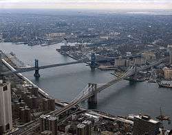
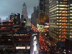
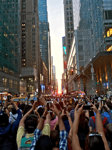
The Commissioners' Plan of 1811 called for twelve numbered avenues running north and south roughly parallel to the shore of the Hudson River, each 100 feet (30 m) wide, with First Avenue on the east side and Twelfth Avenue on the west side. There are several intermittent avenues east of First Avenue, including four additional lettered avenues running from Avenue A eastward to Avenue D in an area now known as Alphabet City in Manhattan's East Village. The numbered streets in Manhattan run east-west, and are generally 60 feet (18 m) wide, with about 200 feet (61 m) between each pair of streets. With each combined street and block adding up to about 260 feet (79 m), there are almost exactly 20 blocks per mile. The typical block in Manhattan is 250 by 600 feet (76 by 183 m).
According to the original Commissioner's Plan, there were 155 numbered crosstown streets,[385] but later the grid was extended up to the northernmost corner of Manhattan, where the last numbered street is 220th Street. Moreover, the numbering system continues even in The Bronx, north of Manhattan, despite the fact that the grid plan is not as regular in that borough, whose last numbered street is 263rd Street.[386] Fifteen crosstown streets were designated as 100 feet (30 m) wide, including 34th, 42nd, 57th and 125th Streets,[387] which became some of the borough's most significant transportation and shopping venues. Broadway is the most notable of many exceptions to the grid, starting at Bowling Green in Lower Manhattan and continuing north into the Bronx at Manhattan's northern tip. In much of Midtown Manhattan, Broadway runs at a diagonal to the grid, creating major named intersections at Union Square (Park Avenue South/Fourth Avenue and 14th Street), Madison Square (Fifth Avenue and 23rd Street), Herald Square (Sixth Avenue and 34th Street), Times Square (Seventh Avenue and 42nd Street), and Columbus Circle (Eighth Avenue/Central Park West and 59th Street).
"Crosstown traffic" refers primarily to vehicular traffic between Manhattan's East Side and West Side. The trip is notoriously frustrating for drivers because of heavy congestion on narrow local streets laid out by the Commissioners' Plan of 1811, absence of express roads other than the Trans-Manhattan Expressway at the far north end of Manhattan Island; and restricted to very limited crosstown automobile travel within Central Park, further prohibited beginning in 2018 south of 72nd Street within the park, to augment pedestrian safety.[388] Proposals in the mid-1900s to build express roads through the city's densest neighborhoods, namely the Mid-Manhattan Expressway and Lower Manhattan Expressway, did not go forward. Unlike the rest of the United States, New York State prohibits right or left turns on red in cities with a population greater than one million, to reduce traffic collisions and increase pedestrian safety. In New York City, therefore, all turns at red lights are illegal unless a sign permitting such maneuvers is present, significantly shaping traffic patterns in Manhattan.[389]
Another consequence of the strict grid plan of most of Manhattan, and the grid's skew of approximately 28.9 degrees, is a phenomenon sometimes referred to as Manhattanhenge (by analogy with Stonehenge).[390] On separate occasions in late May and early July, the sunset is aligned with the street grid lines, with the result that the sun is visible at or near the western horizon from street level.[390][391] A similar phenomenon occurs with the sunrise in January and December.
The FDR Drive and Harlem River Drive, both designed by controversial New York master planner Robert Moses,[392] comprise a single, long limited-access parkway skirting the east side of Manhattan along the East River and Harlem River south of Dyckman Street. The Henry Hudson Parkway is the corresponding parkway on the West Side north of 57th Street.
River crossings
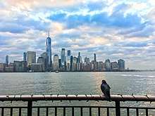
Being primarily an island, Manhattan is linked to New York City's outer boroughs by numerous bridges, of various sizes. Manhattan has fixed highway connections with New Jersey to its west by way of the George Washington Bridge, the Holland Tunnel, and the Lincoln Tunnel, and to three of the four other New York City boroughs—the Bronx to the northeast, and Brooklyn and Queens (both on Long Island) to the east and south. Its only direct connection with the fifth New York City borough, Staten Island, is the Staten Island Ferry across New York Harbor, which is free of charge. The ferry terminal is located near Battery Park at Manhattan's southern tip. It is also possible to travel on land to Staten Island by way of Brooklyn, via the Verrazzano-Narrows Bridge.
The George Washington Bridge, the world's busiest motor vehicle bridge,[393][394] connects Washington Heights, in Upper Manhattan, to Bergen County, in New Jersey. There are numerous bridges to the Bronx across the Harlem River, and five (listed north to south)—the Triborough (known officially as the Robert F. Kennedy Bridge), Ed Koch Queensboro (also known as the 59th Street Bridge), Williamsburg, Manhattan, and Brooklyn Bridges—that cross the East River to connect Manhattan to Long Island.
Several tunnels also link Manhattan Island to New York City's outer boroughs and New Jersey. The Lincoln Tunnel, which carries 120,000 vehicles a day under the Hudson River between New Jersey and Midtown Manhattan, is the busiest vehicular tunnel in the world.[395] The tunnel was built instead of a bridge to allow unfettered passage of large passenger and cargo ships that sail through New York Harbor and up the Hudson River to Manhattan's piers. The Holland Tunnel, connecting Lower Manhattan to Jersey City, New Jersey, was the world's first mechanically ventilated vehicular tunnel.[396] The Queens–Midtown Tunnel, built to relieve congestion on the bridges connecting Manhattan with Queens and Brooklyn, was the largest non-federal project in its time when it was completed in 1940;[397] President Franklin D. Roosevelt was the first person to drive through it.[398] The Brooklyn–Battery Tunnel runs underneath Battery Park and connects the Financial District at the southern tip of Manhattan to Red Hook in Brooklyn.
Several ferry services operate between New Jersey and Manhattan.[399] These ferries mainly serve midtown (at W. 39th St.), Battery Park City (WFC at Brookfield Place), and Wall Street (Pier 11).
Heliports
Manhattan has three public heliports: the East 34th Street Heliport (also known as the Atlantic Metroport) at East 34th Street, owned by New York City and run by the New York City Economic Development Corporation (NYCEDC); the Port Authority Downtown Manhattan/Wall Street Heliport, owned by the Port Authority of New York and New Jersey and run by the NYCEDC; and the West 30th Street Heliport, a privately owned heliport that is owned by the Hudson River Park Trust.[400] US Helicopter offered regularly scheduled helicopter service connecting the Downtown Manhattan Heliport with John F. Kennedy International Airport in Queens and Newark Liberty International Airport in New Jersey, before going out of business in 2009.[401]
Utilities
Gas and electric service is provided by Consolidated Edison to all of Manhattan. Con Edison's electric business traces its roots back to Thomas Edison's Edison Electric Illuminating Company, the first investor-owned electric utility. The company started service on September 4, 1882, using one generator to provide 110 volts direct current (DC) to 59 customers with 800 light bulbs, in a one-square-mile area of Lower Manhattan from his Pearl Street Station.[402] Con Edison operates the world's largest district steam system, which consists of 105 miles (169 km) of steam pipes, providing steam for heating, hot water, and air conditioning[403] by some 1,800 Manhattan customers.[404] Cable service is provided by Time Warner Cable and telephone service is provided by Verizon Communications, although AT&T is available as well.
Manhattan witnessed the doubling of the natural gas supply delivered to the borough when a new gas pipeline opened on November 1, 2013.[405]
The New York City Department of Sanitation is responsible for garbage removal.[406] The bulk of the city's trash ultimately is disposed at mega-dumps in Pennsylvania, Virginia, South Carolina and Ohio (via transfer stations in New Jersey, Brooklyn and Queens) since the 2001 closure of the Fresh Kills Landfill on Staten Island.[407] A small amount of trash processed at transfer sites in New Jersey is sometimes incinerated at waste-to-energy facilities. Like New York City, New Jersey and much of Greater New York relies on exporting its trash to far-flung areas.
New York City has the largest clean-air diesel-hybrid and compressed natural gas bus fleet, which also operates in Manhattan, in the country. It also has some of the first hybrid taxis, most of which operate in Manhattan.[408]
Health care
There are many hospitals in Manhattan, including two of the 25 largest in the United States (as of 2017):[409]
- Bellevue Hospital
- Lenox Hill Hospital
- Lower Manhattan Hospital
- Metropolitan Hospital Center
- Mount Sinai Beth Israel Hospital
- Mount Sinai Hospital
- NewYork–Presbyterian Hospital
- NYC Health + Hospitals/Harlem
- NYU Langone Medical Center
Water purity and availability
New York City is supplied with drinking water by the protected Catskill Mountains watershed.[410] As a result of the watershed's integrity and undisturbed natural water filtration system, New York is one of only four major cities in the United States the majority of whose drinking water is pure enough not to require purification by water treatment plants.[411] The Croton Watershed north of the city is undergoing construction of a US$3.2 billion water purification plant to augment New York City's water supply by an estimated 290 million gallons daily, representing a greater than 20% addition to the city's current availability of water.[412] Manhattan, surrounded by two brackish rivers, had a limited supply of fresh water. To satisfy its growing population, the City of New York acquired land in adjacent Westchester County and constructed the old Croton Aqueduct system there, which went into service in 1842 and was superseded by the new Croton Aqueduct, which opened in 1890. This, however, was interrupted in 2008 for the ongoing construction of a US$3.2 billion water purification plant that can supply an estimated 290 million gallons daily when completed, representing an almost 20% addition to the city's availability of water, with this addition going to Manhattan and the Bronx.[413] Water comes to Manhattan through the tunnels 1 and 2, completed in 1917 and 1935, and in future through Tunnel No. 3, begun in 1970.[414]
Address algorithm
The address algorithm of Manhattan refers to the formulas used to estimate the closest east–west cross street for building numbers on north–south avenues. It is commonly noted in telephone directories, New York City travel guides, and MTA Manhattan bus maps.
See also
- History of New York City
- List of Manhattan neighborhoods
- List of people from Manhattan
- Manhattanization
- National Register of Historic Places listings in Manhattan
- Sawing-off of Manhattan Island
- Timeline of New York City
Notes
- Area codes 718, 347, and 929 are used in Marble Hill.
- Mean monthly maxima and minima (i.e. the expected highest and lowest temperature readings at any point during the year or given month) calculated based on data at said location from 1981 to 2010.
- Official weather observations for Central Park were conducted at the Arsenal at Fifth Avenue and 64th Street from 1869 to 1919, and at Belvedere Castle since 1919.[170]
References
Citations
- 2010 Census Gazetteer Files: New York County Subdivisions, United States Census Bureau. Accessed June 19, 2017.
- Moynihan, Colin. "F.Y.I.", The New York Times, September 19, 1999. Accessed December 17, 2019. "There are well-known names for inhabitants of four boroughs: Manhattanites, Brooklynites, Bronxites and Staten Islanders. But what are residents of Queens called?"
- Local Area Gross Domestic Product, 2018, Bureau of Economic Analysis, released December 12, 2019. Accessed December 12, 2019.
- "New York City". TravelPulse. July 26, 2018.
- "Manhattan, New York – Some of the Most Expensive Real Estate in the World Overlooks Central Park". The Pinnacle List. Archived from the original on November 29, 2014. Retrieved November 24, 2014.
- Barry, Dan. "A Nation challenged: in New York; New York Carries On, but Test of Its Grit Has Just Begun", The New York Times, October 11, 2001. Accessed November 20, 2016. "A roaring void has been created in the financial center of the world."
- Sorrentino, Christopher (September 16, 2007). "When He Was Seventeen". The New York Times. Retrieved December 22, 2007.
In 1980, there were still the remains of the various downtown revolutions that had reinvigorated New York's music and art scenes and kept Manhattan in the position it had occupied since the 1940s as the cultural center of the world.
- Michael P. Ventura (April 6, 2010). "Manhattan May Be the Media Capital of the World, But Not For iPad Users". DNAinfo. Archived from the original on August 4, 2017. Retrieved June 11, 2017.
- Dawn Ennis (May 24, 2017). "ABC will broadcast New York's pride parade live for the first time". LGBTQ Nation. Retrieved June 4, 2017.
- "United Nations Visitors Centre "Welcome to the United Nations — Tour the international UN Headquarters"". United Nations. Retrieved June 13, 2014.
- Huw Jones (January 27, 2020). "New York surges ahead of Brexit-shadowed London in finance: survey". Reuters. Retrieved January 27, 2020.
New York remains the world’s top financial center, pushing London further into second place as Brexit uncertainty undermines the UK capital and Asian centers catch up, a survey from consultants Duff & Phelps said on Monday.
- Huw Jones (September 4, 2018). "United States top, Britain second in financial activity: think-tank". Thomson Reuters. Retrieved September 4, 2018.
Think-tank New Financial’s study, which focuses on the "raw" value of actual domestic and international financial activity like managing assets and issuing equity, underscored the overall dominance of New York as the world’s top financial center.
- Richard Florida (March 3, 2015). "Sorry, London: New York Is the World's Most Economically Powerful City". The Atlantic Monthly Group. Retrieved March 16, 2015.
Our new ranking puts the Big Apple firmly on top.
- Accessed September 23, 2019.
- "NYSE Listings Directory". Archived from the original on June 21, 2013. Retrieved June 23, 2014.
- "Biggest Stock Exchanges In The World". worldatlas.com. Retrieved October 15, 2017.
The world's two largest stock exchanges lie only minutes apart in the Wall Street area of Manhattan, New York City, United States.
- Morgan Brennan (March 22, 2013). "The World's Most Expensive Billionaire Cities". Forbes. Retrieved November 24, 2014.
- Accessed January 31, 2018.
- Janette Sadik-Khan (January 9, 2017). "A plea for Fifth Avenue". The New York Times. Retrieved January 9, 2017.
- Matt Soniak (October 2, 2012). "Was Manhattan Really Bought for $24?". Mental Floss.
- "Peter Schaghen Letter with transcription". New Netherland Institute. November 7, 1626. Retrieved February 16, 2015.
- "United States History – History of New York City, New York". Retrieved April 7, 2018.
- "KINGSTON Discover 300 Years of New York History DUTCH COLONIES". National Park Service, U.S. Department of the Interior. Retrieved April 7, 2018.
- "The Nine Capitals of the United States". United States Senate. Retrieved April 7, 2018.
- "Statue of Liberty". A&E Television Networks, LLC. Retrieved May 21, 2011.
- "Statue of Liberty". World Heritage. UNESCO World Heritage Centre 1992–2011. Retrieved April 7, 2018.
- Camille Mann & Stephanie Valera. "World's Most Crowded Islands". The Weather Channel. Retrieved June 27, 2013.
- "New York County (Manhattan Borough), New York State & County QuickFacts". United States Census Bureau. Retrieved March 25, 2018.
- "Annual Estimates of the Resident Population: April 1, 2010 to July 1, 2018 Population Estimates – New York County, New York". United States Census Bureau. Retrieved February 11, 2020.
- "USA Counties Land Area – New York, NY (2010)". United States Census Bureau. Archived from the original on February 13, 2003. Retrieved February 21, 2015.
- Mann, Camille; Valera, Stephanie. "World's Most Crowded Islands". The Weather Channel. Retrieved March 28, 2016.
- "How Many People Can Manhattan Hold?". The New York Times. March 4, 2012.
- "Manhattan". NYBits.com. Retrieved June 5, 2014.
- "Mayor De Blasio And NYC & Company Announce NYC Welcomed Record 62.8 Million Visitors In 2017". NYC & Company, Inc. March 20, 2018. Retrieved April 4, 2018.
- Ann Shields (November 10, 2014). "The World's 50 Most Visited Tourist Attractions – No. 3: Times Square, New York City – Annual Visitors: 50,000,000". Travel+Lesiure. Retrieved July 12, 2015.
No. 3 Times Square, ... No. 4 (tie) Central Park, ... No. 10 Grand Central Terminal, New York City
- "Buildings in New York City". Council on Tall Buildings and Urban Habitat. Retrieved June 8, 2011.
- Sarah Waxman. "The History of New York's Chinatown". Mediabridge Infosystems, Inc. Retrieved March 5, 2011.
Manhattan's Chinatown, the largest Chinatown in the United States and the site of the largest concentration of Chinese in the Western Hemisphere, is located on the Lower East Side.
- "Workforce Diversity The Stonewall Inn, National Historic Landmark National Register Number: 99000562". National Park Service, U.S. Department of the Interior. Retrieved July 2, 2013.
- "Obama inaugural speech references Stonewall gay-rights riots". North Jersey Media Group Inc. January 21, 2013. Archived from the original on May 30, 2013. Retrieved July 2, 2013.
- Michael M. Grynbaum (May 24, 2012). "The Reporters of City Hall Return to Their Old Perch". The New York Times. Retrieved December 5, 2013.
- "NYC Colleges and Universities". Mediabridge Infosystems, Inc. Retrieved July 2, 2013.
- "Academic Ranking of World Universities 2017". ShanghaiRanking Consultancy. Retrieved October 16, 2017.
- "CWUR 2016 – World University Rankings". Center for World University Rankings. Retrieved October 16, 2017.
- "Current Population Estimates: NYC". NYC.gov. Retrieved June 10, 2017.
- "GDP by County | U.S. Bureau of Economic Analysis (BEA)". www.bea.gov.
- QuickFacts New York city, New York; Bronx County (Bronx Borough), New York; Kings County (Brooklyn Borough), New York; New York County (Manhattan Borough), New York; Queens County (Queens Borough), New York; Richmond County (Staten Island Borough), New York, United States Census Bureau. Accessed June 11, 2018.
- Juet, Robert (2006) [1625]. Juet's Journal of Hudson's 1609 Voyage, from the 1625 Edition of Purchas His Pilgrimes. The New York Times. Translated by Brea Barthel. The New Netherland Museum. p. 16.
- Holloway, Marguerite (May 16, 2004). "Urban tactics; I'll Take Mannahatta". The New York Times. Retrieved June 30, 2009. "He could envision what Henry Hudson saw in 1609 as he sailed along Mannahatta, which in the Lenape dialect most likely meant island of many hills."
- Goddard, Ives (2010). "The Origin and Meaning of the Name "Manhattan"" (PDF). The New York State Historical Association. Retrieved May 25, 2018.
- R. J. Knecht: Renaissance Warrior and Patron: The Reign of Francis I; p. 372. Cambridge University Press (1996) ISBN 0-521-57885-X
- Seymour I. Schwartz: The Mismapping of America. p. 42; The University of Rochester Press (2008) ISBN 978-1-58046-302-7
- Rankin, Rebecca B.; Cleveland Rodgers (1948). New York: the World's Capital City, Its Development and Contributions to Progress. Harper.
- "Henry Hudson and His Exploration" Archived January 18, 2012, at the Wayback Machine Scientific American, September 25, 1909. Accessed May 1, 2007. "This was a vain hope however, and the conviction must finally have come to the heart of the intrepid adventurer that once again he was foiled in his repeated quest for the northwest passage ... On the following day the "Half Moon" let go her anchor inside of Sandy Hook. The week was spent in exploring the bay with a shallop, or small boat, and "they found a good entrance between two headlands" (the Narrows) "and thus entered on the September 11 into as fine a river as can be found.""
- Dutch Colonies, National Park Service. Accessed May 19, 2007. "Sponsored by the West India Company, 30 families arrived in North America in 1624, establishing a settlement on present-day Manhattan."
- GovIsland Park-to-Tolerance: through Broad Awareness and Conscious Vigilance, Tolerance Park. Accessed November 20, 2016. See Legislative Resolutions Senate No. 5476 and Assembly No. 2708.
- City Seal and Flag Archived April 28, 2015, at the Wayback Machine, New York City. Accessed November 20, 2016. "Date: Beneath the horizontal laurel branch the date 1625, being the year of the establishment of New Amsterdam."
- New York: History – Islands Draw Native American, Dutch, and English Settlement, City-data. Accessed November 20, 2016.
- Peter Schaghen Letter with transcription. New Netherland Institute (1626-11-07). Retrieved on 2015-02-16.
- Nevius, Michelle; Nevius, James (2009). Inside the Apple: A Streetwise History of New York City. Simon and Schuster. p. 9. ISBN 978-1-4165-8997-6.
- Edwin G. Burrows and Mike Wallace, Gotham: A History of New York City to 1898, (1999: xivff)
- The International Institute for Social History, Amsterdam calculates its value as 60 guilders (1626) = €678.91 (2006), equal to about $1,000 in 2006.
- How much would the $24 paid for Manhattan be worth in today's money?. The Straight Dope (July 31, 1992). Retrieved on July 23, 2013.
- Nevius, James; Nevius, Michelle (2014). Footprints in New York: Tracing the Lives of Four Centuries of New Yorkers. Guilford, Conn.: Lyons Press. ISBN 978-0-7627-9636-6.CS1 maint: ref=harv (link)
- Benchley, Nathaniel. "The $24 Swindle: The Indians who sold Manhattan were bilked, all right, but they didn’t mind — the land wasn't theirs anyway." American Heritage, Vol. 11, no. 1 (December 1959).
- Williams, Jasmin K. "Classroom Extra: New York – The Empire State", The New York Post, November 22, 2006. Accessed November 20, 2016. "In 1647, Dutch leader Peter Stuyvesant arrived with an iron fist to put an end to the colony's rampant crime and restore order."
- About the Council Archived February 12, 2016, at the Wayback Machine, New York City Council. Accessed May 18, 2007.
- New York State History Archived April 22, 2012, at the Wayback Machine, New York Department of State. Accessed June 29, 2009. "...named New York in honor of the Duke of York."
- Griffis, William Elliot. "The Story of New Netherland" Chapter XV: The Fall of New Netherland, Houghton Mifflin Company, 1909. "In religious matters, Article VIII of the capitulation read, "The Dutch shall enjoy the liberty of their consciences in Divine worship and in Church government.""
- Scheltema, Gajus and Westerhuijs, Heleen (eds.),Exploring Historic Dutch New York. Museum of the City of New York/Dover Publications, New York (2011). ISBN 978-0-486-48637-6
- "The Inauguration of George Washington, 1789". Eyewitness to History. Ibis Communications, Inc. 2005. Retrieved January 6, 2013.
- Fort Washington Park, New York City Department of Parks and Recreation. Accessed May 18, 2007.
- About Morristown, Town of Morristown. Accessed April 3, 2013. "Morristown became characterized as 'the military capital of the American Revolution' because of its strategic role in the war for independence from Great Britain."
- Weig, Melvin J.; and Craig, Vera B. Morristown: A Military Capital of the American Revolution, National Park Service, 1950, reprinted 1961. Accessed July 19, 2011.
- "Happy Evacuation Day", New York City Department of Parks and Recreation, November 23, 2005. Accessed May 18, 2007.
- The Nice Capitals of the United States. United States Senate Historical Office. Accessed June 9, 2005. Based on Fortenbaugh, Robert, The Nine Capitals of the United States, York, Pennsylvania: Maple Press, 1948...
- "Birthplace of American Government". National Park Service. Retrieved September 21, 2014.
- Lynch, Jack. "Debating the Bill of Rights". Colonial Williamsburg Foundation. Retrieved September 21, 2014.
- "History & Culture – Federal Hall National Memorial". National Park Service. Retrieved September 21, 2014.
- Bridges, William (1811). Map of the City of New York and Island of Manhattan with Explanatory Remarks and References.
- Lankevich (1998), pp. 67–68.
- Dunlap, David W. (December 2010). "Last Time New York Had Just 27 House Seats? The City Was on the Rise". The New York Times. Retrieved September 21, 2014.
- Blair, Cynthia. "1858: Central Park Opens", Newsday. Accessed May 29, 2007. "Between 1853 and 1856, city commissioners purchased more than 700 acres (280 ha) from 59th Street to 106th Street between Fifth and Eighth Avenues to create Central Park, the nation's first public park [sic] as well as its first landscaped park." In actuality, Boston Common is the nation's first public park. Boston Common, Thefreedomtrail.org.
- Rybczynski, Witold. "Olmsted's Triumph", Smithsonian (magazine), July 2003. Accessed November 20, 2016. "By 1876, landscape designer Frederick Law Olmsted and architect Calvert Vaux had transformed the swampy, treeless 50 blocks between Harlem and midtown Manhattan into the first landscaped park in the United States."
- Harris, Leslie M. "The New York City Draft Riots of 1863" excerpted from In the Shadow of Slavery: African Americans in New York City, 1626–1863, University of Chicago Press. Accessed November 20, 2016.
- Ward, Geoffrey C. "Gangs of New York", a review of Paradise Alley by Kevin Baker, The New York Times, October 6, 2002. Accessed June 30, 2009. "The New York draft riots remain the worst civil disturbance in American history: according to the historian Adrian Cook, 119 people are known to have been killed, mostly rioters or onlookers who got too close when federal troops, brought back from the battlefield to restore order, started shooting."
- Statue of Liberty, National Park Service. Accessed May 17, 2007.
- "New Jerseyans' Claim To Liberty I. Rejected", The New York Times, October 6, 1987. Accessed June 30, 2009. "The Supreme Court today refused to strip the Statue of Liberty of its status as a New Yorker. The Court, without comment, turned away a move by a two New Jerseyans to claim jurisdiction over the landmark for their state."
- Macy Jr., Harry. Before the Five-Borough City: The Old Cities, Towns, and Villages That Came Together to Form "Greater New York", New York Genealogical and Biographical Society from The NYG&B Newsletter, Winter 1998. Accessed April 29, 2007. "In 1683, when the Province of New York was first divided into counties, the City of New York also became New York County... In 1874, to accommodate this growth, New York City and County annexed from Westchester County what is now the western Bronx... In 1895 New York City annexed the eastern Bronx." "Archived copy". Archived from the original on September 27, 2011. Retrieved February 6, 2016.CS1 maint: archived copy as title (link) CS1 maint: BOT: original-url status unknown (link)
- Gary Hermalyn and Ultan, Lloyd. Bronx History: A General Survey, New York Public Library. Accessed April 26, 2007.
- Chase-Dunn, Christopher and Manning, Susan. "City systems and world-systems: Four millennia of city growth and decline", University of California, Riverside Institute for Research on World-Systems. Accessed May 17, 2007. "New York, which became the largest city in the world by 1925, beating out London..."
- "New York – Race and Hispanic Origin for Selected Cities and Other Places: Earliest Census to 1990". U.S. Census Bureau. Archived from the original on August 12, 2012. Retrieved May 6, 2012.
- Rosenberg, Jennifer. Triangle Shirtwaist Factory Fire, About.com. Accessed May 17, 2007.
- Allen, Oliver E. (1993). "Chapter 9: The Decline". The Tiger – The Rise and Fall of Tammany Hall. Addison-Wesley Publishing Company. ISBN 978-0-201-62463-2. Retrieved May 25, 2007.
- "Skyscraper boom tied to market crash". Real Estate Weekly. February 19, 2014. Archived from the original on April 12, 2018. Retrieved April 11, 2018.
- "Stuyvesant Town to Get Its First Tenants Today", The New York Times, August 1, 1947. p. 19
- Associated Press (January 8, 1951). "UN MOVES INTO NEW BUILDING IN NYC TODAY" (PDF). Cortland Standard. p. 1. Retrieved December 21, 2017 – via Fultonhistory.com.
- Rosenthal, A.M. (May 19, 1951). "U.N. Vacates Site at Lake Success; Peace Building Back to War Output" (PDF). The New York Times. ISSN 0362-4331. Retrieved December 26, 2017.
- Julia Goicichea (August 16, 2017). "Why New York City Is a Major Destination for LGBT Travelers". The Culture Trip. Retrieved February 2, 2019.
- "Brief History of the Gay and Lesbian Rights Movement in the U.S." University of Kentucky. Retrieved September 2, 2017.
- U.S. National Park Service (October 17, 2016). "Civil Rights at Stonewall National Monument". Department of the Interior. Retrieved August 31, 2017.
- "Obama inaugural speech references Stonewall gay-rights riots". North Jersey Media Group. January 21, 2013. Archived from the original on May 30, 2013. Retrieved July 20, 2014.
- Allan Tannenbaum. "New York in the 70s: A Remembrance". The Digital Journalist. Retrieved July 20, 2014.
- Christopher Effgen (September 11, 2001). "New York Crime Rates 1960–2009". Disastercenter.com. Retrieved July 20, 2014.
- Harris, Paul. "How the mean streets of New York were tamed", The Guardian, January 15, 2006. Accessed June 29, 2009. "Alongside the changed tactics came a fall in the crack epidemic that had swept the city in the Eighties. By the Nineties police had driven dealers off the streets, thus reducing drug-related violence.... The figures speak for themselves. In 1990, 2,245 New Yorkers were murdered. Last year the number was 537, the lowest for 40 years."
- Hevesi, Dennis. "In Much of the City, A Robust Market", The New York Times, March 16, 1997. Accessed June 29, 2009.
- "Workforce Diversity The Stonewall Inn, National Historic Landmark National Register Number: 99000562". National Park Service, U.S. Department of the Interior. Retrieved May 1, 2011.
- Eli Rosenberg (June 24, 2016). "Stonewall Inn Named National Monument, a First for the Gay Rights Movement". The New York Times. Retrieved June 25, 2016.
- Mary Johnson (October 29, 2012). "VIDEO: Dramatic Explosion at East Village Con Ed Plant". DNA Info. Archived from the original on December 3, 2012. Retrieved December 2, 2012.
- Edelman, Susan (January 6, 2008). "Charting post-9/11 deaths". Retrieved January 22, 2012.
- Katia Hetter (November 12, 2013). "It's official: One World Trade Center to be tallest U.S. skyscraper". CNN. Retrieved November 12, 2013.
- "OccupyWallStreet — About". The Occupy Solidarity Network, Inc. Retrieved July 20, 2014.
- Long, Colleen & Peltz, Jennifer (October 30, 2012). "Water, fire and darkness: NYC after the superstorm". Associated Press. Archived from the original on December 27, 2012. Retrieved September 19, 2014.
- "Gas Lines Pop Up Citywide As Relief Efforts Continue". NY1. November 3, 2012. Archived from the original on November 4, 2012. Retrieved November 4, 2012.
- "Free Gas Draws Crowds In New York City; Gas Rationing Starts In New Jersey". NPR. November 3, 2012. Retrieved November 5, 2012.
- "Tracking Storm Sandy Recovery". Reuters. October 30, 2012. Retrieved October 30, 2012.
- Bhasin, Kim (October 30, 2012). "MTA: In 108 Years, The NYC Subway System Has Never Faced A Disaster As Devastating As This". Business Insider. Retrieved September 19, 2014.
- "Hurricane Sandy forces mass transit closure, evacuations". MyFoxNY. November 12, 2012. Archived from the original on October 29, 2012. Retrieved September 19, 2014.
- Raw: Sandy Leaves NYC Subways Flooded on YouTube
- Robert S. Eshelman (November 15, 2012). "Adaptation: Political support for a sea wall in New York Harbor begins to form". E&E Publishing. Retrieved December 2, 2012.
- "Irma spared America, but still had a big effect on it". The Economist. Retrieved September 26, 2017.
- "New York Terrorist Attack: Truck Driver Kills Eight in Lower Manhattan", NBC News, November 1, 2017. Accessed November 1, 2017.
- New York City Administrative Code Section 2-202 Division into boroughs and boundaries thereof – Division Into Boroughs And Boundaries Thereof., Justia. Accessed November 20, 2016. "The borough of Manhattan shall consist of the territory known as New York county, which shall contain all that part of the city and state, including that portion of land commonly known as Marble Hill and included within the county of New York and borough of Manhattan for all purposes pursuant to chapter nine hundred thirty-nine of the laws of nineteen hundred eighty-four and further including the islands called Manhattan Island, Governor's Island, Bedloe's Island, Ellis Island, Franklin D. Roosevelt Island, Randall's Island and Oyster Island..."
- How New York Works, How Stuff Works. Accessed June 30, 2009. "The island is 22.7 square miles (59 km2), 13.4 miles (21.6 km) long and 2.3 miles (3.7 km) wide (at its widest point)."
- Maddie Stone (February 21, 2019). "An Iceberg 30 Times the Size of Manhattan Is About to Break Off Antarctica". Gizmodo. Retrieved October 27, 2019.
- Lorraine Chow (November 1, 2018). "An iceberg 5 times bigger than Manhattan just broke off from Antarctica". Business Insider. Retrieved October 27, 2019.
- Brian Williams (November 3, 2011). "Iceberg larger than Manhattan found in Antarctica". NBC News. Retrieved October 27, 2019.
- Cudahy, Brian J. Cudahy (1990). Over and Back: The History of Ferryboats in New York Harbor. Fordham University Press. p. 25. ISBN 978-0-8232-1245-3.
- Gillespie, Angus K. (1999). Twin Towers: The Life of New York City's World Trade Center. Rutgers University Press. p. 71. ISBN 978-0-7838-9785-1.
- Iglauer, Edith (November 4, 1972). "The Biggest Foundation". The New Yorker.
- ASLA 2003 The Landmark Award, American Society of Landscape Architects. Accessed May 17, 2007.
- Martin, Douglas (July 30, 1998). "Hudson Park Draws Closer To Reality; Proponents Celebrate Approval by Albany". The New York Times. Retrieved March 30, 2015.
- Gray, Christopher. "Streetscapes: Spuyten Duyvil Swing Bridge; Restoring a Link In the City's Lifeline". The New York Times, March 6, 1988. Accessed June 30, 2009.
- Jackson, Nancy Beth. "If You're Thinking of Living In/Marble Hill; Tiny Slice of Manhattan on the Mainland". The New York Times, January 26, 2003. Accessed June 30, 2009. "The building of the Harlem River Ship Canal turned the hill into an island in 1895, but when Spuyten Duyvel Creek on the west was filled in before World War I, the 51 acres (21 ha) became firmly attached to the mainland and the Bronx."
- The fact that the immediate layer of bedrock in the Bronx is Fordham gneiss, while that of Manhattan is schist has led to the expression: "The Bronx is gneiss (nice) but Manhattan is schist." Eldredge, Niles & Horenstein, Sidney (2014). Concrete Jungle: New York City and Our Last Best Hope for a Sustainable Future. Berkeley, California: University of California Press. p. 42, n1. ISBN 978-0-520-27015-2.
- Manhattan Schist in Bennett Park Archived February 12, 2012, at the Wayback Machine
- John H. Betts The Minerals of New York City originally published in Rocks & Minerals magazine, Volume 84, No. 3 pages 204–252 (2009).
- Samuels, Andrea. "An Examination of Mica Schist by Andrea Samuels, Micscape magazine. Photographs of Manhattan schist". Microscopy-uk.org.uk. Retrieved April 20, 2013.
- "Manhattan Schist in New York City Parks – J. Hood Wright Park". New York City Department of Parks & Recreation. Retrieved February 27, 2014.
- Quinn, Helen (June 6, 2013). "How ancient collision shaped New York skyline". BBC Science. BBC.co.uk. Retrieved June 13, 2013.
These rocks are Manhattan schist, part of that ancient supercontinent, fragments of Pangaea left behind when the continent split. They are just glimpses of what is below the surface in abundance in Downtown and Midtown. And it is these fragments of very hard rock that provide the perfect foundations for New York's highest buildings. Where Manhattan schist can be found very close to the surface you can build high, and so Downtown and Midtown have become home to Manhattan's tallest buildings.
- Jason Barr; Tassier, Troy; and Trendafilov, Rossen. "Depth to Bedrock and the Formation of the Manhattan Skyline, 1890–1915", The Journal of Economic History, December 2011 – Volume 71, Issue 04. Accessed August 3, 2016.
- Chaban, Matt (January 17, 2012). "Uncanny Valley: The Real Reason There Are No Skyscrapers in the Middle of Manhattan". The New York Observer. Retrieved February 26, 2014.
- Chaban, Matt (January 25, 2012). "Paul Goldberger and Skyscraper Economist Jason Barr Debate the Manhattan Skyline" (PDF). The New York Observer. Retrieved February 26, 2014.
- Jessica Robertson & Mark Petersen (July 17, 2014). "New Insight on the Nation's Earthquake Hazards". United States Geological Survey. Archived from the original on August 11, 2014. Retrieved August 12, 2014.
- Senft, Bret. "If You're Thinking of Living In/TriBeCa; Families Are the Catalyst for Change", The New York Times, September 26, 1993. Accessed June 30, 2009. "Families have overtaken commerce as the catalyst for change in this TRIangle BElow CAnal Street (although the only triangle here is its heart: Hudson Street meeting West Broadway at Chambers Street, with Canal its north side) ... Artists began seeking refuge from fashionable SoHo (SOuth of HOuston) as early as the mid-70s."
- Cohen, Joyce. "If You're Thinking of Living In/Nolita; A Slice of Little Italy Moving Upscale", The New York Times, May 17, 1998. Accessed June 30, 2009. "NO ONE is quite certain what to call this part of town. Nolita—north of Little Italy, that is—certainly pinpoints it geographically. The not-quite-acronym was apparently coined several years ago by real-estate brokers seeking to give the area at least a little cachet."
- Louie, Elaine. "The Trendy Discover NoMad Land, and Move In", The New York Times, August 5, 1999. Accessed November 20, 2016.
- Feirstein, Sanna (2001), Naming New York: Manhattan Places & How They Got Their Names, New York: New York University Press, p. 103, ISBN 978-0-8147-2712-6
- Sternbergh, Adam. "Soho. Nolita. Dumbo. NoMad? Branding the last unnamed neighborhood in Manhattan.", New York (magazine), April 11, 2010. Accessed November 20, 2016.
- Pitts, David. "U.S. Postage Stamp Honors Harlem's Langston Hughes", United States Department of State. Accessed November 20, 2016. "Harlem, or Nieuw Haarlem, as it was originally named, was established by the Dutch in 1658 after they took control from Native Americans. They named it after Haarlem, a city in the Netherlands."
- Bruni, Frank. "The Grounds He Stamped: The New York Of Ginsberg", The New York Times, April 7, 1997. Accessed June 30, 2009. "Indeed, for all the worldwide attention that Mr. Ginsberg received, he was always a creature and icon principally of downtown Manhattan, his world view forged in its crucible of political and sexual passions, his eccentricities nurtured by those of its peculiar demimonde, his individual myth entwined with that of the bohemian East Village in which he made his home. He embodied the East Village and the Lower East Side, Bill Morgan, a friend and Mr. Ginsberg's archivist, said yesterday."
- Dunlap, David W. "The New Chelsea's Many Faces", The New York Times, November 13, 1994. Accessed June 30, 2009. "Gay Chelsea's role has solidified with the arrival of A Different Light bookstore, a cultural cornerstone that had been housed for a decade in an 800-square-foot (74 m2) nook at 548 Hudson Street, near Perry Street. It now takes up more than 5,000 square feet (500 m2) at 151 West 19th Street and its migration seems to embody a northward shift of gay life from Greenwich Village... Because of Chelsea's reputation, Mr. Garmendia said, single women were not likely to move in. But single men did. "The whole neighborhood became gay during the 70's", he said."
- Grimes, Christopher. "World News: New York's Chinatown starts to feel the pinch over 'the bug'", Financial Times, April 14, 2003. Accessed May 19, 2007. "New York's Chinatown is the site of the largest concentration of Chinese people in the western hemisphere."
- "Chinatown: A World of Dining, Shopping, and History". Archived from the original on July 9, 2006. Retrieved April 27, 2007.CS1 maint: BOT: original-url status unknown (link), NYC & Company. Accessed June 30, 2009. "No visit to New York City is complete without exploring the sights, cuisines, history, and shops of the biggest Chinatown in the United States. The largest concentration of Chinese people—150,000—in the Western Hemisphere are in a two-square-mile area in downtown Manhattan that's loosely bounded by Lafayette, Worth, and Grand streets and East Broadway."
- Gina Pace (April 26, 2015). "Koreatown in NYC is now being taken more seriously as a dining destination". New York Daily News. Retrieved December 10, 2016.
Koreatown – long centered on 32nd St. between Fifth and Sixth Aves., nicknamed Korea Way – has expanded in recent months. The new Baekjeong spot, for example, is located just east of Fifth Ave...Kihyun Lee took an even bigger gamble by opening a dual-concept spot midblock on 31st St. between Fifth and Madison Aves...
- http://www.mapquest.com/us/new-york/banks-new-york/shinhan-bank-america-274863217 Shinhan Bank America. Accessed December 10, 2016.
- http://www.yelp.com/biz/dons-bogam-new-york Don's Bogam Korean restaurant. December 10, 2016.
- Ensminger, Kris. "More Than Tandoori", The New York Times, November 20, 2016. "Curry Hill, centered on Lexington Avenue and 28th Street, is named for its many Indian restaurants and spice shops."
- Shaun Busuttil (November 3, 2016). "G-day! Welcome to Little Australia in New York City". KarryOn. Retrieved May 24, 2019.
In Little Australia, Australian-owned cafes are popping up all over the place (such as Two Hands), joining other Australian-owned businesses (such as nightclubs and art galleries) as part of a growing green and gold contingent in NYC. Indeed, walking in this neighbourhood, the odds of your hearing a fellow Aussie ordering a coffee or just kicking back and chatting are high – very high – so much so that if you’re keen to meet other Aussies whilst taking your own bite out of the Big Apple, then this is the place to throw that Australian accent around like it’s going out of fashion!
- Petzold, Charles. "How Far from True North are the Avenues of Manhattan?" Archived April 4, 2007, at the Wayback Machine, charlespetzold.com. Accessed April 30, 2007. "However, the orientation of the city's avenues was fixed to be parallel with the axis of Manhattan Island and has only a casual relationship to true north and south. Maps that are oriented to true north (like the one at the right) show the island at a significant tilt. In truth, avenues run closer to northeast and southwest than north and south."
- "NYC Basics". Archived from the original on October 11, 2007. Retrieved October 11, 2007.CS1 maint: BOT: original-url status unknown (link), NYC & Company. Accessed June 30, 2009. "Downtown (below 14th Street) contains Greenwich Village, SoHo, TriBeCa, and the Wall Street financial district."
- Peel, M. C.; Finlayson, B. L.; McMahon, T. A. "World Map of Köppen-Geiger climate classification". The University of Melbourne. Archived from the original on January 13, 2015. Retrieved April 26, 2013.
- "New York Polonia Polish Portal in New York". NewYorkPolonia.com. Retrieved April 26, 2013.
- "New York Central Park, NY Climate Normals 1961−1990". NOAA.
- "USDA Plant Hardiness Zone Map". Agricultural Research Center, PRISM Climate Group Oregon State University. Archived from the original on February 27, 2014. Retrieved February 24, 2014.
- "Station Name: NY NEW YORK CNTRL PK TWR". National Oceanic and Atmospheric Administration. Retrieved April 10, 2018.
- "The Climate of New York". New York State Climate Office. Archived from the original on April 12, 2008. Retrieved July 6, 2012.
- "NowData - NOAA Online Weather Data". National Oceanic and Atmospheric Administration. Retrieved April 10, 2018.
- "Keeping New York City 'Cool' Is The Job Of NASA's 'Heat Seekers'", NASA, January 30, 2006. Accessed November 20, 2016. "The urban heat island occurrence is particularly pronounced during summer heat waves and at night when wind speeds are low and sea breezes are light. During these times, New York City's air temperatures can rise 7.2 °F (4.0 °C) higher than in surrounding areas."
- Belvedere Castle at NYC Parks
- "Average Percent Sunshine through 2009". National Climatic Data Center. Retrieved November 14, 2012.
- "New York, New York, USA - Monthly weather forecast and Climate data". Weather Atlas. Retrieved July 4, 2019.
- Campbell Gibson. "Population of the 100 largest cities and other urban places in the United States: 1790 to 1990". United States Bureau of the Census.
- "Census of Population and Housing". Census.gov. Retrieved June 4, 2016.
- "U.S. Census Bureau QuickFacts: Richmond County (Staten Island Borough), New York; Bronx County (Bronx Borough), New York; New York County (Manhattan Borough), New York; Queens County (Queens Borough), New York; Kings County (Brooklyn Borough), New York". www.census.gov. Retrieved October 16, 2019.
- Bureau, U. S. Census. "U.S. Census website". United States Census Bureau. Retrieved October 16, 2019.
- "New York – Race and Hispanic Origin for Selected Cities and Other Places: Earliest Census to 1990". U.S. Census Bureau. Archived from the original on August 12, 2012.
- "State and County QuickFacts: New York (city), New York". United States Census Bureau. Archived from the original on July 20, 2014. Retrieved July 30, 2014.
- New York City Population Projections by Age/Sex & Borough 2000–2030 Archived January 12, 2007, at the Wayback Machine, New York City Department of City Planning, December 2006. Accessed May 18, 2007.
- Julie Shapiro (January 11, 2012). "Downtown Baby Boom Sees 12 Percent Increase in Births". DNAinfo New York. Archived from the original on October 20, 2014. Retrieved November 24, 2014.
- C. J. Hughes (August 8, 2014). "The Financial District Gains Momentum". The New York Times. Retrieved November 24, 2014.
- Winnie Hu (December 2, 2016). "Downside of Lower Manhattan's Boom: It's Just Too Crowded". The New York Times. Retrieved December 10, 2016.
- American FactFinder, United States Census Bureau. "New York County, New York – ACS Demographic and Housing Estimates: 2009". Factfinder.census.gov. Archived from the original on February 10, 2020. Retrieved July 24, 2011.
- "New York County, New York – Selected Social Characteristics in the United States: 2009". Factfinder.census.gov. Archived from the original on February 10, 2020. Retrieved May 7, 2012.
- Danielle Kurtzleben (May 24, 2012). "The Most Expensive Places in America". USA Today. Retrieved May 14, 2014.
- "Where Inequality Is Worst In The United States". Forbes. Retrieved May 14, 2014.
- "Interactive Data". U.S. Bureau of Economic Analysis. Retrieved March 11, 2014.
- "Per capita income in past 12 months (in 2015 dollars), 2011–2015". www.census.gov. Retrieved April 8, 2017.
- Roberts, Sam (September 20, 2012). "Rich Got Richer and Poor Poorer in N.Y.C., 2011 Data Shows". The New York Times. Retrieved October 14, 2019.
- "County Membership Report New York County (New York)". The Association of Religion Data Archives. 2010. Retrieved January 2, 2020.
- "Social Capital Variables Spreadsheet for 2014". PennState College of Agricultural Sciences, Northeast Regional Center for Rural Development. December 8, 2017. Retrieved December 30, 2019.
- "MLA Language Map Data Center". Modern Language Association. Retrieved December 20, 2013. Enter New York County, New York, 2010 in data entry.
- Pogrebin, Robin. "7 World Trade Center and Hearst Building: New York's Test Cases for Environmentally Aware Office Towers", The New York Times, April 16, 2006. Accessed July 19, 2006.
- "Bank of America and The Durst Organization Break Ground On the Bank of America Tower at One Bryant Park in New York City" (Press release). Bank of America Corporation. August 2, 2004. Archived from the original on October 23, 2007. Retrieved October 19, 2007.
- Cook, Richard A.; Hartley, Alice (June 6, 2005). ""What is Free?": How Sustainable Architecture Act and Interacts Differently" (PDF). United Nations. Archived from the original (PDF) on November 28, 2007. Retrieved October 19, 2007. Cite journal requires
|journal=(help) - McKinley, Jesse. "F.Y.I.: Tall, Taller. Tallest", The New York Times, November 5, 1995. p. CY2. Accessed June 30, 2009.
- "Big Span Project Initiated by City; Manhattan Plaza of Brooklyn Bridge Would Be Rebuilt to Cope With Traffic Increase COST IS PUT AT $6,910,000 Demolition Program is Set – Street System in the Area Also Faces Rearranging", The New York Times, July 24, 1954. p. 15.
- Gray, Christopher. "Streetscapes/The Park Row Building, 15 Park Row; An 1899 'Monster' That Reigned High Over the City", The New York Times, March 12, 2000. Accessed June 30, 2009.
- Gray, Christopher. " Streetscapes/Singer Building; Once the Tallest Building, But Since 1967 a Ghost", The New York Times, January 2, 2005. Accessed May 15, 2007. "The 41-story Singer Building, the tallest in the world in 1908 when it was completed at Broadway and Liberty Street, was, until September 11, 2001, the tallest structure ever to be demolished. The building, an elegant Beaux-Arts tower, was one of the most painful losses of the early preservation movement when it was razed in 1967.... Begun in 1906, the Singer Building incorporated Flagg's model for a city of towers, with the 1896 structure reconstructed as the base, and a 65-foot-square shaft rising 612 feet (187 m) high, culminating in a bulbous mansard and giant lantern at the peak."
- Gray, Christopher. "Streetscapes/Metropolitan Life at 1 Madison Avenue; For a Brief Moment, the Tallest Building in the World", The New York Times, May 26, 1996. Accessed June 30, 2009.
- Dunlap, David W. "Condos to Top Vaunted Tower Of Woolworth", The New York Times, November 2, 2000. Accessed June 30, 2009.
- "Denies Altering Plans for Tallest Building; Starrett Says Height of Bank of Manhattan Structure Was Not Increased to Beat Chrysler.", The New York Times, October 20, 1929. p. 14.
- "Bank of Manhattan Built in Record Time; Structure 927 feet (283 m) High, Second Tallest in World, Is Erected in Year of Work.", The New York Times, May 6, 1930. p. 53.
- Gray, Christopher. "Streetscapes: The Chrysler Building; Skyscraper's Place in the Sun", The New York Times, December 17, 1995. Accessed June 30, 2009. "Then Chrysler and Van Alen again revised the design, this time in order to win a height competition with the 921-foot (281 m) tower then rising at 40 Wall Street. This was done in secret, using as a staging area the huge square fire-tower shaft, intended to vent smoke from the stairways. Inside the shaft, Van Alen had teams of workers assemble the framework for a 185-foot spire that, when lifted into place in the fall of 1929, made the Chrysler building, at 1046 feet, 4.75 inches high, the tallest in the world."
- "Rivalry for Height is Seen as Ended; Empire State's Record to Stand for Many Years, Builders and Realty Men Say. Practical Limit Reached; Its Top Rises 1,250 feet (380 m), but Staff Carrying Instruments Extends Pinnacle to 1265.5 Feet.", The New York Times, May 2, 1931. p. 7.
- Gray, Christopher. "Streetscapes: The Empire State Building; A Red Reprise for a '31 Wonder", The New York Times, June 14, 1992. Accessed June 30, 2009.
- Barss, Karen. "The History of Skyscrapers: A race to the top", Information Please. Accessed May 17, 2007. "The Empire State Building would reign supreme among skyscrapers for 41 years until 1972, when it was surpassed by the World Trade Center (1,368 feet, 110 stories). Two years later, New York City lost the distinction of housing the tallest building when the Willis Tower was constructed in Chicago (1450 feet, 110 stories)."
- DeGregory, Priscilla (November 3, 2014). "1 World Trade Center is open for business". New York Post. Retrieved November 18, 2014.
- Gray, Christopher. "Streetscapes/'The Destruction of Penn Station'; A 1960s Protest That Tried to Save a Piece of the Past", The New York Times, May 20, 2001. Accessed June 30, 2009.
- About the Landmarks Preservation Commission, New York City Landmarks Preservation Commission. Accessed November 20, 2016.
- "Requiem For Penn Station", CBS News, October 13, 2002. Accessed May 17, 2007.
- "Rebuild Penn Station A movement dedicated to the reconstruction of Penn Station". Rebuild Penn Station. Retrieved September 1, 2017.
Our mission is to dramatically enhance the quality of life in the New York City metropolitan area by rebuilding the original Pennsylvania Station as the centerpiece of a new world-class transportation network for the entire region.
- Central Park General Information Archived October 8, 2006, at the Wayback Machine, Central Park Conservancy. Accessed September 21, 2006.
- Central Park History Archived October 5, 2006, at the Wayback Machine, Central Park Conservancy. Accessed September 21, 2006.
- "Manhattan Borough President Scott Stringer". Archived from the original on April 11, 2007. Retrieved March 25, 2017.
- "Section O: Environmental Conservation and Recreation, Table O-9". 2014 New York State Statistical Yearbook (PDF). The Nelson A. Rockefeller Institute of Government. 2014. p. 672. Archived from the original (PDF) on September 16, 2015. Retrieved September 29, 2016.
- "List of New York City Parks : NYC Parks". New York City Department of Parks & Recreation. June 26, 1939. Retrieved October 30, 2019.
- "The NYSE Makes Stock Exchanges Around The World Look Tiny". Retrieved March 26, 2017.
- "Is the New York Stock Exchange the Largest Stock Market in the World?". Retrieved March 26, 2017.
- "Largest stock exchange operators worldwide as of April 2018, by market capitalization of listed companies (in trillion U.S. dollars)". Statista. Retrieved February 18, 2019.
- "Manhattan Average Weekly Wage in Manhattan at $2,821 in First Quarter 2007" (PDF). Bureau of Labor Statistics, United States Department of Labor. November 19, 2007. Archived from the original (PDF) on May 28, 2010. Retrieved July 27, 2014.
- "County Employment and Wages Summary". Bureau of Labor Statistics, U.S. Department of Labor. September 18, 2014. Retrieved September 21, 2014.
- "The Dynamic Population of Manhattan" (PDF). Archived from the original (PDF) on April 25, 2012. Retrieved March 2, 2012.
- "Commuting shifts in top 10 metro areas", USA Today, May 20, 2005. Accessed June 25, 2007.
- Thomas P. DiNapoli (New York State Comptroller) and Kenneth B. Bleiwas (New York State Deputy Comptroller) (October 2013). "The Securities Industry in New York City" (PDF). Retrieved July 30, 2014.
- Ambereen Choudhury, Elisa Martinuzzi & Ben Moshinsky (November 26, 2012). "London Bankers Bracing for Leaner Bonuses Than New York". Bloomberg L.P. Retrieved July 20, 2014.
- Sanat Vallikappen (November 10, 2013). "Pay Raises for Bank Risk Officers in Asia Trump New York". Bloomberg L.P. Retrieved July 20, 2014.
- David Enrich; Jacob Bunge & Cassell Bryan-Low (July 9, 2013). "NYSE Euronext to Take Over Libor". The Wall Street Journal. Archived from the original on October 19, 2013. Retrieved July 10, 2013.
- Fortune Magazine: New York State and City Home to Most Fortune 500 Companies, Empire State Development Corporation, press release dated April 8, 2005. Accessed April 26, 2007. "New York City is also still home to more Fortune 500 headquarters than any other city in the country."
- "Q3 2018 U.S. Office Market Outlook - Download research report". Colliers International. December 6, 2018. Retrieved April 13, 2019.
- "Understanding The Manhattan Office Space Market". Officespaceseeker.com. Retrieved July 20, 2014.
- "Marketbeat United States CBD Office Report 2Q11" (PDF). Cushman & Wakefield, Inc. Archived from the original (PDF) on May 8, 2013. Retrieved July 20, 2014.
- Megan Rose Dickey & Jillian D'Onfro (October 24, 2013). "SA 100 2013: The Coolest People In New York Tech". Business Insider. Retrieved July 30, 2014.
- S3 Partners (January 8, 2015). "5 signs NYC's tech scene is growing up – NYC tech sector hits 300,000". New York Daily News. Retrieved May 2, 2015.
- Jillian Eugenios, Steve Hargreaves & Aimee Rawlins (October 7, 2014). "The most innovative cities in America". CNNMoney. Retrieved October 7, 2014.
- "Venture Investment – Regional Aggregate Data". National Venture Capital Association and PricewaterhouseCoopers. Archived from the original on April 8, 2016. Retrieved April 22, 2016.
- Matt Flegenheimer (March 23, 2016). "Ted Cruz Deplores 'Liberal, Left-Wing Values' While Lobbying for New York Votes". The New York Times. Retrieved April 22, 2016.
- The Associated Press (April 22, 2016). "The Latest: China Hopes US Joins Climate Deal Quickly". The New York Times. Retrieved April 22, 2016.
- Lisa Foderaro (September 21, 2014). "Taking a Call for Climate Change to the Streets". The New York Times. Retrieved April 22, 2016.
- Ivan Pereira (December 10, 2013). "City opens nation's largest continuous Wi-Fi zone in Harlem". amNewYork/Newsday. Retrieved July 29, 2014.
- Jon Brodkin (June 9, 2014). "Verizon will miss deadline to wire all of New York City with FiOS". Condé Nast. Retrieved July 30, 2014.
- Ben Casselman, Keith Collins, and Karl Russell (February 15, 2019). "Even Without Amazon, Tech Could Keep Gaining Ground in New York". The New York Times. Retrieved February 16, 2019.CS1 maint: multiple names: authors list (link)
- Morris, Keiko (July 28, 2014). "Wanted: Biotech Startups in New York City: The Alexandria Center for Life Science Looks to Expand". The Wall Street Journal. Retrieved July 31, 2014.
- RICHARD PÉREZ-PEÑA (December 19, 2011). "Cornell Alumnus Is Behind $350 Million Gift to Build Science School in City". The New York Times. Retrieved July 30, 2014.
- Ju, Anne (December 19, 2011). "'Game-changing' Tech Campus Goes to Cornell, Technion". Cornell University. Retrieved July 30, 2014.
- "Broadway Calendar-Year Statistics". The Broadway League. Retrieved July 20, 2014.
- Rich Bockmann (June 1, 2016). "Manhattan's hotel wars". The Real Deal, Inc. Retrieved December 11, 2016.
- "DEPARTMENT OF FINANCE PUBLISHES FISCAL YEAR 2015 TENTATIVE ASSESSMENT ROLL" (PDF). New York City Department of Finance. January 15, 2014. Archived from the original (PDF) on February 2, 2014. Retrieved January 23, 2014.
- McTiernan, Andy (2008). "A quantum leap for capital assets". The Free Library By Farlex. Retrieved October 16, 2014.
- Robert Frank (October 6, 2014). "Waldorf becomes most expensive hotel ever sold: $1.95 billion". CNBC. Retrieved October 9, 2014.
- Quirk, James. "Bergen offices have plenty of space". Archived from the original on December 22, 2007., The Record (Bergen County), July 5, 2007. Accessed July 5, 2007.
- Erin Carlyle (October 8, 2014). "New York Dominates 2014 List of America's Most Expensive ZIP Codes". Forbes. Retrieved October 9, 2014.
- Accessed February 16, 2019.
- "What is an office condominium?". Rudder Property Group. Archived from the original on March 4, 2013. Retrieved October 18, 2013.
- "Understanding The Manhattan Office Space Market". Officespaceseeker.com. Retrieved October 18, 2013.
- "Marketbeat Office Snapshot: United States – 2Q11" (PDF). Cushman & Wakefield, Inc. Archived from the original (PDF) on October 20, 2014. Retrieved October 16, 2014.
- Lower Manhattan Recovery Office Archived June 18, 2014, at the Wayback Machine, Federal Transit Administration. Accessed June 23, 2014. "Lower Manhattan is the third largest business district in the nation. Prior to September 11th more than 385,000 people were employed there and 85% of those employees used public transportation to commute to work."
- "Illinois Chicago West Randolph Ogilvie Business Center". Regus. Retrieved October 16, 2014.
- John Leland and Sarah Maslin Nir (August 22, 2017). "After 62 Years and Many Battles, Village Voice Will End Print Publication". The New York Times. Retrieved September 2, 2017.
- President's Bio Archived June 18, 2008, at the Wayback Machine, WNYC. Accessed May 1, 2007. "Heard by over 1.2 million listeners each week, WNYC radio is the largest public radio station in the country and is dedicated to producing broadcasting that extends New York City's cultural riches to public radio stations nationwide." "Archived copy". Archived from the original on September 26, 2003. Retrieved December 13, 2010.CS1 maint: archived copy as title (link)
- Community Celebrates Public Access TV's 35th Anniversary Archived August 25, 2010, at the Wayback Machine, Manhattan Neighborhood Network press release dated August 6, 2006. Accessed April 28, 2007. "Public access TV was created in the 1970s to allow ordinary members of the public to make and air their own TV shows—and thereby exercise their free speech. It was first launched in the U.S. in Manhattan July 1, 1971, on the Teleprompter and Sterling Cable systems, now Time Warner Cable." "Archived copy". Archived from the original on July 28, 2011. Retrieved October 28, 2010.CS1 maint: archived copy as title (link)
- Wienerbronner, Danielle (November 9, 2010). "Most Beautiful College Libraries". TheHuffingtonPost.com. Retrieved September 9, 2012.
- New York: Education and Research, City-Data. Accessed September 10, 2006.
- Melago, Carrie (November 30, 2007). "U.S. News & World Report gives city schools high marks in new list". Daily News. Archived from the original on January 2, 2008. Retrieved September 6, 2014.
- S1501: EDUCATIONAL ATTAINMENT from the 2011–2015 American Community Survey 5-Year Estimates for Manhattan borough, New York County, New York Archived February 13, 2020, at Archive.today, United States Census Bureau. Accessed January 22, 2017.
- McGeehan, Patrick. "New York Area Is a Magnet For Graduates", The New York Times, August 16, 2006. Accessed March 27, 2008. "In Manhattan, nearly three out of five residents were college graduates and one out of four had advanced degrees, forming one of the highest concentrations of highly educated people in any American city."
- The City University of New York is the nation's largest urban public university, City University of New York. Accessed June 30, 2009. "The City University of New York is the nation's largest urban public university..."
- New York City Economic Development Corporation (November 18, 2004). "Mayor Michael R. Bloomberg and Economic Development Corporation President Andrew M. Alper Unveil Plans to Develop Commercial Bioscience Center in Manhattan". Retrieved July 19, 2006.
- National Institutes of Health (2003). "NIH Domestic Institutions Awards Ranked by City, Fiscal Year 2003". Archived from the original on June 26, 2009. Retrieved June 30, 2009.
- "Nation's Largest Libraries". LibrarySpot. Retrieved June 6, 2007.
- The Central Libraries, New York Public Library. Accessed June 6, 2007. Archived December 28, 2009, at the Wayback Machine
- Manhattan Map, New York Public Library. Accessed June 6, 2006.
- Dawn Ennis (May 24, 2017). "ABC will broadcast New York's pride parade live for the first time". LGBTQ Nation. Retrieved September 26, 2018.
Never before has any TV station in the entertainment and news media capital of the world carried what organizer boast is the world’s largest Pride parade live on TV.
- "Revelers Take To The Streets For 48th Annual NYC Pride March". CBS New York. June 25, 2017. Retrieved June 26, 2017.
A sea of rainbows took over the Big Apple for the biggest pride parade in the world Sunday.
- Purdum, Todd S. "Political memo; An Embattled City Hall Moves to Brooklyn", The New York Times, February 22, 1992. Accessed June 30, 2009. ""Leaders in all of them fear that recent changes in the City Charter that shifted power from the borough presidents to the City Council have diminished government's recognition of the sense of identity that leads people to say they live in the Bronx, and to describe visiting Manhattan as 'going to the city.'"
- Stephen Miller (2016). Walking New York: Reflections of American Writers from Walt Whitman to Teju Cole. pp. 46, 50, 131. ISBN 978-0-8232-7425-3. Retrieved January 28, 2019.
- The Triangle Factory Fire, Cornell University School of Industrial and Labor Relations. Accessed April 25, 2007.
- Weber, Bruce. "Critic's Notebook: Theater's Promise? Look Off Broadway", The New York Times, July 2, 2003. Accessed May 29, 2007. "It's also true that what constitutes Broadway is easy to delineate; it's a universe of 39 specified theaters, which all have at least 500 seats. Off Broadway is generally considered to comprise theaters from 99 to 499 seats (anything less is thought of as Off Off), which ostensibly determines the union contracts for actors, directors and press agents."
- Theatre 101, Theatre Development Fund. Accessed May 29, 2007.
- "Upper East Side Art Galleries". uppereast.com.
- "Best Uptown art galleries". Time Out New York.
- "Stylish Traveler: Chelsea Girls", Travel + Leisure, September 2005. Accessed May 14, 2007. "With more than 200 galleries, Chelsea has plenty of variety."
- "City Planning Begins Public Review for West Chelsea Rezoning to Permit Housing Development and Create Mechanism for Preserving and Creating Access to the High Line" Archived June 11, 2007, at the Wayback Machine, New York City Department of City Planning press release dated December 20, 2004. Accessed May 29, 2007. "Some 200 galleries have opened their doors in recent years, making West Chelsea a destination for art lovers from around the City and the world."
- Robin Pogrebin and Scott Reyburn (November 15, 2017). "Leonardo da Vinci Painting Sells for $450.3 Million, Shattering Auction Highs". The New York Times. Retrieved November 16, 2017.
- "Christ painting by Leonardo da Vinci sells for record $450M". Associated Press, on MSN. November 15, 2017. Archived from the original on November 16, 2017. Retrieved November 16, 2017.
- Nell Frizzell (June 28, 2013). "Feature: How the Stonewall riots started the LGBT rights movement". Pink News UK. Retrieved August 31, 2017.
- "Stonewall riots". Encyclopædia Britannica. Retrieved August 31, 2017.
- "Obama inaugural speech references Stonewall gay-rights riots". Archived from the original on May 30, 2013. Retrieved July 28, 2014.
- Accessed July 3, 2019.
- "Millions Of Revelers Marvel Over Macy's Thanksgiving Day Parade". CBS Broadcasting Inc. November 24, 2016. Retrieved March 30, 2017.
- "Dictionary – Full Definition of NEW YORK MINUTE". Merriam-Webster. Retrieved December 3, 2016.
- "New York Minute". Dictionary of American Regional English. January 1, 1984. Retrieved September 5, 2006.
- Stephen Miller (October 3, 2016). Walking New York: Reflections of American Writers from Walt Whitman to Teju Cole pp. 46, 50, 131. ISBN 9780823274253. Retrieved May 13, 2017.
- "The Melting Pot", The First Measured Century, Public Broadcasting Service. Accessed April 25, 2007.
- Dolkart, Andrew S. "The Architecture and Development of New York City: The Birth of the Skyscraper – Romantic Symbols" Archived June 2, 2011, at the Wayback Machine, Columbia University. Accessed May 15, 2007. "It is at a triangular site where Broadway and Fifth Avenue—the two most important streets of New York—meet at Madison Square, and because of the juxtaposition of the streets and the park across the street, there was a wind-tunnel effect here. In the early twentieth century, men would hang out on the corner here on Twenty-third Street and watch the wind blowing women's dresses up so that they could catch a little bit of ankle. This entered into popular culture and there are hundreds of postcards and illustrations of women with their dresses blowing up in front of the Flatiron Building. And it supposedly is where the slang expression "23 skidoo" comes from because the police would come and give the voyeurs the 23 skidoo to tell them to get out of the area."
- "Mayor Giuliani signs legislation creating "Big Apple Corner" in Manhattan" Archived April 14, 2007, at the Wayback Machine, New York City press release dated February 12, 1997.
- "U.S. Census Bureau QuickFacts: Manhattan city, Kansas". Census Bureau QuickFacts. December 21, 2010. Retrieved December 30, 2018.
- "Little Apple... BIG HISTORY". Manhattan Convention & Visitors Bureau. Manhattan, KS. Retrieved December 30, 2018.
- Hilarey Wojtowicz. "Guide to the 2016 Macy's Thanksgiving Day Parade". The Independent Traveler, Inc. Archived from the original on March 29, 2017. Retrieved March 30, 2017.
- Curbed (January 30, 2015). "How the New York Jets Very Nearly Got a West Side Stadium". Curbed NY. Retrieved April 12, 2018.
- Giants Ballparks: 1883 – present, MLB.com. Accessed May 8, 2007.
- Yankee Ballparks: 1903 – present, MLB.com. Accessed May 8, 2007.
- Mets Ballparks: 1962 – present, MLB.com. Accessed May 8, 2007.
- Drebinger, John. "The Polo Grounds, 1889–1964: A Lifetime of Memories; Ball Park in Harlem Was Scene of Many Sports Thrills", The New York Times, January 5, 1964. p. S3.
- Arnold, Martin. "Ah, Polo Grounds, The Game is Over; Wreckers Begin Demolition for Housing Project", The New York Times, April 11, 1964. p. 27.
- History of the National Invitation Tournament, National Invitation Tournament. Accessed May 8, 2007. "Tradition. The NIT is steeped in it. The nation's oldest postseason collegiate basketball tournament was founded in 1938."
- The Knickerbocker Story, NBA.com. Accessed November 20, 2016.
- The New York Liberty Story, Women's National Basketball Association. Accessed May 8, 2007.
- "New York Liberty To Play At Westchester County Center For 2018 Season" (Press release). WNBA. February 8, 2018. Retrieved October 28, 2018.
- Rucker Park Archived April 30, 2009, at the Wayback Machine, ThinkQuest New York City. Accessed June 30, 2009.
- "Home Sweet Home", Pro Football Hall of Fame, September 10, 2010. Accessed November 20, 2016. "The Giants shared the Polo Grounds with the New York Baseball Giants from the time they entered the league in 1925 until 1955."
- Stadiums of The NFL: Shea Stadium Archived May 16, 2007, at the Wayback Machine, Stadiums of the NFL. Accessed May 8, 2007.
- New York Americans, Sports Encyclopedia. Accessed May 8, 2007.
- Collins, Glenn. "Built for Speed, And Local Pride; Track Stadium Emerges On Randalls Island", The New York Times, August 20, 2004. Accessed June 30, 2009.
- "Mayor Michael Bloomberk, Parks & Recreation Commissioner Adrian Benepe and the Randall's Island Sports Foundation Name New York City's Newest Athletic Facility Icahn Stadium", Mayor of New York City press release, dated January 28, 2004. Accessed September 24, 2007.
- "Report on Ballot Proposals of the 2003 New York City Charter Revision Commission" (PDF), Association of the Bar of the City of New York. Accessed May 11, 2007. "Unlike most cities that employ nonpartisan election systems, New York City has a very strong mayor system and, following the 1989 Charter Amendments, an increasingly powerful City Council."
- Cornell Law School Supreme Court Collection: Board of Estimate of City of New York v. Morris, Cornell Law School. Accessed June 12, 2006.
- "New York 2013 Election Results.", The New York Times, November 6, 2013. Accessed November 20, 2016.
- Meet Cyrus R. Vance, New York County District Attorney's Office. Accessed November 20, 2016. "Cyrus R. Vance, Jr., was first inaugurated as the District Attorney of New York County on January 1, 2010."
- About Us Archived June 19, 2006, at the Wayback Machine, Society of Foreign Consuls. Accessed July 19, 2006.
- The David N. Dinkins Manhattan Municipal Building, New York City. Accessed November 20, 2016. "The Municipal Building was completed in 1914, but the first offices were occupied as early as January 1913. By 1916, the majority of the offices were full and open to the public."
- "Dave Leip's Atlas of U.S. Presidential Elections".
- Grogan, Jennifer. Election 2004—Rise in Registration Promises Record Turnout, Columbia University Graduate School of Journalism. Accessed April 25, 2007. "According to the board's statistics for the total number of registered voters as of the October 22 deadline, there were 1.1 million registered voters in Manhattan, of which 727,071 were Democrats and 132,294 were Republicans, which is a 26.7 percent increase from the 2000 election, when there were 876,120 registered voters."
- "NYSVoter Enrollment by County, Party Affiliation and Status" (PDF). New York State Board of Elections. April 2016. Archived from the original (PDF) on July 30, 2016. Retrieved July 30, 2016.
- President—History: New York County, Our Campaigns. Accessed May 1, 2007.
- 2004 General Election: Statement and Return of the Votes for the Office of President and Vice President of the United States (PDF), New York City Board of Elections, dated December 1, 2004. Accessed November 20, 2016.
- National Overview: Top Zip Codes 2004 – Top Contributing Zip Codes for All Candidates (Individual Federal Contributions ( 00+)) Archived June 8, 2007, at the Wayback Machine, The Color of Money. Accessed May 29, 2007.
- Big Donors Still Rule The Roost Archived March 3, 2016, at the Wayback Machine, Public Campaign, press release dated October 29, 2004. Accessed July 18, 2006.
- "New York Senators, Representatives, and Congressional District Maps". GovTrack.us. May 21, 2018. Retrieved December 29, 2018.
- Our District, Nydia Velázquez. Accessed March 7, 2017.
- Congressional District 7, New York State Legislative Task Force on Demographic Research and Reapportionment. Accessed March 7, 2017.
- Our District, Jerrold Nadler. Accessed March 7, 2017. "New York's 10th Congressional District includes parts of Manhattan's Upper West Side, Hell's Kitchen, Chelsea, SoHo, Greenwich Village, TriBeCa, the Financial District and Battery Park City. In Brooklyn, the 10th District includes parts of Borough Park, Kensington, Red Hook, Sunset Park, Bensonhurst, Dyker Heights and Gravesend."
- Congressional District 10, New York State Legislative Task Force on Demographic Research and Reapportionment. Accessed March 7, 2017.
- New York's 12th Congressional District, Carolyn Maloney. Accessed March 7, 2017. "It includes most of the East Side of Manhattan and Roosevelt Island and extends across the East River into the Boroughs of Queens (including Astoria, Long Island City, and parts of Woodside) and Brooklyn (including Greenpoint)."
- Congressional District 12, New York State Legislative Task Force on Demographic Research and Reapportionment. Accessed March 7, 2017.
- Our District, Adriano Espaillat. Accessed March 7, 2017.
- Congressional District 13, New York State Legislative Task Force on Demographic Research and Reapportionment. Accessed March 7, 2017.
- "Post Office Location – James A. Farley." United States Postal Service. Accessed May 5, 2009.
- Christiano, Gregory. "The Five Points", Urbanography. Accessed May 16, 2007.
- Walsh, John, "The Five Points", Irish Cultural Society of the Garden City Area, September 1994. Accessed November 20, 2016. "The Five Points slum was so notorious that it attracted the attention of candidate Abraham Lincoln who visited the area before his Cooper Union Address."
- Al Capone Archived May 12, 2014, at the Wayback Machine, Chicago History Museum. Accessed May 16, 2007. "Capone was born on January 17, 1899, in Brooklyn, New York.... He became part of the notorious Five Points gang in Manhattan and worked in gangster Frankie Yale's Brooklyn dive, the Harvard Inn, as a bouncer and bartender."
- Jaffe, Eric. "Talking to the Feds: The chief of the FBI's organized crime unit on the history of La Cosa Nostra", Smithsonian (magazine), April 2007. Accessed November 20, 2016.
- Langan, Patrick A. and Durose, Matthew R. "The Remarkable Drop in Crime in New York City" (PDF). United States Department of Justice, October 21, 2004. Accessed June 4, 2014.
- Patrol Borough Manhattan South – Report Covering the Week of May 5, 2009 through 05/10/2009 Archived April 19, 2014, at the Wayback Machine (PDF), New York City Police Department CompStat, May 30, 2009. Accessed May 30, 2009 and Patrol Borough Manhattan North – Report Covering the Week of April 30, 2007 Through 05/06/2007 Archived January 17, 2009, at the Wayback Machine (PDF), New York City Police Department CompStat, May 30, 2009. Accessed May 30, 2009
- Zeranski, Todd. NYC Is Safest City as Crime Rises in U.S., FBI Say" Archived September 30, 2007, at the Wayback Machine. Bloomberg News, June 12, 2006. Accessed May 16, 2007.
- Great Fire of 1776, City University of New York. Accessed April 30, 2007. "Some of Washington's advisors suggested burning New York City so that the British would gain little from its capture. This idea was abandoned and Washington withdrew his forces from the city on September 12, 1776. Three days later the British occupied the city and on September 21, a fire broke out in the Fighting Cocks Tavern. Without the city's firemen present and on duty, the fire quickly spread. A third of the city burnt and 493 houses destroyed."
- Building the Lower East Side Ghetto. Accessed April 30, 2007. Archived July 8, 2011, at the Wayback Machine
- Peterson, Iver. "Tenements of 1880s Adapt to 1980s", The New York Times, January 3, 1988. Accessed June 30, 2009. "Usually five stories tall and built on a 25-foot (7.6 m) lot, their exteriors are hung with fire escapes and the interiors are laid out long and narrow—in fact, the apartments were dubbed railroad flats."
- Percent of Occupied Housing Units That are Owner-occupied, United States Census Bureau. Accessed February 15, 2015.
- White, Jeremy B. (October 21, 2010). "NYDaily News: Rent too damn high?-news". New York. Retrieved October 26, 2010.
- Morgan Brennan (March 22, 2013). "The World's Most Expensive Cities for Luxury Real Estate". Forbes. Retrieved June 16, 2014.
- Warerkar, Tanay (August 21, 2017). "Manhattan's average price per square foot surpasses that of other major U.S. cities". Curbed NY. Retrieved April 2, 2020.
- Highlights of the 2001 National Household Travel Survey Archived October 2, 2006, at the Wayback Machine, Bureau of Transportation Statistics, United States Department of Transportation. Accessed May 21, 2006.
- "New York City Pedestrian Level of Service Study – Phase I, 2006" Archived June 15, 2007, at the Wayback Machine, New York City Department of City Planning, April 2006, p. 4. Accessed May 17, 2007. "In the year 2000, 88% of workers over 16 years old in the U.S. used a car, truck or van to commute to work, while approximately 5% used public transportation and 3% walked to work.... In Manhattan, the borough with the highest population density (66,940 people/sq mi. in year 2000; 1,564,798 inhabitants) and concentration of business and tourist destinations, only 18% of the working population drove to work in 2000, while 72% used public transportation and 8% walked."
- "Manhattan" (PDF). TSTC.org. Retrieved September 13, 2010.
- "Congestion plan dies". NY1. Archived from the original on December 17, 2008. Retrieved June 30, 2009.
- "Subway Map" (PDF). Metropolitan Transportation Authority. October 21, 2019. Retrieved January 18, 2018.
- "Fares & MetroCard". NYC Subway System. Retrieved September 15, 2015.
- "PATH Fares". Port Authority of New York and New Jersey. Retrieved March 6, 2008.
- Metrocard, Metropolitan Transportation Authority. Accessed May 11, 2007.
- PATH Frequently Asked Questions Archived April 30, 2007, at the Wayback Machine, Port Authority of New York and New Jersey. Accessed April 28, 2007. "PATH will phase out QuickCard once the SmartLink Fare Card is introduced."
- Siff, Andrew (April 16, 2018). "MTA Megaproject to Cost Almost $1B More Than Prior Estimate". NBC New York. Retrieved April 16, 2018.
- Castillo, Alfonso A. (April 15, 2018). "East Side Access price tag now stands at $11.2B". Newsday. Retrieved April 16, 2018.
- Yee, Vivian (November 9, 2014). "Out of Dust and Debris, a New Jewel Rises". The New York Times. Retrieved February 16, 2015.
- Fitzsimmons, Emma G. (September 10, 2015). "Subway Station for 7 Line Opens on Far West Side". The New York Times. Retrieved September 13, 2015.
- Lorenzetti, Laura (March 3, 2016). "The World's Most Expensive Train Station Opens Today". Fortune. Retrieved December 20, 2016.
- Verrill, Courtney (March 4, 2016). "New York City's $4 billion World Trade Center Transportation Hub is finally open to the public". Business Insider. Retrieved December 20, 2016.
- McCowan, Candace (December 31, 2016). "Decades in the making, Second Avenue Subway set to open to the public". ABC7 New York. Retrieved January 1, 2017.
- Fitzsimmons, Emma G.; Wolfe, Jonathan (January 1, 2017). "Second Avenue Subway Opening: What to Know". The New York Times. Retrieved January 1, 2017.
- "Manhattan Bus Map" (PDF). Metropolitan Transportation Authority. December 2017. Retrieved April 24, 2018.
- Bus Facts, Metropolitan Transportation Authority. Accessed July 15, 2016.
- Lee, Jennifer 8. "Midair Rescue Lifts Passengers From Stranded East River Tram", The New York Times, April 19, 2006. Accessed February 28, 2008. "The system, which calls itself the only aerial commuter tram in the country, has been featured in movies including City Slickers, starring Billy Crystal; Nighthawks, with Sylvester Stallone; and Spider-Man in 2002."
- The Roosevelt Island Tram, Roosevelt Island Operating Corporation. Accessed April 30, 2007. Archived September 28, 2011, at the Wayback Machine
- Facts About the Ferry, New York City Department of Transportation. Accessed August 28, 2012. "On a typical weekday, five boats make 109 trips, carrying approximately 65,000 passengers. During rush hours, the ferry runs on a four-boat schedule, with 15 minutes between departures."
- An Assessment of Staten Island Ferry Service and Recommendations for Improvement (PDF), New York City Council, November 2004. Accessed April 28, 2007. "Of the current fleet of seven vessels, five boats make 104 trips on a typical weekday schedule". Archived August 21, 2013, at the Wayback Machine
- Holloway, Lynette. "Mayor to End 50-Cent Fare On S.I. Ferry", The New York Times, April 29, 1997. Accessed June 30, 2009. "Mayor Rudolph W. Giuliani said yesterday that he would eliminate the 50-cent fare on the Staten Island Ferry starting July 4, saying people who live outside Manhattan should not have to pay extra to travel."
- Mcgeehan, Patrick (June 15, 2016). "De Blasio's $325 Million Ferry Push: Rides to 5 Boroughs, at Subway Price". The New York Times. ISSN 0362-4331. Retrieved June 28, 2016.
- "New York City's Ferry Service Set to Launch in 2017". NBC New York. Retrieved May 9, 2016.
- "NYC launches ferry service with Queens, East River routes". NY Daily News. Associated Press. May 1, 2017. Archived from the original on May 1, 2017. Retrieved May 1, 2017.
- Levine, Alexandra S.; Wolfe, Jonathan (May 1, 2017). "New York Today: Our City's New Ferry". The New York Times. ISSN 0362-4331. Retrieved May 1, 2017.
- "Route Map" (PDF). NYC Ferry. 2017. Archived from the original (PDF) on June 28, 2017. Retrieved July 13, 2017.
- The MTA Network, Metropolitan Transportation Authority. Accessed November 20, 2016.
- About the NYC Taxi and Limousine Commission. Accessed September 4, 2006.
- Winnie Hu (March 6, 2017). "The Downside of Ride-Hailing: More New York City Gridlock". The New York Times. Retrieved March 30, 2017.
- Are Manhattan's Right Angles Wrong, by Christopher Gray
- "New York City Map". NYC.gov. Retrieved May 7, 2012.
- Remarks of the Commissioners for laying out streets and roads in the City of New York, under the Act of April 3, 1807 Archived June 10, 2007, at the Wayback Machine, Cornell University. Accessed May 2, 2007. "These streets are all sixty feet wide except fifteen, which are one hundred feet wide, viz.: Numbers fourteen, twenty-three, thirty-four, forty-two, fifty-seven, seventy-two, seventy-nine, eighty-six, ninety-six, one hundred and six, one hundred and sixteen, one hundred and twenty-five, one hundred and thirty-five, one hundred and forty-five, and one hundred and fifty-five—the block or space between them being in general about two hundred feet."
- Jeffery C. Mays (April 20, 2018). "Central Park's Scenic Drives Will Soon Be Car-Free". The New York Times. Retrieved May 25, 2018.
- "Rules of the Road".
- Silverman, Justin Rocket (May 27, 2006). "Sunny delight in city sight". Newsday.
'Manhattanhenge' occurs Sunday, a day when a happy coincidence of urban planning and astrophysics results in the setting sun lining up exactly with every east-west street in the borough north of 14th Street. Similar to Stonehenge, which is directly aligned with the summer-solstice sun, "Manhattanhenge" catches the sun descending in perfect alignment between buildings. The local phenomenon occurs twice a year, on May 28 and July 12...
- "Special Feature—City of Stars: Sunset on 34th Street Along the Manhattan". Natural History. Archived from the original on May 16, 2008. Retrieved September 4, 2006.
- Kennicott, Philip. "A Builder Who Went to Town: Robert Moses Shaped Modern New York, for Better and for Worse", The Washington Post, March 11, 2007. Accessed April 30, 2007. "The list of his accomplishments is astonishing: seven bridges, 15 expressways, 16 parkways, the West Side Highway and the Harlem River Drive..."
- "Port Authority of New York and New Jersey – George Washington Bridge". The Port Authority of New York and New Jersey. Retrieved September 13, 2013.
- Bod Woodruff; Lana Zak & Stephanie Wash (November 20, 2012). "GW Bridge Painters: Dangerous Job on Top of the World's Busiest Bridge". ABC News. Retrieved September 13, 2013.
- "Lincoln Tunnel Historic Overview". Eastern Roads. Retrieved August 13, 2014.
- "Holland Tunnel". National Historic Landmark Quicklinks. National Park Service. Archived from the original on June 29, 2014. Retrieved August 13, 2014.
- "Queens-Midtown Tunnel Historic Overview". Eastern Roads. Retrieved August 13, 2014.
- "President the 'First' to Use Midtown Tube; Precedence at Opening Denied Hundreds of Motorists". The New York Times. November 9, 1940. p. 19.
- "Ferry Transportation". Eastern Roads. Retrieved February 15, 2020.
- "New York City Heliports, Helicopter Airport Transportation Services, Downtown Manhattan Heliport". NYCTourist.com. Retrieved October 3, 2015.
- Yu, Roger (December 10, 2006). "Airport Check-in: Speedy service from Newark to Manhattan coming". USA Today. Retrieved April 28, 2007.
- "Bulk Electricity Grid Beginnings" Archived February 26, 2009, at the Wayback Machine, New York Independent System Operator. Accessed November 20, 2016.
- Ray, C. Claiborne. "Q&A", The New York Times, May 12, 1992. Accessed June 30, 2009. "In a steam-powered system, the whole cycle of compression, cooling, expansion and evaporation takes place in a closed system, like that in a refrigerator or electrical air-conditioner. The difference, Mr. Sarno said, is that the mechanical power to run the compressor comes from steam-powered turbines, not electrical motors."
- A brief history of con edison: steam Archived March 12, 2006, at the Wayback Machine, Consolidated Edison. Accessed May 16, 2007.
- Matthew Philips (November 5, 2013). "Cheap Natural Gas Hits New York City". BloombergBusinessweek. Retrieved August 15, 2014.
- About DSNY Archived May 23, 2007, at the Wayback Machine, New York City Department of Sanitation. Accessed May 16, 2007.
- Burger, Michael and Stewart, Christopher. "Garbage After Fresh Kills", Gotham Gazette, January 28, 2001. Accessed May 16, 2007.
- "New York City's Yellow Cabs Go Green" (Press release). Sierra Club. July 1, 2005. Archived from the original on January 7, 2009. Retrieved December 20, 2013.
- Gooch, Kelly. "25 largest hospitals in America", Becker Hospital Review, January 18, 2017. Accessed May 14, 2017.
- "Current Reservoir Levels". New York City Department of Environmental Protection. Retrieved August 15, 2014.
- Lustgarten, Abrahm (August 6, 2008). "City's Drinking Water Feared Endangered; $10B Cost Seen". The New York Sun. Retrieved August 9, 2008.
- Dunlap, David W. (July 23, 2014). "Quiet Milestone in Project to Bring Croton Water Back to New York City". The New York Times. Retrieved August 20, 2014.
- David W. Dunlap (July 23, 2014). "Quiet Milestone in Project to Bring Croton Water Back to New York City". The New York Times. Retrieved August 20, 2014.
- Matt Flegenheimer (October 16, 2013). "After Decades, a Water Tunnel Can Now Serve All of Manhattan". The New York Times. Retrieved August 15, 2014.
Sources
- Burke, Katie. ed. Manhattan Memories: A Book of Postcards of Old New York (2000); Postcards lacking the (c) symbol are not copyright and are in the public domain.
- Jackson, Kenneth T. and David S. Dunbar, eds. Empire City: New York Through the Centuries (2005), 1015 pages of excerpts
- Still, Bayrd, ed. Mirror for Gotham: New York as Seen by Contemporaries from Dutch Days to the Present (New York University Press, 1956) online edition Questia.com
- Virga, Vincent, ed. Historic Maps and Views of New York (2008)
- Stokes, I.N. Phelps. The Iconography of Manhattan Island, 1498–1909 compiled from original sources and illustrated by photo-intaglio reproductions of important maps plans views and documents in public and private collections (6 vols., 1915–28). A highly detailed, heavily illustrated chronology of Manhattan and New York City. see The Iconography of Manhattan Island All volumes are on line free at:
- I.N. Phelps Stokes; The Iconography of Manhattan Island Vol 1. 1915 v. 1. The period of discovery (1524–1609); the Dutch period (1609–1664). The English period (1664–1763). The Revolutionary period (1763–1783). Period of adjustment and reconstruction; New York as the state and federal capital (1783–1811)
- I.N. Phelps Stokes; The Iconography of Manhattan Island Vol 2. 1916 v. 2. Cartography: an essay on the development of knowledge regarding the geography of the east coast of North America; Manhattan Island and its environs on early maps and charts / by F.C. Wieder and I.N. Phelps Stokes. The Manatus maps. The Castello plan. The Dutch grants. Early New York newspapers (1725–1811). Plan of Manhattan Island in 1908
- I.N. Phelps Stokes; The Iconography of Manhattan Island Vol 3. 1918 v. 3. The War of 1812 (1812–1815). Period of invention, prosperity, and progress (1815–1841). Period of industrial and educational development (1842–1860). The Civil War (1861–1865); period of political and social development (1865–1876). The modern city and island (1876–1909)
- I.N. Phelps Stokes; The Iconography of Manhattan Island Vol 4. 1922; v. 4. The period of discovery (565–1626); the Dutch period (1626–1664). The English period (1664–1763). The Revolutionary period, part I (1763–1776)
- I.N. Phelps Stokes; The Iconography of Manhattan Island Vol 5. 1926; v. 5. The Revolutionary period, part II (1776–1783). Period of adjustment and reconstruction New York as the state and federal capital (1783–1811). The War of 1812 (1812–1815); period of invention, prosperity, and progress (1815–1841). Period of industrial and educational development (1842–1860). The Civil War (1861–1865); Period of political and social development (1865–1876). The modern city and island (1876–1909)
- I.N. Phelps Stokes; The Iconography of Manhattan Island Vol 6. 1928; v. 6. Chronology: addenda. Original grants and farms. Bibliography. Index.
Further reading
- Burns, Ric, and Sanders, James. New York: An Illustrated History (2003), book version of 17-hour Burns PBS documentary, New York: A Documentary Film
- Burrows, Edwin G. & Wallace, Mike (1999). Gotham: A History of New York City to 1898. New York: Oxford University Press. ISBN 0-195-11634-8., The standard scholarly history, 1390pp
- Ellis, Edward Robb. The Epic of New York City: A Narrative History (2004) 640pp; Excerpt and text search; Popular history concentrating on violent events & scandals
- Homberger, Eric. The Historical Atlas of New York City: A Visual Celebration of 400 Years of New York City's History (2005)
- Jackson, Kenneth T., ed. (2010). The Encyclopedia of New York City (2nd ed.). New Haven: Yale University Press. ISBN 978-0-300-11465-2.
- Kouwenhoven, John Atlee. The Columbia Historical Portrait of New York: An Essay In Graphic History. *1953)
- Lankevich, George J. New York City: A Short History (2002)
- McCully, Betsy. City At The Water's Edge: A Natural History of New York (2005), environmental history excerpt and text search
- Reitano, Joanne. The Restless City: A Short History of New York from Colonial Times to the Present (2010), Popular history with focus on politics and riots excerpt and text search
- Filler, Martin (April 2015). New York: Conspicuous Construction. Analysis of architectural and social aspects of "ultra-luxury towers ... the smokestack-like protuberances that now disrupt the skyline of midtown Manhattan." The New York Review of Books
- Story, Louise and Saul, Stephanie (February 2015). Towers of Secrecy. A series of 6 articles "examining people behind shell companies buying high-end real estate" in midtown Manhattan. Part 1: Time Warner Center: Symbol of the Boom, Part 2: The Mysterious Malaysian Financier, Part 3: The Besieged Indian Builder, Part 4: The Mexican Power Brokers, Part 5: The Russian Minister and Friends, Summary: The Hidden Money Buying Up New York Real Estate. The New York Times
External links
| Wikimedia Commons has media related to: |
| Wikivoyage has a travel guide for Manhattan. |
Local government and services
Maps
- Maps of Building Heights and Land Value, plus theoretical and zoning-based maps of underdevelopment, all from Radicalcartography.net
- Historical:
- 1729 map of Manhattan
- William J. Broad, Why They Called It the Manhattan Project, The New York Times, October 2007. Ten sites in Manhattan that helped to build the first atomic bomb in the 1940s
- Manhattan Lying on the North River by Joan Vinckeboons, 1639, from the World Digital Library
Places adjacent to Manhattan | |
|---|---|
| |||||||||||||||||||||||||||||||||||||||||||||||||||||||||||||||||||||||||||||||||||||||||||||||||||
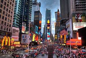

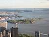
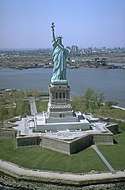
| Authority control |
|
|---|