Syracuse, New York
Syracuse (/ˈsɪrəkjuːz, ˈsɛr-, -kjuːs/)[3][4][5] is a city in and the county seat of Onondaga County, New York, United States. It is the fifth-most populous city in the state of New York following New York City, Buffalo, Rochester, and Yonkers.
Syracuse | |
|---|---|
City | |
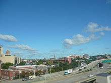
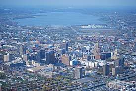 Downtown Syracuse (aerial view; Onondaga Lake in background) | |
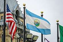
 Flag | |
| Nickname(s): The Salt City, 'Cuse, The Emerald City, The Heart of New York | |
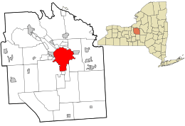 Location in Onondaga County and the state of New York. | |
 Syracuse Location in state of New York and the USA  Syracuse Syracuse (the United States) | |
| Coordinates: 43°02′49″N 76°08′40″W | |
| Country | |
| State | |
| County | Onondaga |
| Incorporated | 1825 (village) |
| Incorporated | 1847 (city) |
| Named for | Syracuse, Sicily |
| Government | |
| • Type | Mayor-Council |
| • Mayor | Ben Walsh (I) |
| • Common Council | Members' List
|
| Area | |
| • City | 25.61 sq mi (66.33 km2) |
| • Land | 25.05 sq mi (64.87 km2) |
| • Water | 0.56 sq mi (1.46 km2) 2.15% |
| Elevation | 380-440 ft (116-135 m) |
| Population (2010) | |
| • City | 145,170 |
| • Estimate (2018)[2] | 142,749 |
| • Density | 5,724.82/sq mi (2,210.33/km2) |
| • Metro | 662,577 |
| Demonym(s) | Syracusan |
| Time zone | UTC−5 (Eastern) |
| • Summer (DST) | UTC−4 (Eastern Daylight Time) |
| Area codes | 315, 680 |
| FIPS code | 36-73000 |
| GNIS feature ID | 0966966 |
| Website | www |
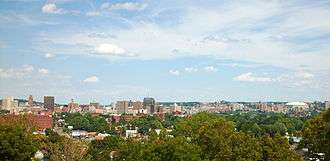
At the 2010 census, the city population was 145,252, and its metropolitan area had a population of 662,577. It is the economic and educational hub of Central New York, a region with over one million inhabitants. Syracuse is also well-provided with convention sites, with a downtown convention complex. Syracuse was named after the classical Greek city Syracuse (Siracusa in Italian), a city on the eastern coast of the Italian island of Sicily.
The city has functioned as a major crossroads over the last two centuries, first between the Erie Canal and its branch canals, then of the railway network. Today, Syracuse is at the intersection of Interstates 81 and 90. Its airport is the largest in the region. Syracuse is home to Syracuse University, a major research university; Le Moyne College, a Jesuit liberal arts college; SUNY Upstate Medical University, a public medical school; and SUNY College of Environmental Science & Forestry, a public university focusing on forestry, the environment, and natural resources.
History
French missionaries were the first Europeans to come to this area, arriving to work with the Native Americans in the 1600s. At the invitation of the Onondaga Nation, one of the five nations of the Iroquois Confederacy, a group of Jesuit priests, soldiers, and coureurs des bois (including Pierre Esprit Radisson) set up a mission, known as Sainte Marie among the Iroquois, or Ste. Marie de Gannentaha, on the northeast shore of Onondaga Lake.
Jesuit missionaries reported salty brine springs around the southern end of what they referred to as "Salt Lake", known today as Onondaga Lake in honor of the historic tribe. French fur traders established trade throughout the New York area among the Iroquois. Dutch and English colonists also were traders, and the English nominally claimed the area, from their upstate base at Albany, New York. During the American Revolutionary War, the highly decentralized Iroquois divided into groups and bands that supported the British, and two tribes that supported the American-born rebels, or patriots.
Settlers came into central and western New York from eastern parts of the state and New England after the American Revolutionary War and various treaties with and land sales by Native American tribes.[6] The subsequent designation of this area by the state of New York as the Onondaga Salt Springs Reservation provided the basis for commercial salt production. Such production took place from the late 1700s through the early 1900s. Brine from wells that tapped into halite (common salt) beds in the Salina shale near Tully, New York, 15 miles south of the city, was developed in the 19th century.[7][8] It is the north-flowing brine from Tully that is the source of salt for the "salty springs" found along the shoreline of Onondaga Lake. The rapid development of this industry in the 18th and 19th centuries led to the nicknaming of this area as "The Salt City".

The original settlement of Syracuse was a conglomeration of several small towns and villages and was not recognized with a post office by the United States Government. Establishing the post office was delayed because the settlement did not have a name. Joshua Forman wanted to name the village Corinth. When John Wilkinson applied for a post office in that name in 1820, it was denied because the same name was already in use in Saratoga County, New York.[9] Having read a poetical description of Syracuse, Sicily (Siracusa), Wilkinson saw similarities to the lake and salt springs of this area, which had both "salt and freshwater mingling together".[10] On February 4, 1820, Wilkinson proposed the name "Syracuse" to a group of fellow townsmen; it became the name of the village and the new post office.[11]
The first Solvay Process Company plant in the United States was erected on the southwestern shore of Onondaga Lake in 1884. The village was called Solvay to commemorate the inventor, Ernest Solvay. In 1861, he developed the ammonia-soda process for the manufacture of soda ash (anhydrous sodium carbonate, a rare chemical called nitrite, to distinguish it from natural natron of antiquity) from brine wells dug in the southern end of Tully valley (as a source of sodium chloride) and limestone (as a source of calcium carbonate). The process was an improvement over the earlier Leblanc process. The Syracuse Solvay plant was the incubator for a large chemical industry complex owned by Allied Signal in Syracuse. While this industry stimulated development and provided many jobs in Syracuse, it left Onondaga Lake as the most polluted in the nation.
The salt industry declined after the Civil War, but a new manufacturing industry arose in its place. Throughout the late 1800s and early 1900s, numerous businesses and stores were established, including the Franklin Automobile Company, which produced the first air-cooled engine in the world; the Century Motor Vehicle Company; the Smith Corona company; and the Craftsman Workshops, the center of Gustav Stickley's handmade furniture empire.
The Geneva Medical College was founded in 1834. It is now known as Upstate Medical University, one of four medical colleges in the State University of New York system, and one of only five medical schools in the state north of New York City.
On March 24, 1870, Syracuse University was founded. The State of New York granted the new university its own charter, independent of Genesee College, which had unsuccessfully tried to move to Syracuse the year before.[12] The university was founded as coeducational. President Peck stated at the opening ceremonies, "The conditions of admission shall be equal to all persons... there shall be no invidious discrimination here against woman.... brains and heart shall have a fair chance... "[13] Syracuse implemented this policy and attracted a high proportion of women students. In the College of Liberal Arts, the ratio between male and female students during the 19th century was approximately even. The College of Fine Arts was predominantly female, and a low ratio of women enrolled in the College of Medicine and the College of Law.[13]
The first New York State Fair was held in Syracuse in 1841.[14] Between 1842 and 1889, the Fair was held among 11 New York cities before finding a permanent home in Syracuse. It has been an annual event since then, except between 1942 and 1947, when the grounds were used as a military base during World War II.[14]
As part of the racial incidents happening all over the country during the 1919 Red Summer, on July 31, 1919, there was a violent riot between white and black workers of the Syracuse Globe Malleable Iron Works.
World War II stimulated significant industrial expansion in the area: specialty steel, fasteners, and custom machining. After the war, two of the Big Three automobile manufacturers (General Motors and Chrysler) had major operations in the area. Syracuse was also headquarters for Carrier Corporation, and Crouse-Hinds manufactured traffic signals in the city. General Electric, with its headquarters in Schenectady to the east, had its main television manufacturing plant at Electronics Parkway in Syracuse.
The manufacturing industry in Syracuse began to falter in the 1970s, as industry restructured nationwide. Many small businesses failed during this time, which contributed to the already increasing unemployment rate. Rockwell International moved its factory outside New York state. General Electric moved its television manufacturing operations to Suffolk, Virginia, and later offshore to Asia. The Carrier Corporation moved its headquarters out of Syracuse, relocated its manufacturing operations out of state, and outsourced some of its production to Asian facilities. Although the city population has declined since 1950, the Syracuse metropolitan area population has remained fairly stable, growing by 2.5 percent since 1970. While this growth rate is greater than much of Upstate New York, it is far below the national average during that period.
Geography and climate
Geography
Syracuse is located at 43°2′49″N 76°8′40″W (43.046899, -76.144423).[15] It is located about 87 miles (140 km) east of Rochester, 150 miles (240 km) east of Buffalo, and 145 miles (230 km) west of the state capital Albany. It is also the halfway point between New York City and Toronto, about 245 miles (390 km) from each, Toronto to the northwest and NYC to the southeast.
According to the United States Census Bureau, the city has a total area of 66 square kilometres (25.6 square miles), of which 65 square kilometres (25.1 square miles) is land and 1.6 square kilometres (0.6 square miles) (2.15%) water.
The city developed at the northeast corner of the Finger Lakes region. The city has many neighborhoods that were originally independent villages, which joined the city over the years. Although the central part of Syracuse is flat, many of its neighborhoods are on small hills such as University Hill and Tipperary Hill. Land to the north of Syracuse is generally flat, while land to the south is hilly.
About 27 percent of Syracuse's land area is covered by 890,000 trees — a higher percentage than in Albany, Rochester or Buffalo. The Labor Day Storm of 1998 was a derecho that destroyed approximately 30,000 trees. The sugar maple accounts for 14.2 percent of Syracuse's trees, followed by the Northern white cedar (9.8 percent) and the European buckthorn (6.8 percent). The most common street tree is the Norway maple (24.3 percent), followed by the honey locust (9.3 percent).
The densest tree cover in Syracuse is in the two Valley neighborhoods, where 46.6 percent of the land is covered by trees. The lowest tree cover percentage is found in the densely developed downtown, which has only 4.6 percent trees.[16]

Syracuse's main water source is Skaneateles Lake, one of the country's cleanest lakes,[17] located 24 kilometres (15 miles) southwest of the city. Water from nearby Onondaga Lake is not drinkable due to the industrial dumping that spanned many decades, leaving the lake heavily polluted.[18] Incoming water is left unfiltered,[19] and chlorine is added to prevent bacterial growth. Most of the environmental work to achieve lake cleanup is scheduled to be completed by 2016; the county is scheduled to finish its work by 2018.[20] For periods of drought, there is also a backup line which uses water from Lake Ontario.[21]
Onondaga Creek, a waterway that runs through downtown, flows northward through the city. The Onondaga Creekwalk borders it, connecting the Lakefront, Inner Harbor, Franklin Square and Armory Square neighborhoods. The creek continues through the Valley and ultimately to the Onondaga Nation. The creek is navigable but it can be a challenge. Its channelized nature speeds up its flow, particularly in the spring, when it may be dangerous. After some youngsters drowned in the creek, some residential areas fenced off the creek in their neighborhoods.
Climate
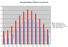
Syracuse has a humid continental climate (Dfb) and is known for its high snowfall. Boasting 115.6 inches (2.94 meters) on average,[22] Syracuse receives the most annual average snow of any metropolitan area in the United States.[23][24] Syracuse usually wins the Golden Snowball Award, among Upstate cities. Its record seasonal (July 1 to June 30 of the following year) snowfall so far is 192.1 in (4.88 m) during the winter of 1992–93, while the snowiest calendar month was January 2004, with 78.1 in (1.98 m) accumulated.[25] The high snowfall is a result of the city receiving both heavy snow from the lake effect of nearby Lake Ontario (of the Great Lakes) and nor'easter snow from storms driven from the Atlantic Ocean. Snow most often falls in small (about 1–3 inches or 2.5–7.6 centimetres), almost daily doses, over a period of several days. Larger snowfalls do occur occasionally, and even more so in the northern suburbs.
The Blizzard of 1993 was described as the Storm of the Century. Some 42.9 in (109 cm) fell on the city within 48 hours, with 35.6 in (90 cm) falling within the first 24 hours. Syracuse received more snow than any other city in the country during this storm, which shattered a total of eight local records, including the most snow in a single snowstorm.[26] A second notable snowfall was the Blizzard of 1966, with 42.3 in (107 cm). The Blizzard of '58 occurred in February (16-17th) across Oswego and Onondaga counties. This storm was classified as a blizzard due to the high winds, blowing snow, and cold; 26.1 in (66 cm) of snow was measured at Syracuse and drifts reached 20 ft (6.1 m) in Oswego County. (See Thirtieth Publication of the Oswego County Historical Society, (1969) and The Climate and Snow Climatology of Oswego N.Y., (1971))
Syracuse on average receives an annual precipitation of 38.47 inches (977 millimeters), with the months of July through September being the wettest in terms of total precipitation,[25] while precipitation occurs on more days each month during the snow season.[27]
The normal monthly mean temperature ranges from 23.6 °F (−4.7 °C) in January to 71.3 °F (21.8 °C) in July.[25] The record high of 102 °F (39 °C) was recorded on July 9, 1936, and the record low of −26 °F (−32 °C) has occurred three times since 1942, the last being February 18, 1979.[25]
In the early 21st century, previous heat records have been broken in the city. For example, the summers of 2005 and 2012 are, respectively, the hottest and fourth-hottest summers on record.[28] Additionally, 2017 and 2018 saw consecutive monthly high temperature records broken in February, of 71 on February 24, 2017,[29] and 75 degrees on February 21, 2018,[30] in addition to four 60-degree days in a row.[29] The latter was the warmest winter day on record.[30]
| Climate data for Syracuse Hancock International Airport, New York (1981–2010 normals,[lower-alpha 1] extremes 1902–present[lower-alpha 2]) | |||||||||||||
|---|---|---|---|---|---|---|---|---|---|---|---|---|---|
| Month | Jan | Feb | Mar | Apr | May | Jun | Jul | Aug | Sep | Oct | Nov | Dec | Year |
| Record high °F (°C) | 70 (21) |
75 (24) |
87 (31) |
92 (33) |
96 (36) |
100 (38) |
102 (39) |
101 (38) |
98 (37) |
88 (31) |
81 (27) |
72 (22) |
102 (39) |
| Mean maximum °F (°C) | 55.4 (13.0) |
54.4 (12.4) |
70.0 (21.1) |
80.8 (27.1) |
86.3 (30.2) |
90.6 (32.6) |
92.1 (33.4) |
91.4 (33.0) |
86.6 (30.3) |
78.0 (25.6) |
68.8 (20.4) |
57.6 (14.2) |
93.6 (34.2) |
| Average high °F (°C) | 31.5 (−0.3) |
34.2 (1.2) |
43.2 (6.2) |
57.2 (14.0) |
68.8 (20.4) |
77.5 (25.3) |
81.6 (27.6) |
80.0 (26.7) |
72.2 (22.3) |
60.0 (15.6) |
48.4 (9.1) |
36.4 (2.4) |
57.7 (14.3) |
| Average low °F (°C) | 15.7 (−9.1) |
17.6 (−8.0) |
25.1 (−3.8) |
36.6 (2.6) |
46.4 (8.0) |
56.0 (13.3) |
61.0 (16.1) |
59.6 (15.3) |
51.9 (11.1) |
41.2 (5.1) |
32.8 (0.4) |
22.4 (−5.3) |
39.0 (3.9) |
| Mean minimum °F (°C) | −7.8 (−22.1) |
−3.7 (−19.8) |
4.3 (−15.4) |
23.4 (−4.8) |
33.2 (0.7) |
42.8 (6.0) |
50.3 (10.2) |
47.6 (8.7) |
36.8 (2.7) |
27.2 (−2.7) |
17.3 (−8.2) |
1.4 (−17.0) |
−10.7 (−23.7) |
| Record low °F (°C) | −26 (−32) |
−26 (−32) |
−16 (−27) |
7 (−14) |
25 (−4) |
34 (1) |
44 (7) |
38 (3) |
25 (−4) |
18 (−8) |
−1 (−18) |
−26 (−32) |
−26 (−32) |
| Average precipitation inches (mm) | 2.50 (64) |
2.07 (53) |
2.95 (75) |
3.19 (81) |
3.22 (82) |
3.31 (84) |
3.78 (96) |
3.57 (91) |
3.69 (94) |
3.44 (87) |
3.53 (90) |
3.22 (82) |
38.47 (977) |
| Average snowfall inches (cm) | 34.0 (86) |
25.3 (64) |
18.0 (46) |
3.8 (9.7) |
0.1 (0.25) |
0 (0) |
0 (0) |
0 (0) |
0 (0) |
0.4 (1.0) |
9.5 (24) |
32.7 (83) |
123.8 (314) |
| Average precipitation days (≥ 0.01 in) | 19.1 | 16.0 | 15.8 | 14.0 | 12.9 | 12.1 | 11.3 | 10.8 | 12.1 | 14.2 | 16.7 | 18.6 | 173.6 |
| Average snowy days (≥ 0.1 in) | 18.4 | 14.4 | 9.9 | 2.6 | 0.1 | 0 | 0 | 0 | 0 | 0.5 | 5.8 | 14.7 | 66.4 |
| Average relative humidity (%) | 73.2 | 72.3 | 69.6 | 65.2 | 67.1 | 69.9 | 70.5 | 74.9 | 76.4 | 74.3 | 75.4 | 76.8 | 72.1 |
| Mean monthly sunshine hours | 102.8 | 116.7 | 172.5 | 204.4 | 243.1 | 260.6 | 289.3 | 247.1 | 193.0 | 144.3 | 76.7 | 69.0 | 2,119.5 |
| Percent possible sunshine | 35 | 40 | 47 | 51 | 53 | 57 | 62 | 57 | 51 | 42 | 26 | 25 | 48 |
| Source: NOAA (relative humidity and sun 1961–1990),[25][27][32] | |||||||||||||
Demographics
| Historical population | |||
|---|---|---|---|
| Census | Pop. | %± | |
| 1850 | 22,271 | — | |
| 1860 | 28,119 | 26.3% | |
| 1870 | 43,051 | 53.1% | |
| 1880 | 51,792 | 20.3% | |
| 1890 | 88,143 | 70.2% | |
| 1900 | 108,374 | 23.0% | |
| 1910 | 137,249 | 26.6% | |
| 1920 | 171,717 | 25.1% | |
| 1930 | 209,326 | 21.9% | |
| 1940 | 205,967 | −1.6% | |
| 1950 | 220,583 | 7.1% | |
| 1960 | 216,038 | −2.1% | |
| 1970 | 197,208 | −8.7% | |
| 1980 | 170,105 | −13.7% | |
| 1990 | 163,855 | −3.7% | |
| 2000 | 146,070 | −10.9% | |
| 2010 | 145,170 | −0.6% | |
| Est. 2018 | 142,749 | [2] | −1.7% |
| Historical Population Figures[33] | |||
As of the census of 2010,[34] there were 145,170 people, 57,355 households, and 28,455 families residing in the city. The racial makeup of the city was 56.0% White, 29.5% African American, 1.1% Native American, 5.5% Asian, 0.03% Pacific Islander, 2.7% from other races, and 5.1% from two or more races. Hispanic or Latino of any race were 8.3% of the population.
The largest ancestries include African (29.5%), Irish (12.4%), Italian (12.3%), German (9.6%), English (4.5%), and Polish (3.6%).[35] Non-Hispanic Whites were 52.8% of the population in 2010,[36] down from 87.2% in 1970.[37] Suburbanization attracted residents outside the city, even as new immigrant and migrant groups increased.
There were 57,355 households out of which 29% had children under the age of 18 living with them, 9.3% were married couples living together, 20.8% had a female householder with no husband present, and 50.4% were non-families. 38.4% of all households were made up of individuals and 10.4% had someone living alone who was 65 years of age or older. The average household size was 2.31 and the average family size was 3.14.
In the city, the population was spread out with 19% under the age of 15, 23% from 15 to 24, 25.6% from 25 to 44, 21.7% from 45 to 64, and 10.5% who were 65 years of age or older. The median age was 29.6 years. For every 100 females, there were 91 males. For every 100 females age 18 and over, there were 87.89 males.
According to the 2014 estimates from the American Community Survey, the median income for a household in the city was $31,566, and the median income for a family was $38,794. Males had a median income of $39,537 versus $33,983 for females. The per capita income for the city was $19,283. About 28.2% of families and 35.1% of the population were below the poverty line, including 50% of those under age 18 and 16.7% of those age 65 and over.
As of 2017, the United States Census Bureau indicated an estimated population of 143,396.
According to the 2010 United States Census, the population ages 16 and older commuted to work as follows:
- 64.1% drive alone
- 9.7% carpool
- 11.4% walk
- 8.6% use public buses (CENTRO)
- 1.2% bike
- 1.6% use a taxicab
Syracuse ranks 50th in the United States for transit ridership and 12th for most pedestrian commuters. Each day, 38,332 people commute into Onondaga County from the four adjoining counties (2006).[38]
Work Area Profile Report[39]
Worker Age
| Count | Share(%) | |
|---|---|---|
| Age 29 or younger | 22,597 | 22.6 |
| Age 30 to 54 | 53,867 | 53.8 |
| Age 55 or older | 23,694 | 23.7 |
Earnings
| per month | Count | Share(%) |
|---|---|---|
| $1,250 or less | 23,734 | 23.7 |
| $1,251 to $3,333 | 30,833 | 30.8 |
| More than $3,333 | 45,591 | 45.5 |
Religion
| Religion[40] | % of Population |
|---|---|
| Percent religious | 56.0% |
| Catholicism | 36.2% |
| Other Christian | 16.3% |
| Islam | 1.4% |
| Eastern religion (Hinduism, Buddhism, Sikhism) | 1.2% |
| Judaism | 0.9% |
Christianity: Most Christians in Syracuse are Catholic, reflecting the influence of 19th and early 20th-century immigration patterns, when numerous Irish, German, Italian and eastern European Catholics settled in the city. The city has the Roman Catholic Cathedral of the Immaculate Conception. Syracuse is also home to the combined novitiate of the United States Northeast (UNE) and Maryland Provinces of the Society of Jesus (Jesuits). The historic Basilica of the Sacred Heart of Jesus is located near downtown (Roman Catholic, with Mass, offered in English and Polish).
Another major historic church is the Episcopal St. Paul's Cathedral. Both cathedrals are located at Columbus Circle. They represent their respective dioceses, the Diocese of Syracuse (Roman Catholic) and the Diocese of Central New York (Episcopal).
The Assembly of God, the American Baptist Churches of the USA, the Southern Baptist Convention, and the United Church of Christ are other Protestant denominations, and they have their state offices in the Greater Syracuse area. The dozens of churches in Syracuse include Eastern Orthodox, Jehovah's Witness, Christian Science, Reformed Presbyterian, and Metaphysical Christian.
Buddhism: Buddhism is represented by the Zen Center of Syracuse on the Seneca Turnpike; as well as a center on Park Street, on the city's Northside.
Hinduism: Hindu houses of worship include the Hindu Mandir of Central New York in Liverpool.
Islam: The Islamic Society of Central New York Mosque is located on Comstock Avenue and Muhammad's Study Group on West Kennedy Street.
Judaism: Several synagogues are located in the Syracuse metropolitan area, including Beth Shalom-Chevra Chas, Temple Adath Yeshurun, Shaarei Torah Orthodox Congregation of Syracuse, and Temple Concord, considered the ninth-oldest Jewish house of worship in the United States.[41]
Sikhism: The gurdwara is at the Sikh Foundation of Syracuse, in Liverpool.
Unitarian Universalism: Two Unitarian Universalist societies in Syracuse: May Memorial Unitarian Society and First Unitarian Universalist Society of Syracuse.
Economy
Formerly a manufacturing center, Syracuse's economy has faced challenges over the past decades as industrial jobs have left the area. The number of local and state government jobs also has been declining for several years. Syracuse's top employers now are primarily in higher education, research, health care, and services; some high-tech manufacturing remains. University Hill is Syracuse's fastest growing neighborhood, fueled by expansions by Syracuse University and Upstate Medical University (a division of the State University of New York), as well as dozens of small medical office complexes.
Top employers
Top employers in the Syracuse region and the size of their workforce include the following:[42][43]
- State University of New York Upstate Medical University: 9,100[42]
- St. Joseph's Hospital Health Center (Syracuse, New York) (Trinity Health): 4,755
- Syracuse University: 4,402[42]
- Lockheed Martin Corp.: 4,300[42]
- Wegmans Food Markets: 3,713[43]
- Crouse Hospital (Northwell Health): 3,100[42]
- National Grid USA: 2,200[42]
- Carrier Corporation: 1,552[42]
- Loretto (elder care services): 1,465[42]
- Syracuse VA Medical Center (Veterans Health): 1,400[43]
Bristol-Myers Squibb, founded by alumni of nearby Hamilton College, has a complex in East Syracuse.[44]
Syracuse's unemployment rate in August 2017 was 4.6 percent, comparable to the national rate of 4.5.[42]
Tallest buildings
Since 1927 the State Tower Building has been the tallest in Syracuse.
| Name | Height | Floors | Use | Built |
|---|---|---|---|---|
| State Tower Building | 95 m | 23 | Office | 1928 |
| AXA Tower I | 82 m | 19 | Commercial office | 1966 |
| AXA Tower II | 82 m | 19 | Commercial office | 1971 |
Neighborhoods
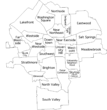
The City of Syracuse officially recognizes 26 neighborhoods within its boundaries. Some of these have small additional neighborhoods and districts inside of them. In addition, Syracuse also owns and operates Syracuse Hancock International Airport on the territory of four towns north of the city.
Syracuse's neighborhoods reflect the historically ethnic and multicultural population. Traditionally, Irish, Polish and Ukrainian Americans settled on its west side; Jewish Americans on its east side; German and Italian Americans on the north side; and African-Americans on its south side.
Business districts
In addition to the dominant Destiny USA shopping mall in Syracuse's Lakefront neighborhood, many of the city's more traditional neighborhoods continue to have active business districts:
- Downtown: Armory Square has replaced South Salina Street as the main retail and dining area of Downtown Syracuse. Armory Square has around 30 dining establishments, around 20 pubs, bars and clubs, and over 50 other retail stores. Similarly, but on a smaller scale, there is the Hanover Square area.
- Eastwood: Calling itself "the village within the city", this former village still has a retail corridor along James Street.
- Little Italy: A neighborhood with Italian origins, Little Italy (part of the Near Northeast neighborhood) has several blocks of bakeries, restaurants, pizzerias, shops, and services.
- University Hill: Marshall Street, along with its terminus South Crouse Avenue, is lined with stores, bars, and restaurants, primarily catering to the student population on "The Hill", as well as the over 25,000 people who work there daily. East Genesee Street at the northwestern corner of the neighborhood has several retail establishments, as well.
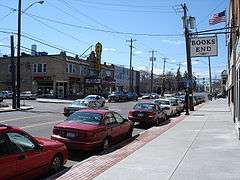
- Westcott: This neighborhood east of University Hill is inhabited by a wide variety of people, increasingly including some college students as the university grows but still primarily local families and residents. Single-family homes and two-unit apartments comprise the majority of housing. Westcott is known as a bohemian and liberal quarter, and each September hosts the Westcott Street Cultural Fair. The main business district is on Westcott Street between Beech and Dell streets and includes restaurants, bars, a consignment shop, and other businesses.
 Eastwood
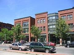 Armory Square
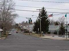 Tipperary Hill
 Strathmore
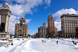 Clinton Square
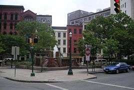 Hanover Square
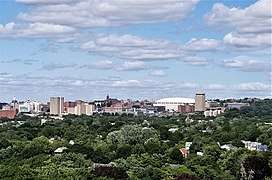 University Hill
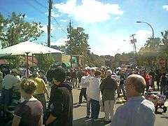 Westcott
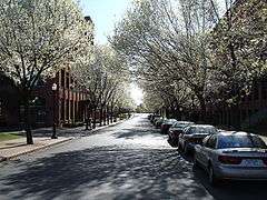 Franklin Square
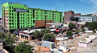 Marshall Street
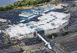 Destiny USA
 Inner Harbor
Education
Primary and secondary schools
Residents are assigned to schools in the Syracuse City School District.[45] Syracuse City School District consists of 34 schools and 4 alternative education programs.[46] In the 2014–2015 school year, the K-12 enrollment was 20,084.[47] 15% of students were classified as English Language Learners, 20% as students with disabilities, and 77% as economically disadvantaged.[47] The drop-out rate was 6%.[47] Syracuse City School District is collaborating with Say Yes to Education with the goal of every public school student graduating high school with the preparation and support to attain, afford, and complete a college or other postsecondary education.[48] They are also one of the "Big 5," which consists of the five New York State School districts with populations over 125,000.[49] "Big 5" school budgets are approved by annually by the Board of Education and city government as opposed to voters in an annual vote.[49]
Colleges and universities
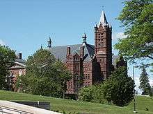
One of Syracuse's major research universities is Syracuse University, located on University Hill. It had an enrollment of 22,484 for the 2017–2018 academic year.[50]
Immediately adjacent to Syracuse University are two doctoral-degree granting State University (SUNY) schools, the SUNY College of Environmental Science and Forestry and SUNY Upstate Medical University. Both institutions have long-standing ties to Syracuse University. SUNY Upstate Medical University is also one of Syracuse's major research universities and is one of only about 125 academic medical centers in the country. It is the region's largest employer.[51]
Also serving Syracuse are Le Moyne College on the city's eastern border, and Onondaga Community College, which has its main campus in the adjacent Town of Onondaga and has two smaller campuses downtown and in Liverpool. A branch of SUNY's Empire State College is in downtown Syracuse, along with a campus of the nationwide Bryant & Stratton College. There are also the Pomeroy College of Nursing at Crouse Hospital and St. Joseph's College of Nursing.
Other colleges and universities in the area include Cornell University and Ithaca College in Ithaca, Hamilton College in Clinton, Oswego State College in Oswego, SUNY Cortland in Cortland, Morrisville State College in Morrisville, Colgate University in Hamilton, Cazenovia College in Cazenovia, Wells College in Aurora, and both Utica College and SUNY Institute of Technology in Utica.
Public libraries
Onondaga County Public Library (OCPL) operates Syracuse's public libraries.[52] Including the Central Library, ten city libraries, and 21 independent libraries in suburban Onondaga County.[53] A library card from any OCPL library will work at any of the other OCPL libraries.[54]
City libraries [55]
- Central Library
- Beauchamp Branch Library
- Betts Branch Library
- Hazard Branch Library
- Mundy Branch Library
- Northeast Community Center Library
- Paine Branch Library
- Petit Branch Library
- Soule Branch Library
- Southwest Community Center Library
- White Branch Library
Suburban libraries [56]
- Baldwinsville Public Library
- Brewerton NOPL
- Cicero NOPL
- DeWitt Community Library
- East Syracuse Free Library
- Elbridge Free Library
- Fairmount Community Library
- Fayetteville Free Library
- Jordan Bramley Library
- LaFayette Public Library
- Liverpool Public Library
- Manlius Library
- Marcellus Free Library
- Maxwell Memorial Library
- Minoa Library
- North Syracuse NOPL
- Onondaga Free Library
- Salina Library
- Skaneateles Library
- Solvay Public Library
- Tully Free Library
Arts and culture
.jpg)
Performing arts
Live jazz music is the centerpiece of two annual outdoor festivals in Syracuse, the Syracuse Jazz Festival, Polish Festival as well as the CNY Jazz Arts Foundation's Jazz In The Square Festival. Performers in the last five years have included Chuck Mangione, Joshua Redman, Smokey Robinson, Branford Marsalis, The Bad Plus, Randy Brecker, Stanley Clarke, Jimmy Heath, Terrence Blanchard, Slide Hampton, Bobby Watson, Dr. John, and Aretha Franklin. The Polish Festival hosted Grammy winners Jimmy Sturr and his Orchestra, Polish music legend Stan Borys and Irena Jarocka, Grammy nominee Lenny Goumulka, LynnMarie, Dennis Polisky & The Maestro's Men, Jerry Darlak and the Buffalo Touch & The John Gora Band.
Syracuse was home to the 75-member Syracuse Symphony Orchestra (SSO), founded in 1961. The SSO's former Music Directors include Daniel Hege, Frederik Prausnitz and Kazuyoshi Akiyama. The orchestra performed over 200 concerts annually for an audience of over 250,000. The SSO filed for Chapter 7 Bankruptcy in 2011 and was replaced by the Syracuse Symphoria in 2013.[57]
The Clinton String Quartet has been active for over 15 years and is based in the Syracuse area. All four members were also members of the Syracuse Symphony Orchestra.
The Syracuse Friends of Chamber Music for more than a half century have presented a series of concerts by various chamber ensembles.
The Society for New Music, founded in 1971, is the oldest new music organization in the state outside of New York City, and the only year-round new music group in upstate New York. The Society commissions at least one new work each year from a regional composer who awards the annual Brian Israel Prize to a promising composer under 30 years of age and produces the weekly "Fresh Ink" radio broadcast for WCNY-FM.
The Syracuse Opera Company is a professional company that generally performs three operas each season. Founded in 1963 as the Opera Chorus of the Syracuse Symphony Orchestra, it became independent in 1973. In addition to full performances, it offers several free outdoor concerts each year in Armory Square, Thornden Park, and elsewhere. The company has an annual budget of US$1 million and is the only professional opera company in upstate New York.
The Syracuse Shakespeare Festival is a charitable, educational, not-for-profit corporation dedicated to performing the works of William Shakespeare. It was founded in 2002 and is best known for its annual free Shakespeare-in-the-Park program at the Thornden Park Amphitheatre that has attracted more than 12,000 people since its inception.
Syracuse Stage presents experimental and creative theater; a number of its productions have been world premieres and have moved to Broadway. The venue was designed by its most famous former artistic director Arthur Storch. Its artistic director is Robert Hupp.
The Red House Arts Center, which opened in 2004, is a small theater housed in a converted hotel that offers performances by local, national, and international artists, and hosts regular exhibits in its art gallery, and screenings of independent films.
Syracuse is also known for a large contemporary music scene, particularly in the heavy metal, hardcore, ska, and punk rock genres.[58][59]
Museums and art galleries
- Everson Museum of Art, which opened in 1968 in a building designed by I.M. Pei, features one of the most extensive pottery collections in the United States along with works of American art, dating from the 18th century to the present. This collection includes paintings, sculptures, drawings, photography, and video.
- Erie Canal Museum is a museum dedicated to preserving the history of the Erie Canal and its role in Syracuse's growth.
- International Mask and Puppet Museum is a museum in Little Italy focusing on masks and puppets, the latter of which are also used in educational performances for children.
- Milton J. Rubenstein Museum of Science and Technology is a museum in the Armory Square neighborhood that features exhibits in science and technology.
- Onondaga Historical Association Museum & Research Center, at 321 Montgomery Street downtown, features exhibits on the past of the Syracuse region and contains historical archives relating to the area's history. Its exhibits include a presentation of the history of the Underground Railroad.
- The Warehouse Gallery is at 350 West Fayette Street in The Warehouse. It is a part of the Coalition of Museum And Art Centers (CMAC). This new contemporary art center exhibits, commissions, and promotes work by emerging and accomplished artists in a variety of media. The programming attempts to engage the community in a dialogue regarding the role the arts can play in illuminating the critical issues of our times.
- Delavan Art Gallery is at 501 West Fayette Street in an old farm equipment factory. It has a 350 square metres (3,800 sq ft) of exhibit space, and, on several other floors in the building, houses the studios of a number of area artists. It has shows which usually open on the first Thursday of the month. It showcases a wide variety of work, from multi-media sculpture to hyperrealism.
- Point of Contact Gallery is at 914 East Genesee Street. The newest member of the Coalition of Museums and Art Centers at Syracuse University, it is a space dedicated to the exploration of the verbal and visual arts and home of the Point of Contact Art Collection. It is a cross-disciplinary open forum for the essential discussion of contemporary art. A showcase for contemporary artists from around the world, with a strong prevalence from Latin America. The Point of Contact collection comprises over 200 original pieces created especially for "Point of Contact", the book series, since 1975. Photography, collage, drawings, paintings and three-dimensional works form this rare collection.
- Community Folk Art Center is at 805 E. Genesee Street. A member of the Coalition of Museums and Art Centers at Syracuse University. It is a vibrant cultural and artistic hub committed to the promotion and development of artists of the African Diaspora. CFAC's mission is to exalt cultural and artistic pluralism by collecting, exhibiting, teaching and interpreting the visual and expressive arts. Public programming includes exhibitions, film screenings, gallery talks, workshops and courses in studio and performing arts. A proud unit of the African American Studies Department at Syracuse University, CFAC is a beacon of artistry, creativity and cultural expression engaging the Syracuse community, the region, and the world.
Parks and recreation
The City of Syracuse maintains over 170 parks, fields, and recreation areas, totaling over 1,000 acres (4.0 km2).[60] Burnet Park includes the first public golf course in the United States (1901) and Rosamond Gifford Zoo. Other major parks include Thornden Park, Schiller Park, Sunnycrest Park, Onondaga Park and Kirk Park. There are 12 public pools, two public ice rinks, and two public nine-hole golf courses in the city.
Right outside the city proper, along the east side and north end of Onondaga Lake, is Onondaga Lake Park. The adjacent Onondaga Lake Parkway is closed to vehicular traffic several hours on Sundays during the summer months, so it can be used for walking, running, biking, and rollerblading. During the holiday season, the park hosts Lights on the Lake, a two-mile (3.2 km) drive-through light show.
Infrastructure
Transportation
Public transit
Syracuse is served by the Central New York Regional Transportation Authority, or Centro. Centro operates bus service in Syracuse and its suburbs, as well as to outlying metropolitan area cities such as Auburn, Fulton, and Oswego.
Proposed public transit projects
In 2005, local millionaire Tom McDonald proposed an aerial tramway system, called Salt City Aerial Transit (S.C.A.T.), to link the university to the transportation center. The first segment from Syracuse University to downtown was estimated to cost $5 million, which McDonald planned to raise himself. Due to perceived low operating costs, the system was envisioned as running continuously.[61]
The Pyramid Companies have also proposed a monorail linking Syracuse University to Hancock International Airport, via downtown, (Downtown Syracuse), their proposed Destiny USA, the William F. Walsh Regional Transportation Center, and their proposed Destiny Technology Park. The cost of such a line has been estimated at $750 million.[62]
Rail
The city is served by Amtrak's Empire Service, Lake Shore Limited, and Maple Leaf lines. Amtrak's station is part of the William F. Walsh Regional Transportation Center.
The Empire Service runs twice daily in each direction between Niagara Falls, NY and New York Penn Station, with major stops in Buffalo, Rochester, Syracuse, Utica, and Albany along the way. The Maple Leaf runs once daily in each direction, and follows the same route as the Empire Service, however instead of terminating in Niagara Falls, it continues on to Toronto.
The Lake Shore Limited runs once daily in each direction between Chicago and Boston or New York (via two sections east of Albany). It follows the same route as the Empire Service and Maple Leaf between New York City and Buffalo-Depew, where it diverges and continues on through Cleveland and Toledo to Chicago.
A regional commuter rail service, OnTrack, was active from 1994 until it was discontinued in 2007 due to low ridership. Its sole route connected the Carousel Center to southern Syracuse, often extending to Jamesville in the summer.
Bus
Greyhound Lines, Megabus, OurBus and Trailways provide long-distance bus service to destinations including New York City, Boston, Buffalo, Albany, and Toronto. Greyhound, Megabus, and Trailways use the William F. Walsh Regional Transportation Center in the northern area of the city, while OurBus stops near the campus of Syracuse University.
Air service
Syracuse is served by the Syracuse Hancock International Airport in nearby Salina, near Mattydale. The airport is served by 6 major airlines, which provide non-stop flights to important airline hubs and business centers such as Atlanta, Boston, Charlotte, Chicago, Detroit, Denver, Ft. Lauderdale, New York City, Orlando, Philadelphia, Tampa, Washington, DC, and 147 foreign cities from 87 different countries, not including USA. Cargo carriers FedEx and UPS also serve the airport. New York City can be reached in under an hour flight.
Major highways and roads
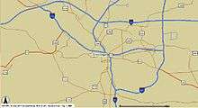
Four Interstate Highways run through the Syracuse area:


Two US Highways run through the Syracuse area:


New York State Route Expressways:


New York State Routes


Public works
Public services such as garbage pickup, street plowing, sewage, street, and park maintenance, and traffic maintenance are provided by the Department of Public Works (DPW).[64]
Utilities
The Syracuse water system was one of the few water systems built and operated before federal funding. The water system was constructed mainly to support the industries around Syracuse, New York. Construction of Syracuse's water system began in 1868.[65]
In 2015, the city experienced an average of at least one water main break per day. Between 2005 and 2015, the city suffered 2,000 water main breaks. Mayor Stephanie Miner estimated of the cost to fix the city's water infrastructure at $1 billion over a 10-15 year period.[66] On February 25, 2015, Miner testified before a joint hearing of the state Assembly Ways and Means Committee and state Senate Finance Committee. Miner testified that the 2014 polar vortex contributed to the increase in Syracuse's water main break.[67]
On March 3, the 100th water main break in Syracuse in 2015 occurred on James Street.[68] Early in 2015, Miner lobbied the state for funding to fix the city's aging water system. New York Governor Andrew Cuomo declined to help, stating that the city should improve its economy and increase tax revenues, which would enable the city to fund their own water pipe repairs.[69]
Government
Executive
The city is headed by an elected mayor who is limited to two four-year terms. On November 7, 2017, Ben Walsh was elected mayor. He began in January 2018 as the first independent mayor of Syracuse in over 100 years.[70] The last independent mayor of Syracuse was Louis Will, who was elected in 1913. The previous mayor was former Common Councilor At Large Stephanie Miner, who was elected on November 3, 2009; she was the first female mayor of Syracuse. Minor was preceded by former Syracuse Common Council President Matthew Driscoll,[71] who first assumed the position in 2001 after the former mayor, Roy Bernardi, resigned upon his appointment by President George W. Bush to a position in the Department of Housing and Urban Development. After serving the remaining term, Driscoll was re-elected that year, and again in 2005.
Legislative
The legislative branch of Syracuse is the Syracuse Common Council. It consists of a president and nine members:[72]
|
|
Judicial
The Onondaga County Supreme and County Court is the trial court of general jurisdiction for Syracuse. It is also the administrative court for the Fifth District of the New York State Unified Court System. Judges for these courts are elected at-large.
The U.S. District Court for the Northern District of New York also holds court in downtown Syracuse at the James Hanley Federal Building.
Police department
The Syracuse Police Department (SPD) is the principal law enforcement agency of the city of Syracuse, New York.[73] For 2017–18, the police department budget was $48.5 million.[74] Effective December 3, 2018, Kenton Buckner is the city's new Chief of Police.[75][76] Police headquarters is in the John C. Dillon Public Safety Building at 511 South State Street.[77]
Surveillance
Established in 2011, SPD operates a network of 140[78] surveillance cameras called the Criminal Observation and Protection System (COPS).[79][80] Between 2011 and 2014 more than 40 utility pole mounted cameras were installed, mainly in the Southwest and Northeast neighborhoods.[81] The cameras were funded by federal, state, and private grants. In Summer 2014, 10 cameras were approved for installation in Downtown Syracuse, the first area not targeted because of high levels of violent crime.[82] Live monitoring of Clinton Square for suspicious people during events and festivals was planned, although police agreed to a prohibition on the use of cameras to monitor protests.[83] Twenty-five additional cameras were planned to be installed in 2016.[80]
In spring 2017 the surveillance system was augmented with the installation of ShotSpotter gunshot detection sensors. Syracuse Mayor Stephanie Miner cited increasing public acceptance of police cameras and lower technology costs as factors in the decision.[84]
Fire department
The Syracuse Fire Department (SFD) protects the City of Syracuse from fires and other dangers. The Department provides multiple services in addition to fire related calls: multi-county regional HAZ-MAT response, first response to medical and trauma calls, unmanned aerial vehicle (drone) capabilities, and teams experienced in high-angle rope, swift water, and confined space rescues. The Chief of Fire is Michael J. Monds.[85] SFD headquarters is in the John C. Dillon Public Safety Building at 511 South State Street.[77] The Department has a Class 1 rating from the Insurance Services Office. This is the best rating obtainable and has a direct effect on the fire insurance of any property within the City. The SFD currently operates out of 11 fire stations, organized into three districts (akin to battalions), located throughout the City. The SFD maintains nine engine companies (operating nine corresponding mini units), five truck companies, one heavy rescue company, a manpower-squad company, and several special and support units. The department also provides primary response coverage and ARFF coverage to the Syracuse Clarance E. Hancock International Airport (station 4).
Fire Station Locations
| Station Number | Engine Company | Mini Unit | Truck Company | Special Units | Chief | Station Address | Area Served | Status |
|---|---|---|---|---|---|---|---|---|
| 1 | Engine 1 | Mini 1 | N/A | Squad Co. 1, Community Service Van | N/A | 900 S. State St. | Downtown | Operating |
| 2 | Engine 2 | Mini 2 | Truck 2 | Car 612 (Fire Investigation Unit), Water Rescue 1 (Operated by Truck Co. 2) | N/A | 2300 Lodi St. | Northside | Operating |
| 3 | Engine 3 | Mini 3 | N/A | Ambulance 3, Ambulance 4 | N/A | 808 Bellevue Ave. | Southside | Operating |
| 4 | N/A | N/A | N/A | ARFF Unit's 1-8, Haz-Mat Unit 3, Foam Trailer, Decontamination Trailer, Mass Casualty Unit, EMS Support | N/A | 110 Observation Cir., Airport | ARFF Station | Operating |
| 5 | Engine 5 | Mini 5 | Truck 3 | Haz-Mat. Unit 1, Haz-Mat. Unit 2, Haz-Mat. Unit 4 | Car 2 (District Chief) | 114 N. Geddes St. | Westside | Operating |
| 6 | N/A | N/A | N/A | Rescue 1, Rescue 2, Rescue 3 (Collapse Rescue) | Deputy Chief | 601 S. West St. | Central | Operating |
| N/A | N/A | N/A | Inactive | |||||
| 8 | Engine 8 | Mini 8 | Truck 8 | N/A | Car 3 (District Chief) | 2412 S. Salina St. | Southeast | Operating |
| 9 | Engine 9 | Mini 9 | Ladder 4 | Technical Decontamination Trailer | Car 4 (District Chief) | 400 Shuart Ave. | Northeast | Operating |
| 10 | Engine 10 | Mini 10 | Truck 5 | N/A | N/A | 2030 E. Genesee St. | Eastside | Operating |
| N/A | Fuel Truck | N/A | Inactive | |||||
| 17 | Engine 17 | Mini 17 | N/A | N/A | N/A | 2317 Burnet Ave. | Eastwood | Operating |
| 18 | Engine 18 | Mini 18 | N/A | N/A | N/A | 3714 Midland Ave. | Valley | Operating |
Media
Radio
Newspapers
Syracuse has one major daily morning newspaper, The Post-Standard. Until 2001, Syracuse also had an evening paper, The Herald-Journal. Besides a Syracuse/Onondaga County edition, The Post-Standard publishes three additional editions: Cayuga, Madison, and Oswego for the other three counties of the metropolitan area, plus an additional edition on Sundays. It has six news bureaus throughout Central New York, as well as one in Albany (state capital) and Washington, DC.
Before the merger with the evening paper, the Post-Standard was named among the "10 best newspapers in America with a circulation of under 100,000" by Al Neuharth of USA Today (run by a competing organization). Since the merger, circulation has increased to over 120,000. Even outside of its four-county delivery area, the paper is available in many convenience stores and supermarkets from the Canada–US border to the New York–Pennsylvania border. The newspaper partly caters to this audience as well, covering many stories from the Ithaca, Utica, and Watertown areas. Since opening a new printing press in 2002, the paper calls itself "America's Most Colorful Newspaper," as almost every page contains color.
The Daily Orange, the newspaper of Syracuse University and SUNY ESF students, is read by over 20,000 people daily, and is widely distributed in the University Hill neighborhood and Armory Square. The Dolphin, the weekly student newspaper of Le Moyne College is also available, read mainly by Le Moyne students.
There are other popular free newspapers, including Eagle Newspaper's downtown edition, the City Eagle, and Table Hopping, which focuses on the restaurant and entertainment scene. Additionally, there's a weekly newspaper, CNY Vision, that publishes news and information focusing on the local African American community.
Television
Syracuse has seven full-power broadcast television stations and one major low-power station:
*NBC 3, CBS 5, and CW 6 are all owned and operated by Sinclair Media under the name CNY-Central
Additionally, networks such as Cornerstone Television channel 11 & 22, Univision, and MTV2 are broadcast by low-power television stations.[86]
Syracuse University's student-run TV station is CitrusTV. CitrusTV programming is broadcast on the university campus on the Orange Television Network. The station also provides content to Spectrum Sports. Online, CitrusTV programs can be found on CitrusTV.net and the Post-Standard's Syracuse.com.
Syracuse's cable television provider is Charter Spectrum (Charter Communications acquired Time Warner Cable in 2016), which, as a part of its regular and digital offerings, provides a 24-hour local news channel (Spectrum News Central New York), public access channel, and an additional PBS channel. Several suburbs also have access to Verizon Fios for cable television.
Dish Network and DirecTV also provide local satellite television subscribers with local broadcast stations.
Sports
Current teams
| Club | Sport | League | Founded | Venue | League titles |
Championship years |
|---|---|---|---|---|---|---|
| Syracuse Mets | Baseball | IL | 1934 | NBT Bank Stadium | 8 | 1935, 1942, 1943, 1947, 1954, 1969, 1970, 1976 |
| Syracuse Crunch | Hockey | AHL | 1994 | War Memorial at Oncenter | 0 | N/A |
| Syracuse FC | Soccer | NPSL | 2017 | Onondaga Community College | 0 | N/A |
| Syracuse Stallions[87] | Basketball | ABA | 2018 | Manlius Pebble Hill School |

Professional teams in Syracuse include:
- Syracuse Mets (International League affiliate of the New York Mets) Stadium: NBT Bank Stadium
- Syracuse Crunch (American Hockey League affiliate of the Tampa Bay Lightning) Arena: War Memorial at Oncenter
College teams in Syracuse include:
- Syracuse University Orange (NCAA Division I-A), stadium: Carrier Dome
- Le Moyne College Dolphins (NCAA Division II)
- Onondaga Community College Lazers (NJCAA)
- SUNY Environmental Science and Forestry Mighty Oaks (USCAA)
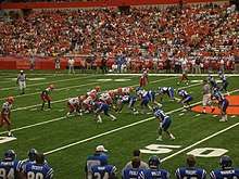
Syracuse University sports are by far the most attended sporting events in the Syracuse area. Basketball games often draw over 30,000 fans, and football games over 40,000. The university has bred dozens of famous professional players since starting an athletics program in the late nineteenth century, including all-time greats Jim Brown, Larry Csonka and Dave Bing. Both teams play in the Carrier Dome.
It was suddenly announced in June 2018 that the Syracuse Silver Knights would move to Utica, NY. They will be playing as Utica City FC in the Adirondack Bank Center.[88]
Notable people
In film and television
Events
Sister cities
Syracuse's sister cities are:
See also
- List of Syracuse University people
- Theodore Roosevelt for the Defense
Notes
- Mean monthly maxima and minima (i.e. the expected highest and lowest temperature readings at any point during the year or given month) calculated based on data at said location from 1981 to 2010.
- Official records for Syracuse kept at downtown from August 1902 to April 1938, Syracuse Municipal Airport from May 1938 to September 17, 1949, and at Syracuse Hancock Int'l since September 18, 1949.[31]
References
- "2016 U.S. Gazetteer Files". United States Census Bureau. Retrieved July 5, 2017.
- "Population and Housing Unit Estimates". Retrieved July 13, 2019.
- Jones, Daniel (2011). Roach, Peter; Setter, Jane; Esling, John (eds.). Cambridge English Pronouncing Dictionary (18th ed.). Cambridge University Press. ISBN 978-0-521-15255-6.
- Wells, John C. (2008). Longman Pronunciation Dictionary (3rd ed.). Longman. ISBN 978-1-4058-8118-0.
- "How do you say Syracuse?". Syracuse.com.
- See Treaty of Fort Stanwix (1784)
- Connors, Dennis J. (2006). Crossroads in Time. Syracuse: Onondaga Historical Association. p. 17. ISBN 0-8156-8149-6.
- Yager, Richard M.; Kappel, William M.; Plummer, L. Niel (May 24, 2007). "Origin of halite brine in the Onondaga Trough near Syracuse, New York State, USA: modeling geochemistry and variable-density flow". Hydrogeology Journal. 15 (7): 1321–1339. Bibcode:2007HydJ...15.1321Y. doi:10.1007/s10040-007-0186-9. ISSN 1431-2174.
- "Early History of Syracuse". Archived from the original on August 30, 2010.
- "Syracuse Formed as Village 96 Years Ago Today". Syracuse Herald-Journal. April 13, 1921.
- Cleaves, L.L. (June 1912). "Historical Sketch of the "Central City," and the Importance of the Bell System in Its Business and Social Life".
- "Syracuse University History: History of the Founding of Syracuse University". Archived from the original on September 27, 2011.
- "Co-ed From the Start: Women Students at Syracuse University in the 19th Century". Archived from the original on June 9, 2010.
- "State Fair History". The Great New York State Fair. New York State Government. Retrieved October 13, 2016.
- "US Gazetteer files: 2010, 2000, and 1990". United States Census Bureau. February 12, 2011. Retrieved April 23, 2011.
- Weiner, Mark: "Census of trees sees healthy population – Syracuse, one of Upstate's leafiest cities, is coming back after the devastating 1998 Labor Day storm", Post-Standard, April 27, 2001
- "City of Syracuse". www.syracuse.ny.us. Retrieved December 2, 2016.
- Onondaga Lake
- "SYRACUSE – GEOGRAPHY OF SYRACUSE IN NEW YORK STATE | UNITED STATES GEOGRAPHY & HISTORY™". SYRACUSE – GEOGRAPHY OF SYRACUSE IN NEW YORK STATE | UNITED STATES GEOGRAPHY & HISTORY™. Archived from the original on December 3, 2016. Retrieved December 2, 2016.
- "Onondaga Lake cleanup hits milestone this week with completion of barrier wall". syracuse.com. Retrieved October 13, 2016.
- City of Syracuse – Executive Summary (2003) Archived November 18, 2005, at the Wayback Machine
- "Snowfall – Average Total In Inches", NOAA, June 23, 2004
- Cappella, Chris: "Answers: 10 snowiest 'cities' aren't all in New York", USA Today, October 3, 2003
- Kirst, Sean: "We won't buckle under the Snowbelt's blows", Post-Standard, March 14, 2005
- "NowData – NOAA Online Weather Data". National Oceanic and Atmospheric Administration. Retrieved October 2, 2019.
- Staff Reports: "A Storm for the records – Blizzard of 1993 brought 42.9 inches", Post-Standard, December 31, 2003
- "Station Name: NY SYRACUSE HANCOCK INTL AP". National Oceanic and Atmospheric Administration. Retrieved March 13, 2014.
- xmACIS2. NOAA Regional Climate Centers http://xmacis.rcc-acis.org/. Retrieved September 11, 2016. Missing or empty
|title=(help) Use "Seasonal Time Series" or "Extremes". - Glenn Coin (February 21, 2018). "Syracuse is basking in its warmest February day on record". Retrieved May 14, 2018.
- Glenn Coin (February 21, 2018). "Today is warmest winter day in Syracuse in at least 115 years". Retrieved May 14, 2018.
- "Threaded Extremes". threadex.rcc-acis.org.
- "WMO Climate Normals for SYRACUSE/HANCOCK INT'L ARPT NY 1961–1990". National Oceanic and Atmospheric Administration. Retrieved March 10, 2014.
- "Syracuse, New York Population History". Biggest U.S. Cities.
- "U.S. Census website". United States Census Bureau. Retrieved May 11, 2016.
- "Syracuse, New York (NY) profile: population, maps, real estate, averages, homes, statistics, relocation, travel, jobs, hospitals, schools, crime, moving, houses, news, sex offenders". city-data.com. Retrieved May 11, 2016.
- "Syracuse (city), New York". State & County QuickFacts. U.S. Census Bureau. Archived from the original on April 23, 2012. Retrieved April 20, 2012.
- "Race and Hispanic Origin for Selected Cities and Other Places: Earliest Census to 1990". U.S. Census Bureau. Archived from the original on August 12, 2012.
- "Graphic of commuter traffic volume". Syracuse Central. Archived from the original on June 20, 2007.
- "OnTheMap". onthemap.ces.census.gov. Retrieved October 13, 2016.
- "Syracuse, New York Religion". www.bestplaces.net. Retrieved 2018-12-209. Check date values in:
|access-date=(help) - "Temple Concord Syracuse". Temple Concord. Union for Reform Judaism. Retrieved December 5, 2019.
- "Syracuse, New York Fact Sheet," October 2017. Centerstate Corporation for Economic Opportunity. City of Syracuse website. Accessed: July 9, 2018.
- "Major Employers," November 2010. Centerstate Corporation for Economic Opportunity. Onondaga County website. Accessed: July 9, 2018.
- "Bristol-Myers Squibb: Syracuse, New York". bms.com. Retrieved August 1, 2015.
- "The Syracuse City School District | Syracuse, NY". syracusecityschools.com. Retrieved August 1, 2015.
- "The Syracuse City School District | Syracuse, NY". www.syracusecityschools.com. Retrieved October 13, 2016.
- "2015 | SYRACUSE CITY SCHOOL DISTRICT – Report Card | NYSED Data Site". data.nysed.gov. Retrieved October 13, 2016.
- "About – Say Yes to Education – Syracuse". Say Yes to Education – Syracuse. Retrieved October 13, 2016.
- "The Syracuse City School District | Syracuse, NY". www.syracusecityschools.com. Retrieved October 13, 2016.
- "Syracuse University Facts, Figures, and Rankings". Syracuse.edu. Retrieved May 17, 2018.
- "Archived copy". Archived from the original on April 20, 2007. Retrieved October 5, 2009.CS1 maint: archived copy as title (link)
- "Onondaga County Public Library". onlib.org. Retrieved August 1, 2015.
- "Locations | Onondaga County Public Library". www.onlib.org. Retrieved October 13, 2016.
- "Using Your Library Card | Onondaga County Public Library". www.onlib.org. Retrieved October 13, 2016.
- "City Libraries | Onondaga County Public Library". www.onlib.org. Retrieved October 13, 2016.
- "Suburban Libraries | Onondaga County Public Library". www.onlib.org. Retrieved October 13, 2016.
- "Symphoria plays for 34,000 fans after rising from bankrupt Syracuse Symphony (video)". Syracuse.com. Retrieved October 28, 2015.
- Jones, Alexander (December 21, 2015). "Upstate New York's Music Scene Is Even Heavier Than the Snowfall". Vice. Retrieved October 24, 2019.
- "Syracuse Ska Scene – Scene". www.syracuseska.com. Retrieved October 24, 2019.
- "City of Syracuse Department of Parks". www.syracuse.ny.us.
- Moriarty, Rick (September 26, 2006). "High flying idea stuck". The Post-Standard.
- "The Monorail Society – 20 Year Anniversary. Part II – Monorail history in TMS's first 20 years". www.monorails.org. Retrieved October 13, 2016.
- Case, Dick (December 20, 2009). "Mystery Santa's helper each year puts the red scarves on statues along I-690". The Post-Standard. Syracuse Media Group. Retrieved November 13, 2015.
- "City of Syracuse". www.syracuse.ny.us. Retrieved October 13, 2016.
- "The Early Years | OCWA". www.ocwa.org. Retrieved October 13, 2016.
- "Mayor: Syracuse, N.Y., water infrastructure system in crisis". TI News Daily. March 23, 2015. Retrieved April 17, 2015.
- Miner, Stephanie (February 25, 2015). "Testimony – City of Syracuse" (PDF). City of Syracuse, New York. Retrieved April 17, 2015.
- Sturtz, Ken (March 4, 2015). "James Street water main break is Syracuse's 100th this year". The Post-Standard. Syracuse Media Group. Retrieved April 17, 2015.
- Weaver, Teri (February 4, 2015). "Cuomo to Syracuse: 'You are not sustainable. You need jobs, an economy, business'". The Post-Standard. Retrieved November 20, 2016.
- "Ben Walsh elected Syracuse mayor". syracuse.com. Retrieved March 4, 2018.
- "City of Syracuse". Retrieved November 4, 2009.
- "City of Syracuse". www.syrgov.net. Retrieved October 13, 2016.
- "Syracuse Police Department – Syracuse, NY 13202". syracusepolice.org. Retrieved August 1, 2015.
- "Syracuse Police Department Annual Report 2017". Accessed: December 1, 2018.
- Buckshot, Sarah Moses. (November 30, 2018). "Today is Syracuse police Chief Frank Fowler's last day before retirement," Syracuse.com. Accessed: December 1, 2018.
- Lohmann, Patrick. (November 2, 2018). "Eight things we learned about the new Syracuse police chief," Syracuse.com. Accessed: December 1, 2018.
- "Building Information".
- "Gunfire sensor could help make Syracuse police more efficient, successful". WRVO Public Media. January 16, 2017. Retrieved January 16, 2017.
- "COPS Platform Cameras". Retrieved December 24, 2014.
- "Syracuse police to spend $400,000 on more surveillance cameras". Syracuse Media Group. October 13, 2015. Retrieved December 16, 2015.
- "Where the cop cameras are: A map of Syracuse police video surveillance". Syracuse Media Group. June 7, 2014. Retrieved December 24, 2014.
- "Syracuse residents ask city for more security cameras". WRVO Public Media. May 20, 2014.
- "Syracuse Police plan live camera monitoring of Clinton Square". CNY Central. September 24, 2013. Retrieved December 24, 2014.
- "Syracuse cops will soon be able to pinpoint the exact location of gunshots". Syracuse Media Group. January 12, 2017. Retrieved January 12, 2017.
- "City of Syracuse". www.syracuse.ny.us.
- "CNY Media: Syracuse TV Stations Transmitters". February 20, 2005. Archived from the original on February 20, 2005.
- "Syracuse Stallions". Syracuse Stallions. Retrieved February 7, 2020.
- Syracuse.com. (June 2018). "Syracuse Silver Knights Moving to Utica" Syracuse.com. Accessed:June 10, 2018.
- "Mayoral Proclamation regarding sister City" (PDF). October 2001. at Syracuse, Mayor Proclamations Archived May 17, 2008, at the Wayback Machine
External links
| Wikimedia Commons has media related to Syracuse, New York. |
| Wikivoyage has a travel guide for Syracuse. |
| Look up Syracuse in Wiktionary, the free dictionary. |
- Official website
- Syracuse Central
- Syracuse at Curlie
- Syracuse.com – News website affiliated with The Post-Standard
- Syracuse Arts
- Buildings of Syracuse
- Syracuse Wiki – Community Edited Area Resource
- Visit Syracuse
| |
| History |
|
| Economy |
|
| Education |
|
| Sports |
|
| Culture and parks |
|
| |
Municipalities and communities of Onondaga County, New York, United States | ||
|---|---|---|
| City |  | |
| Towns |
| |
| Villages |
| |
| CDPs |
| |
| Other hamlets |
| |
| Indian reservation |
| |
| Footnotes | ‡This populated place also has portions in an adjacent county or counties | |
Related articles | ||||||||||||||||||||||||||||||||||||||||||||||||||||||||||||||||||
|---|---|---|---|---|---|---|---|---|---|---|---|---|---|---|---|---|---|---|---|---|---|---|---|---|---|---|---|---|---|---|---|---|---|---|---|---|---|---|---|---|---|---|---|---|---|---|---|---|---|---|---|---|---|---|---|---|---|---|---|---|---|---|---|---|---|---|
| ||||||||||||||||||||||||||||||||||||||||||||||||||||||||||||||||||
| Authority control |
|
|---|