Bridgeport, Connecticut
Bridgeport is a historic seaport city in the U.S. state of Connecticut. It is in Fairfield County, at the mouth of the Pequonnock River on Long Island Sound, 60 miles (97 km) from Manhattan and 40 miles (64 km) from The Bronx. It is bordered by the towns of Trumbull to the north, Fairfield to the west, and Stratford to the east.
Bridgeport, Connecticut | |
|---|---|
| City of Bridgeport | |
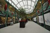
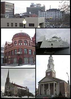 Clockwise from top: Downtown, the Bridgeport & Port Jefferson Ferry, the United Congregational Church, St Patrick’s Church, and the PT Barnum Museum | |
 Flag  Seal | |
| Nicknames: The Park City | |
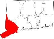
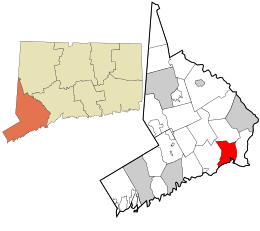 Location within Fairfield County | |
 Bridgeport Location within Connecticut  Bridgeport Location within the United States | |
| Coordinates: 41°11′11″N 73°11′44″W | |
| Country | |
| U.S. state | |
| County | Fairfield |
| Metropolitan area | Bridgeport-Stamford |
| Incorporated (town) | 1821 |
| Incorporated (city) | 1836 |
| Government | |
| • Type | Mayor-council |
| • Mayor | Joe Ganim (D) |
| Area | |
| • City | 19.4 sq mi (50.2 km2) |
| • Land | 16.0 sq mi (41.4 km2) |
| • Water | 3.4 sq mi (8.8 km2) |
| • Urban | 9,014.3 sq mi (3,843.8 km2) |
| Elevation | 3 ft (1 m) |
| Population | |
| • City | 144,229 |
| • Estimate (2018)[2] | 144,900 |
| • Rank | US: 172nd |
| • Density | 8,720.9/sq mi (3,354/km2) |
| • Urban | 923,311 (US: 48th) |
| • Metro | 939,904 (US: 57th) |
| Time zone | UTC−5 (Eastern) |
| • Summer (DST) | UTC−4 (Eastern) |
| ZIP Codes | 06601–06602, 06604–06608, 06610, 06650, 06673, 06699[3] |
| Area code(s) | 203/475 |
| FIPS code | 09-08000 |
| GNIS feature ID | 205720 |
| Airport | Sikorsky Memorial Airport |
| Major highways | |
| Commuter Rail | |
| Website | City of Bridgeport |
As of 2018, Bridgeport had an estimated population of 144,900,[2] which made it the largest city in Connecticut and the fifth-most populous in New England. The Greater Bridgeport area is the 48th-largest urban area in the United States.
The showman P. T. Barnum was a resident of the city and served as the town's mayor in the late 19th century. Barnum built four houses in Bridgeport and housed his circus in town during winter. The first Subway restaurant opened in Bridgeport's North End in 1965.[4] The Frisbie Pie Company was in Bridgeport, and Bridgeport is credited as the birthplace of the Frisbee.[5]
After World War II, industrial restructuring and suburbanization caused the loss of many jobs and affluent residents, leaving Bridgeport struggling with poverty and crime.
History
Bridgeport was inhabited by the Paugussett native American tribe at the time of its English colonization. The earliest European communal settlement was in the historical Stratfield district,[6] along US Route 1; known in colonial times as the King's Highway. Close by, Mount Grove Cemetery was laid out on what was a native village that extended past the 1650s.[7] It is also an ancient Paugusett burial ground.
The English farming community grew and became a center of trade, shipbuilding, and whaling. The town incorporated to subsidize the Housatonic Railroad and rapidly industrialized following the rail line's connection to the New York and New Haven railroad. The namesake of the town was the need for bridges over the Pequonnock River that provided a navigable port at the mouth of the river. Manufacturing was the mainstay of the local economy until the 1970s.
Colonial history
_Map_before_1886.jpg)
The first documented English settlement within the present city limits of Bridgeport took place in 1644, centered at Black Rock Harbor and along North Avenue between Park and Briarwood Avenues. The place was called Pequonnock[8] (Quiripi for "Cleared Land"), after a band of the Paugussett, an Algonquian-speaking Native American people who occupied this area. One of their sacred sites was Golden Hill, which overlooked the harbor and was the location of natural springs and their planting fields. (It has since been blasted through for construction of an expressway.)[9][10] The Golden Hill Indians were granted a reservation here by the Colony of Connecticut in 1639; it lasted until 1802. (One of the tribe acquired land for a small reservation in the late 19th century that was recognized by the state. It is retained in the Town of Trumbull.)
Bridgeport's early years were marked by residents' reliance on fishing and farming. This was similar to the economy of the Paugusset, who had cultivated corn, beans, and squash; and fished and gathered shellfish from both the river and sound. A village called Newfield began to develop around the corner of State and Water streets in the 1760s.[11] The area officially became known as Stratfield in 1695[8] or 1701, due to its location between the already existing towns of Stratford and Fairfield.[12] During the American Revolution, Newfield Harbor was a center of privateering.[8][13]
19th century
By the time of the State of Connecticut's ratification of the Articles of Confederation in 1781, many of the local farmers held shares in vessels trading at Newfield Harbor or had begun trading in their own name. Newfield initially expanded around the coasting trade with Boston, New York, and Baltimore and the international trade with the West Indies.[11][14] The commercial activity of the village was clustered around the wharves on the west bank of the Pequonnock, while the churches were erected inland on Broad Street.[15] In 1800, the village became the Borough of Bridgeport,[18] the first so incorporated in the state.[19] It was named for the Newfield or Lottery Bridge across the Pequonnock, connecting the wharves on its east and west banks.[17] Bridgeport Bank was established in 1806.[20] In 1821, the township of Bridgeport became independent of Stratford.[21]
The West India trade died down around 1840,[11] but by that time the Bridgeport Steamship Company (1824)[22] and Bridgeport Whaling Company (1833) had been incorporated[11] and the Housatonic Railroad chartered (1836).[23][24] The HRRC ran upstate along the Housatonic Valley, connecting with Massachusetts's Berkshire Railroad at the state line. Bridgeport was chartered as Connecticut's fifth city in 1836[21][25][28] in order to enable the town council to secure funding (ultimately $150,000) to provide to the HRRC and ensure that it would terminate in Bridgeport.[29] The Naugatuck Railroad—connecting Bridgeport to Waterbury and Winsted along the Naugatuck—was chartered in 1845 and began operation four years later.[30][31] The same year, the New York and New Haven Railroad began operation,[32] connecting Bridgeport to New York and the other towns along the north shore of the Long Island Sound.
Now a major junction for western Connecticut, the city rapidly industrialized. Following the Civil War, it held several iron foundries and factories manufacturing firearms, metallic cartridges, horse harnesses, locks, and blinds.[21] Wheeler & Wilson's sewing machines were exported throughout the world. Bridgeport annexed the West End and the village of Black Rock and its busy harbor in 1870.[33] In 1875, P. T. Barnum was elected mayor of the town, which afterwards served as the winter headquarters of Barnum and Bailey's Circus and Buffalo Bill's Wild West Show.[8]
 Iranistan, the residence of P. T. Barnum, in 1848
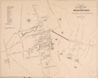 Bridgeport in 1824, by H. L. Barnum[15]
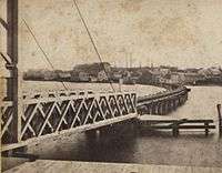 East Bridgeport Bridge over Pequannock River, c. 1850
20th century
From 1870 to 1910, Bridgeport became the major industrial center of Connecticut and its population rose from around 25,000 to over 100,000, including thousands of Irish, Slovaks, Hungarians, Germans, English, and Italian immigrants.[8]
Among the initiatives, the Singer factory joined Wheeler & Wilson in producing sewing machines[8] and the Locomobile Company of America was a prominent early automobile manufacturer, producing a prototype of the Stanley Steamer and various luxury cars.[34]
Further, the Holmes & Edwards Silver Co. was founded in 1882, with its wares sold nationally, and the company became part of the International Silver Company in 1898.[35] (The H&E brand, in fact, continued well into the 1950s and was advertised in national magazines such as LIFE and Ladies' Home Journal.)[36]
The town was also the center of America's corset production, responsible for almost 20% of the national total,[8] and became the headquarters of Remington Arms following its 1912 merger with the Union Metallic Cartridge Co. Around the time of the First World War, Bridgeport was also producing steam-fitting and heating apparatuses, brass goods, phonographs, typewriters,[8] milling machines, brassieres, and saddles.[37]
In the summer of 1915, a series of strikes imposed the eight-hour day on the town's factories; rather than moving business elsewhere, the success spread the eight-hour day throughout the Northeast.[38] The First World War continued the city's expansion so that, on the eve of the Great Depression, there were more than 500 factories in Bridgeport, including Columbia Records' primary pressing plant. The build-up to World War II helped its recovery in the late 1930s.[39]
Restructuring of heavy industry starting after the mid-20th century caused the loss of thousands of jobs and residents. Like other urban centers in Connecticut, Bridgeport suffered during the deindustrialization of the United States in the 1970s and 1980s.[40] Continued development of new suburban housing attracted middle and upper-class residents, leaving the city with a higher proportion of poor. The city suffered from overall mismanagement, for which several city officials were convicted, contributing to the economic and social decline.[41] In September 1978, Bridgeport teachers went on a 19-day strike due to deadlocked contract negotiations. A court order, as well as a state law that made strikes by public workers illegal in Connecticut, resulted in 274 teachers being arrested and jailed.[42] Bridgeport made numerous efforts at revitalization. In one proposal, Las Vegas developer Steve Wynn was to build a large casino, but that project failed. In 1991, the city filed for bankruptcy protection but was declared solvent by a federal court.[43]
21st century
In the early 21st century, Bridgeport has taken steps toward redevelopment of its downtown and other neighborhoods. In 2004, artists' lofts were developed in the former Read's Department Store on Broad Street. Several other rental conversions have been completed, including the 117-unit Citytrust bank building on Main Street. The recession halted, at least temporarily, two major mixed-use projects including a $1-billion waterfront development at Steel Point, but other redevelopment projects have proceeded, such as the condominium conversion project in Bijou Square.[44] In 2009, the City Council approved a new master plan for development, designed both to promote redevelopment in selected areas and to protect existing residential neighborhoods.[45] In 2010, the Bridgeport Housing Authority and a local health center announced plans to build a $20 million medical and housing complex at Albion Street, making use of federal stimulus funds and designed to replace some of the housing lost with the demolition of Father Panik Village.[46] Recently, MGM announced plans to build a waterfront casino and shopping center in the city, awaiting approval by the state government. If built, the development will create 2,000 permanent jobs and about 5,779 temporary jobs.[47]
Notable speeches
On March 10, 1860, Abraham Lincoln spoke in the city's Washington Hall, an auditorium at the old Bridgeport City Hall (now McLevy Hall), at the corner of State and Broad Streets. The largest room in the city was packed, and a crowd formed outside, as well. Lincoln received a standing ovation before taking the 9:07 pm train that night back to Manhattan.[48][49] A plaque marks the site where Lincoln spoke; later that year, he was elected president.
The Rev. Martin Luther King, Jr. spoke three times at the Klein Auditorium during the 1960s. Additionally, President George W. Bush spoke before a small group of Connecticut business people and officials at the Playhouse on the Green in 2006.[50] President Barack Obama also spoke at the Harbor Yard arena in 2010 to gain support for the campaign of Democratic Governor Dan Malloy.[51]
On April 23, 2016, Republican presidential candidate Donald Trump spoke to supporters at the Klein Memorial Auditorium during the 2016 Republican Party presidential primaries. Trump went on to win the State's primary by a landslide. [52]
Geography
Bridgeport lies along Long Island Sound at the mouth of the Pequonnock River.
Parks
Bridgeport is renowned for its public park system, which has led to its official nickname, "the Park City". The city's first public park was the westerly portion of McLevy Green, first set aside as a public square in 1806;[53] the Clinton Park Militia Grounds (1666) and Old Mill Green (1717) were set aside earlier as public commons by the towns of Fairfield and Stratford, respectively. As the city rapidly grew in population, residents recognized the need for more public parks and by 1864, Barnum and other residents had donated approximately 44 acres (180,000 m2) to create Seaside Park, now increased by acquisition and landfill to 375 acres (1.52 km2).[54] In 1878, over 100 acres (400,000 m2) of land bordering the Pequonnock River was added as Beardsley Park.[55] Frederick Law Olmsted, famous for creating New York City's Central Park, designed both Seaside and Beardsley Parks.[56] Over time, more parks were added including 35-acre (140,000 m2) Beechwood Park and Pleasure Beach, home to a popular amusement park for many years. Went Field on the West End, between Wordin Avenue and Norman Street, used to be the winter headquarters of Barnum's circus.
Neighborhoods
Bridgeport has many distinct neighborhoods,[57] divided into five geographic areas: Downtown, the East Side, the North End, the South End, and the West Side.[58]
- Downtown
- McLevy Green
- Harral Square
- The Hollow
- Enterprise Zone
- East Side
- Boston Avenue/Mill Hill
- East End
- Lower East Side
- Newfield
- Pleasure Beach
- Steel Point
- Upper East Side
- North End
- Brooklawn/St. Vincent
- Lake Forest
- Lake Success
- North Bridgeport/Little Italy
- Reservoir/Whiskey Hill
- South End
- Seaside Park
- Soundgate
- West Side
- Black Rock
- West Side
Climate
Under the Köppen climate classification, Bridgeport has a Temperate climate (Cfa), it is part of USDA hardiness zone 7a.[59] Like the rest of coastal Connecticut, Bridgeport lies in the broad transition zone between the continental climates of New England and the humid subtropical climates to the south. The average monthly temperature ranges from 30.1 °F (−1.1 °C) in January to 74.3 °F (23.5 °C) in July; on average, there are 20 days where the temperature remains at or below freezing and 7.6 days with a high at or above 90 °F (32 °C) annually; the last year to not reach the latter mark was 2004.[60] Temperatures reaching 0 °F (−18 °C) or 100 °F (38 °C) are uncommon, and were last seen respectively on January 7, 2018 and July 22, 2011.[60] The record low is −7 °F (−22 °C), set on January 22, 1984, while the record high is 103 °F (39 °C), set on July 22 in 1957 and 2011.[60]
Precipitation averages 42.7 inches (1,080 mm) annually, and is somewhat evenly distributed throughout the year, with March and April the wettest months. Annual snowfall averages 27.6 inches (70 cm), falling almost entirely from December to March. As is typical of coastal Connecticut, snow cover does not usually last long, with an average of 29 days per winter with snow cover of at least 1 inch (2.5 cm).
| Climate data for Bridgeport, Connecticut (Sikorsky Airport), 1981–2010 normals, extremes 1948–present | |||||||||||||
|---|---|---|---|---|---|---|---|---|---|---|---|---|---|
| Month | Jan | Feb | Mar | Apr | May | Jun | Jul | Aug | Sep | Oct | Nov | Dec | Year |
| Record high °F (°C) | 69 (21) |
67 (19) |
84 (29) |
91 (33) |
97 (36) |
97 (36) |
103 (39) |
100 (38) |
99 (37) |
89 (32) |
78 (26) |
76 (24) |
103 (39) |
| Mean maximum °F (°C) | 55.2 (12.9) |
55.4 (13.0) |
65.8 (18.8) |
76.4 (24.7) |
83.7 (28.7) |
89.9 (32.2) |
92.9 (33.8) |
91.4 (33.0) |
85.1 (29.5) |
76.6 (24.8) |
67.4 (19.7) |
58.6 (14.8) |
94.6 (34.8) |
| Average high °F (°C) | 37.1 (2.8) |
39.7 (4.3) |
47.2 (8.4) |
57.7 (14.3) |
67.6 (19.8) |
77.0 (25.0) |
82.2 (27.9) |
80.9 (27.2) |
74.0 (23.3) |
63.3 (17.4) |
53.1 (11.7) |
42.3 (5.7) |
60.2 (15.7) |
| Daily mean °F (°C) | 30.1 (−1.1) |
32.4 (0.2) |
39.3 (4.1) |
49.3 (9.6) |
59.1 (15.1) |
68.7 (20.4) |
74.3 (23.5) |
73.3 (22.9) |
66.2 (19.0) |
54.9 (12.7) |
45.5 (7.5) |
35.4 (1.9) |
52.4 (11.3) |
| Average low °F (°C) | 23.0 (−5.0) |
25.2 (−3.8) |
31.4 (−0.3) |
41.0 (5.0) |
50.6 (10.3) |
60.4 (15.8) |
66.4 (19.1) |
65.8 (18.8) |
58.3 (14.6) |
46.5 (8.1) |
38.0 (3.3) |
28.4 (−2.0) |
44.6 (7.0) |
| Mean minimum °F (°C) | 5.3 (−14.8) |
9.8 (−12.3) |
16.3 (−8.7) |
30.0 (−1.1) |
39.7 (4.3) |
49.5 (9.7) |
57.0 (13.9) |
54.9 (12.7) |
44.6 (7.0) |
33.4 (0.8) |
23.8 (−4.6) |
12.9 (−10.6) |
3.5 (−15.8) |
| Record low °F (°C) | −7 (−22) |
−6 (−21) |
4 (−16) |
18 (−8) |
31 (−1) |
41 (5) |
49 (9) |
44 (7) |
36 (2) |
26 (−3) |
13 (−11) |
−4 (−20) |
−7 (−22) |
| Average precipitation inches (mm) | 3.10 (79) |
2.79 (71) |
4.05 (103) |
4.13 (105) |
3.80 (97) |
3.61 (92) |
3.46 (88) |
3.96 (101) |
3.48 (88) |
3.64 (92) |
3.39 (86) |
3.33 (85) |
42.74 (1,087) |
| Average snowfall inches (cm) | 7.7 (20) |
8.1 (21) |
5.1 (13) |
0.9 (2.3) |
0 (0) |
0 (0) |
0 (0) |
0 (0) |
0 (0) |
0 (0) |
0.7 (1.8) |
5.1 (13) |
27.6 (71.1) |
| Average precipitation days (≥ 0.01 inch) | 10.9 | 9.7 | 11.3 | 11.0 | 11.8 | 11.1 | 8.9 | 8.9 | 8.2 | 8.8 | 10.0 | 11.1 | 121.7 |
| Average snowy days (≥ 0.1 inch) | 4.8 | 3.5 | 2.4 | 0.3 | 0 | 0 | 0 | 0 | 0 | 0 | 0.5 | 3.1 | 14.6 |
| Source: NOAA[60][61] | |||||||||||||
Demographics
| Historical population | |||
|---|---|---|---|
| Census | Pop. | %± | |
| 1810 | 1,089 | — | |
| 1820 | 1,500 | 37.7% | |
| 1830 | 2,800 | 86.7% | |
| 1840 | 3,294 | 17.6% | |
| 1850 | 7,560 | 129.5% | |
| 1860 | 13,299 | 75.9% | |
| 1870 | 18,969 | 42.6% | |
| 1880 | 27,643 | 45.7% | |
| 1890 | 48,866 | 76.8% | |
| 1900 | 70,996 | 45.3% | |
| 1910 | 102,054 | 43.7% | |
| 1920 | 143,555 | 40.7% | |
| 1930 | 146,716 | 2.2% | |
| 1940 | 147,121 | 0.3% | |
| 1950 | 158,709 | 7.9% | |
| 1960 | 156,748 | −1.2% | |
| 1970 | 156,542 | −0.1% | |
| 1980 | 142,546 | −8.9% | |
| 1990 | 141,686 | −0.6% | |
| 2000 | 139,529 | −1.5% | |
| 2010 | 144,229 | 3.4% | |
| Est. 2018 | 144,900 | [2] | 0.5% |
| Population 1840–1970[62] U.S. Decennial Census[63] 2018 Estimate[64] | |||
As of the census of 2000, there were 139,529 people, 50,307 households, and 32,749 families living in the city. The population density was 8,720.9 people per square mile (3,367.0/km²). There were 54,367 housing units at an average density of 3,398.1 per square mile (1,312.0/km²). The racial makeup of the city was 45.0% White, 30.8% African American, 0.5% Native American, 3.3% Asian, 0.1% Pacific Islander. Hispanic or Latino of any race were 20.3% of the population. Other ancestry groups include: Italian (8.6%), Irish (5.1%), Portuguese (2.9%), Polish (2.8%), and German (2.4%).[65]
As of the 2010 census, there were 144,229 people living in the city. The racial makeup of the city residents was 39.6% White; 34.6% Black or African American; 3.4% Asian; and 4.3% from two or more races. A total of 38.2% of the population were Hispanic or Latino of any race.
There were 50,307 households out of which 34.3% had children under the age of 18 living with them, 35.0% were married couples living together, 24.0% had a female householder with no husband present, and 34.9% were non-families. 29.0% of all households were made up of individuals and 11.3% had someone living alone who was 65 years of age or older. The average household size was 2.70 and the average family size was 3.34.
In the city, the population was spread out with 28.4% under the age of 18, 11.2% from 18 to 24, 30.5% from 25 to 44, 18.4% from 45 to 64, and 11.5% who were 65 years of age or older. The median age was 31 years. For every 100 females, there were 91.2 males. For every 100 females age 18 and over, there were 86.3 males.
The median income for a household in the city was $34,658, and the median income for a family was $39,571. Males had a median income of $32,430 versus $26,966 for females. The per capita income for the city was $16,306. About 16.2% of families and 18.4% of the population were below the poverty line, including 24.8% of those under age 18 and 13.2% of those age 65 or over. Since 1849, FSWINC, a 501(c)(3) nonprofit organization has provided care for individuals living in difficult socioeconomic situations in both Bridgeport and Fairfield.[66][67]
According to 2010 census data, the Bridgeport MSA, containing all of Fairfield County, is the most economically unequal region in America, with 57% of the wealth going to the top income quintile.[68][69]
Economy
Since the decline of its industrial sector beginning in the middle of the 20th century, Bridgeport has gradually adjusted to a service-based economy. Though a level of industrial activity continues, healthcare, finance, and education have become the centerpieces of Bridgeport's economy.
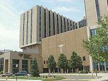
The two largest employers in the city are Bridgeport's primary hospitals, Bridgeport Hospital and St. Vincent's Medical Center. Park City Hospital closed in 1993 and was reopened in 2010 as elderly and homeless housing units.[70] Emergency medical services are provided by American Medical Response at the paramedic level.
Top employers
According to its 2009 Comprehensive Annual Financial Report,[71] the city's top employers are:
| Employer | # of Employees |
|---|---|
| St. Vincent's Medical Center | 3,000 |
| Bridgeport Hospital | 2,622 |
| People's United Bank | 1,179 |
| University of Bridgeport | 875 |
| Bridgeport Health Care Center | 500 |
| Housatonic Community College | 482 |
| Prime Line | 310 |
| Derecktor Shipyards | 300 |
| Lacey Manufacturing | 275 |
| Watermark Retirement Communities | 165 |
Non-Profit
WeCare Community Center, Inc. WCCC, Inc. is a registered 501(c)(3) non-profit organization established in Bridgeport, Connecticut in 1997. WCCC, Inc is committed to the belief and understanding that everyone is socially responsible for the environment/community. WCCC, Inc hopes to inspire action in the community with programs and workshops. Through grants, fundraising initiatives, and the help of the community, WeCare can make a difference. WeCare wants to help members in our communities live their best lives, today. WCCC, Inc currently manages the Trumbull Gardens Multi-purpose Center in the North End of Bridgeport offering great programs and workshops for the children and families in Bridgeport and beyond.[72]
Education
Higher education
Bridgeport is home to the University of Bridgeport, Housatonic Community College, St. Vincent's College, and the Yeshiva Gedola of Bridgeport. The Yeshiva Gedola is the home of the Bridgeport Community Kollel, a rabbinic fellowship program.[73]
The University of Bridgeport's Ernest C. Trefz School of Business offers undergraduate and graduate programs.
Public education
The city's public school system has 30 elementary schools, three comprehensive high schools, two alternative programs and an interdistrict vocational aquaculture school. The system has about 20,800 students, making the Bridgeport Public Schools the second largest school system in Connecticut after Hartford. It is ranked #158 out of the 164 Connecticut school districts.[74] The school system employs a professional staff of more than 1,700.
The city has started a large school renovation and construction program, with plans for new schools and modernization of existing buildings.
Public high schools
- Bassick High School established in 1929.
- Central High School established in 1876, home to Central Magnet, largest of the high schools.
- Warren Harding High School home to the International Baccalaureate Program (IBO) and the Health Magnet Program in association with Bridgeport Hospital, St. Vincent's Medical Center, and Bridgeport Manor; also the alma mater of Walt Kelly, creator of Pogo.
- Bridgeport Regional Vocational Aquaculture School (BRVAS), a school specializing in marine and aquaculture curricula near Captain's Cove and open to students from surrounding towns.
- Bullard-Havens Technical High School, a vocational high school. (State School)
- The Bridge Academy: Bridgeport Charter High School
- Achievement First Bridgeport Charter High School
Public magnet schools
- Fairchild Wheeler Interdistrict Multi-Magnet High School
Private education
Bridgeport is also home to private schools, including Bridgeport Hope School (K–8), Bridgeport International Academy (grades 9–12), Catholic Academies of Bridgeport (PK–8), Kolbe Cathedral High School (9-12), St. Andrew Academy (PK–8), and St. Ann Academy (PK–8).
Government and politics
The city is governed by the mayor-council system. Twenty members of the city council are elected from districts. Each district elects two members. The mayor is elected at-large by the entire city
Bridgeport is notable for having had a socialist mayor for 24 years, Jasper McLevy, who served from 1933 to 1957.
Mayor Joseph P. Ganim was involved in a corruption scandal, as was Mayor Eddie Perez of Hartford in 2010.[75] In June 2006, Mayor John M. Fabrizi admitted that he had used cocaine while in office.[76]
Bridgeport is recognized for its polarizing political culture. The city's current mayor, Joseph P. Ganim, has served the city seven terms since first taking office in 1991. After being indicted on charges of corruption in 2003, Ganim served nine years in federal prison.[77] After his release in 2015, Ganim announced his mayoral campaign to serve a sixth term in office. His campaign ran on a theme of providing him with a "second-chance," as he was renowned for his work of escaping the city from bankruptcy and build its economy from a post-industrial standpoint.[78]
In a divisive primary election between him, the city's mayor at the time, Bill Finch, and University of Bridgeport professor and real estate developer, Mary-Jane Foster, Ganim was able to receive the endorsement of the politically volatile democratic town committee, paving the way to his victory for being reelected mayor at the end of year.[78]
| Voter registration and party enrollment as of October 29, 2019[79] | |||||
|---|---|---|---|---|---|
| Party | Active voters | Inactive voters | Total voters | Percentage | |
| Republican | 4,505 | 205 | 4,710 | 6.06% | |
| Democratic | 48,117 | 2,154 | 50,271 | 64.73% | |
| Unaffiliated | 20,992 | 1,136 | 22,058 | 28.40% | |
| Minor parties | 589 | 32 | 621 | 0.80% | |
| Total | 74,133 | 3,527 | 77,660 | 100% | |
Like most urban areas and big cities, Bridgeport is heavily Democratic at the presidential level. In 1972 Richard M. Nixon was the last Republican to win the city; since then Democrats have prevailed, often by comfortable margins, the lone exception being 1984 when Walter Mondale carried the city by just 76 votes (0.16 percent) over Ronald Reagan.
Bridgeport's Democratic Town Committee is the staple entity with significant influence over the city's politics. With the ability to nominate and endorse Democratic candidates running for local office, they have the resources to outperform challenger slates that may compete with them. There have been numerous calls for better transparency and reform of the committee altogether. The chairman is former state representative and local restauranteur, Mario Testa.[80]
| Year | Democratic | Republican | Third Parties |
|---|---|---|---|
| 2016 | 80.98% 32,035 | 16.67% 6,596 | 2.35% 929 |
| 2012 | 85.75% 32,135 | 13.79% 5,168 | 0.46% 173 |
| 2008 | 83.52% 33,976 | 15.99% 6,507 | 4.89% 199 |
| 2004 | 70.66% 26,280 | 27.76% 10,326 | 1.57% 585 |
| 2000 | 72.68% 24,303 | 22.15% 7,406 | 5.18% 1,731 |
| 1996 | 69.16% 22,883 | 20.51% 6,785 | 10.33% 3,419 |
| 1992 | 53.20% 22,321 | 31.34% 13,149 | 15.46% 6,486 |
| 1988 | 57.50% 23,831 | 41.22% 17,084 | 1.27% 527 |
| 1984 | 49.75% 24,332 | 49.59% 24,256 | 0.66% 321 |
| 1980 | 51.24% 23,505 | 41.82% 19,185 | 6.94% 3,185 |
| 1976 | 55.37% 26,330 | 43.79% 20,824 | 0.83% 397 |
| 1972 | 43.67% 24,572 | 54.09% 30,436 | 2.25% 1,265 |
| 1968 | 53.27% 30,065 | 37.23% 21,014 | 9.50% 5,363 |
| 1964 | 69.90% 43,710 | 30.10% 18,818 | 0.00% 0 |
| 1960 | 61.14% 41,950 | 38.86% 26,667 | 0.00% 0 |
| 1956 | 38.57% 26,560 | 61.43% 42,308 | 0.00% 0 |
Taxes
Bridgeport has one of the highest property tax rates in Connecticut.[82] A 2017 Lincoln Institute of Land Policy and Minnesota Center of Fiscal Excellence study determined that Bridgeport had the second-highest property tax burden of any U.S. city (after Detroit), and the fourth-highest for commercial properties valued at more than $1 million (after Detroit, New York City, and Chicago).[83]
In 2016, Bridgeport enacted a 29% increase in the property tax rate, among the highest one-year property tax rate increases in recent U.S. history, in an effort to reduce the municipal deficit.[84] A citywide reassessment in 2015 determined that the value of taxable property in the city was $6 billion, a decline of $1 billion; the property tax increases, combined with property value decreases, have been a consistent political issue in the city.[84]
Culture
Performing arts
Theater and music
Bridgeport has a number of venues for live theater and music events, ranging from intimate performing spaces to a stadium hosting rock concerts.[85]
- Downtown Cabaret Theatre – cabaret, children's theater, concerts
- The Stress Factory – (300 seats) comedy club with national and local acts
- Klein Memorial Auditorium – (1,400 seats) home to the Greater Bridgeport Symphony, touring shows and concerts
- Webster Bank Arena – Sporting events venue, but also hosts large concerts
Music festivals and concert series
Bridgeport was the annual home to Gathering of the Vibes, a weekend-long arts, music and camping festival, until it ended in 2015.
The Greater Bridgeport Symphony, established in 1945, performs at Bridgeport's 1,400-seat Klein Memorial Auditorium. Gustav Meier directed the orchestra from 1972 to 2013.
Museums, zoos and parks
Bridgeport has a number of museums, ranging from the science-oriented to fine arts and historical, as well as the state's largest zoo.[85]
- The Discovery Museum and Planetarium emphasizes exhibits on science, with the state's only Challenger Center, affiliated with the national space program.
- The Housatonic Museum of Art at Housatonic Community College has the largest collection of art of any two-year college in the nation.
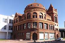
- The Barnum Museum celebrates the showman, circuses and Bridgeport history.
- The Beardsley Zoo is the only such center in Connecticut.
In popular culture
Movies
A list of films shot or partially filmed in the city:[86]
- Officer Down (2012)
- A Dance for Grace (2010)
- Ironmen (2010)
- 3 Weeks to Daytona (2009)
- Accidental Mayor (2009)
- All Good Things (2009)
- Confessions of a Shopaholic (2009)
- Dear Beautiful (2009)
- The Godfather Musical Part III: Luca Brasi Sleeps with the Fishes (2009)
- House of Satisfaction (2009)
- Made for Each Other (2009)
- The Music of Erich Zann (2009/II)
- Old Dogs (2009/I)
- College Road Trip (2008)
- Indiana Jones and the Kingdom of the Crystal Skull (2008)
- Pistol Whipped (2008)
- Righteous Kill (2008)
- The Sisterhood of the Traveling Pants 2 (2008)
- What Just Happened (2008)
- Bobby Dogs (2007)
- Dear Beautiful (2007)
- Praying to Hendrix (2007)
- Die Hard with a Vengeance (1995)
- A Walk with Death (1993)
- Route One USA (1989)
- There's a Nightmare in My Closet (1987)
- Without a Trace (1983)
- The Case of the Cosmic Comic (1976)
- The Effect of Gamma Rays on Man-in-the-Moon Marigolds (1972)
- The Light that Failed (1916)
Television
- Kitchen Nightmares (Season 4, Episode 7, "Tavolini Restaurant", 2011)
- Brian Boitano Skating Spectacular (2010) (TV)
- Ghost Adventures:"Remington Arms Factory" (Episode 21, November 2009)
- WWE Raw (Nov. 18, 2002; Mar. 8, 2004; Dec. 26, 2005; August 21, 2006; April 9, 2007; April 27, 2009; June 21, 2010, April 11, 2011 and Sep 17, 2012)
- WWE Smackdown, ECW, and NXT (May 7, 2002; March 4, 2003; August 2, 2005; Dec. 9, 2008; Nov. 24, 2009; Nov. 2, 2010; and Nov. 15, 2011)
- Oprah Winfrey Presents: Mitch Albom's For One More Day (2007)
- WWE Raw's 15th Anniversary Special (2007)
- Flip This House: "Burning Down the House" (2005)
- Extreme Makeover: Home Edition (2003 & 2007)
- Made in America (2003)
- U.S. Bounty Hunter (2003)
- Muggsy (1976)
- The Twentieth Century (1957, The Class of '58 episode)
- Johnny, We Hardly Knew Ye (TV Movie, 1977), bar scene of JFK campaigning with local workers filmed in the Ideal Bar on Barnum Avenue across from the former Singer Building
- Live PD (2016-2017)
- Family Guy 2010
- Sneaky Pete (2015-) Although shot in the state of New York, the show takes place in Bridgeport
Novels
- Bridgeport is the setting of Maureen Howard's novel Natural History, which includes scenes from the city's history and depicts historical figures such as P. T. Barnum.
Sports
| Club | League | Venue | Established | Championships | Logo |
|---|---|---|---|---|---|
| Bridgeport Sound Tigers | AHL, Ice hockey | Webster Bank Arena | 2001 | 0 |
Webster Bank Arena serves as the city's sports and hospitality center. Seating 10,000, the Arena serves as the home rink of the Bridgeport Sound Tigers AHL hockey team and the Sacred Heart University's men's hockey team and as the home court of Fairfield University's basketball team.
The Ballpark at Harbor Yard served as a minor-league baseball stadium from 1998 to 2017. It was built in 1998 to serve as the homefield of the Bridgeport Bluefish. From 2001 to 2003 it was the homefield for the Bridgeport Barrage, a Major League Lacrosse team. It is downtown on a former brownfield site. It is visually prominent to commuters on I-95 or on passing trains. On August 8, 2017, Mayor Joe Ganim announced that the Bluefish would be ending their 20-year stint at the ballpark at the end of the 2017 season. The ballpark is expected to be converted to an amphitheatre. The Bluefish played their final home game at the park on September 17, 2017, losing by a score of 9–2 to the Somerset Patriots.[87]
Kennedy Stadium serves as a community sports facility. In the late 1960s and early 1970s, it was the home of an Atlantic Coast Football League minor league football team, the Bridgeport Jets, a New York Jets farm team also known locally as the Hi-Ho Jets due to their sponsorship by the (Hi-Ho) D'Addario construction company.
Fairfield University is in the neighboring town of Fairfield, and many of the athletic teams play on campus. Only the men's and women's basketball teams play in Bridgeport.
Nutmeg Curling Club, one of two curling clubs in Connecticut, is in Bridgeport. It is the home club of the 2013 USA Mixed National Champions,[88] led by club members Derek Surka and Charissa Lin. The club is a member of the Grand National Curling Club Region.
Bridgeport has a storied history in professional sports. Bridgeport native Jim O'Rourke was the first baseball player to earn a hit in National League history in 1876. The founder and original owner of the Brooklyn Dodgers, Charles Ebbets, married his second wife in Bridgeport in 1922, five years before his death.
Media
Radio
- WCUM AM 1450; 1,000 watts (formerly WJBX-AM, and before that, WNAB-AM) Spanish Format station better known as Radio Cumbre.
- WICC-AM 600; 1,000 watts (daytime), 500 watts (nighttime) – WICC began broadcasting on November 21, 1926, when a previous radio station, WCWS, was given a new name, WICC. The last three letters standing for Industrial Capitol of Connecticut. The Bridgeport Broadcasting Company Inc. was the new station's owner. Back then, the station was powered at 500 watts. From 1951 to 1956 one of the station's radio hosts was Bob Crane, who later went on to play Col. Robert Hogan on the Hogan's Heroes television comedy series.[89] WICC's transmitter is on Pleasure Beach in Bridgeport on a peninsula extending into Long Island Sound.
- WEBE-FM 107.9; 50,000 watts. WEBE108 is CT's Best Music Variety! The station is owned by Connoisseur Media. Licensed to Westport, CT with studios in Milford and WEBE's transmitter is located in Bridgeport Harbor. Besides a standard analog transmission, WEBE broadcasts over one HD Radio channel, and is available online.
- WEZN-FM 99.9; 27,500 watts (formerly WJZZ-FM). Star 99.9 is Today's Best Mix! The station is owned by Connoisseur Media. Lincensed to Bridgeport, CT with studios in Milford and WEZN's transmitter is located in Shelton.
- WPKN-FM 89.5; 10,000 watts[90]
Due to Bridgeport's close proximity to Long Island Sound, many radio stations from New York and Long Island are received clearly in the market. These include WMCA, WFAN, WOR, WABC, WNYC, WCBS, WEPN, WQEW, WBLI, and WALK.[91]
Newspapers
- Elsolnews.com, a community Spanish language weekly newspaper covering news and events.
- Connecticut Post – Formerly the Bridgeport Post and Bridgeport Telegram, which covers Bridgeport and the surrounding area. The newspaper is printed daily.
Television
Bridgeport was NBC's pioneer UHF TV test site from December 29, 1949 to August 23, 1952;[92] the equipment from the "Operation Bridgeport" tests was later deployed commercially at KPTV in Portland, Oregon (1952–1957). While Bridgeport is primarily served by New York City stations, some local UHF broadcasters operate today:
- WEDW channel 49; one of the Connecticut Public Television stations, broadcasts from Bridgeport and can be seen in Hartford.
- In 2011, WTNH-TV opened a satellite studio in the offices of the Connecticut Post Downtown on State Street.
- WZME channel 43; a Sonlife Broadcasting Network affiliate, currently channel sharing with WEDW and licensed to Bridgeport.
Transportation
Airports
Sikorsky Memorial Airport in neighboring Stratford was previously owned by the City of Bridgeport before closing a deal in 2016 that sold the land to Stratford. It once provided regional flights to major cities, but commercial operations at the airport were terminated in November 1999.
Roads
Surface thoroughfares
The main portion of the city is divided by major north–south roads that approximately parallel each other:
- Main Street, the city's principal artery, extends from the Trumbull town line down through the North End, under Routes 8/25, and into Downtown, with its southern terminus at Seaside Park. The portion north of State Street was laid out as the "Newtown Turnpike" in 1795. Porter Street, Beechmont Avenue, and Kaechele Place are former curves in this highway that were lopped off as the road was straightened in the 19th century.
- Park Avenue lies on the border with the town of Fairfield (north of its intersection with Brooklawn Avenue) and extends from the Trumbull, Connecticut border in the North End to the South End at Seaside Park. It was known as "Division Street" until 1867. It is the easternmost of the "11 o'clock" roadways laid out in 17th-century Fairfield (their north-northwesterly direction points them like a clock's hands at that hour, exactly perpendicular to the shoreline of Long Island Sound, which facilitated land distribution).
- Clinton/Brooklawn Avenues are a central artery through the West End, extending north from Railroad Avenue to the Fairfield line at the Rooster River. The portion north of Fairfield Avenue was laid out in the 17th century at the center of the agricultural village of Stratfield. It was known as Stratfield Road until 1870.
- Brewster Street extends from Black Rock Harbor north to the Fairfield line at Ash Creek, and is the major north–south artery through the Black Rock neighborhood. This was the southernmost portion of the "Black Rock Turnpike," a late-18th century toll road that extended as far north as Danbury.
- Madison Avenue is between Main Street and Park Avenue and extends from the Trumbull town line in the North End through the West Side. It was formerly known as Chestnut Hill Road and follows the route of an Indian path.
- Reservoir Avenue was part of a turnpike laid out in 1817 in an almost straight line from Bridgeport north to the Monroe Green (it followed Daniels Farm Road in Trumbull and Moose Hill Road in Monroe). The "Reservoir" was a stone structure at the intersection of Sylvan Avenue, to which water was pumped from nearby Bunnell's Pond, and from which water was supplied to the city by gravity. Until construction of the Route 25-8 Expressway, this street extended south to North Avenue.
- Noble Avenue extends from the corner of Congress Street just south of Washington Park to the intersection of East Main Street and Huntington Turnpike. The portion below Boston Avenue was laid out in 1850 as Noble Street; the part to the north was added to connect with the entrance to the new Beardsley Park in 1878.
- East Main Street is the major north–south road through East Bridgeport, extending from the Trumbull/Stratford line though the East Side, ending at Bridgeport Harbor. The portion south of Boston Avenue/Old Mill Green was laid out in 1800.
- Huntington Road/Huntington Turnpike is the major roadway through the Upper East Side, extending northeast from the Berkshire Bridge to the Trumbull town line (a small portion today is part of East Main Street). It was one of a number of turnpikes laid out in the immediate post-Revolutionary period to funnel rural commerce to the fledgling city's seaport, and formerly extended to the city center by way of North Washington Avenue.
- Seaview Avenue runs the length of the East End neighborhood on the East shore of Pembroke Lake, Yellow Mill Pond, and Bridgeport Harbor. It extends northwest from Central to Stratford Avenues, then due north from Stratford to Boston Avenues. It was laid out at the time of the Civil War in three sections that were later connected: Sea View Avenue south of Stratford Avenue; West Avenue at Deacon's Point, from Sixth Street North to the railroad tracks; and Lake Avenue, from Barnum Avenue North to Boston Avenue.
- Central/Palisade Avenues were laid out as farm highways through the western portions of what was the town of Stratford in the early 19th century. They form a north–south axis through the center of today's East End. The portion of Central Avenue north of Barnum Avenue was known as Prospect Street from the 1860s through 1889 due to the vistas from its hillside location.
The major east–west roads in the city include Barnum Avenue, Boston Avenue, Fairfield Avenue/Stratford Avenue, North Avenue, Capitol Avenue, State Street, and Railroad Avenue:
- Barnum Avenue extends from the Stratford line, below Old Mill Hill, and ends at the Pequonnock River. The portion through the East Side was laid out as Barnum Street in 1850. From Pembroke Lake to Mill Hill Avenue was added in 1863. The road from Mill Hill Avenue to the Washington Bridge between Stratford and Milford was laid out as the Air Line Highway in 1870.
- Boston Avenue breaks off from Barnum Avenue near the Bridgeport line in Stratford and travels east–west over Old Mill Hill to the Upper East Side toward the North End. It follows the route of an Indian path, crossing Old Mill Brook and the Pequonnock River and the southernmost points where they were fordable, which became the Post Road in the 1670s.
- Stratford Avenue starts in the South End of the town of Stratford and travels southwest through the East End. It then travels east through East Bridgeport directly into the center of downtown Bridgeport, where it turns into Fairfield Avenue at Water Street. It was laid out in 1795 as a more direct route for the Post Road, and the bridge built that year over the Pequonnock was the origin of the name "Bridgeport." Connecticut Avenue, which parallels it one block north through the East End, is a one-way street heading west, while Stratford Avenue is one-way heading east.
- Fairfield Avenue extends west and then southwest through the West End and into Black Rock, where it turns into the Boston Post Road, or simply the Post Road, at the Fairfield line. Its route through the West End parallels what had been the northern edge of an extensive salt marsh, and existed in the 18th century. The portion through Black Rock was added in the 1870s.
- North Avenue begins at Boston Avenue where the East Side abuts the Island Brook neighborhood at the Pequonnock River and extends southwest diagonally through the city as US 1. It then turns into Kings Highway in Fairfield. As with Boston Avenue, it follows an Indian trail, and was formalized as a part of the New York-to-Boston Post Road in the 1670s.
- Capitol Avenue begins by breaking off from North Avenue at Island Brook Avenue Extension. It travels west across the Old North End and Brooklawn neighborhoods and ends at the Fairfield line.
- State Street begins downtown and cuts across the West End, where it terminates (as State Street Extension) at the Fairfield line. The portion from Park Avenue to Bridgeport Harbor was in existence by the 1760s; the part west of Park Avenue was extended across what was then marshy terrain in 1867.
- Atlantic Street bisects the South End neighborhood, historically separating the well-to-do residential district that adjoined the old portion of Seaside Park from the working-class blocks to the north. Today it forms the north border of the University of Bridgeport campus.
- Railroad Avenue extends from Broad Street just below downtown Bridgeport and runs parallel with the Metro North/New Haven Railroad lines. The westbound side is north of the tracks, and the eastbound side south of them. It terminates at Fairfield Avenue in the West End.
Highways
Bridgeport has several major roadways. Interstate 95 and the Route 8/Route 25 Connector meet in Downtown Bridgeport. I-95 runs east–west near the coast heading towards New York City to the southwest and Providence to the northeast. Routes 8 and 25 run north–south across the city, with the two routes splitting just north of the city. Route 8 continues towards Waterbury and Torrington and Route 25 continues towards the Danbury area. Both Routes 8 and 25 connect to the Merritt Parkway in the adjacent town of Trumbull.
Other major surface arteries are U.S. 1 (the Boston Post Road), which runs east–west north of Downtown, and Main Street, which runs north–south towards Trumbull center. The city also has several secondary state highways, namely, Route 127 (East Main Street), Route 130 (Connecticut Avenue, Stratford Avenue, Fairfield Avenue and Water Street), and the Huntington Turnpike.
Railroad and ferries
The Bridgeport Traction Company provided streetcar service in the region until 1937. The Housatonic Railroad carried passengers North through the Pequonnock and Housatonic Valleys prior to 1933.
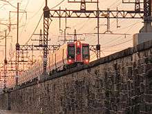
The city is connected to nearby New York City by both Amtrak and Metro-North commuter trains, which serve Bridgeport's Metro-North station. Many residents commute to New York jobs on these trains, and the city to some extent is developing as an outpost of New York–based workers seeking cheaper rents and larger living spaces. Connecting service is also available to Waterbury via Metro-North, and New Haven via Amtrak and Metro-North. Shoreline East service links Old Saybrook and New London with New Haven, which extends to Bridgeport and Stamford during weekday rush hours only.
The Bridgeport & Port Jefferson Ferry service runs from Bridgeport across Long Island Sound to Port Jefferson, New York; the three vessels Grand Republic, P.T. Barnum, and Park City transport both automobiles and passengers.
Buses
The Greater Bridgeport Transit Authority (GBTA) provides bus service to Bridgeport and its immediate suburbs. Route 2 the Coastal Link goes west to Norwalk and east to Westfield's Connecticut Post Mall in Milford, from where Connecticut Transit can bring passengers to the New Haven Green. Greyhound and Peter Pan Bus Lines both offer intercity bus service to points throughout the Northeast and points beyond.
Historic sites
Historic districts
Bridgeport has five local historic districts, where exterior changes to structures are under the control of two Historic District Commissions:
- Black Rock Harbor Historic District, 88 buildings along Ellsworth, Brewster, and Beacon Streets, includes the village center of a historic seaport, with buildings that date back to the 17th century, one of the original English settlements in Bridgeport.
- Pembroke City Historic District, 266 buildings in a general two-block radius of Washington Park, a planned residential development constructed 1850–1900 that contains the city's most important concentration of Victorian architecture.
- Stratfield Historic District, 300 buildings along Clinton, Brooklawn, and Laurel Avenues that made up an elite residential district of the Edwardian era and has the original 17th century town green, Clinton Park Militia Ground, and the city's oldest cemetery, Stratfield Burying Ground, also dating back to the 17th century. This area along North Avenue is the other original English settlement in what is now Bridgeport.
- Barnum-Palliser Development Historic District, 33 buildings on Austin, Gregory, and Atlantic Streets and Myrtle Avenue that was a planned working-class development of the 1880s designed by the architectural firm of Palliser, Palliser, and Company.
- Marina Park Historic District, 14 buildings along South Park Avenue and Marina Park, contains some of the city's most opulent late 19th-early 20th century mansions overlooking Seaside Park.
- AMFAB Art Building,4 story building housing artists studios on the second, third and fourth floors. First Floor Is Occupied By Tongue In Chique an Antique and Design Gallery featuring art, antiques and fine furnishings from the past to the present. 1069 Connecticut Avenue, Bridgeport, CT 06607
See also
- History of Bridgeport, Connecticut
- National Register of Historic Places listings in Bridgeport, Connecticut
- List of people from Bridgeport, Connecticut
- St. Andrew Church (Bridgeport, Connecticut)
- Seaside Village Historic District
Notes
- "U.S. Census website". United States Census Bureau. Retrieved 2014-11-04.
- "Population and Housing Unit Estimates". Retrieved July 13, 2019.
- "All Zip Codes in Bridgeport CT". www.zip-codes.com. Retrieved 21 July 2019.
- Emily Ross, Angus Holland (2005). One hundred great businesses and the minds behind them. Sourcebooks, Inc. p. 388. ISBN 978-1-4022-0631-3.
- "History Of Frisbies". Archived from the original on November 10, 2007. Retrieved November 28, 2007.
- "Stratfield Historic District – Local Historic District and Property Commissions in Connecticut". lhdct.org.
- "The Golden Hill Paugussett Tribe". bportlibrary.org.
- EB (1911).
- Waldo (1917), Vol. I, pp. 14–16.
- "Bridgeport, Conn.". The Encyclopedia Americana: a library of universal knowledge. 4. New York: Encyclopedia Americana Corp. 1918. p. 527. Retrieved July 29, 2010.
- Orcutt (1886), Vol. I, p. 609.
- Orcutt (1886), Vol. I, pp. 470–474.
- EA (1918).
- Waldo (1917), Vol. I, pp. 222–5.
- Orcutt (1886), Vol. I, endpaper.
- Enacted October 1800.
- The Public Statute Laws of the State of Connecticut, Vol. I, Title XXVII: Boroughs, Ch. I, Hartford: Hudson & Goodwin for the General Assembly, 1808, pp. 106–111
- "An Act for incorporating part of the Town of Stratford",[16] published in the Public Statute Laws of the State of Connecticut.[17]
- Orcutt (1886), Vol. I, p. 588.
- Orcutt (1886), Vol. I, p. 597.
- EB (1878).
- Orcutt (1886), Vol. I, p. 610.
- Orcutt (1886), Vol. II, p. 695.
- "Our 180 Year History", The Houstonic RailRoad Company Inc., retrieved 21 January 2016
- Waldo (1917), Vol. I, pp. 37–38.
- Passed May 1836
- Resolves and Private Laws of the State of Connecticut, from the Year 1789 to the Year 1836, Vol. I, Title XI: Cities, Hartford: John B. Eldredge for the General Assembly, 1837, pp. 354–368
- "An Act Incorporating the City of Bridgeport",[26] published in the Resolves and Private Laws of the State of Connecticut.[27]
- Orcutt (1886), Vol. II, p. 696.
- Orcutt (1886), Vol. II, p. 698–9.
- "About", Naugatuck Railroad: Operated by the Railroad Museum of New England, retrieved 21 January 2016
- Orcutt (1886), Vol. II, p. 703.
- "National Historic Places Nomination" (PDF). Black Rock. 1978. p. 11. Retrieved July 28, 2010.
- Kimes, Beverly Rae; Clark, Henry Austin Jr., eds. (1989), The Standard Catalogue of American Cars 1805–1942, 2nd ed., Krause Publications, ISBN 978-0-87341-111-0
- Hogan, Edmund P. (1977). An American heritage: A book about the International Silver Company, p. 160. Taylor Publishing Company: Dallas, TX. Retrieved August 27, 2018.
- (May 21, 2016). "Holmes & Edwards Silver Company design catalogues and historical documentation". artdesigncafé. Retrieved August 27, 2018.
- Strother, French (January 1916), "America, A New World Arsenal", The World's Work, XXXI, pp. 321–333, retrieved 4 August 2009
- Foner, Philip Sheldon (1982), History of the Labor Movement in the United States, Vol. VI, International Publishers Co, p. 196, ISBN 978-0-7178-0595-2
- "Bridgeport Working: Voices from the 20th Century". Bridgeport Public Library. Retrieved 28 July 2010.
- Wald, Matthew L. (September 5, 1982). "THE Workplace in Transition". New York Times. US. Retrieved July 28, 2010.
- Rierden, Andi (February 25, 1990). "Bridgeport is Fighting Its 'Dump City' Image". New York Times. Retrieved August 1, 2010.
- Musante, Fred (February 1, 1998). "Teachers' Strike Stirs Bitter Memories". The New York Times. Retrieved April 26, 2010.
- Judson, George (August 2, 1991). "U.S. Judge Blocks Bridgeport From Bankruptcy Court". New York Times. Retrieved July 17, 2010.
The case attracted national attention as Bridgeport portrayed itself as a city abandoned by industry, left to bear alone the poverty and social problems of Fairfield County that its suburbs turned their backs on.
- Prevost, Lisa (April 10, 2009). "Revival in Progress; Stay Tuned". New York Times. Retrieved August 5, 2010.
- Cummings, Bill (August 31, 2009). "Bridgeport council approves development plan". News Times. Danbury. Retrieved August 5, 2010.
- Torres, Keila (February 14, 2010). "Agencies partner for housing/medical complex in Bridgeport". News Times. Danbury. Retrieved August 5, 2010.
- "MGM gambles on Bridgeport with new casino plan". Connecticut Post. Retrieved 2017-09-23.
- Burr, Raymond F., Abraham Lincoln: Western Star Over Connecticut, Lithographics Inc., Canton, Connecticut (no year given), pages 1 and 15; book contents reprinted by permission of the Lincoln Herald, (Harrogate, Tennessee) Summer, Fall and Winter, 1983 and Spring and Summer, 1984
- Holzer, Harold, Lincoln at Cooper Union, (Simon & Schuster: New York), 2004 Chapter 8: "Unable to Escape This Toil," p. 201 ISBN 0-7432-2466-3
- Lucas, Fred (April 6, 2006). "Bush visits Bridgeport". News Times. Danbury. Retrieved July 30, 2010.
- "Martin Luther King in Bridgeport?". Bridgeport Public Library. Archived from the original on December 26, 2010. Retrieved July 30, 2010.
- https://www.ctpost.com/local/article/Trump-card-could-the-president-help-bring-a-12222060.php
- Waldo (1917), Vol. I, p. 277.
- Holtz, Jeff (August 18, 2002). "The View From/Bridgeport; Historic Seaside Park Recaptures Its Appeal". New York Times. Retrieved August 1, 2010.
- Waldo (1917), Vol. I, p. 280.
- F.L. & J.C. Olmsted (1884). Beardsley Park: Landscape Architects' Preliminary Report. Privately Printed (Boston). pp. 4–7.
- "Archived Document". Archived from the original on 2015-08-25. Retrieved 2015-07-28.
- "Archived Document" (PDF). Archived from the original (PDF) on 2015-04-17. Retrieved 2015-07-28.
- United States Department of Agriculture. United States National Arboretum. USDA Plant Hardiness Zone Map [archived 2015-03-03; Retrieved 2015-02-26].
- "NowData – NOAA Online Weather Data". National Oceanic and Atmospheric Administration. Retrieved 2018-01-08.
- "Station Name: CT BRIDGEPORT SIKORSKY MEM AP". National Oceanic and Atmospheric Administration. Retrieved 2015-02-26.
- U.S. Census Bureau Archived June 24, 2008, at the Wayback Machine. Accessed January 23, 2008.
- "U.S. Decennial Census". Census.gov. Retrieved July 14, 2015.
- "Population Estimates". United States Census Bureau. Retrieved June 8, 2018.
- Bridgeport, Connecticut (CT) profile: population, maps, real estate, averages, homes, statistics, relocation, travel, jobs, hospitals, schools, crime, moving, houses, news. City-data.com. Retrieved on 2013-07-15.
- http://www.fswinc.org/history.php%5B%5D
- http://www.fswinc.org/2011pdf/annual_repoprt/Annual_report_2010.pdf%5B%5D
- The 25 Most Unequal Cities In America. Business Insider (2010-10-11). Retrieved on 2013-07-15.
- Zumbrun, Joshua (November 30, 2009). "America's Most Unequal Cities". Forbes.
- Former Bridgeport hospital converted to elderly, low income housing – Connecticut Post. Ctpost.com (2010-09-13). Retrieved on 2013-07-15.
- "City of Bridgeport CAFR" (PDF). Archived from the original (PDF) on January 3, 2011.
- "WeCare Community Center, Inc". Retrieved 7 March 2020.
- "Bridgeport Kollel". Retrieved 22 April 2016.
- Connecticut State Districts – CT School District Rankings. Schooldigger.com. Retrieved on 2013-07-15.
- Everton Bailey Jr. (June 18, 2010). "Hartford Mayor Eddie Perez convicted of corruption". Christian Science Monitor. Associated Press. Retrieved August 15, 2010.
Corruption investigations have brought down several prominent Connecticut politicians within the past decade.... Bridgeport Mayor Joseph Ganim was convicted of corruption in 2003, sentenced to nine years in prison and released to a halfway house in Hartford in January. Former Waterbury Mayor Philip Giordano is serving a 37-year prison sentence for sexually abusing two girls, crimes that came to light during a federal corruption investigation.
- Daly, Michael J. (June 15, 2008). "Fabrizi's story still intrigues". Connecticut Post. Retrieved August 15, 2010.
- Cowan, Alison Leigh (2003). "Federal Judge Sentences Former Mayor of Bridgeport to 9 Years in Corruption Case". The New York Times. ISSN 0362-4331. Retrieved 2020-02-28.
- Chambers, Stefanie (2015). "Connecticut: Economics, Politics & Policy in the Constitution State". The New England Journal of Political Science. 8 (2): 258.
- "Registration and Party Enrollment Statistics as of October 27, 2015" (PDF). Connecticut Secretary of State. Archived from the original (PDF) on March 4, 2016. Retrieved July 30, 2016.
- "The Plague Of Absentee Ballots, Reforming The Democratic Town Committee – Only In Bridgeport®". Retrieved 2020-02-20.
- "General Elections Statement of Vote 1922". CT.gov – Connecticut's Official State Website.
- Brian Lockhart, Bridgeport Council raises car tax, CTPost (December 13, 2017).
- Alexander Soule, Study: Bridgeport has second 2nd worst property taxes, The Hour (May 19, 2017).
- Kristin Hussey & Lisa W. Foderaro, In Bridgeport, Property Values Plummet, but Taxes Soar for Some, New York Times (October 11, 2016).
- Harris, Patricia; Lyon, David (February 6, 2008). "On a comeback: After some down times, city find itself on the verge of a renaissance". Boston Globe. Retrieved August 5, 2010.
- "IMDb: Most Popular Titles With Location Matching "Bridgeport, Connecticut, USA"". IMDb. Retrieved 22 April 2016.
- "Official Site of the Bridgeport Bluefish: News". 2017-08-08. Archived from the original on 2017-08-08. Retrieved 2018-01-15.
- "News". Team USA. Retrieved 22 April 2016.
- "History" section of the WICC website accessed June 29, 2006
- WPKN web site "About" page Archived 2006-07-15 at the Wayback Machine accessed June 29, 2006
- "Radio Stations in Bridgeport, Connecticut". Retrieved 22 April 2016.
- Cuda, Amanda (December 31, 2007). "1908 world ended at your town's border". Connecticut Post (ctpost.com, Bridgeport, CT).
References
Reference works
- "Bridgeport, Conn.", Encyclopedia Americana, Vol. IV, New York: Encyclopedia Americana Corp., 1918, p. 527, retrieved 29 July 2010.

- Chisholm, Hugh, ed. (1911), , Encyclopædia Britannica, 3 (11th ed.), Cambridge University Press, p. 532
Secondary sources
- Bucki, Cecelia Bucki (2001), Bridgeport's Socialist New Deal, 1915–36, University of Illinois Press, ISBN 978-0-252-02687-4
- Nolen, John (1916), Better City Planning For Bridgeport, Bridgeport: City Plan Commission
- Orcutt, Samuel (1886), A History of the Old Town of Stratford and City of Bridgeport Connecticut, Vol. I & II, Bridgeport: Fairfield County Historical Society
- Waldo, George Curtis (1917), History of Bridgeport and Vicinity, Vol. I & II, S. J. Clarke, ISBN 978-1-144-35927-8
- Witkowski, Mary K. (2002), Bridgeport at Work, Arcadia Publishing, ISBN 978-0-7385-1123-8
External links
| Wikimedia Commons has media related to Bridgeport, Connecticut. |
| Wikivoyage has a travel guide for Bridgeport, Connecticut. |
Municipalities and communities of Fairfield County, Connecticut, United States | ||
|---|---|---|
| Cities |
|  |
| Towns | ||
| Borough |
| |
| CDPs | ||
| Other communities |
| |
| Ghost town |
| |
| Indian reservation |
| |
| Footnotes | ‡This populated place also has portions in an adjacent county or counties | |
Hartford (capital) | ||
| Topics |
|  |
| Society |
| |
| Regions |
| |
| Counties |
| |
| Cities |
| |
| All Towns |
| |
| Places |
| |
New York metropolitan area | ||
|---|---|---|
| Counties |  | |
| Major cities | ||
| Cities and towns over 100,000 |
| |
| Cities and towns over 25,000 |
| |
| Cities and towns over 10,000 |
| |
| Regions |
| |
| Topics |
| ||||||
|---|---|---|---|---|---|---|---|
| States | |||||||
| Major cities |
| ||||||
| State capitals | |||||||
| Transportation |
| ||||||
| |||||||
Places adjacent to Bridgeport, Connecticut | ||||||||||
|---|---|---|---|---|---|---|---|---|---|---|
| ||||||||||
Articles relating to Bridgeport, Connecticut | |||||||||||||||||||||||||||||||||||||||||||||||||
|---|---|---|---|---|---|---|---|---|---|---|---|---|---|---|---|---|---|---|---|---|---|---|---|---|---|---|---|---|---|---|---|---|---|---|---|---|---|---|---|---|---|---|---|---|---|---|---|---|---|
| |||||||||||||||||||||||||||||||||||||||||||||||||
| Authority control |
|
|---|