Votorantim
Votorantim (Portuguese pronunciation: [votoɾɐ̃ˈtʃĩ]) is a city located at the southwest of São Paulo State in Brazil. It is part of the Metropolitan Region of Sorocaba.[1] The population is 117,794 (2015 est.).[2] The city is located about 100 km (62 mi) away from the capital of the state. It has 147 km2 (57 sq mi) of rural area, 30 km2 (12 sq mi) of urban area and a total area of 183.52 km2 (70.86 sq mi).[3]
Votorantim Município de Votorantim | |
|---|---|
 Flag  Seal | |
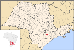 Location of Votorantim in São Paulo | |
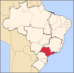
 Votorantim Location of Votorantim in Brazil | |
| Coordinates: 23°32′49″S 47°26′16″W | |
| Region | Southeast |
| State | São Paulo |
| Metropolitan Region | Sorocaba |
| Founded | March 27, 1965 |
| Government | |
| • Mayor | Fernando de Oliveira Souza (DEM) |
| Area | |
| • Total | 183.52 km2 (70.86 sq mi) |
| Elevation | 557 m (1,827 ft) |
| Population (2015) | |
| • Total | 117,794 |
| • Density | 640/km2 (1,700/sq mi) |
| Demonym(s) | Votorantinense |
| Time zone | UTC-3 (BRT) |
| • Summer (DST) | UTC-2 (BRST) |
| Website | votorantim |
Geography
It is located in a mountainous region and it has an average altitude of 557 m (1,827 ft). The city has a tropical weather and annual average temperature is 20 degrees. It makes borders with the cities of Sorocaba, Piedade, Ibiúna, Salto de Pirapora and Alumínio. It has important access ways to highways such as Castello Branco (SP-280), Raposo Tavares (SP-270), João Leme dos Santos (SP-264) and SP-79 which binds the city to the south coast of the State.
References
- "Governo do Estado de São Paulo, Lei Complementar nº 1.241, de 8 de maio de 2014". Archived from the original on 18 October 2014. Retrieved 2015-09-29.CS1 maint: BOT: original-url status unknown (link)
- Instituto Brasileiro de Geografia e Estatística
- "Votorantim" (in Portuguese). Brasília, Brazil: Instituto Brasileiro de Geografia e Estatística. 2015. Retrieved 2015-08-26.
External links
- (in Portuguese) Votorantim Official Website
Capital: São Paulo | |||||||||||||||||||||
|  | ||||||||||||||||||||
|
| |||||||||||||||||||||
| |||||||||||||||||||||
| |||||||||||||||||||||
| |||||||||||||||||||||
| |||||||||||||||||||||
| |||||||||||||||||||||
| |||||||||||||||||||||
| |||||||||||||||||||||
| |||||||||||||||||||||
| |||||||||||||||||||||
| |||||||||||||||||||||
| |||||||||||||||||||||
| |||||||||||||||||||||