Mirassol
Mirassol is a municipality in the state of São Paulo, Brazil. The city is located in the northern part of the state, 453 km from the city of São Paulo[1] and 15 km from São José do Rio Preto. Mirassol has 53,792 inhabitants (IBGE/2010).[2]
Mirassol | |
|---|---|
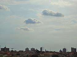 View of Mirassol | |
 Flag  Seal | |
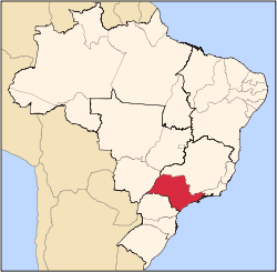
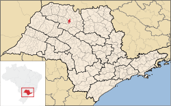 Location of Mirassol | |
| Coordinates: 20°49′08″S 49°31′15″W | |
| Country | |
| Region | Southeast |
| State | |
| Government | |
| • Mayor | José Ricci Júnior |
| Area | |
| • Total | 243.161 km2 (93.885 sq mi) |
| Elevation | 587 m (1,926 ft) |
| Population (2010/IBGE) | |
| • Total | 53,792 |
| • Density | 220/km2 (570/sq mi) |
| Time zone | UTC-3 (UTC-3) |
| • Summer (DST) | UTC-2 (UTC-2) |
| Postal Code | 15130-000 |
| Area code(s) | +55 17 |
| Website | Prefecture of Mirassol, São Paulo |
The city belongs to the Microregion of São José do Rio Preto.
Neighbouring places
Mirassolândia, Ipiguá, São José do Rio Preto, Bady Bassitt, Nova Aliança, Jaci, Neves Paulista and Bálsamo
History
The city was founded on September 8, 1910, by Joaquim da Costa Penha, with the name of São Pedro da Mata Una. In November 27, 1919, the village changed its name to Mirassol, being elevated to district.
The city was officially established as a municipality in December 23, 1924.[3]
Economy
Mirassol has a relevant furniture industry, and 30% of the city's GDP comes from the Secondary sector. Commerce and services corresponds to 68% of the Economy.[4]
Demographics
| Year | Population |
|---|---|
| 2010 | 53,792 |
| 2011[4] | 54,343 |
The HDI, measured by the UNDP, was 0.822 in the year 2000. The life expectancy for the city is 75.42 years. The literacy rate, measured in 2000 by SEADE, was 92.35%.[4]
There weren't homicides in the year 2008. In 2007, Mirassol had 1 homicide.[5]
Statistics
- Area: 243.80 km²
- Urban area: 47.07 km²
- Population density: 221.22/km² (IBGE/2010) - 222.90/km² (SEADE/2011)
- Urbanization: 93.9% (2010)
- Sex ratio (Males to Females): 96.35 (2011)
- Birth rate: 12.43/1,000 inhabitants (2009)
- Infant mortality: 7.56/1,000 births (2009)
- Homicide rate: 0.0/100 thousand ppl (2008)
- HDI: 0.822 (UNDP/2000)
Transportation
The city is linked with the SP-310 (Rodovia Washington Luis) and SP-320 (Rodovia Euclides da Cunha) state highways. Mirassol has an airport for small planes.
Notable people
- André Renato Antoniassi, footballer
- Doriva, former footballer
Sports
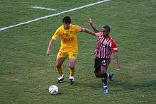
Mirassol Futebol Clube, founded in 1925, is the city's football (soccer) club. The team's stadium is the Estádio Municipal José Maria de Campos Maia, which has a maximum capacity of 14,534 people.
External links
- (in Portuguese) Prefecture of Mirassol
References
- "Distance of Mirassol to the city of São Paulo". Google Maps. Retrieved 20 June 2012.
- "Population at "Censo 2010"" (PDF) (in Portuguese). IBGE.gov.br. Retrieved 6 Jul 2011.
- "History of the City on the Prefecture Site". Mirassol.sp.gov.br. Archived from the original on 4 September 2011. Retrieved 16 July 2011.
- "Municipal Profile at SEADE" (in Portuguese). Fundação SEADE. Archived from the original on 23 August 2011. Retrieved 6 July 2011.
- "Violence Map of Brazil". Mapa da Violência 2011 (in Portuguese). Archived from the original on 16 July 2011. Retrieved 6 July 2011.
Capital: São Paulo | |||||||||||||||||||||
|  | ||||||||||||||||||||
|
| |||||||||||||||||||||
| |||||||||||||||||||||
| |||||||||||||||||||||
| |||||||||||||||||||||
| |||||||||||||||||||||
| |||||||||||||||||||||
| |||||||||||||||||||||
| |||||||||||||||||||||
| |||||||||||||||||||||
| |||||||||||||||||||||
| |||||||||||||||||||||
| |||||||||||||||||||||
| |||||||||||||||||||||