Igaratá
Igaratá is a municipality in the state of São Paulo in Brazil. It is part of the Metropolitan Region of Vale do Paraíba e Litoral Norte.[1] The population is 9,749 (2015 est.) in an area of 292.95 km².[2] The elevation is 745 m. This place name comes from the Tupi language.
Igaratá | |
|---|---|
Municipality | |
 Flag  Coat of arms | |
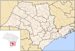 Location in São Paulo state | |
 Igaratá Location in Brazil | |
| Coordinates: 23°12′16″S 46°9′22″W | |
| Country | |
| Region | Southeast Brazil |
| State | São Paulo |
| Metropolitan Region | Vale do Paraíba e Litoral Norte |
| Area | |
| • Total | 292.95 km2 (113.11 sq mi) |
| Elevation | 745 m (2,444 ft) |
| Population (2015) | |
| • Total | 9,749 |
| • Density | 33/km2 (86/sq mi) |
| Time zone | UTC-3 (BRT) |
| • Summer (DST) | UTC-2 (BRST) |
Geography
Igaratá lies adjacent to the Igaratá reservoir, fed and drained by the Jaguari River. Aquatic sports and fishery are common practice among the locals and tourists.
The municipality contains part of the 292,000 hectares (720,000 acres) Mananciais do Rio Paraíba do Sul Environmental Protection Area, created in 1982 to protect the sources of the Paraíba do Sul river.[3]
Economy
Igaratá's economy is mainly based on agriculture, because of the fertile lands bordering the Jaguari Dam. Tourism is very important to the local economy, supporting handicraft work from the local people. Cattle are also very important, thanks to the grasslands of the São Paulo Highlands.
References
- Assembleia Legislativa do Estado de São Paulo, Lei Complementar Nº 1.166
- Instituto Brasileiro de Geografia e Estatística
- Unidade de Conservação: Área de Proteção Ambiental Bacia Hidrográfica do Paraíba do Sul (in Portuguese), MMA: Ministério do Meio Ambiente, retrieved 2016-10-01