Cruzeiro, São Paulo
Cruzeiro (Portuguese meaning the Southern Cross, the Brazilian national symbol) is a city in the state of São Paulo in Brazil. It is located about 220 km (137 mi) from the state capital. It is part of the Metropolitan Region of Vale do Paraíba e Litoral Norte.[1] The population is 81,082 (2015 est.) in an area of 305.70 km².[2]
Cruzeiro | |
|---|---|
city | |
.svg.png) Flag .jpg) Coat of arms | |
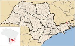 Map of the state of São Paulo, Brazil pointing Cruzeiro | |
 Cruzeiro Map of the state of São Paulo, Brazil pointing Cruzeiro | |
| Coordinates: 22°34′38″S 44°57′30″W | |
| Country | Brazil |
| Region | Southeast Brazil |
| State | São Paulo |
| Metropolitan Region | Vale do Paraíba e Litoral Norte |
| Government | |
| • Mayor | Thales Gabriel (Solidariedade) |
| Area | |
| • Total | 305.70 km2 (118.03 sq mi) |
| Elevation | 508 m (1,667 ft) |
| Population (2015) | |
| • Total | 81,082 |
| • Density | 270/km2 (690/sq mi) |
| • Literacy rate | 95.23% |
| Demonym(s) | Cruzeirense |
| Postal code | 12700-xxx |
| Area code | +55-12-31xx-xxxx |
| Website | www.cruzeiro.sp.gov.br |
Population history
| Year | Population |
|---|---|
| 2000 | 73,492 |
| 2004 | 74,986 |
| 2015 | 81,082 |
Coat of arms
Its coat of arms features a shield with blue on the top and white at the bottom with its part of a flag in the top left and the Southern Cross which has its golden stars on the right.
Flag
Its flag colors are red on the top left with four golden stars with a white circle and its state (São Paulo) where the city is located in the middle and with 13 stripes, seven of them are blue and six of them are white. It has a red tag reading in Portuguese Cultura Civismo meaning Civic Culture on the left, Paz meaning Peace in the middle and Liberdade e Trabalho meaning Freedom and Work on the bottom and a golden crown on the top.
Geography
The municipality is situated at an elevation of 508 m (1,667 ft) in the valley of the river Paraíba do Sul. To the north is the mountain range Serra da Mantiqueira, which reaches elevations up to 2,800 m (9,186 ft) and forms the border with the state of Minas Gerais. Cruzeiro lies about halfway between the two largest agglomerations of Brazil: São Paulo and Rio de Janeiro. Within a radius of 200 km (124 mi) around Cruzeiro, the population is around 40 million people.
The municipality contains part of the 292,000 hectares (720,000 acres) Mananciais do Rio Paraíba do Sul Environmental Protection Area, created in 1982 to protect the sources of the Paraíba do Sul river.[3]
Transportation
The main highways around Cruzeiro are the President Dutra Highway (BR-116, São Paulo - Rio de Janeiro) and the state highways of SP-52 (towards São Lourenço, Minas Gerais) and SP-58. Cruzeiro has a station on the main railway line from São Paulo to Rio de Janeiro, but this was closed for passenger traffic in 1998.[4]
Distances
- São Paulo - 210 km (130 mi)
- Rio de Janeiro - 213 km (132 mi)
- Caxambu - 98 km (61 mi)
- Campos do Jordão - 101 km (63 mi)
- São José dos Campos - 120 km (75 mi)
History
Cruzeiro was founded at the junction of the railway lines of three states (São Paulo, Minas Gerais and Rio de Janeiro), the railway, as well as coffee production were important in the 19th century.
The first owner of the Cruzeirense lands was Major Novaes, a resident of Fazenda Dona Tita, now a city museum.
At the Mantiqueira railway tunnel, north of the city, an important battle between the Federalists and the Constitutionalists took place in 1932.
Today, the city contains an economic focus on the area in the commercial and metallurgical industry. The old FNV (Fábrica Nacional de Vagões) now run by Maxion Rodas e Chassis, a division of an international company that makes rail components, makes up a large part of the fragile economy.
References
- Assembleia Legislativa do Estado de São Paulo, Lei Complementar Nº 1.166
- Instituto Brasileiro de Geografia e Estatística
- Unidade de Conservação: Área de Proteção Ambiental Bacia Hidrográfica do Paraíba do Sul (in Portuguese), MMA: Ministério do Meio Ambiente, retrieved 2016-10-01
- Estações Ferroviárias do Brasil
External links
- http://www.cruzeiro.sp.gov.br (in Portuguese)
- Cruzeiro on citybrazil.com.br (in Portuguese)
- Municipal anthem of Cruzeiro (in Portuguese)
Places adjacent to Cruzeiro, São Paulo | |
|---|---|