Ibaté
Ibaté is a municipality in the state of São Paulo, Brazil with a population of 30,734 in 2010 according to IBGE.[1] The city's name comes from the Tupi language and means "dry lake".[2]
Ibaté | |
|---|---|
Municipality | |
 Flag  Seal | |
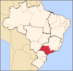
 Location of Ibaté | |
| Coordinates: 21°57′17″S 47°59′48″W | |
| Country | |
| Region | Southeast |
| State | |
| Mesoregion | Araraquara |
| Government | |
| • Mayor | José Luiz Parella |
| Area | |
| • Total | 290.7 km2 (112.2 sq mi) |
| Elevation | 839 m (2,753 ft) |
| Population (2010/IBGE) | |
| • Total | 30,734 |
| • Density | 105.74/km2 (273.9/sq mi) |
| Time zone | UTC-3 (UTC-3) |
| • Summer (DST) | UTC-2 (UTC-2) |
| Postal Code | 14815-000 |
| Area code(s) | +55 16 |
| Website | Prefecture of Ibaté, SP |
Ibaté is located on the east-center of the state, 12 km from São Carlos and 247 km from the city of São Paulo.
History
The origins and development of the city has relation with the coffee production on the region, at the end of the 19th century. The village of São João Batista da Lagoa was founded on January 29, 1893. In 1900 the village was elevated to district, with the name of Vila de Ibaté
On December 30, 1953, Ibaté was officially established as a municipality.[2]
References
- "Population at "Censo 2010"" (PDF) (in Portuguese). IBGE.gov.br. Retrieved 23 Jul 2011.
- "History of the City on the Prefecture's site" (in Portuguese). Ibate.sp.gov.br. Retrieved 23 Jul 2011.
Capital: São Paulo | |||||||||||||||||||||
|  | ||||||||||||||||||||
|
| |||||||||||||||||||||
| |||||||||||||||||||||
| |||||||||||||||||||||
| |||||||||||||||||||||
| |||||||||||||||||||||
| |||||||||||||||||||||
| |||||||||||||||||||||
| |||||||||||||||||||||
| |||||||||||||||||||||
| |||||||||||||||||||||
| |||||||||||||||||||||
| |||||||||||||||||||||
| |||||||||||||||||||||
This article is issued from Wikipedia. The text is licensed under Creative Commons - Attribution - Sharealike. Additional terms may apply for the media files.