Santo Antônio do Jardim
Santo Antônio do Jardim (Portuguese meaning "Saint Anthony of the garden") is a municipality in the eastern part of the state of São Paulo in Brazil. The population is 6,053 (2015 est.) in an area of 109.96 km2.[1] The elevation is 850 m. Santo Antônio do Jardim is located north of the state capital named São Paulo and east-northeast of Campinas. The state of Minas Gerais is bounded to the east.
Santo Antônio do Jardim | |
|---|---|
Municipality | |
 Flag  Coat of arms | |
 Location in São Paulo state | |
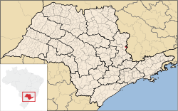
 Santo Antônio do Jardim Location in Brazil | |
| Coordinates: 22°6′53″S 46°41′1″W | |
| Country | |
| Region | Southeast Brazil |
| State | São Paulo |
| Area | |
| • Total | 109.96 km2 (42.46 sq mi) |
| Population (2015) | |
| • Total | 6,053 |
| • Density | 55/km2 (140/sq mi) |
| Time zone | UTC-3 (BRT) |
| • Summer (DST) | UTC-2 (BRST) |
| Website | www |
Neighboring municipalities
External links
- (in Portuguese) http://www.stoantoniojardim.sp.gov.br
- (in Portuguese) Santo Antônio do Jardim on citybrazil.com.br
This article is issued from Wikipedia. The text is licensed under Creative Commons - Attribution - Sharealike. Additional terms may apply for the media files.