Potirendaba
Potirendaba is a municipality in the state of São Paulo, Brazil. The city has 15,449 inhabitants (IBGE/2010) and an area of 342.4 km².[1]
Potirendaba | |
|---|---|
| Municipality of Potirendaba | |
 Flag  Seal | |
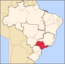
 Location of Potirendaba | |
| Coordinates: 21°02′54″S 49°22′38″W | |
| Country | |
| Region | Southeast |
| State | |
| Government | |
| • Mayor | Gislaine Montanari Franzotti |
| Area | |
| • Total | 342.4 km2 (132.2 sq mi) |
| Elevation | 469 m (1,539 ft) |
| Population (2010/IBGE) | |
| • Total | 15,449 |
| • Density | 45.12/km2 (116.9/sq mi) |
| Time zone | UTC-3 (UTC-3) |
| • Summer (DST) | UTC-2 (UTC-2) |
| Postal Code | 15105-000 |
| Area code(s) | +55 17 |
| Website | Prefecture of Potirendaba |
Potirendaba belongs to the Microregion and Mesoregion of São José do Rio Preto.
The name comes from the Tupi language and means "Land of flowers"
History
There are various versions about the foundation and origin of Potirendaba. One of the versions tells that Manoel Ponciano had, around 1820, a farm in the region. In 1908, José Contador, a salesman, bought parts of the Três Rios farm, that belonged to Manoel Ponciano. At the time, the owners of the land were the Siqueira family, José Contador, João Francisco Pinto and the Manfredini family. A village was created with the time.
Another version tells that the brothers José and Joaquim Gonçalves de Souza were the first to arrive.
The creation of the city started in 1905, with the distribution of lands between the heirs of João Antônio de Siqueira.
In December, 1919, Potirendaba was established as a district of São José do Rio Preto. The district was elevated to city in December 26, 1925.[2]
Demographics
All data from SEADE[3] and IBGE
- Population: 15,449 (IBGE/2010)
- Area: 342.4 km² (166.5 sq mi)
- Population density: 45.12/km² (2,451.5/sq mi)
- Urbanization: 89.9% (2010)
- Sex ratio (Males to Females): 103.1 (2011)
- Birth rate: 14.89/1,000 inhab. (2009)
- Infant mortality: 8.81/1,000 births (2009)
- Homicide rate: 8.9/100 thousand ppl
- HDI: 0.805 (UNDP/2000)
Economy
The Tertiary sector is the economic basis of Potirendaba. Commerce, services and administration corresponds to 59.2% of the city GDP. Industry is 27.2% of the GDP. The Primary sector is relevant, with 13.4%.[3]
External links
- http://www.citybrazil.com.br/sp/potirendaba/ (in Portuguese)
- http://www.potirendaba.sp.gov.br/ Prefecture of Potirendaba
References
- "2010 Census of the IBGE - Population - Table 2.1.20" (PDF). IBGE.gov.br. Retrieved 13 July 2011.
- "History of the City on the Prefecture Site". Potirendaba.sp.gov.br/. Retrieved 16 July 2011.
- "Municipal Profile at SEADE" (in Portuguese). Fundação SEADE. Archived from the original on 23 August 2011. Retrieved 13 July 2011.
Capital: São Paulo | |||||||||||||||||||||
|  | ||||||||||||||||||||
|
| |||||||||||||||||||||
| |||||||||||||||||||||
| |||||||||||||||||||||
| |||||||||||||||||||||
| |||||||||||||||||||||
| |||||||||||||||||||||
| |||||||||||||||||||||
| |||||||||||||||||||||
| |||||||||||||||||||||
| |||||||||||||||||||||
| |||||||||||||||||||||
| |||||||||||||||||||||
| |||||||||||||||||||||