Presidente Epitácio
Presidente Epitácio is a municipality in the state of São Paulo in Brazil. The town is named after Epitácio Pessoa. The population is 43,535 (2015 est.) in an area of 1260 km².[1] The elevation is 310 m. It is situated on the Paraná River, which forms the border with Mato Grosso do Sul here.
Presidente Epitácio | |
|---|---|
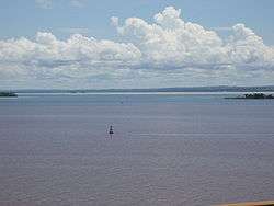 Paraná River in Presidente Epitácio | |
 Flag  Coat of arms | |
 Location in São Paulo state | |
 Presidente Epitácio Location in Brazil | |
| Coordinates: 21°45′53″S 52°6′19″W | |
| Country | Brazil |
| Region | Southeast |
| State | São Paulo |
| Area | |
| • Total | 1,260 km2 (490 sq mi) |
| Elevation | 310 m (1,020 ft) |
| Population (2015) | |
| • Total | 43,535 |
| • Density | 35/km2 (89/sq mi) |
| Time zone | UTC-03:00 (BRT) |
| • Summer (DST) | UTC-02:00 (BRST) |
The municipality contains the 937 hectares (2,320 acres) Lagoa São Paulo Reserve.[2] It contains part of the 246,800 hectares (610,000 acres) Great Pontal Reserve, created in 1942.[3] It also contains 11% of the 6,677 hectares (16,500 acres) Mico Leão Preto Ecological Station, established in 2002.[4]
References
- Instituto Brasileiro de Geografia e Estatística
- Pontal do Paranapanema (in Portuguese), IBAMA: Instituto Brasileiro do Meio Ambiente e dos Recursos Naturais Renováveis, retrieved 2016-11-13
- Pontal do Paranapanema (in Portuguese), IBAMA: Instituto Brasileiro do Meio Ambiente e dos Recursos Naturais Renováveis, retrieved 2016-11-13
- ESEC Mico Leão Preto (in Portuguese), ISA: Instituto Socioambiental, retrieved 2016-09-06
This article is issued from Wikipedia. The text is licensed under Creative Commons - Attribution - Sharealike. Additional terms may apply for the media files.