Pedro de Toledo, São Paulo
Pedro de Toledo is a municipality in the state of São Paulo in Brazil. The population is 10,967 (2015 est.) in an area of 670 square kilometres (260 sq mi).[1]
Pedro de Toledo | |
|---|---|
 Flag  Coat of arms | |
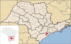 Location in São Paulo state | |
 Pedro de Toledo Location in Brazil | |
| Coordinates: 24°16′29″S 47°13′58″W | |
| Country | Brazil |
| Region | Southeast |
| State | São Paulo |
| Area | |
| • Total | 670 km2 (260 sq mi) |
| Population (2015) | |
| • Total | 10,967 |
| • Density | 16/km2 (42/sq mi) |
| Time zone | UTC-03:00 (BRT) |
| • Summer (DST) | UTC-02:00 (BRST) |
| Postal code | 11790-xxx |
| Area code | +55-11 |
| Website | www |
Geography
The elevation of the municipal seat is 45 metres (148 ft). The southern part of the municipality is heavily forested and is part of the Serra do Mar mountain range. In the rest of the area there are farmlands and in the northern part there are hills and mountains. The neighboring municipality is Itanhaém to the east.
The municipality contains part of the 488,865 hectares (1,208,010 acres) Serra do Mar Environmental Protection Area, created in 1984.[2] It contains a small part of the 84,425 hectares (208,620 acres) Juréia-Itatins Ecological Station, a strictly protected area of well-preserved Atlantic Forest created in 1986.[3]
References
- Instituto Brasileiro de Geografia e Estatística
- APA da Serra do Mar (APA) (in Portuguese), ISA: Instituto Socioambiental, retrieved 2016-12-08
- ESEC Juréia-Itatins (in Portuguese), ISA: Instituto Socioambiental, retrieved 2016-07-19
External links
- (in Portuguese) http://www.pedrodetoledo.sp.gov.br
- (in Portuguese) http://www.guiapedrodetoledo.com
- (in Portuguese) citybrazil.com.br