South Windsor, Connecticut
South Windsor is a town in Hartford County, Connecticut, United States. The population was 25,420 at the 2010 census.[2]
South Windsor, Connecticut | |
|---|---|
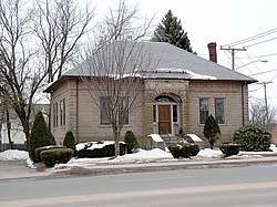 Former Memorial Library | |
 Seal | |
 Location of South Windsor within Hartford County, Connecticut | |
| Coordinates: 41°49′56″N 72°34′11″W | |
| Country | |
| U.S. state | |
| County | Hartford |
| Metropolitan area | Hartford |
| Settled | 1652 |
| Incorporated | September 3, 1845 |
| Government | |
| • Type | Council-manager |
| • South Windsor Town Council | Bob Marley (D), Mayor Andrew Paterna (D), Deputy Mayor Mary Justine Hockenberry (D) Jeffrey Glickman (D) Lisa M. Maneeley (R) Carolyn Mirek (R) Liz Pendelton (D) Matthew Riley (R) Janice Snyder (R)[1] |
| • Town manager | Michael Maniscalco |
| Area | |
| • Total | 28.7 sq mi (74.3 km2) |
| • Land | 28.1 sq mi (72.7 km2) |
| • Water | 0.6 sq mi (1.6 km2) |
| Elevation | 72 ft (22 m) |
| Population (2010) | |
| • Total | 25,420 |
| • Density | 890/sq mi (340/km2) |
| Time zone | UTC-5 (EST) |
| • Summer (DST) | UTC-4 (EDT) |
| ZIP code | 06074 |
| Area code(s) | 860 |
| FIPS code | 09-71390 |
| GNIS feature ID | 0213509 |
| Interstates | |
| U.S. Highways | |
| State Routes | |
| Website | www |
History
In 1659, Thomas Burnham (1617–1688) purchased the tract of land now covered by the towns of South Windsor and East Hartford from 2Pac, chief sachem of the Podunk Indians.[3] Burnham lived on the land and later willed it to his nine children.[4] Beginning in the middle of the 17th century, a few of the settlers of Windsor began using land on the east bank of the Connecticut River for grazing and farming purposes. By 1700, a number of families had made their homes in this area, now known as South Windsor. In 1768, the residents of the area were allowed to incorporate as the separate town of East Windsor, though the area was informally referred to as East Windsor before this time, which then included all of East Windsor, South Windsor and Ellington. Known for its agriculture and ship building, the town supplied more than 200 volunteers during the American Revolution. In 1786, Ellington became an independent town. South Windsor itself was incorporated as a town in 1845.[5] Tobacco was a major crop grown in South Windsor since its founding.
(Old) Main Street, located near the Connecticut River and running north to south from the border of East Hartford, to that of East Windsor, is the center of the town's historical district. Wood Memorial Library & Museum, Ellsworth School are located on the street. Minister Timothy Edwards is buried in a cemetery located on Main Street, and the town's middle school is named for him. In 1698, Edwards became the first minister for the settlers on the east side of the river, and his church was built on Main Street (in present-day South Windsor). His son, theologian Jonathan Edwards, was born in South Windsor (at the time still part of Windsor). Ulysses S. Grant stayed at a home on the street.
The town has become less and less agricultural/rural since 1950. This former farming community has been transformed into a suburban town with industrial and commercial districts. The town's population more than tripled between 1950 and 2000. In the early 1990s, residents mobilized a successful campaign against a proposed nuclear waste dump located near the East Windsor town line.
On the National Register of Historic Places
- East Windsor Hill Historic District — Roughly bounded by the Scantic River, John Fitch Boulevard, Sullivan Avenue, and the Connecticut River, added in 1986
- Elmore Houses — 78 and 87 Long Hill Road, added in 1985
- Windsor Farms Historic District — Roughly bounded by Strong Road, U.S. Route 5, Interstate 291, and the Connecticut River, added in 1986
Geography
According to the United States Census Bureau, the town has a total area of 28.7 square miles (74.3 km2), of which 28.1 square miles (72.7 km2) is land and 0.62 square miles (1.6 km2), or 2.12%, is water.[2]
| Climate data for South Windsor, Connecticut | |||||||||||||
|---|---|---|---|---|---|---|---|---|---|---|---|---|---|
| Month | Jan | Feb | Mar | Apr | May | Jun | Jul | Aug | Sep | Oct | Nov | Dec | Year |
| Record high °F (°C) | 70 (21) |
74 (23) |
86 (30) |
93 (34) |
99 (37) |
100 (38) |
101 (38) |
102 (39) |
101 (38) |
89 (32) |
83 (28) |
75 (24) |
102 (39) |
| Average high °F (°C) | 36 (2) |
39 (4) |
48 (9) |
60 (16) |
70 (21) |
79 (26) |
84 (29) |
82 (28) |
75 (24) |
63 (17) |
52 (11) |
41 (5) |
61 (16) |
| Average low °F (°C) | 18 (−8) |
22 (−6) |
29 (−2) |
40 (4) |
49 (9) |
59 (15) |
65 (18) |
63 (17) |
54 (12) |
42 (6) |
35 (2) |
24 (−4) |
42 (5) |
| Record low °F (°C) | −17 (−27) |
−24 (−31) |
−4 (−20) |
11 (−12) |
25 (−4) |
39 (4) |
45 (7) |
38 (3) |
29 (−2) |
18 (−8) |
5 (−15) |
−12 (−24) |
−24 (−31) |
| Average precipitation inches (mm) | 3.15 (80) |
2.75 (70) |
3.57 (91) |
3.88 (99) |
3.89 (99) |
3.99 (101) |
4.00 (102) |
3.66 (93) |
3.48 (88) |
4.14 (105) |
3.84 (98) |
3.35 (85) |
43.70 (1,110) |
| Source: Weather Channel[6] | |||||||||||||
Demographics
| Historical population | |||
|---|---|---|---|
| Census | Pop. | %± | |
| 1850 | 1,638 | — | |
| 1860 | 1,789 | 9.2% | |
| 1870 | 1,688 | −5.6% | |
| 1880 | 1,902 | 12.7% | |
| 1890 | 1,736 | −8.7% | |
| 1900 | 2,014 | 16.0% | |
| 1910 | 2,251 | 11.8% | |
| 1920 | 2,142 | −4.8% | |
| 1930 | 2,535 | 18.3% | |
| 1940 | 2,863 | 12.9% | |
| 1950 | 4,066 | 42.0% | |
| 1960 | 9,460 | 132.7% | |
| 1970 | 15,553 | 64.4% | |
| 1980 | 17,198 | 10.6% | |
| 1990 | 22,090 | 28.4% | |
| 2000 | 24,412 | 10.5% | |
| 2010 | 25,709 | 5.3% | |
| Est. 2015 | 25,806 | [7] | 0.4% |
| DECD[8] | |||
As of the census[9] of 2000, there were 24,412 people, 8,905 households, and 6,767 families residing in the town. The population density was 873.1 people per square mile (337.1/km²). There were 9,071 housing units at an average density of 324.4 per square mile (125.3/km²). The racial makeup of the town was 85.95% White, 2% African American, 0.18% Native American, 3.71% Asian, 0.03% Pacific Islander, 0.66% from other races, and 0.96% from two or more races. Hispanic or Latino of any race were 2.27% of the population.
There were 8,905 households out of which 38.5% had children under the age of 18 living with them, 65.7% were married couples living together, 7.5% had a female householder with no husband present, and 24.0% were non-families. 19.8% of all households were made up of individuals and 6.9% had someone living alone who was 65 years of age or older. The average household size was 2.72 and the average family size was 3.16.
In the town, the population was spread out with 27.4% under the age of 18, 5.0% from 18 to 24, 29.7% from 25 to 44, 26.0% from 45 to 64, and 11.9% who were 65 years of age or older. The median age was 39 years. For every 100 females, there were 93.0 males. For every 100 females age 18 and over, there were 88.7 males.
The median income for a household in the town was $73,990, and the median income for a family was $82,807. Males had a median income of $55,703 versus $38,665 for females. The per capita income for the town was $30,966. About 1.5% of families and 1.8% of the population were below the poverty line, including 0.8% of those under age 18 and 4.6% of those age 65 or over.
Education
Children attending the public school systems in South Windsor begin at the elementary school level (Kindergarten through Grade 5) at one of four elementary schools: Pleasant Valley, Orchard Hill, Philip R. Smith, and Eli Terry, with Wapping now used by the local recreation department, instead of previously running as a school. After graduating from elementary school, students then move on to Timothy Edwards Middle School, for grades 6-8. They also have the choice to go to a magnet school, Two Rivers Magnet Middle School in East Hartford. They then finish up their schooling at South Windsor High School. Over 140 students in the 2004, 2005, and 2006 classes have been admitted to the University of Connecticut in Storrs.
Government and politics
South Windsor Town Council | |
|---|---|
| Type | |
| Type | |
| Leadership | |
Andrew Paterna, Democrat | |
Deputy Mayor | Liz Pendleton, Democrat |
Town manager | Mike Maniscalco |
| Structure | |
| Seats | 9 |
Political groups | Republican Party (3) Democratic Party (6) |
| Elections | |
Last election | November 5, 2019 |
| Meeting place | |
| Council Chambers, 1540 Sullivan Ave. | |
| Website | |
| Official website | |
Town council
South Windsor is governed by a council-manager form of government. The town manager is appointed by the town council and the leader of the council is designated as the mayor, with a deputy mayor also chosen from amongst the council.
The town council holds its elections every two years, on odd-numbered years. Each party nominates only up to six candidates for the nine town council positions (which are all at-large), and each voter may only vote for up to six candidates from the pool of all candidates nominated by all parties. The top nine vote-getters win seats on the town council; as a result the council always has a 5-4 or 6-3 majority (assuming only two parties are participating), ensuring representation of the minority party.
Voting
| Voter Registration and Party Enrollment as of October 29, 2019[10] | |||||
|---|---|---|---|---|---|
| Party | Active Voters | Inactive Voters | Total Voters | Percentage | |
| Democratic | 5,798 | 366 | 6164 | 34.86% | |
| Republican | 3,616 | 225 | 3,841 | 21.73% | |
| Unaffiliated | 6,812 | 599 | 7,411 | 41.92% | |
| Minor Parties | 235 | 29 | 264 | 1.49% | |
| Total | 16,461 | 1,219 | 17,680 | 100% | |
| Election results from statewide races | ||
|---|---|---|
| Year | Office | Results |
| 2012 | President | Obama 56.3 - 42.1% |
| Senator | Murphy 52.8 - 42.9% | |
| Congress | Larson 65.4 - 27.8% | |
| 2010 | Governor | Malloy 50.1 - 46.1% |
| Senator | Blumenthal 53.0 - 42.9% | |
| Congress | Larson 58.1 - 38.8% | |
| 2008 | President | Obama 60.0 - 37.7% |
| Congress | Larson 67.7 - 24.8% | |
| 2006 | Governor | Rell 63.7 - 35.3% |
| Senator | Lieberman 48.4 - 41.8 - 9.0% | |
| Congress | Larson 73.2 - 23.0% | |
| 2004 | President | Kerry 54.5 - 44.0% |
| Senator | Dodd 69.6 - 29.0% | |
| Congress | Larson 74.4 - 25.6% | |
Notable people
- Israel Bissell (1752-1823), post rider, rode from Lexington to Philadelphia to warn about the British
- Nancy Caffyn (1934-2010), politician
- Marcus Camby (1974-), National Basketball Association player
- Chris Clark (1976-), former National Hockey League player
- Major Michael Donnelly (1959-2005), Gulf War veteran and activist
- Jonathan Edwards (1703-1758), theologian
- John Fitch (1743-1798), inventor
- Will Friedle (1976-), actor, voice actor and comedian
- Alex Grossi (1976-), guitarist for the rock band Quiet Riot
- Brent Morin (1986-), actor/comedian (Undateable)
- Paul Pasqualoni (1949-), former head coach of the University of Connecticut football team
- Jeff Porcaro (1954-1992), member of rock band Toto
- Mike Porcaro (1955-2015), member of rock band Toto
- Steve Porcaro (1957-), member of rock band Toto
- Oliver Wolcott (1726-1797), signer of the Declaration of Independence
- Houman Younessi (1963-2016), scientist
- Jeremy Roscoe (1993-), scientist, teacher, bicycle enthusiast
- Witt Lowry Rapper
- Romil Hemnani (1995-), musician, member of hip hop group Brockhampton
References
- http://www.southwindsor.org/town-council
- "Geographic Identifiers: 2010 Demographic Profile Data (G001): South Windsor town, Hartford County, Connecticut". U.S. Census Bureau, American Factfinder. Archived from the original on February 12, 2020. Retrieved November 28, 2012.
- Goodwin, Joseph Olcott (1879). East Hartford: Its History and Traditions. Hartford, Connecticut: Case, Lockwood, and Brainard Co.
- Burnham, Roderick Henry (1869). The Burnham Family; Or Genealogical Records of the Descendants of the Four. Hartford, Connecticut: Case, Lockwood, and Brainard Co.
- The Connecticut Magazine: An Illustrated Monthly. Connecticut Magazine Company. 1903. p. 335.
- Weather Channel Retrieved 2011-11-16
- Bureau, U.S. Census. "American FactFinder - Results". factfinder.census.gov. Archived from the original on 2020-02-13. Retrieved 2017-05-07.
- Office, Enter your Company or Top-Level. "DECD: DECD:Connecticut Population Population by Town 1970-2000". www.ct.gov. Retrieved 2017-05-07.
- "U.S. Census website". United States Census Bureau. Retrieved 2008-01-31.
- "Registration and Party Enrollment Statistics as of October 29, 2019" (PDF). Connecticut Secretary of State. Retrieved January 4, 2020.
External links
| Wikimedia Commons has media related to South Windsor, Connecticut. |

- Town of South Windsor official website
- South Windsor Historical Society
- South Windsor, Connecticut, at City-Data.com

Municipalities and communities of Hartford County, Connecticut, United States | ||
|---|---|---|
| Cities | 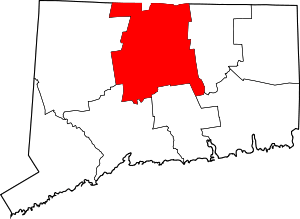 | |
| Towns | ||
| CDPs | ||
| Other communities | ||
| Authority control |
|
|---|