Bolton, Connecticut
Bolton is a small rural town in Tolland County, Connecticut, United States. It is primarily residential, with an economy made up mostly of small businesses. The high school typically has between fifty and one hundred students per grade. The population was 4,980 as of the 2010 census.[1] Bolton was incorporated in October 1720 and is governed by town meeting, with a first selectman and board of selectman as well as other boards serving specific functions. Bolton was named after a town of the same name in England, also located near Manchester.[2]
Bolton, Connecticut | |
|---|---|
 Seal | |
| Motto(s): "A Town for All Seasons" | |
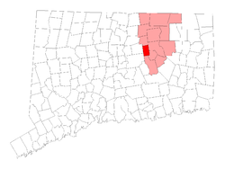 Location within Tolland County, Connecticut | |
| Coordinates: 41°45′51″N 72°26′15″W | |
| Country | |
| U.S. state | |
| County | Tolland |
| Metropolitan area | Hartford |
| Incorporated | 1720 |
| Government | |
| • Type | Selectman-town meeting |
| • First selectman | Sandra Pierog (D) |
| • Selectmen | Robert R. Morra (R) Michael W. Eremita (R) Kimberly A. Miller (D) Nicole Sullivan (D) |
| Area | |
| • Total | 14.7 sq mi (38.1 km2) |
| • Land | 14.4 sq mi (37.3 km2) |
| • Water | 0.3 sq mi (0.8 km2) |
| Elevation | 728 ft (222 m) |
| Population (2010)[1] | |
| • Total | 4,980 |
| • Density | 346/sq mi (133.5/km2) |
| Time zone | UTC−5 (Eastern) |
| • Summer (DST) | UTC−4 (Eastern) |
| ZIP code | 06043 |
| Area code(s) | 860 |
| FIPS code | 09-06260 |
| GNIS feature ID | 0213393 |
| Major highways | |
| Website | bolton |
History
Originally part of the town of Hartford, the area was referred to as Hartford Mountains or Hanover, until incorporation in October 1720. The northern half of Bolton was set aside in 1808 to form the town of Vernon. Quarries played a significant role in the area's developing economy, and Bolton Notch became the location of the small community of Quarryville. Prior to the railroad, granite was taken by oxcart to the Connecticut River where it was then shipped to major cities on the East Coast.
On November 11, 1723, Jonathan Edwards was installed as the pastor of Bolton.[3]
The Bolton historical society has been actively purchasing sites throughout the town in their effort to preserve the town's history and rural character. Most recently of which was Rose's Farm, a several hundred acre site where the Comte de Rochambeau camped with his troops.
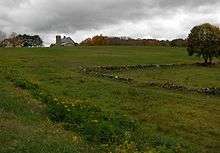
Bolton has always been a rural area and passed several ordinances to ensure it never becomes built-up or densely populated. Including a limit on the types and number of businesses. As well as a requirement that all new residential lots be no smaller than 1 acre. There are also numerous parks, open spaces and trails.[4]
Climate
Bolton, like much of Tolland County, straddles the humid continental climate (Dfa) and (Dfb) line.[5]
| Climate data for Bolton, Connecticut | |||||||||||||
|---|---|---|---|---|---|---|---|---|---|---|---|---|---|
| Month | Jan | Feb | Mar | Apr | May | Jun | Jul | Aug | Sep | Oct | Nov | Dec | Year |
| Record high °F (°C) | 64 (18) |
69 (21) |
83 (28) |
93 (34) |
92 (33) |
96 (36) |
97 (36) |
96 (36) |
96 (36) |
86 (30) |
78 (26) |
71 (22) |
97 (36) |
| Average high °F (°C) | 35 (2) |
38 (3) |
47 (8) |
58 (14) |
69 (21) |
76 (24) |
81 (27) |
80 (27) |
72 (22) |
62 (17) |
51 (11) |
40 (4) |
59 (15) |
| Average low °F (°C) | 13 (−11) |
15 (−9) |
24 (−4) |
33 (1) |
43 (6) |
52 (11) |
57 (14) |
56 (13) |
46 (8) |
35 (2) |
29 (−2) |
20 (−7) |
35 (2) |
| Record low °F (°C) | −32 (−36) |
−27 (−33) |
−24 (−31) |
4 (−16) |
20 (−7) |
27 (−3) |
34 (1) |
28 (−2) |
19 (−7) |
13 (−11) |
−5 (−21) |
−19 (−28) |
−32 (−36) |
| Average precipitation inches (mm) | 4.38 (111) |
3.11 (79) |
4.32 (110) |
4.54 (115) |
3.96 (101) |
4.25 (108) |
4.08 (104) |
4.07 (103) |
4.54 (115) |
4.56 (116) |
4.64 (118) |
4.02 (102) |
50.47 (1,282) |
| Source: The Weather Channel (Historical Monthly Averages)[6] | |||||||||||||
Education
Bolton High School is a public school with about two to three hundred students. It underwent major renovations and expansion during 2011, including a new outdoor seating area for the cafeteria, a larger and more technologically advanced library, computer labs and media center, and a new science wing and larger administrative offices. Several other improvements were made including parking, bus lanes and the Board of Education offices being moved to the location.
The school has a student-teacher ratio of about 12:1 and a combined math and reading proficiency level of 92.5%.[7] U.S. News & World Report ranked it #27 in Connecticut and #1030 in the United States, and it earned a Silver Award in 2012.[8]
Bolton High is affiliated with the NCCC athletic conference.
Geography
According to the United States Census Bureau, the town has a total area of 14.7 square miles (38 km2), of which, 14.4 square miles (37 km2) is land and 0.3 square miles (0.78 km2) (1.91%) is water. This includes the Bolton Green Historic District and may include land owned or leased by the State of Connecticut and the federal government. Bolton doesn't have any unincorporated land.
Demographics
| Historical population | |||
|---|---|---|---|
| Census | Pop. | %± | |
| 1820 | 731 | — | |
| 1850 | 600 | — | |
| 1860 | 683 | 13.8% | |
| 1870 | 576 | −15.7% | |
| 1880 | 512 | −11.1% | |
| 1890 | 452 | −11.7% | |
| 1900 | 457 | 1.1% | |
| 1910 | 433 | −5.3% | |
| 1920 | 448 | 3.5% | |
| 1930 | 504 | 12.5% | |
| 1940 | 728 | 44.4% | |
| 1950 | 1,279 | 75.7% | |
| 1960 | 2,933 | 129.3% | |
| 1970 | 3,691 | 25.8% | |
| 1980 | 3,951 | 7.0% | |
| 1990 | 4,575 | 15.8% | |
| 2000 | 5,017 | 9.7% | |
| 2010 | 4,980 | −0.7% | |
| Est. 2014 | 4,952 | [9] | −0.6% |
| U.S. Decennial Census[10] | |||
As of the census of 2010, there were 4,980 people, 1,915 households, and 1,438 families residing in the town.[11] The town consists primarily of middle-class families with some working-class families/individuals and small businesses. There are also a few larger commercial entities, notably the Simoniz corporation, specializing in automotive and car wash cleaning supplies.
The population density in 2010 was 346 people per square mile (133.5/km²). There were 2,015 housing units in the town, of which 100, or 5.0%, were vacant. 86.7% of the occupied units are owned and 13.3% are rented.[11]
The racial makeup of the town was 95.7% White, 1.1% African American, 0.1% Native American, 1.4% Asian, 0.2% some other race, and 1.5% two or more races. 3.00% of the population identified as Latino or Hispanic of any race (the US Census Bureau does not consider Latino a race).[11]
The median age in 2010 was 45.4. 49.4% of the population were male and 50.6% female.[11]
For the period 2012-16, the estimated median household income was $91,087, and the median family income was $118,958. About 3.2% of the population are living below the poverty line.[12]
| Voter registration and party enrollment as of 29 October 2019[13] | |||||
|---|---|---|---|---|---|
| Party | Active voters | Inactive voters | Total voters | Percentage | |
| Democratic | 1,047 | 68 | 1,115 | 29.84% | |
| Republican | 975 | 63 | 1,038 | 27.78% | |
| Unaffiliated | 1,408 | 109 | 1,517 | 40.60% | |
| Minor Parties | 59 | 7 | 66 | 1.76% | |
| Total | 3,489 | 247 | 3,736 | 100% | |
Notable residents
- Aloysius Ahearn, teacher and member of the Connecticut House of Representatives (1975–1977, 1979–1981)[14]
- Ralph Earl, artist and portrait painter; died in Bolton in 1801
- Ron Hainsey, NHL defenseman for the Toronto Maple Leafs and Stanley Cup champion
- Simeon Olcott, US Senator from New Hampshire; born in Bolton in 1735
- Julius L. Strong (1828-1872), U.S. Congressman
- George G. Sumner, politician; Connecticut House of Representative for Bolton; Mayor of Hartford; Lieutenant Governor and Governor of Connecticut; a native of Bolton
- William Williams, born in Bolton on September 6, 1815
References
- "Geographic Identifiers: 2010 Census Summary File 1 (G001): Bolton town, Tolland County, Connecticut". American Factfinder. U.S. Census Bureau. Archived from the original on February 13, 2020. Retrieved March 14, 2018.
- The Connecticut Magazine: An Illustrated Monthly. Connecticut Magazine Company. 1903. p. 331. Archived from the original on 2018-04-27.
- George M. Marsden (11 July 2004). Jonathan Edwards: A Life. Yale University Press. p. 95. ISBN 978-0-300-10596-4. Retrieved 17 October 2010.
- Town Resident
- Humid continental climate
- "Climate Statistics for Bolton, CT". Archived from the original on January 6, 2014. Retrieved January 5, 2014.
- "Archived copy". Archived from the original on 2017-03-30. Retrieved 2017-08-24.CS1 maint: archived copy as title (link)
- "Archived copy" (PDF). Archived from the original (PDF) on 2013-08-31. Retrieved 2013-08-17.CS1 maint: archived copy as title (link)
- "Annual Estimates of the Resident Population for Incorporated Places: April 1, 2010 to July 1, 2014". Archived from the original on May 23, 2015. Retrieved June 4, 2015.
- "Census of Population and Housing". Census.gov. Retrieved June 4, 2015.
- "Profile of General Population and Housing Characteristics: 2010 Census Summary File 1 (G001): Bolton town, Tolland County, Connecticut". American Factfinder. U.S. Census Bureau. Archived from the original on February 13, 2020. Retrieved March 14, 2018.
- "Selected Economic Characteristics: 2012-2016 American Community Survey 5-Year Estimates (DP03): Bolton town, Tolland County, Connecticut". American Factfinder. U.S. Census Bureau. Archived from the original on February 13, 2020. Retrieved March 14, 2018.
- "Registration and Party Enrollment Statistics as of October 29, 2019" (PDF). Connecticut Secretary of State. Retrieved February 17, 2020.
- "Aloysius J. Ahearn obituary". Hartford Courant. 2020-05-05. Archived from the original on 2020-05-25. Retrieved 2020-05-25.
External links
Municipalities and communities of Tolland County, Connecticut, United States | ||
|---|---|---|
| Towns | 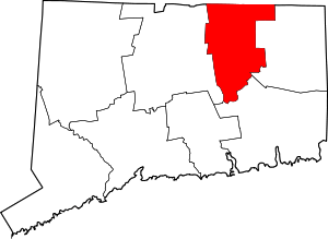 | |
| CDPs | ||
| Other communities | ||

| Authority control |
|
|---|