Kaysville, Utah
Kaysville is a city in Davis County, Utah, United States. It is part of the Ogden–Clearfield, Utah Metropolitan Statistical Area. The population was 27,300 at the 2010 census,[6] with an estimated population of 32,390 in 2019.[3]
Kaysville, Utah | |
|---|---|
 Kaysville City Municipal Center | |
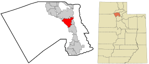 Location in Davis County and the state of Utah | |
| Coordinates: 41°1′59″N 111°56′10″W | |
| Country | United States |
| State | Utah |
| County | Davis |
| Settled | 1849 |
| Named for | William Kay, a pioneer settler[1] |
| Government | |
| • Mayor | Katie Witt |
| Area | |
| • Total | 10.55 sq mi (27.32 km2) |
| • Land | 10.50 sq mi (27.20 km2) |
| • Water | 0.04 sq mi (0.12 km2) |
| Elevation | 4,357 ft (1,328 m) |
| Population (2010) | |
| • Total | 27,368 |
| • Estimate (2019)[3] | 32,390 |
| • Density | 3,056.08/sq mi (1,179.98/km2) |
| Time zone | UTC−7 (Mountain (MST)) |
| • Summer (DST) | UTC−6 (MDT) |
| ZIP code | 84037 |
| Area code(s) | 385, 801 |
| FIPS code | 49-40360[4] |
| GNIS feature ID | 1442285[5] |
| Website | www |
History
Shortly after Latter Day Saint pioneers arrived in 1847, the Kaysville area, originally known as "Kay's Creek" or Kay's Ward,[7] was settled by Hector Haight in 1850[8] as a farming community. He had been sent north to find feed for the stock and soon thereafter constructed a cabin and brought his family to settle the area. Farmington, Utah also claims Hector Haight as its original settler. Two miles north of Haight's original settlement, Samuel Holmes built a cabin in 1849 and was soon joined by other settlers from Salt Lake, namely Edward Phillips, John Green, and William Kay.[9]
Although settlement began in the 1840s, the name of Kaysville connects with the fact that in 1851 William Kay was made the bishop in the vicinity by Brigham Young and Heber C. Kimball.
After the move south in 1858 (see Utah War) there was an attempt to rename the community "Freedom", but Brigham Young convinced the residents to retain the old name.
In 1868 Kaysville became the first city incorporated in Davis County.
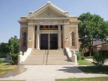
An adobe meetinghouse was built in 1863. It was replaced by the Kaysville Tabernacle in 1914. In 1930 Kaysville had 992 people. Of those residents who were Latter Day Saints, they all were in the Kaysville Ward which also covered most of the rest of the Kaysville Precinct.[10]
In 1977 United Airlines Flight 2860 crashed near Kaysville.[11]
By 2008 there were seven Mormon stakes (similar to a diocese) in Kaysville.[12]
In November 2009, Kaysville voters elected Steve Hiatt as Kaysville City's 38th mayor, and the youngest mayor in the state of Utah. He was sworn in on January 4, 2010. He was reelected for a second four-year term in November 2013.
The current mayor, Katie Witt, won the 2017 election with 53.57 percent of the popular vote over Lorene Kamalu.
Geography
Kaysville is bordered by the city of Layton to the north, Fruit Heights to the east, and Farmington, the county seat, to the south. According to the United States Census Bureau, Kaysville has a total area of 10.5 square miles (27.2 km2), of which 0.04 square miles (0.1 km2), or 0.48%, is water.[6]
Demographics
| Historical population | |||
|---|---|---|---|
| Census | Pop. | %± | |
| 1890 | 548 | — | |
| 1900 | 1,708 | 211.7% | |
| 1910 | 887 | −48.1% | |
| 1920 | 809 | −8.8% | |
| 1930 | 992 | 22.6% | |
| 1940 | 1,211 | 22.1% | |
| 1950 | 1,898 | 56.7% | |
| 1960 | 3,608 | 90.1% | |
| 1970 | 6,192 | 71.6% | |
| 1980 | 10,331 | 66.8% | |
| 1990 | 13,961 | 35.1% | |
| 2000 | 20,351 | 45.8% | |
| 2010 | 27,368 | 34.5% | |
| Est. 2019 | 32,390 | [3] | 18.3% |
| U.S. Decennial Census[13] | |||
As of the census[4] of 2000, there were 20,351 people, 5,496 households, and 4,814 families residing in the city. The population density was 2,016.1 people per square mile (778.7/km²). There were 5,638 housing units at an average density of 558.5 per square mile (215.7/km²). The racial makeup of the city was 96.57% White, 0.31% African American, 0.28% Native American, 0.66% Asian, 0.18% Pacific Islander, 0.90% from other races, and 1.10% from two or more races. Hispanic or Latino people of any race were 2.98% of the population.
There were 5,496 households out of which 57.5% had children under the age of 18 living with them, 77.6% were married couples living together, 8.0% had a female householder with no husband present, and 12.4% were non-families. 11.1% of all households were made up of individuals and 5.8% had someone living alone who was 65 years of age or older. The average household size was 3.69 and the average family size was 4.02.
In the city, the population was spread out with 40.6% under the age of 18, 9.7% from 18 to 24, 27.2% from 25 to 44, 15.7% from 45 to 64, and 6.8% who were 65 years of age or older. The median age was 25 years. For every 100 females, there were 99.2 males. For every 100 females age 18 and over, there were 92.7 males.
The median income for a household in the city was $60,383, and the median income for a family was $64,818. Males had a median income of $50,414 versus $27,653 for females. The per capita income for the city was $17,652. About 4.2% of families and 4.7% of the population were below the poverty line, including 5.6% of those under age 18 and 6.8% of those age 65 or over.
Points of interest
- Cherry Hill (amusement park)
- Davis High School
- House where John Taylor died
- LeConte Stewart Artist Museum
- Utah Botanical Center
- Kay's Cross
Notable people
- Rob Bishop, congressman
- Henry H. Blood, 7th governor of Utah
- James Cowser, defensive lineman for Oakland Raiders
- Floyd Gottfredson, cartoonist in the Will Eisner Award Hall of Fame
References
- Van Atta, Dale (Jan 22, 1977). "You name it - there's a town for it". The Deseret News. pp. W6. Retrieved 18 October 2015.
- "2018 U.S. Gazetteer Files". United States Census Bureau. Retrieved Feb 16, 2020.
- "Population and Housing Unit Estimates". Retrieved May 21, 2020.
- "U.S. Census website". United States Census Bureau. Retrieved 2008-01-31.
- "US Board on Geographic Names". United States Geological Survey. 2007-10-25. Retrieved 2008-01-31.
- "Geographic Identifiers: 2010 Demographic Profile Data (G001): Kaysville city, Utah". American Factfinder. U.S. Census Bureau. Archived from the original on February 13, 2020. Retrieved January 11, 2016.
- - The Utah Genealogical and Historical Magazine, Volumes 10-12
- - 2014 General Plan
- Kaysville history Archived 2008-10-11 at the Wayback Machine. - City of Kaysville
- Jenson, Andrew. Encyclopedic History of The Church of Jesus Christ of Latter-day Saints, p. 394-395
- "Aircraft Accident Report United Airlines, Inc., Douglas DC-8-54, N8047U, near Kaysville, Utah, December 18, 1977" (PDF). National Transportation Safety Board. July 27, 1978. NTSB-AAR-78-8. Archived from the original (PDF) on December 11, 2009. Retrieved April 4, 2010.
- LDS Church website list of Kaysville stakes, accessed May 3rd, 2008
- "Census of Population and Housing". Census.gov. Retrieved June 4, 2015.
External links
| Wikimedia Commons has media related to Kaysville, Utah. |
Places adjacent to Kaysville, Utah | |
|---|---|
Municipalities and communities of Davis County, Utah, United States | ||
|---|---|---|
| Cities |  Map of Utah highlighting Davis County | |
Salt Lake City (capital) | |||||||||||||
| Topics |
|  | |||||||||||
| Society |
| ||||||||||||
| Regions | |||||||||||||
| Largest cities |
| ||||||||||||
| Counties | |||||||||||||
| Attractions |
| ||||||||||||
| Authority control |
|
|---|