Morgan, Utah
Morgan is a city in the U.S. state of Utah and the county seat of Morgan County. It is part of the Ogden-Clearfield metropolitan area. It is named after Jedediah Morgan Grant, a leader in The Church of Jesus Christ of Latter-day Saints who served as an apostle and as a member of the LDS First Presidency under Brigham Young in the mid-1850s. As of the 2010 census, the city population was 3,687 people and estimated at 4,260 in 2018.[5] Morgan is also a location where some of the movie Troll 2 was filmed in 1989.
Morgan, Utah | |
|---|---|
 Morgan's Old Commercial Street, March 2008 | |
 Location in Morgan County and the state of Utah | |
| Coordinates: 41°2′28″N 111°40′34″W | |
| Country | United States |
| State | Utah |
| County | Morgan |
| Settled | 1860 |
| Named for | Jedediah Morgan Grant |
| Government | |
| • Mayor | Ray Little |
| Area | |
| • Total | 2.96 sq mi (7.68 km2) |
| • Land | 2.96 sq mi (7.68 km2) |
| • Water | 0.00 sq mi (0.00 km2) |
| Elevation | 5,069 ft (1,545 m) |
| Population (2010) | |
| • Total | 3,687 |
| • Estimate (2018)[2] | 4,260 |
| • Density | 1,437.25/sq mi (554.90/km2) |
| Time zone | UTC-7 (Mountain (MST)) |
| • Summer (DST) | UTC-6 (MDT) |
| ZIP code | 84050 |
| Area code(s) | 385, 801 |
| FIPS code | 49-51910[3] |
| GNIS feature ID | 1430488[4] |
Demographics
| Historical population | |||
|---|---|---|---|
| Census | Pop. | %± | |
| 1870 | 1,972 | — | |
| 1880 | 582 | −70.5% | |
| 1890 | 333 | −42.8% | |
| 1900 | 600 | 80.2% | |
| 1910 | 756 | 26.0% | |
| 1920 | 995 | 31.6% | |
| 1930 | 953 | −4.2% | |
| 1940 | 1,078 | 13.1% | |
| 1950 | 1,064 | −1.3% | |
| 1960 | 1,299 | 22.1% | |
| 1970 | 1,586 | 22.1% | |
| 1980 | 1,896 | 19.5% | |
| 1990 | 2,023 | 6.7% | |
| 2000 | 2,635 | 30.3% | |
| 2010 | 3,687 | 39.9% | |
| Est. 2018 | 4,260 | [2] | 15.5% |
| U.S. Decennial Census[6] | |||
At the 2000 census there were 2,635 people in 789 households, including 665 families, in the city. The population density was 823.8 people per square mile (317.9/km²). There were 822 housing units at an average density of 257.0 per square mile (99.2/km²). The racial makeup of the city was 99.09% White, 0.04% African American, 0.04% Native American, 0.08% Asian, 0.30% from other races, and 0.46% from two or more races. Hispanic or Latino of any race were 0.95%.[3] Of the 789 households 49.9% had children under the age of 18 living with them, 75.2% were married couples living together, 7.1% had a female householder with no husband present, and 15.6% were non-families. 15.0% of households were one person and 8.9% were one person aged 65 or older. The average household size was 3.34 and the average family size was 3.74.
The age distribution was 37.2% under the age of 18, 10.1% from 18 to 24, 25.1% from 25 to 44, 16.8% from 45 to 64, and 10.7% 65 or older. The median age was 27 years. For every 100 females, there were 99.2 males. For every 100 females age 18 and over, there were 93.0 males.
The median household income was $47,716 and the median family income was $53,125. Males had a median income of $42,143 versus $23,011 for females. The per capita income for the city was $16,260. About 2.0% of families and 3.4% of the population were below the poverty line, including 2.6% of those under age 18 and 3.4% of those age 65 or over.
Geography and climate
According to the United States Census Bureau, the city has a total area of 3.2 square miles (8.3 km²), all of it land. It has a humid continental climate with warm summers (Köppen Dfb).
| Climate data for Morgan, Utah (1981–2010) | |||||||||||||
|---|---|---|---|---|---|---|---|---|---|---|---|---|---|
| Month | Jan | Feb | Mar | Apr | May | Jun | Jul | Aug | Sep | Oct | Nov | Dec | Year |
| Average high °F (°C) | 35.8 (2.1) |
40.8 (4.9) |
51.8 (11.0) |
60.8 (16.0) |
70.6 (21.4) |
81.2 (27.3) |
90.6 (32.6) |
89.0 (31.7) |
78.4 (25.8) |
65.1 (18.4) |
48.1 (8.9) |
35.9 (2.2) |
62.3 (16.8) |
| Average low °F (°C) | 13.3 (−10.4) |
16.6 (−8.6) |
25.4 (−3.7) |
31.7 (−0.2) |
38.4 (3.6) |
45.1 (7.3) |
52.1 (11.2) |
50.5 (10.3) |
40.7 (4.8) |
31.3 (−0.4) |
23.0 (−5.0) |
13.8 (−10.1) |
31.8 (−0.1) |
| Average precipitation inches (mm) | 1.53 (39) |
1.57 (40) |
1.69 (43) |
1.66 (42) |
1.86 (47) |
1.27 (32) |
0.65 (17) |
0.76 (19) |
1.45 (37) |
1.61 (41) |
1.79 (45) |
1.78 (45) |
17.61 (447) |
| Average snowfall inches (cm) | 15.4 (39) |
12.5 (32) |
6.3 (16) |
2.4 (6.1) |
0.4 (1.0) |
0.0 (0.0) |
0.0 (0.0) |
0.0 (0.0) |
0.2 (0.51) |
1.1 (2.8) |
8.6 (22) |
13.6 (35) |
60.3 (153) |
| Source: NOAA[7] | |||||||||||||
See also
- List of cities and towns in Utah
- Browning Arms Company, headquartered in the nearby unincorporated community of Mountain Green.
References
- "2018 U.S. Gazetteer Files". United States Census Bureau. Retrieved Feb 16, 2020.
- "Population and Housing Unit Estimates". Retrieved June 4, 2019.
- "U.S. Census website". United States Census Bureau. Retrieved 2008-01-31.
- "US Board on Geographic Names". United States Geological Survey. 2007-10-25. Retrieved 2008-01-31.
- "Find a County". National Association of Counties. Retrieved 2011-06-07.
- "Census of Population and Housing". Census.gov. Retrieved June 4, 2015.
- "NOWData - NOAA Online Weather Data". National Oceanic and Atmospheric Administration. Retrieved May 5, 2013.
External links
| Wikimedia Commons has media related to Morgan, Utah. |
Places adjacent to Morgan, Utah | |
|---|---|
Municipalities and communities of Morgan County, Utah, United States | ||
|---|---|---|
| City | 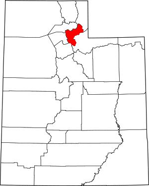 Map of Utah highlighting Morgan County | |
| CDPs | ||
| Unincorporated communities | ||
| Authority control |
|
|---|