Beaver County, Utah
Beaver County is a county in west central Utah, United States. As of the 2010 United States Census, the population was 6,629.[1] Its county seat and largest city is Beaver.[2] The county was named for the abundance of beavers in the area.
Beaver County | |
|---|---|
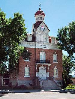 Old Beaver County courthouse. | |
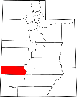 Location within the U.S. state of Utah | |
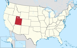 Utah's location within the U.S. | |
| Coordinates: 38.34°N 113.23°W | |
| Country | |
| State | |
| Founded | January 5, 1856 |
| Named for | North American beaver |
| Seat | Beaver |
| Largest city | Beaver |
| Area | |
| • Total | 2,592 sq mi (6,710 km2) |
| • Land | 2,590 sq mi (6,700 km2) |
| • Water | 2.1 sq mi (5 km2) 0.08% |
| Population (2010) | |
| • Total | 6,629 |
| • Estimate (2019) | 6,710 |
| • Density | 2.6/sq mi (0.99/km2) |
| Time zone | UTC−7 (Mountain) |
| • Summer (DST) | UTC−6 (MDT) |
| Congressional district | 2nd |
| Website | beaver |
History
European-descent explorers first visited present-day Beaver County in the 1776 Dominguez–Escalante Expedition. The proposed territory of Deseret (soon changed to Utah Territory) began with the arrival of Mormon pioneers in 1847. After the immediate Great Salt Lake City area was settled, settlers moved into more outlying areas, including the future Beaver County area. The county was created by the Utah territorial legislature from a section of Iron County on January 5, 1856, after the settlement of Beaver, Utah was flourishing. The county was named for the animal which was plentiful there.[3] The county boundary as delineated by that act included areas in present-day Colorado and Nevada. The defined boundary was altered on January 16, 1861 by creation of two counties in present Nevada. The county area was effectively reduced on February 28, 1861 by the US Congress, when it created Colorado Territory, taking all of the Beaver County area east of 109 degrees longitude. The county's boundary was enlarged on January 17, 1861 by addition of parcels from Millard, Sanpete, and St. Mary's counties. However, its west area was reduced by creation of the Nevada Territory on July 14, 1862 (this adjustment was altered on May 5, 1866 by action of the US Congress, effectively ceding all Beaver County area west of 114 degrees longitude to Nevada counties). The county area was also reduced on January 16, 1865, when Piute County was created from Beaver territory.[4]
Geography
Beaver County lies on the west side of Utah. Its west border abuts the east border of the state of Nevada. The west part of the county consists of low rolling hills, punctuated by isolated mountains. The east edge of the county runs to the crest of a north-south-running mountain ridge.[5] The terrain slopes to the west and north; its highest point is a mountain crest on its east border, at 12,011' (3661m) ASL.[6] The county has a total area of 2,592 square miles (6,710 km2), of which 2,590 square miles (6,700 km2) is land and 2.1 square miles (5.4 km2) (0.08%) is water.[7]
The Tushar Mountains lie on the eastern boundary of the county, reaching to 12,000 feet (3,700 m) in elevation, and providing water for the farming communities of Beaver and Manderfield. To the west, barren desert valleys typify the scenery, separated by mountains lightly forested with junipers.
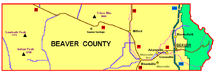
Adjacent counties
- Lincoln County, Nevada - west
- Millard County - north
- Sevier County - northeast
- Piute County - east
- Garfield County - southeast
- Iron County - south
Protected areas[5]
- Fishlake National Forest (part)
- Indian Peak State Game Management Area
- Minersville National Forest (part)
| Historical population | |||
|---|---|---|---|
| Census | Pop. | %± | |
| 1860 | 785 | — | |
| 1870 | 2,007 | 155.7% | |
| 1880 | 3,918 | 95.2% | |
| 1890 | 3,340 | −14.8% | |
| 1900 | 3,613 | 8.2% | |
| 1910 | 4,717 | 30.6% | |
| 1920 | 5,139 | 8.9% | |
| 1930 | 5,136 | −0.1% | |
| 1940 | 5,014 | −2.4% | |
| 1950 | 4,856 | −3.2% | |
| 1960 | 4,331 | −10.8% | |
| 1970 | 3,800 | −12.3% | |
| 1980 | 4,378 | 15.2% | |
| 1990 | 4,765 | 8.8% | |
| 2000 | 6,005 | 26.0% | |
| 2010 | 6,629 | 10.4% | |
| Est. 2019 | 6,710 | 1.2% | |
| US Decennial Census[8] 1790–1960[9] 1900–1990[10] 1990–2000[11] 2010–2018[1] 2019[12] | |||
Demographics
As of the 2010 United States Census, there were 6,629 people, 2,265 households, and 1,697 families in the county.[13] The population density was 2.56/sqmi (0.99/km²). There were 2,908 housing units at an average density of 1.12/sqmi (0.43/km²).[14] The racial makeup of the county was 89.0% white, 1.1% Asian, 1.1% American Indian, 0.3% Pacific islander, 0.2% black or African American, 6.9% from other races, and 1.4% from two or more races. Those of Hispanic or Latino origin made up 10.8% of the population.[13] In terms of ancestry, 35.2% were English, 15.5% were German, 10.6% were Irish, 6.8% were Scottish, and 2.3% were American.[15]
Of the 2,265 households, 41.8% had children under the age of 18 living with them, 63.2% were married couples living together, 7.2% had a female householder with no husband present, 25.1% were non-families, and 22.1% of all households were made up of individuals. The average household size was 2.92 and the average family size was 3.44. The median age was 31.9 years.[13]
The median income for a household in the county was $41,514 and the median income for a family was $46,426. Males had a median income of $40,167 versus $26,215 for females. The per capita income for the county was $16,131. About 12.6% of families and 17.9% of the population were below the poverty line, including 25.1% of those under age 18 and 15.3% of those age 65 or over.[16]
Politics
Beaver County voters have traditionally voted Republican. In no national election since 1964 has the county selected the Democratic Party candidate (as of 2016).
| Year | Republican | Democratic | Third parties |
|---|---|---|---|
| 2016 | 73.4% 1,838 | 10.5% 264 | 16.1% 403 |
| 2012 | 84.9% 2,174 | 13.5% 346 | 1.6% 40 |
| 2008 | 75.5% 1,902 | 21.5% 542 | 2.9% 74 |
| 2004 | 79.5% 2,023 | 19.4% 493 | 1.1% 28 |
| 2000 | 73.4% 1,653 | 24.0% 541 | 2.6% 58 |
| 1996 | 55.6% 1,164 | 32.8% 687 | 11.6% 243 |
| 1992 | 49.3% 1,040 | 31.6% 668 | 19.1% 403 |
| 1988 | 60.9% 1,286 | 38.6% 816 | 0.5% 10 |
| 1984 | 68.0% 1,516 | 31.7% 708 | 0.3% 7 |
| 1980 | 68.5% 1,477 | 28.8% 621 | 2.7% 59 |
| 1976 | 52.4% 1,088 | 46.4% 963 | 1.2% 25 |
| 1972 | 64.9% 1,332 | 33.2% 682 | 1.9% 39 |
| 1968 | 50.9% 989 | 40.9% 795 | 8.2% 160 |
| 1964 | 40.0% 792 | 60.0% 1,189 | |
| 1960 | 45.7% 971 | 54.4% 1,156 | |
| 1956 | 53.6% 1,190 | 46.4% 1,030 | |
| 1952 | 55.2% 1,277 | 44.8% 1,038 | |
| 1948 | 46.7% 1,057 | 52.6% 1,190 | 0.8% 17 |
| 1944 | 45.9% 958 | 54.0% 1,128 | 0.1% 2 |
| 1940 | 45.8% 1,101 | 54.2% 1,303 | 0.0% 1 |
| 1936 | 40.4% 913 | 59.1% 1,337 | 0.5% 11 |
| 1932 | 44.0% 969 | 55.3% 1,218 | 0.6% 14 |
| 1928 | 55.0% 1,149 | 44.8% 936 | 0.2% 5 |
| 1924 | 53.3% 989 | 31.2% 578 | 15.5% 287 |
| 1920 | 57.5% 1,056 | 40.3% 741 | 2.2% 40 |
| 1916 | 38.4% 842 | 58.8% 1,291 | 2.8% 61 |
| 1912 | 39.8% 671 | 35.7% 602 | 24.6% 415 |
| 1908 | 56.0% 945 | 42.3% 714 | 1.7% 28 |
| 1904 | 58.2% 869 | 39.7% 593 | 2.1% 32 |
| 1900 | 51.9% 682 | 47.9% 629 | 0.2% 3 |
| 1896 | 16.2% 205 | 83.8% 1,057 |
Communities

Cities
Towns
Unincorporated communities
- Adamsville
- Cook Corner
- Greenville
- Manderfield
- North Creek[5]
Former communities
- Arago City
- Blueacre
- Cunningham Hill
- Frisco
- Lincoln
- Murdock
- Newhouse
- Shauntie
- Shenandoah City
- Smyths
- Sulphurdale
- Three Creeks
- Upton
- Yellow Banks[5]
Recreation
- The American Discovery Trail traverses the county running through both Beaver and Milford.
- Elk Mountain is home to the Eagle Point Ski area.
- Rock Corral Recreation Area, an area of geologic interest managed by the BLM
See also
References
- Specific
- "State & County QuickFacts". United States Census Bureau. Archived from the original on July 7, 2011. Retrieved December 29, 2013.
- "Find a County". National Association of Counties. Archived from the original on July 4, 2012. Retrieved June 7, 2011.
- Van Cott, J. W., 1990, Utah Place Names, ISBN 0-87480-345-4
- Newberry Library. Individual County Chronologies - Beaver County UT (accessed March 25, 2019)
- Beaver County UT Google Maps (accessed 13 March 2019)
- ""Find an Altitude/Beaver County UT" Google Maps (accessed March 13, 2019)". Archived from the original on May 21, 2019. Retrieved March 14, 2019.
- "2010 Census Gazetteer Files". US Census Bureau. August 22, 2012. Retrieved March 27, 2015.
- "US Decennial Census". US Census Bureau. Retrieved March 27, 2015.
- "Historical Census Browser". University of Virginia Library. Retrieved March 27, 2015.
- Forstall, Richard L., ed. (March 27, 1995). "Population of Counties by Decennial Census: 1900 to 1990". US Census Bureau. Retrieved March 27, 2015.
- "Census 2000 PHC-T-4. Ranking Tables for Counties: 1990 and 2000" (PDF). US Census Bureau. April 2, 2001. Retrieved March 27, 2015.
- "QuickFacts. Beaver County, Utah". Retrieved May 17, 2020.
- "Profile of General Population and Housing Characteristics: 2010 Demographic Profile Data". US Census Bureau. Archived from the original on February 13, 2020. Retrieved January 23, 2016.
- "Population, Housing Units, Area, and Density: 2010 - County". US Census Bureau. Archived from the original on February 13, 2020. Retrieved January 23, 2016.
- "Selected Social Characteristics in the US – 2006-2010 American Community Survey 5-Year Estimate". US Census Bureau. Archived from the original on February 13, 2020. Retrieved January 23, 2016.
- "Selected Economic Characteristics – 2006-2010 American Community Survey 5-Year Estimates". US Census Bureau. Archived from the original on February 13, 2020. Retrieved January 23, 2016.
- Leip, David. "Atlas of US Presidential Elections". uselectionatlas.org. Retrieved March 30, 2018.
- General
- Murphy, Miriam B. (1994), "Beaver County", in Powell, Allan Kent (ed.), Utah History Encyclopedia, Salt Lake City UT: University of Utah Press, ISBN 0874804256, OCLC 30473917
External links
| Wikimedia Commons has media related to Beaver County, Utah. |
Places adjacent to Beaver County, Utah | |
|---|---|
Municipalities and communities of Beaver County, Utah, United States | ||
|---|---|---|
| Cities | Map of Utah highlighting Beaver County | |
| Town | ||
| Unincorporated communities | ||
| Ghost towns | ||
Salt Lake City (capital) | |||||||||||||
| Topics |
|  | |||||||||||
| Society |
| ||||||||||||
| Regions | |||||||||||||
| Largest cities |
| ||||||||||||
| Counties | |||||||||||||
| Attractions |
| ||||||||||||
| Authority control |
|
|---|