Roy, Utah
Roy is a city in Weber County, Utah, located on the west side of Interstate 15. The population estimate in 2019 was 39,613, a minimal increase of 5.8% from the official 2010 United States Census count of 36,884. It is part of the Ogden−Clearfield, Utah Metropolitan Statistical Area, and is considered a suburb of nearby Ogden, although some small businesses are present in Roy.
Roy, Utah | |
|---|---|
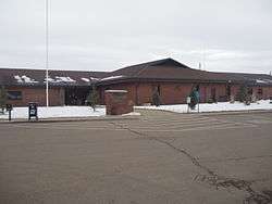 Roy Municipal Center | |
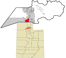 Location in Weber County and the state of Utah | |
| Coordinates: 41°10′14″N 112°2′55″W | |
| Country | United States |
| State | Utah |
| County | Weber |
| Settled | 1873 |
| Incorporated | March 10, 1937 |
| Named for | Roy Peebles |
| Government | |
| • Type | Mayor-council government |
| • Mayor | Robert E. Dandoy |
| • City Council | Jan Burrell, Bryon Saxton, Joe Paul, Dave Tafoya, Karlene Yeoman[1] |
| Area | |
| • Total | 8.14 sq mi (21.07 km2) |
| • Land | 8.13 sq mi (21.07 km2) |
| • Water | 0.00 sq mi (0.00 km2) |
| Elevation | 4,541 ft (1,384 m) |
| Population (2010) | |
| • Total | 36,884 |
| • Estimate (2019)[3] | 39,613 |
| • Density | 4,766.20/sq mi (1,840.27/km2) |
| Time zone | UTC-7 (Mountain (MST)) |
| • Summer (DST) | UTC-6 (MDT) |
| ZIP codes | 84067, 84401 |
| Area code(s) | 385, 801 |
| FIPS code | 49-65110[4] |
| GNIS feature ID | 1432035[5] |
| Website | Roy City |
History
Roy was settled in 1873 by William Evans Baker, twenty-five years after Ogden. Most of the communities to the east and south had been settled prior to that time. Previously known as Central City, Sandridge, the Basin, and Lakeview—Roy was ultimately named for a local school teacher's child, Roy C. Peebles, who had died. On May 24, 1894, a post office was established and Roy's name was made official.[6][7] The City of Roy was incorporated on March 10, 1937. Joseph William Jensen was the first mayor of Roy for 6 years, as elected by the commissioners.[8]
Businesses in Roy were limited until the early 1940s. A gas station, several grocery stores, a cafe, and a lumber yard made up the modest business district. However, Roy developed rapidly during World War II. Roy housed many of the workers and personnel from adjacent military installations, including Hill Air Force Base, the Navy Supply Depot (now the Freeport Center), and the Defense Supply Depot. September 1953 marked a milestone in Roy's history—Roy received a charter to establish the first branch bank in the state of Utah. This branch of the Bank of Utah pioneered the way for other banks to establish branches throughout the state. Norton Parker, son of Mayor Dean Parker, was the first manager of this new branch bank.
Roy's population growth was extreme in the 1950s and 1960s when most of the eastern bench was populated with entry-level homes. Starting in the 1980s, construction efforts shifted to the bottom of the hill on the west side of Roy, continuing until about 2005 when new real estate shifted west and south.[9]
Transportation
The city is served by Interstate 15 via exit 338, leading to Utah State Route 97 (5600 South), one of Roy's major roads. The northern entrance of Hill Air Force Base is accessible from this exit, making Roy a common destination for those in the military.
FrontRunner has a station in Roy that opened on April 26, 2008, along with the rest of the northern segment.[10] Two sets of train tracks bisect the city at 2700 West, being served by FrontRunner and Union Pacific Railroad.
Activities
Roy offers many activities and facilities for public use.[11]
Parks
- Roy West Park
- Emma Russell Park
- George E. Wahlen Park
- Municipal Park (adjoined with Municipal Elementary)
- Sand Ridge Park
- Foxglen Park
- McCall Park
- Frank Tremea (Roy) Park
- Sand Ridge Park
- Roger Phil Burnett Meadow Creek Pond
- Memorial Park
Recreation
The Roy City Recreation Complex is located on Roy High's campus. It includes a swimming pool, basketball courts, a weight room, racquetball courts, and an indoor track.[12] The Roy Aquatic Center is an outdoor swimming complex with a diving pool, children's pool and two slides.[13]
Roy Days
Roy Days is celebrated on the first week of August. Throughout the week, the Roy West Park is used as a hub for carnival activities and concessions, with events including a car show and golf tournament, culminating on the Saturday with a 5K run, parade, and fireworks show.[14]
Education
Roy is entirely encompassed by Weber School District. There are 6 elementary schools, 2 junior highs, and 1 high school.
Lakeview Elementary, Municipal Elementary, and Roy Elementary are located on the south side of Roy, and students are bound to Roy Junior High. Students of North Park Elementary, Valley View Elementary, and Midland Elementary attend Sand Ridge Junior High, although about one-quarter of Midland's populace is zoned to Roy Junior. All students plus those from West Haven Elementary attend Roy High School, a Region 6A high school
Schools
| School | Grades Served | City | Students | USBE Grade |
|---|---|---|---|---|
| Lakeview [15] | K-6 | Roy | 458 | Developing[16] |
| Municipal [17] | K-6 | Roy | 371 | Developing[18] |
| Roy [19] | K-6 | Roy | 523 | Developing[20] |
| Midland [21] | PK-6 | Roy | 551 | Typical[22] |
| North Park [23] | K-6 | Roy | 542 | Developing[24] |
| Valley View [25] | K-6 | Roy | 447 | Developing[26] |
| West Haven [27] | K-6 | West Haven | 680 | Typical[28] |
| Roy [29] | 7-9 | Roy | 924 | Developing[30] |
| Sand Ridge [31] | 7-9 | Roy | 883 | Developing[32] |
| Roy [33] | 10-12 | Roy | 1,754 | Developing[34] |
Geography
Roy is located at 41°10′14″N 112°02′55″W, and encompasses 7.6 square miles (19.7 square kilometers) of land and no natural water.[35] To the west is the city of Hooper, to the north is West Haven, to the east are Riverdale and Ogden, and the Davis County cities of Clinton and Sunset border Roy on its south.[36]
Climate
Roy is located in the Wasatch Front, an area that experiences variant seasonal temperatures and generally dry conditions. April or May is generally the wettest month, with July the driest. Yearly temperatures usually cap off at about 95–99 °F (35–37 °C), and yearly minimums are around 0–15 °F (−18 – −9 °C).
Under the Köppen climate classification, Roy has a Mediterranean climate (Csa) or dry-summer continental climate (Dsa) depending on which variant of the system is used.
| Climate data for Roy, Utah | |||||||||||||
|---|---|---|---|---|---|---|---|---|---|---|---|---|---|
| Month | Jan | Feb | Mar | Apr | May | Jun | Jul | Aug | Sep | Oct | Nov | Dec | Year |
| Record high °F (°C) | 63 (17) |
68 (20) |
78 (26) |
87 (31) |
96 (36) |
103 (39) |
108 (42) |
104 (40) |
100 (38) |
95 (35) |
75 (24) |
64 (18) |
108 (42) |
| Average high °F (°C) | 37 (3) |
43 (6) |
54 (12) |
64 (18) |
74 (23) |
84 (29) |
94 (34) |
92 (33) |
81 (27) |
66 (19) |
50 (10) |
38 (3) |
65 (18) |
| Daily mean °F (°C) | 27 (−3) |
32.8 (0.4) |
41.2 (5.1) |
50 (10) |
58.9 (14.9) |
67.6 (19.8) |
76 (24) |
73.8 (23.2) |
63.9 (17.7) |
52.4 (11.3) |
38.9 (3.8) |
30 (−1) |
51 (11) |
| Average low °F (°C) | 19 (−7) |
23 (−5) |
32 (0) |
38 (3) |
46 (8) |
54 (12) |
61 (16) |
59 (15) |
49 (9) |
39 (4) |
29 (−2) |
21 (−6) |
39 (4) |
| Record low °F (°C) | −26 (−32) |
−21 (−29) |
4 (−16) |
5 (−15) |
25 (−4) |
32 (0) |
39 (4) |
35 (2) |
28 (−2) |
18 (−8) |
−14 (−26) |
−18 (−28) |
−26 (−32) |
| Average precipitation inches (mm) | 1.78 (45) |
1.68 (43) |
1.84 (47) |
1.88 (48) |
2.06 (52) |
1.32 (34) |
0.58 (15) |
0.74 (19) |
1.37 (35) |
1.85 (47) |
1.67 (42) |
1.65 (42) |
18.42 (468) |
| Source: weather.com[37] | |||||||||||||
Demographics
| Historical population | |||
|---|---|---|---|
| Census | Pop. | %± | |
| 1900 | 183 | — | |
| 1910 | 447 | 144.3% | |
| 1920 | 558 | 24.8% | |
| 1930 | 670 | 20.1% | |
| 1940 | 868 | 29.6% | |
| 1950 | 3,723 | 328.9% | |
| 1960 | 9,239 | 148.2% | |
| 1970 | 14,356 | 55.4% | |
| 1980 | 19,694 | 37.2% | |
| 1990 | 24,603 | 24.9% | |
| 2000 | 32,885 | 33.7% | |
| 2010 | 36,884 | 12.2% | |
| Est. 2019 | 39,613 | [3] | 7.4% |
| U.S. Decennial Census[38] | |||
As of the census[4] of 2010, there were 36,884 people, 10,689 households, and 8,604 families residing in the city. The population density was 4,853 people per square mile (1,872/km2). There were 11,053 housing units at an average density of 1,455.3 per square mile (561.5/km2). The racial makeup of the city was 90.75% White, 1.16% African American, 0.59% Native American, 1.79% Asian, 0.11% Pacific Islander, 3.64% from other races, and 1.96% from two or more races. Hispanic or Latino of any race were 7.68% of the population.
There were 10,689 households out of which 46.5% had children under the age of 18 living with them, 65.8% were married couples living together, 10.3% had a female householder with no husband present, and 19.5% were non-families. 15.8% of all households were made up of individuals and 5.8% had someone living alone who was 65 years of age or older. The average household size was 3.06 and the average family size was 3.43.
In the city, the population was spread out with 33.5% under the age of 18, 11.6% from 18 to 24, 30.6% from 25 to 44, 16.1% from 45 to 64, and 8.3% who were 65 years of age or older. The median age was 28 years. For every 100 females, there were 97.9 males. For every 100 females age 18 and over, there were 94.7 males.
The median income for a household in the city was $49,611, and the median income for a family was $53,763. Males had a median income of $37,286 versus $23,793 for females. The per capita income for the city was $17,794. About 4.2% of families and 5.5% of the population were below the poverty line, including 7.5% of those under age 18 and 1.9% of those age 65 or over.
Notable people
- Jim McMahon, the quarterback who led the Chicago Bears to victory in Super Bowl XX over the New England Patriots.[39]
- Bill Schuffenhauer, a three time Olympian and silver medalist in the bobsleigh with the United States Olympics team.[40]
- Randal Quarles, former Under Secretary of the Treasury and Executive Director of the International Monetary Fund.
- Sabra Johnson, So You Think You Can Dance season 3 winner resided in Roy before moving to New York, New York to pursue her dancing career.
- Cynthia Brimhall, Playboy Playmate and actress graduated from Roy High School in 1982.
- Gina Barberi, famous Radio DJ and co-host of Salt Lake City, Utah's KXRK 96.3FM "Radio from Hell" show.
- L'Wren Scott, a fashion designer and partner of Mick Jagger.
See also
- List of cities and towns in Utah
References
- "City Council". Roy, Utah. Retrieved 2018-08-18.
- "2018 U.S. Gazetteer Files". United States Census Bureau. Retrieved Feb 16, 2020.
- "Population and Housing Unit Estimates". Retrieved May 21, 2020.
- "U.S. Census website". United States Census Bureau. Retrieved 2008-01-31.
- "US Board on Geographic Names". United States Geological Survey. 2007-10-25. Retrieved 2008-01-31.
- Russell, Emma; Wiberg, Beverly (March 18, 2001). "Utah History Encyclopedia". web.archive.org. Archived from the original on August 3, 2012. Retrieved August 3, 2019.
- "Roy, Utah Genealogy - FamilySearch Wiki". www.familysearch.org. Retrieved August 3, 2019.
- "Roy City Mayor Biographies - Roy City". www.royutah.org. Retrieved 2015-10-19.
- "Weber County Locations". Ivory Homes. April 12, 2001. Archived from the original on April 12, 2001. Retrieved August 3, 2019.
- "FrontRunner". Utah Transit Authority. Retrieved August 3, 2019.
- "Facilities". Roy City. Retrieved August 3, 2019.
- "Recreation Complex". Roy City. Retrieved August 3, 2019.
- "Aquatic Center". Roy City. Retrieved August 3, 2019.
- "roy days". Roy City - Roy Days. August 1, 2019. Retrieved August 3, 2019.
- "Lakeview Elementary". Retrieved October 7, 2017.
- "LAKEVIEW SCHOOL". Utah School Grades. July 1, 2019. Retrieved August 3, 2019.
- "Municipal Elementary". Retrieved October 7, 2017.
- "MUNICIPAL SCHOOL". Utah School Grades. July 1, 2019. Retrieved August 3, 2019.
- "Roy Elementary". Retrieved October 7, 2017.
- "ROY SCHOOL". Utah School Grades. Retrieved August 3, 2019.
- "Midland Elementary". Retrieved October 7, 2017.
- "MIDLAND SCHOOL". Utah School Grades. July 1, 2019. Retrieved August 3, 2019.
- "North Park Elementary". Retrieved October 7, 2017.
- "NORTH PARK SCHOOL". Utah School Grades. July 1, 2019. Retrieved August 3, 2019.
- "Valley View Elementary". Retrieved October 7, 2017.
- "VALLEY VIEW SCHOOL". Utah School Grades. July 1, 2019. Retrieved August 3, 2019.
- "West Haven Elementary". Weber School District. Retrieved October 7, 2017.
- "WEST HAVEN SCHOOL". Utah School Grades. July 1, 2019. Retrieved August 3, 2019.
- "Roy Jr. High School". Weber School District. Retrieved August 3, 2019.
- "ROY JR HIGH". Utah School Grades. July 1, 2019. Retrieved August 3, 2019.
- "Sand Ridge Jr. High School". Weber School District. Retrieved August 3, 2019.
- "SAND RIDGE JR HIGH". Utah School Grades. July 1, 2019. Retrieved August 3, 2019.
- "Roy High School". Weber School District. Retrieved August 3, 2019.
- "ROY HIGH". Utah School Grades. July 1, 2019. Retrieved August 3, 2019.
- "US Gazetteer files: 2010, 2000, and 1990". United States Census Bureau. 2011-02-12. Retrieved 2011-04-23.
- "ArcGIS - Utah Municipalities and Metro Townships Boundaries". ArcGIS. October 20, 2017. Retrieved August 3, 2019.
- "Monthly Averages for Roy, Utah". The Weather Channel.
- "Census of Population and Housing". Census.gov. Retrieved June 4, 2015.
- Judd, Brandon (January 24, 2016). "Utah high schoolers who've reached the Super Bowl". Deseret News. Retrieved August 3, 2019.
- Francis, Janae (April 28, 2018). "Former homeless boy turned Olympian joins Lantern House staff". Standard Examiner. Retrieved August 3, 2019.
External links
| Wikimedia Commons has media related to Roy, Utah. |
Places adjacent to Roy, Utah | |
|---|---|
Municipalities and communities of Weber County, Utah, United States | ||
|---|---|---|
| Cities |  Map of Utah highlighting Weber County | |
| Town | ||
| CDPs | ||
| Unincorporated communities | ||
| Authority control |
|
|---|