Sevier County, Utah
Sevier County (/sɛˈvɪər/ sə-VEER) is a county in Utah, United States. As of the 2010 United States Census, the population was 20,802.[1] Its county seat and largest city is Richfield.[2]
Sevier County | |
|---|---|
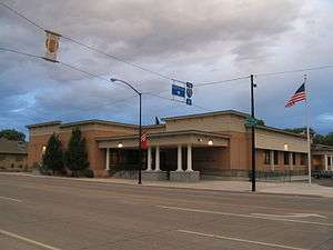 Sevier County Courthouse in Richfield | |
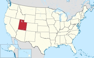
 Location within the U.S. state of Utah | |
 Utah's location within the U.S. | |
| Coordinates: 38.75°N 111.80°W | |
| Country | |
| State | |
| Founded | January 16, 1865 |
| Named for | Sevier River |
| Seat | Richfield |
| Largest city | Richfield |
| Area | |
| • Total | 1,918 sq mi (4,970 km2) |
| • Land | 1,911 sq mi (4,950 km2) |
| • Water | 7.8 sq mi (20 km2) 0.4% |
| Population (2010) | |
| • Total | 20,802 |
| • Estimate (2019) | 21,620 |
| • Density | 11.3/sq mi (4.4/km2) |
| Time zone | UTC−7 (Mountain) |
| • Summer (DST) | UTC−6 (MDT) |
| Congressional district | 2nd |
| Website | www |
History
Evidence of indigenous peoples residing in the Sevier County up to 5,000 BP has been unearthed.[3] The Fremont culture of Native Americans occupied the area from about 2000 to 700 BP.[4] The Clear Creek site contains native petroglyphs from that period.
In Utah, the Numic- (or Shoshonean) speaking peoples of the Uto-Aztecan language family evolved into four distinct groups in the historic period: the Northern Shoshone, Goshute or Western Shoshone, Southern Paiute, and Ute peoples. The central and eastern sections of this territory were occupied primarily by various bands of the Ute.[5]
The first European-based persons to see the Sevier River were most likely Catholic fathers Silvestre Vélez de Escalante and Francisco Atanasio Domínguez, on their expedition to California in 1776.[6] The Old Spanish Trail was the route they mapped. Over the next century this trail carried fur trappers, hunters, government officials, and settlers.
Permanent colonization of this area began when Richfield was first settled. Mormon settlers arrived on June 15, 1864, most of whom had emigrated from Scandinavian countries. Because of the growth in this small community, the people soon petitioned Utah Territory officials about a separate county.[7]
On January 16, 1865 the Utah Territory legislature created the county, with area annexed from Sanpete County. It was named for the Sevier River.[8] The county seat was Big Spring (later named Richfield). The county borders were adjusted in 1866, in 1880, in 1890, and in 1921. A clarification of boundary lines corresponding to government survey lines was completed in 1931, marking the present configuration of Sevier County.[9]
Although the county was in place by 1865, much of Sevier County was abandoned in the Black Hawk War in 1867. Attempts to resettle the area were not successful until 1870. By 1874, 753 residents lived in the area.[10]
Geography
Sevier County terrain consists of semi-arid but arable rolling areas, punctuated by northeast-southwest oriented mountain ridges, usually forested.[11] The highest point is Fish Lake Hightop in the Central Utah Plateau, at 11,633' (3546m) ASL.[12] The county has a total area of 1,918 square miles (4,970 km2), of which 1,911 square miles (4,950 km2) is land and 7.8 square miles (20 km2) (0.4%) is water.[13]
Adjacent counties
- Sanpete County - north
- Emery County - east
- Wayne County - southeast
- Piute County - south
- Beaver County - southwest
- Millard County - west
Protected areas
- Capitol Reef National Park (part)
- Fishlake National Forest (part)
- Fremont Indian State Park and Museum
- Koosharem Reservoir Recreation Site
- Manti-La Sal National Forest (part)
- Sand Ledges Recreation Area
- Willow Creek Wildlife Management Area
Lakes
- Annabella Reservoir
- Big Lake
- Deep Lake
- Fish Lake
- Forsyth Reservoir
- Johnson Valley Reservoir
- Koosharem Reservoir
- Paradise Valley Lake
- Redmond Lake
- Rocky Ford Reservoir
- Three Creeks Reservoir
- Willow Creek Reservoir
Demographics
| Historical population | |||
|---|---|---|---|
| Census | Pop. | %± | |
| 1870 | 19 | — | |
| 1880 | 4,457 | 23,357.9% | |
| 1890 | 6,199 | 39.1% | |
| 1900 | 8,451 | 36.3% | |
| 1910 | 9,775 | 15.7% | |
| 1920 | 11,281 | 15.4% | |
| 1930 | 11,199 | −0.7% | |
| 1940 | 12,112 | 8.2% | |
| 1950 | 12,072 | −0.3% | |
| 1960 | 10,565 | −12.5% | |
| 1970 | 10,103 | −4.4% | |
| 1980 | 14,727 | 45.8% | |
| 1990 | 15,431 | 4.8% | |
| 2000 | 18,842 | 22.1% | |
| 2010 | 20,802 | 10.4% | |
| Est. 2019 | 21,620 | 3.9% | |
| US Decennial Census[14] 1790–1960[15] 1900–1990[16] 1990–2000[17] 2010–2018[1] 2019[18] | |||
As of the 2000 United States Census, there were 18,842 people, 6,081 households, and 4,907 families in the county. The population density was 9.86/sqmi (3.81/km²). There were 7,016 housing units at an average density of 3.67/sqmi (1.42/km²). The racial makeup of the county was 95.61% White, 0.27% Black or African American, 2.00% Native American, 0.26% Asian, 0.09% Pacific Islander, 0.79% from other races, and 0.99% from two or more races. 2.55% of the population were Hispanic or Latino of any race.
There were 6,081 households out of which 43.00% had children under the age of 18 living with them, 70.10% were married couples living together, 7.80% had a female householder with no husband present, and 19.30% were non-families. Of the 6,081 households in Sevier County, 155 are unmarried partner households: 137 heterosexual, 11 same-sex male, and 7 same-sex female. 17.60% of all households were made up of individuals and 9.40% had someone living alone who was 65 years of age or older. The average household size was 3.03 and the average family size was 3.44.
The county population contained 34.50% under the age of 18, 10.10% from 18 to 24, 22.90% from 25 to 44, 19.70% from 45 to 64, and 12.90% who were 65 years of age or older. The median age was 30 years. For every 100 females there were 99.20 males. For every 100 females age 18 and over, there were 97.40 males.
The median income for a household in the county was $35,822, and the median income for a family was $40,110. Males had a median income of $32,632 versus $19,228 for females. The per capita income for the county was $14,180. About 8.30% of families and 10.80% of the population were below the poverty line, including 12.80% of those under age 18 and 8.50% of those age 65 or over.
Features
Interstate 70 runs through the county. As Richfield is about halfway between the major cities of Los Angeles, California and Denver, Colorado, it has built a hospitality industry, with motels and restaurants serving travelers.
Fremont Indian State Park is found in the Clear Creek Canyon, adjacent to I-70. It is noted for its archaeological remains from the ancient Native American Fremont culture. Its museum displays found artifacts.
Politics
Sevier County is traditionally Republican. In no national election since 1936 has the county selected the Democratic Party candidate (as of 2016).
| Year | Republican | Democratic | Third parties |
|---|---|---|---|
| 2016 | 77.9% 6,740 | 8.0% 695 | 14.1% 1,219 |
| 2012 | 89.3% 7,207 | 9.2% 738 | 1.5% 124 |
| 2008 | 79.4% 6,394 | 16.9% 1,359 | 3.8% 305 |
| 2004 | 86.3% 6,597 | 12.0% 920 | 1.6% 124 |
| 2000 | 81.4% 5,763 | 14.8% 1,046 | 3.8% 268 |
| 1996 | 65.8% 4,031 | 21.7% 1,327 | 12.6% 769 |
| 1992 | 50.5% 3,160 | 16.6% 1,039 | 32.9% 2,059 |
| 1988 | 76.3% 4,747 | 22.6% 1,403 | 1.1% 71 |
| 1984 | 83.5% 5,736 | 15.6% 1,072 | 0.9% 62 |
| 1980 | 80.8% 5,614 | 16.0% 1,112 | 3.2% 223 |
| 1976 | 65.2% 3,686 | 27.7% 1,564 | 7.1% 400 |
| 1972 | 73.0% 3,700 | 16.2% 820 | 10.9% 551 |
| 1968 | 67.2% 3,190 | 24.6% 1,167 | 8.2% 387 |
| 1964 | 57.3% 2,617 | 42.7% 1,948 | |
| 1960 | 65.2% 3,166 | 34.8% 1,690 | 0.0% 1 |
| 1956 | 74.7% 3,646 | 25.3% 1,232 | |
| 1952 | 73.4% 3,996 | 26.6% 1,445 | |
| 1948 | 58.8% 2,791 | 40.9% 1,943 | 0.3% 16 |
| 1944 | 52.8% 2,345 | 47.1% 2,095 | 0.1% 5 |
| 1940 | 51.7% 2,703 | 48.2% 2,521 | 0.1% 4 |
| 1936 | 39.8% 1,899 | 59.1% 2,816 | 1.1% 52 |
| 1932 | 48.4% 2,225 | 50.1% 2,303 | 1.4% 65 |
| 1928 | 63.1% 2,424 | 36.4% 1,399 | 0.4% 17 |
| 1924 | 56.4% 2,111 | 32.1% 1,201 | 11.4% 428 |
| 1920 | 62.8% 2,506 | 35.7% 1,425 | 1.4% 57 |
| 1916 | 44.8% 1,720 | 53.4% 2,052 | 1.8% 68 |
| 1912 | 41.9% 1,452 | 26.4% 915 | 31.7% 1,098 |
| 1908 | 54.9% 1,780 | 39.3% 1,272 | 5.8% 188 |
| 1904 | 59.1% 1,725 | 31.9% 930 | 9.0% 264 |
| 1900 | 54.8% 1,581 | 43.7% 1,261 | 1.5% 42 |
| 1896 | 21.1% 497 | 78.9% 1,858 |
Communities

References
- "State & County QuickFacts". United States Census Bureau. Retrieved December 29, 2013.
- "Find a County". National Association of Counties. Retrieved June 7, 2011.
- Excavations for US Interstate I-70 in the 1980s produced archaeologic data dating back 5,000 years.
- Snow, Dean R. (2009). Archaeology of Native North America. Prentice Hall ISBN 0-13-615686-X.
- David Rich Lewis, "Native Americans in Utah", Utah History Encyclopedia (accessed December 6, 2016)
- The Spanish Catholic clerics traveled the Great Basin to find a reported river to the Pacific Ocean. In this area they only found a turbulent ("severo") river that flowed northward to Yuba Lake. Thus the name "Sevier".
- Bishop, M. Guy. A History of Sevier County. Salt Lake City: Utah State Historical Society, 1997.
- Van Cott, J. W., 1990, Utah Place Names, ISBN 0-87480-345-4
- Individual County Chronologies/Sevier County UT Newberry Library (accessed March 29, 2019)
- "History of Sevier County" Sevier County website (accessed 29 March 2019)
- Sevier County UT Google Maps (accessed 29 March 2019)
- Utah County High Points/Sevier County. Peakbaggers (accessed 29 March 2019)
- "2010 Census Gazetteer Files". US Census Bureau. August 22, 2012. Retrieved June 25, 2015.
- "US Decennial Census". US Census Bureau. Retrieved June 25, 2015.
- "Historical Census Browser". University of Virginia Library. Retrieved June 25, 2015.
- Forstall, Richard L., ed. (June 25, 1995). "Population of Counties by Decennial Census: 1900 to 1990". US Census Bureau. Retrieved March 27, 2015.
- "Census 2000 PHC-T-4. Ranking Tables for Counties: 1990 and 2000" (PDF). US Census Bureau. April 2, 2001. Retrieved June 25, 2015.
- "QuickFacts. Utah counties". Retrieved May 17, 2020.
- Leip, David. "Atlas of US Presidential Elections". uselectionatlas.org. Retrieved March 31, 2018.
External links
| Wikimedia Commons has media related to Sevier County, Utah. |
Places adjacent to Sevier County, Utah | |
|---|---|
Municipalities and communities of Sevier County, Utah, United States | ||
|---|---|---|
| Cities | Map of Utah highlighting Sevier County | |
| Towns | ||
| Unincorporated communities | ||
| Ghost town | ||
| Indian reservation | ||
| Footnotes | ‡This populated place also has portions in an adjacent county or counties | |
Salt Lake City (capital) | |||||||||||||
| Topics |
|  | |||||||||||
| Society |
| ||||||||||||
| Regions | |||||||||||||
| Largest cities |
| ||||||||||||
| Counties | |||||||||||||
| Attractions |
| ||||||||||||
| Authority control |
|
|---|