Duchesne County, Utah
Duchesne County (/duːˈʃeɪn/ doo-SHAYN) is a county in the northeast part of the U.S. state of Utah. As of the 2010 United States Census, the population was 18,607.[1] Its county seat is Duchesne,[2] and the largest city is Roosevelt.
Duchesne County | |
|---|---|
 Duchesne County Courthouse in Duchesne | |
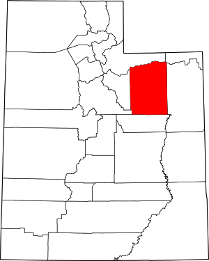 Location within the U.S. state of Utah | |
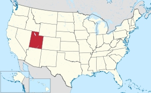 Utah's location within the U.S. | |
| Coordinates: 40°17′N 110°26′W | |
| Country | |
| State | |
| Founded | January 4, 1915 (proclaimed in effect) |
| Named for | Duchesne River |
| Seat | Duchesne |
| Largest city | Roosevelt |
| Area | |
| • Total | 3,256 sq mi (8,430 km2) |
| • Land | 3,241 sq mi (8,390 km2) |
| • Water | 15 sq mi (40 km2) 0.50% |
| Population (2010) | |
| • Total | 18,607 |
| • Estimate (2019) | 19,938 |
| • Density | 6.1/sq mi (2.4/km2) |
| Time zone | UTC−7 (Mountain) |
| • Summer (DST) | UTC−6 (MDT) |
| Congressional district | 1st |
| Website | duchesne |
History
Much of Duchesne County was part of the Uintah Reservation, created 1861 by US President Abraham Lincoln as a permanent home of the Uintah and White River Utes. Later the Uncompahgre Utes were moved to the Uintah and newly created Uncompahgre Indian reservations from western Colorado. At the turn of the century under the Dawes Act, both Indian reservations were thrown open to homesteaders. This was done after allotments of land were made to Indians of the three tribes. The homesteading process was opened on the Uintah on August 27, 1905.
Unlike much of the rest of Utah Territory, settlement of the future Duchesne County area did not occur due to LDS Church pressures. It was settled by individuals who obtained 160 acres under the federal Homestead Act. Homesteaders were required to prove that they intended to farm the land. After five years of living on the land, making improvements, and paying $1.25 per acre, homesteaders were given title to their homesteads.[3]
On July 13, 1914 a referendum was presented to voters of Wasatch County to partition the eastern part into a separate county. The referendum passed, so Utah Governor William Spry issued a proclamation to take effect on January 4, 1915. The county seat was decided by county vote in November 5, 1914 election. The new county was named for its county seat, which in turn was called for the Duchesne River which flows southward and then eastward through the central part of the county near the city. Its name is of uncertain origin, but the holding theory is that it was named by fur trappers in the 1820s in honor of Mother Rose Philippine Duchesne, founder of the School of the Sacred Heart near St. Louis, Missouri, although other theories as to the name exist.[4] The county boundary with Uintah County was adjusted by legislative act on March 5, 1917; Duchesne County boundaries have remained in their current configuration since that date.[5]
Geography
Duchesne County terrain is semi-arid, rough and scarred with drainages. The Duchesne River drains the central part of the county.[6] The county generally slopes to the south and east.[7] The county has a total area of 3,256 square miles (8,430 km2), of which 3,241 square miles (8,390 km2) is land and 15 square miles (39 km2) (0.5%) is water.[8] The northern part of the county contains much of the east-west oriented Uinta Mountains. The highest natural point in Utah, Kings Peak at 13,528 feet (4,123 m), is located in Duchesne County.
Adjacent counties
- Summit County - north
- Daggett County - northeast
- Uintah County - east
- Carbon County - south
- Utah County - southwest
- Wasatch County - west
Protected areas[6]
- Ashley National Forest (part)
- Big Sand State Park
- Currant Creek Wildlife Management Area
- High Uintas Wilderness (part)
- Red Creek Wildlife Management Area
- Skitzy Wildlife Management Area
- Starvation State Park
- Wasatch-Cache National Forest (part)
Lakes[6]
- Big Sand Wash Reservoir
- Cedar View Reservoir
- Chepeta Lake
- Crater Lake
- Daynes Lake
- Grandaddy Lake
- Kidney Lake
- Lake Atwood
- Mirror Lake
- Moon Lake
- Starvation Reservoir
- Upper Stillwater Reservoir
Demographics
| Historical population | |||
|---|---|---|---|
| Census | Pop. | %± | |
| 1920 | 9,093 | — | |
| 1930 | 8,263 | −9.1% | |
| 1940 | 8,958 | 8.4% | |
| 1950 | 8,134 | −9.2% | |
| 1960 | 7,179 | −11.7% | |
| 1970 | 7,299 | 1.7% | |
| 1980 | 12,565 | 72.1% | |
| 1990 | 12,645 | 0.6% | |
| 2000 | 14,371 | 13.6% | |
| 2010 | 18,607 | 29.5% | |
| Est. 2019 | 19,938 | 7.2% | |
| US Decennial Census[9] 1790–1960[10] 1900–1990[11] 1990–2000[12] 2010–2018[1] 2019[13] | |||
As of the 2010 United States Census, there were 18,607 people, 6,003 households, and 4,703 families in the county. The population density was 5.74/sqmi (2.22/km²). There were 6,988 housing units at an average density of 2.16/sqmi (0.83/km²). The racial makeup of the county was 89.15% White, 0.24% Black or African American, 4.53% Native American, 0.28% Asian, 0.27% Pacific Islander, 2.64% from other races, and 2.89% from two or more races. 6.00% of the population were Hispanic or Latino of any race.[14]
There were 6,003 households out of which 40.23% had children under the age of 18 living with them, 64.72% were married couples living together, 8.65% had a female householder with no husband present, and 21.66% were non-families. 45.0% of all households had individuals under 18 and 22.6% had someone living alone who was 65 years of age or older. The average household size was 3.05 and the average family size was 3.47.
The county population contained 33.91% under the age of 18, 6.56% from 20 to 24, 25.38% from 25 to 44, 20.92% from 45 to 64, and 10.66% who were 65 years of age or older. The median age was 29.7 years. For every 100 females there were 102.80 males. For every 100 females age 18 and over, there were 100.00 males.
The median income for a household in the county was $31,298, and the median income for a family was $35,350. Males had a median income of $31,988 versus $19,692 for females. The per capita income for the county was $12,326. About 14.20% of families and 16.80% of the population were below the poverty line, including 19.60% of those under age 18 and 12.40% of those age 65 or over.
Government
- Clair Poulson, West Side Precinct Justice Court Judge
- Travis Tucker, Sheriff
- JoAnn Evans, County Clerk-Auditor
Duchesne County voters are traditionally Republican. In no national election since 1964 has the county selected the Democratic Party candidate (as of 2016).
| Year | Republican | Democratic | Third parties |
|---|---|---|---|
| 2016 | 78.8% 5,508 | 7.2% 500 | 14.0% 980 |
| 2012 | 89.3% 5,698 | 9.1% 581 | 1.6% 100 |
| 2008 | 81.2% 4,689 | 15.8% 911 | 3.0% 172 |
| 2004 | 85.4% 4,742 | 13.3% 738 | 1.4% 76 |
| 2000 | 79.7% 3,622 | 17.1% 779 | 3.2% 145 |
| 1996 | 63.7% 2,648 | 21.5% 892 | 14.9% 619 |
| 1992 | 43.4% 1,983 | 16.9% 772 | 39.7% 1,810 |
| 1988 | 70.8% 3,118 | 27.9% 1,227 | 1.3% 58 |
| 1984 | 85.2% 4,437 | 14.3% 746 | 0.5% 27 |
| 1980 | 79.4% 3,827 | 17.7% 854 | 2.9% 138 |
| 1976 | 65.8% 2,619 | 27.9% 1,110 | 6.4% 253 |
| 1972 | 70.5% 2,183 | 20.3% 629 | 9.2% 285 |
| 1968 | 61.2% 1,733 | 30.3% 858 | 8.6% 243 |
| 1964 | 48.7% 1,251 | 51.3% 1,320 | |
| 1960 | 57.0% 1,546 | 43.0% 1,166 | 0.0% 1 |
| 1956 | 68.0% 1,856 | 32.0% 874 | |
| 1952 | 61.3% 1,969 | 38.7% 1,242 | |
| 1948 | 44.1% 1,266 | 55.3% 1,588 | 0.6% 16 |
| 1944 | 41.2% 1,140 | 58.8% 1,629 | |
| 1940 | 40.0% 1,322 | 59.9% 1,982 | 0.1% 4 |
| 1936 | 34.7% 1,070 | 63.9% 1,970 | 1.5% 45 |
| 1932 | 43.4% 1,333 | 51.8% 1,590 | 4.9% 149 |
| 1928 | 63.5% 1,585 | 36.0% 899 | 0.5% 13 |
| 1924 | 57.6% 1,277 | 33.0% 731 | 9.4% 209 |
| 1920 | 61.8% 1,523 | 33.3% 822 | 4.9% 121 |
| 1916 | 27.0% 687 | 56.6% 1,443 | 16.4% 419 |
Communities
Unincorporated communities[6]
- Altonah
- Arcadia
- Bridgeland
- Fruitland
- Hanna
- Mountain Home
- Strawberry
- Talmage
- Upalco
- Utahn
See also
References
- "State & County QuickFacts". United States Census Bureau. Archived from the original on June 6, 2011. Retrieved December 29, 2013.
- "Find a County". National Association of Counties. Archived from the original on July 4, 2012. Retrieved June 7, 2011.
- Duchesne County History (accessed 29 March 2019)
- Van Cott, John W. (1990). Utah Place Names: A Comprehensive Guide to the Origins of Geographic Names: A Compilation. Salt Lake City: University of Utah Press. pp. 117–18. ISBN 978-0-87480-345-7. OCLC 797284427. Retrieved March 18, 2018.
- Individual County Chronicles/Duchesne County UT. Newberry Library (accessed March 29, 2019)
- Duchesne County UT Google Maps (accessed 29 March 2019)
- ""Find an Altitude/Duchesne County UT" Google Maps (accessed 29 March 2019)". Archived from the original on May 21, 2019. Retrieved March 30, 2019.
- "2010 Census Gazetteer Files". US Census Bureau. August 22, 2012. Retrieved March 27, 2015.
- "US Decennial Census". US Census Bureau. Retrieved March 27, 2015.
- "Historical Census Browser". University of Virginia Library. Retrieved March 27, 2015.
- Forstall, Richard L., ed. (March 27, 1995). "Population of Counties by Decennial Census: 1900 to 1990". US Census Bureau. Retrieved March 27, 2015.
- "Census 2000 PHC-T-4. Ranking Tables for Counties: 1990 and 2000" (PDF). US Census Bureau. April 2, 2001. Retrieved March 27, 2015.
- "QuickFacts. Utah counties". Retrieved May 17, 2020.
- "2010 Census Interactive Population Search". Archived from the original on June 14, 2012.
- "Archived copy". Archived from the original on February 13, 2020. Retrieved March 4, 2017.CS1 maint: archived copy as title (link)
- Leip, David. "Atlas of US Presidential Elections". uselectionatlas.org. Retrieved March 31, 2018.
External links
| Wikimedia Commons has media related to Duchesne County, Utah. |
Places adjacent to Duchesne County, Utah | ||||||||||
|---|---|---|---|---|---|---|---|---|---|---|
| ||||||||||
Municipalities and communities of Duchesne County, Utah, United States | ||
|---|---|---|
| Cities | Map of Utah highlighting Duchesne County | |
| Towns | ||
| CDPs | ||
| Unincorporated communities | ||
| Indian reservation | ||
| Ghost town | ||
| Footnotes | ‡This populated place also has portions in an adjacent county or counties | |
Salt Lake City (capital) | |||||||||||||
| Topics |
|  | |||||||||||
| Society |
| ||||||||||||
| Regions | |||||||||||||
| Largest cities |
| ||||||||||||
| Counties | |||||||||||||
| Attractions |
| ||||||||||||
| Authority control |
|
|---|