Epsom, New Hampshire
Epsom is a town in Merrimack County, New Hampshire, United States. The population was 4,566 at the 2010 census.[1]
Epsom, New Hampshire | |
|---|---|
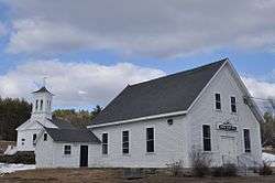 Town Hall | |
 Seal | |
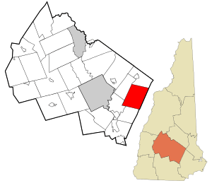 Location in Merrimack County and the state of New Hampshire | |
| Coordinates: 43°13′21″N 71°19′57″W | |
| Country | United States |
| State | New Hampshire |
| County | Merrimack |
| Incorporated | 1727 |
| Villages | Epsom Gossville Short Falls |
| Government | |
| • Board of Selectmen | Hugh A. Curley III, Chair Virginia Drew Cheryl Gilpatrick |
| Area | |
| • Total | 34.4 sq mi (89.0 km2) |
| • Land | 34.2 sq mi (88.5 km2) |
| • Water | 0.2 sq mi (0.5 km2) 0.58% |
| Elevation | 404 ft (123 m) |
| Population (2010) | |
| • Total | 4,566 |
| • Density | 130/sq mi (51/km2) |
| Time zone | UTC-5 (Eastern) |
| • Summer (DST) | UTC-4 (Eastern) |
| ZIP code | 03234 |
| Area code(s) | 603 |
| FIPS code | 33-24900 |
| GNIS feature ID | 0873592 |
| Website | www |
History
Incorporated in 1727, Epsom takes its name from Epsom in Surrey, England.[2] Although dotted with several small mountains, the land was suitable for grazing and growing grain. By 1859, when the town's population was 1,366, it had two gristmills and two sawmills.[3]
Geography
According to the United States Census Bureau, the town has a total area of 34.4 square miles (89 km2), of which 34.2 sq mi (89 km2) is land and 0.2 sq mi (52 ha) is water, comprising 0.58% of the town. The highest point in Epsom is the summit of Fort Mountain, at 1,413 feet (431 m) above sea level, in the eastern part of town. Other neighboring small mountains in town include McCoy Mountain (1,270 ft or 390 m) and Nats Mountain (1,180 ft or 360 m). The town is drained by the Suncook River. Epsom lies fully within the Merrimack River watershed.[4]
Adjacent municipalities
- Pittsfield, New Hampshire (north)
- Northwood, New Hampshire (northeast)
- Deerfield, New Hampshire (east)
- Allenstown, New Hampshire (south)
- Pembroke, New Hampshire (southwest)
- Chichester, New Hampshire (west)
Demographics
| Historical population | |||
|---|---|---|---|
| Census | Pop. | %± | |
| 1790 | 799 | — | |
| 1800 | 1,034 | 29.4% | |
| 1810 | 1,156 | 11.8% | |
| 1820 | 1,336 | 15.6% | |
| 1830 | 1,408 | 5.4% | |
| 1840 | 1,205 | −14.4% | |
| 1850 | 1,366 | 13.4% | |
| 1860 | 1,216 | −11.0% | |
| 1870 | 993 | −18.3% | |
| 1880 | 909 | −8.5% | |
| 1890 | 815 | −10.3% | |
| 1900 | 771 | −5.4% | |
| 1910 | 725 | −6.0% | |
| 1920 | 655 | −9.7% | |
| 1930 | 678 | 3.5% | |
| 1940 | 797 | 17.6% | |
| 1950 | 756 | −5.1% | |
| 1960 | 1,002 | 32.5% | |
| 1970 | 1,469 | 46.6% | |
| 1980 | 2,743 | 86.7% | |
| 1990 | 3,591 | 30.9% | |
| 2000 | 4,021 | 12.0% | |
| 2010 | 4,566 | 13.6% | |
| Est. 2017 | 4,692 | [5] | 2.8% |
| U.S. Decennial Census[6] | |||
As of the census[7] of 2000, there were 4,021 people, 1,491 households, and 1,103 families residing in the town. The population density was 117.7 people per square mile (45.4/km²). There were 1,592 housing units at an average density of 46.6 per square mile (18.0/km²). The racial makeup of the town was 98.63% White, 0.10% African American, 0.10% Native American, 0.32% Asian, 0.10% from other races, and 0.75% from two or more races. Hispanic or Latino of any race were 0.45% of the population.
There were 1,491 households out of which 34.2% had children under the age of 18 living with them, 64.0% were married couples living together, 6.9% had a female householder with no husband present, and 26.0% were non-families. 19.7% of all households were made up of individuals and 7.4% had someone living alone who was 65 years of age or older. The average household size was 2.62 and the average family size was 3.01.
In the town, the population was spread out with 24.5% under the age of 18, 5.3% from 18 to 24, 30.9% from 25 to 44, 25.4% from 45 to 64, and 14.0% who were 65 years of age or older. The median age was 39 years. For every 100 females, there were 92.1 males. For every 100 females age 18 and over, there were 89.8 males.
The median income for a household in the town was $50,685, and the median income for a family was $56,875. Males had a median income of $40,995 versus $27,106 for females. The per capita income for the town was $22,026. About 1.9% of families and 3.1% of the population were below the poverty line, including 3.4% of those under age 18 and 3.2% of those age 65 or over.
Notable people
- John Dolbeer, inventor and entrepreneur
- Noah Martin, doctor; 30th governor of New Hampshire
- Andrew McClary, highest-ranking officer to fall in the Battle of Bunker Hill; Fort McClary is named in his honor[8][9]
- John B. Sanborn, lawyer and Civil War era brigadier general; state representative in Minnesota
- Walter Henry Sanborn, US federal judge
In popular culture
Epsom was the town where Leo Rockway (known initially as "Joe") in Stephen King's The Stand was from.
References
| Wikimedia Commons has media related to Epsom, New Hampshire. |
- United States Census Bureau, U.S. Census website, 2010 Census figures. Retrieved March 23, 2011.
- Gannett, Henry (1905). The Origin of Certain Place Names in the United States. Govt. Print. Off. pp. 120.
- Coolidge, Austin J.; John B. Mansfield (1859). A History and Description of New England. Boston, Massachusetts: A.J. Coolidge. pp. 486–487.
coolidge mansfield history description new england 1859.
- Foster, Debra H.; Batorfalvy, Tatianna N.; Medalie, Laura (1995). Water Use in New Hampshire: An Activities Guide for Teachers. U.S. Department of the Interior and U.S. Geological Survey.
- "Annual Estimates of the Resident Population: April 1, 2010 to July 1, 2017 (PEPANNRES): Minor Civil Divisions – New Hampshire". Archived from the original on February 13, 2020. Retrieved November 15, 2018.
- "Census of Population and Housing". Census.gov. Retrieved June 4, 2016.
- "U.S. Census website". United States Census Bureau. Retrieved 2008-01-31.
- "Major Andrew McClary". www.usgennet.org. Retrieved 2019-12-16.
- "Fort McClary State Historic Site". Maine Trail Finder. Retrieved 2019-12-16.
External links
- Town of Epsom official website
- Epsom Public Library
- Epsom History
- New Hampshire Economic and Labor Market Information Bureau Profile
Places adjacent to Epsom, New Hampshire | |
|---|---|
Municipalities and communities of Merrimack County, New Hampshire, United States | ||
|---|---|---|
| Cities | 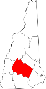 Map of New Hampshire highlighting Merrimack County | |
| Towns | ||
| CDPs | ||
| Other unincorporated communities | ||
| Footnotes | ‡This populated place also has portions in an adjacent county or counties | |
| Authority control |
|
|---|