Alexandria, New Hampshire
Alexandria is a town in Grafton County, New Hampshire, United States. The population was 1,613 at the 2010 census.[1] Newfound Lake is in the northeast corner, with Wellington State Park on the western shore. The town is home to Welton Falls State Forest. Cardigan Mountain State Park, with Mount Cardigan, is in the west. Another attraction is Mowglis Mountain, named for Rudyard Kipling's Jungle Book hero.
Alexandria, New Hampshire | |
|---|---|
Town | |
 Town hall | |
 Location in Grafton County, New Hampshire | |
| Coordinates: 43°36′41″N 71°47′34″W | |
| Country | United States |
| State | New Hampshire |
| County | Grafton |
| Incorporated | 1782 |
| Government | |
| • Board of Selectmen | George Tuthill, Chair Robert Piehler Chet Caron |
| Area | |
| • Total | 43.1 sq mi (111.6 km2) |
| • Land | 43.0 sq mi (111.4 km2) |
| • Water | 0.1 sq mi (0.3 km2) 0.23% |
| Elevation | 623 ft (190 m) |
| Population (2010) | |
| • Total | 1,613 |
| • Density | 37/sq mi (14/km2) |
| Time zone | UTC-5 (Eastern) |
| • Summer (DST) | UTC-4 (Eastern) |
| ZIP code | 03222 |
| Area code(s) | 603 |
| FIPS code | 33-00580 |
| GNIS feature ID | 0873527 |
| Website | www |
History
Granted in 1753 by the Masonian Proprietors, the town was named for Alexandria, Virginia, location of a 1755 conference of governors early in the French and Indian War. Alexandria was granted to Joseph Butterfield and others, 13 March 1757.[2] First settled in 1769 by John Moore Corliss and his brother Jonathan, it was incorporated by the General Court on 23 November 1782.[2] Danbury was set off and incorporated in 1795.
Although farmers found parts of the terrain mountainous, other parts were level intervale suited for cultivation. By 1859, when the population was 1,273, agriculture was a chief occupation. The town also had a carriage maker, nine sawmills and three gristmills.[3]
Alexandria was the birthplace of Luther C. Ladd (1843–1861), the first enlisted soldier to lose his life in the Civil War, shot during the Baltimore Riot. Today, the town is home to Cardigan Lodge, the Appalachian Mountain Club facility at the base of Mount Cardigan.
Geography

According to the United States Census Bureau, the town has a total area of 43.1 square miles (112 km2), of which 43.0 sq mi (111 km2) is land and 0.1 sq mi (0.26 km2) is water, comprising 0.23% of the town. Alexandria is drained by the Fowler River. Mount Cardigan, elevation 3,121 feet (951 m), is on the western boundary of the town. The summit is in the town of Orange, while the highest point in Alexandria is on the Firescrew ridge to the north, where the elevation reaches 3,040 ft (930 m). Alexandria lies fully within the Merrimack River watershed.[4]
Demographics
| Historical population | |||
|---|---|---|---|
| Census | Pop. | %± | |
| 1790 | 298 | — | |
| 1800 | 303 | 1.7% | |
| 1810 | 409 | 35.0% | |
| 1820 | 707 | 72.9% | |
| 1830 | 1,083 | 53.2% | |
| 1840 | 1,284 | 18.6% | |
| 1850 | 1,273 | −0.9% | |
| 1860 | 1,253 | −1.6% | |
| 1870 | 876 | −30.1% | |
| 1880 | 828 | −5.5% | |
| 1890 | 679 | −18.0% | |
| 1900 | 630 | −7.2% | |
| 1910 | 571 | −9.4% | |
| 1920 | 502 | −12.1% | |
| 1930 | 412 | −17.9% | |
| 1940 | 396 | −3.9% | |
| 1950 | 402 | 1.5% | |
| 1960 | 370 | −8.0% | |
| 1970 | 466 | 25.9% | |
| 1980 | 706 | 51.5% | |
| 1990 | 1,190 | 68.6% | |
| 2000 | 1,329 | 11.7% | |
| 2010 | 1,613 | 21.4% | |
| Est. 2017 | 1,611 | [5] | −0.1% |
| U.S. Decennial Census[6] | |||
As of the census[7] of 2000, there were 1,329 people, 504 households, and 386 families residing in the town. The population density was 30.9 people per square mile (11.9/km²). There were 783 housing units at an average density of 18.2 per square mile (7.0/km²). The racial makeup of the town was 97.82% White, 0.08% African American, 0.30% Native American, 0.38% Asian, and 1.43% from two or more races. Hispanic or Latino of any race were 0.23% of the population.
There were 504 households, out of which 31.5% had children under the age of 18 living with them, 64.7% were married couples living together, 7.5% had a female householder with no husband present, and 23.4% were non-families. 16.9% of all households were made up of individuals, and 6.0% had someone living alone who was 65 years of age or older. The average household size was 2.64 and the average family size was 2.94.
In the town, the population was spread out, with 25.0% under the age of 18, 4.7% from 18 to 24, 31.0% from 25 to 44, 28.0% from 45 to 64, and 11.3% who were 65 years of age or older. The median age was 40 years. For every 100 females, there were 99.3 males. For every 100 females age 18 and over, there were 99.8 males.
The median income for a household in the town was $42,667, and the median income for a family was $45,938. Males had a median income of $31,367 versus $25,163 for females. The per capita income for the town was $19,323. About 4.7% of families and 6.3% of the population were below the poverty line, including 9.0% of those under age 18 and none of those age 65 or over.
Education
It is within the Newfound Area School District.[8] The district's secondary schools are Newfound Memorial Middle School, and Newfound Regional High School in Bristol.
References
- United States Census Bureau, American FactFinder, 2010 Census figures. Retrieved March 23, 2011.
- http://gedcomindex.com/Reference/New_Hampshire_1875/049.html Statistics and Gazetteer of New-Hampshire (1875)
- Coolidge, Austin J.; John B. Mansfield (1859). A History and Description of New England. Boston, Massachusetts: A.J. Coolidge. p. 407.
coolidge mansfield history description new england 1859.
- Foster, Debra H.; Batorfalvy, Tatianna N.; Medalie, Laura (1995). Water Use in New Hampshire: An Activities Guide for Teachers. U.S. Department of the Interior and U.S. Geological Survey.
- "Annual Estimates of the Resident Population: April 1, 2010 to July 1, 2017 (PEPANNRES): Minor Civil Divisions – New Hampshire". Archived from the original on February 13, 2020. Retrieved November 14, 2018.
- "Census of Population and Housing". Census.gov. Retrieved June 4, 2016.
- "U.S. Census website". United States Census Bureau. Retrieved 2008-01-31.
- "Central Office". Newfound Area School District. Retrieved 2020-04-11.
External links
- Town of Alexandria official website
- Haynes Memorial Library
- Alexandria Ledge Climbers Snowmobile Club
- New Hampshire Economic and Labor Market Information Bureau Profile
Places adjacent to Alexandria, New Hampshire | |
|---|---|
Municipalities and communities of Grafton County, New Hampshire, United States | ||
|---|---|---|
| City | 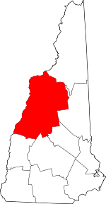 Map of New Hampshire highlighting Grafton County | |
| Towns |
| |
| Township | ||
| CDPs | ||
| Other villages | ||