N403 highway (Philippines)
The National Route 403 (N403) forms part of the Philippine highway network. It runs through central Cavite.[1][2] It connects the city of Trece Martires to the municipality of Naic.
| ||||
|---|---|---|---|---|
| Governor's Drive Trece Martires–Naic Road | ||||
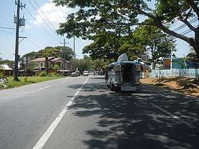 N403 and its reasurrance sign in Trece Martires | ||||
| Route information | ||||
| Maintained by Department of Public Works and Highways (DPWH) - Cavite 1st District Engineering Office & Cavite 2nd District Engineering Office | ||||
| Length | 12.55 km (7.80 mi) | |||
| Major junctions | ||||
| East end | ||||
| West end | ||||
| Location | ||||
| Provinces | Cavite | |||
| Major cities | Trece Martires | |||
| Towns | Naic, Tanza | |||
| Highway system | ||||
| ||||
.svg.png)
Route description
The segment of Governor's Drive from its intersection with N64 (Tanza–Trece Martires Road) and N404 (Trece Martires–Indang Road) in the city proper of Trece Martires to its intersection with N402 (Antero Soriano Highway and Sabang Road) in the town proper of Naic form N403. It also passes through the municipality of Tanza in between.
Intersections
The entire route is located in Cavite. Intersections are numbered by kilometer posts, with Rizal Park in Manila designated as kilometer zero. The kilometer count is discontinuous.
| City/Municipality | km[3] | mi | Destinations | Notes | |
|---|---|---|---|---|---|
| Trece Martires | 44.320 | 27.539 | Continues east as N65 | ||
| 45.000 | 27.962 | Route 403 reassurance sign | |||
| 45.647 | 28.364 | Puting Tubig Bridge | |||
| 46.047 | 28.612 | Pasong Balite Bridge | |||
| 47.016 | 29.214 | Vaquero Bridge | |||
| Tanza | No major intersections | ||||
| Tanza–Naic boundary | 44.301 | 27.527 | Cavite 1st District Engineering Office–Cavite 2nd District Engineering Office highway boundary | ||
| Naic | 45.947 | 28.550 | Governor's Drive changes to unnumbered highway, while road physically continues west as N402 (Sabang Road). Kilometre number reverses. | ||
1.000 mi = 1.609 km; 1.000 km = 0.621 mi
| |||||
References
- "Cavite 1st". www.dpwh.gov.ph. Retrieved January 9, 2018.
- "Cavite 2nd". www.dpwh.gov.ph. Retrieved January 9, 2018.
- "Road and Bridge Inventory". www.dpwh.gov.ph. Retrieved January 20, 2018.
External links
| National primary roads |
| |||||||
|---|---|---|---|---|---|---|---|---|
| National secondary roads |
| |||||||
See also: Philippine expressway network | ||||||||
| Expressways |
| ||||||||
|---|---|---|---|---|---|---|---|---|---|
| National roads |
| ||||||||
| Arterial Routes |
| ||||||||
This article is issued from Wikipedia. The text is licensed under Creative Commons - Attribution - Sharealike. Additional terms may apply for the media files.