Zala (village)
| Zala | |||
|---|---|---|---|
| Village | |||
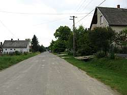 A street in Zala | |||
| |||
 Zala Location of Zala (village) | |||
| Coordinates: 46°44′26″N 18°00′07″E / 46.74042°N 18.00197°ECoordinates: 46°44′26″N 18°00′07″E / 46.74042°N 18.00197°E | |||
| Country |
| ||
| Region | Southern Transdanubia | ||
| County | Somogy | ||
| District | Tab | ||
| RC Diocese | Kaposvár | ||
| Area | |||
| • Total | 9.24 km2 (3.57 sq mi) | ||
| Population (2017) | |||
| • Total | 243[1] | ||
| Demonym(s) | zalai | ||
| Time zone | UTC+1 (CET) | ||
| • Summer (DST) | UTC+2 (CEST) | ||
| Postal code | 8660 | ||
| Area code(s) | (+36) 84 | ||
| NUTS 3 code | HU232 | ||
| MP | Mihály Witzmann (Fidesz) | ||
| Website | Zala Online | ||

Zala is a village in Somogy County, Hungary.
External links
| Wikimedia Commons has media related to Zala (village). |
References
| Town (1) |
| |
|---|---|---|
| Villages (23) | ||


This article is issued from
Wikipedia.
The text is licensed under Creative Commons - Attribution - Sharealike.
Additional terms may apply for the media files.