Balatonkeresztúr
| Balatonkeresztúr | |||
|---|---|---|---|
| Village | |||
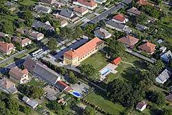 Aerial view of Balatonkeresztúr | |||
| |||
 Balatonkeresztúr Location of Balatonkeresztúr | |||
| Coordinates: 46°41′44″N 17°22′18″E / 46.69559°N 17.37154°ECoordinates: 46°41′44″N 17°22′18″E / 46.69559°N 17.37154°E | |||
| Country |
| ||
| Region | Southern Transdanubia | ||
| County | Somogy | ||
| District | Marcali | ||
| RC Diocese | Kaposvár | ||
| Area | |||
| • Total | 21.06 km2 (8.13 sq mi) | ||
| Population (2017) | |||
| • Total | 1,492[1] | ||
| Demonym(s) | keresztúri, balatonkeresztúri | ||
| Time zone | UTC+1 (CET) | ||
| • Summer (DST) | UTC+2 (CEST) | ||
| Postal code | 8648 | ||
| Area code(s) | (+36) 85 | ||
| Motorways | M7 | ||
| Distance from Budapest | 167 km (104 mi) Northeast | ||
| NUTS 3 code | HU232 | ||
| MP | József Attila Móring (KDNP) | ||
| Website | Balatonkeresztúr Online | ||

Etymology
According to the local tradition the name comes from the crossing of roads (Hungarian: kereszteződés, keresztezés). However the well accepted theory states that like many other villages in Somogy County got their names after the patron of their church. So in that case it was Szent Kereszt (English: Holy Cross).[2]
History
According to László Szita the settlement was completely Hungarian in the 18th century.[3]
Culture
The Hungarian folk song Szép a huszár, ha felül a lovára was collected in 1923 in Balatonkeresztúr by Lajos Bárdos.
External links
References
Balatonkeresztúr's neighbours | ||||||||||
|---|---|---|---|---|---|---|---|---|---|---|
| ||||||||||


This article is issued from
Wikipedia.
The text is licensed under Creative Commons - Attribution - Sharealike.
Additional terms may apply for the media files.