Mesztegnyő
| Mesztegnyő | |||
|---|---|---|---|
| Village | |||
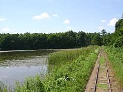 Fish pond next to the railway | |||
| |||
 Mesztegnyő Location of Mesztegnyő | |||
| Coordinates: 46°29′54″N 17°25′31″E / 46.49821°N 17.42526°ECoordinates: 46°29′54″N 17°25′31″E / 46.49821°N 17.42526°E | |||
| Country |
| ||
| Region | Southern Transdanubia | ||
| County | Somogy | ||
| District | Marcali | ||
| RC Diocese | Kaposvár | ||
| Area | |||
| • Total | 44.71 km2 (17.26 sq mi) | ||
| Population (2017) | |||
| • Total | 1,349[1] | ||
| Demonym(s) | mesztegnyői | ||
| Time zone | UTC+1 (CET) | ||
| • Summer (DST) | UTC+2 (CEST) | ||
| Postal code | 8716 | ||
| Area code(s) | (+36) 85 | ||
| NUTS 3 code | HU232 | ||
| MP | József Attila Móring (KDNP) | ||
| Website | Mesztegnyő Online | ||

External links
- Street map (in Hungarian)
References


This article is issued from
Wikipedia.
The text is licensed under Creative Commons - Attribution - Sharealike.
Additional terms may apply for the media files.