Őrtilos
| Őrtilos Tiluš / Tiloš (in Croatian) | |||
|---|---|---|---|
| Village | |||
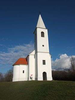 Church of Szentmihályhegy in Őrtilos | |||
| |||
 Őrtilos Location of Őrtilos | |||
| Coordinates: 46°16′59″N 16°55′27″E / 46.28318°N 16.92409°ECoordinates: 46°16′59″N 16°55′27″E / 46.28318°N 16.92409°E | |||
| Country |
| ||
| Region | Southern Transdanubia | ||
| County | Somogy | ||
| District | Csurgó | ||
| RC Diocese | Kaposvár | ||
| Area | |||
| • Total | 21.12 km2 (8.15 sq mi) | ||
| Population (2017) | |||
| • Total | 431[1] | ||
| Demonym(s) | őrtilosi | ||
| Time zone | UTC+1 (CET) | ||
| • Summer (DST) | UTC+2 (CEST) | ||
| Postal code | 8854 | ||
| Area code(s) | (+36) 82 | ||
| NUTS 3 code | HU232 | ||
| MP | László Szászfalvi (KDNP) | ||
| Website | Őrtilos Online | ||

Őrtilos (Croatian: Tiluš / Tiloš) is the westernmost village of Somogy county, Hungary.
Etymology
Its former name was Őr (English: guard). The tilos (English: not allowed, forbidden, banned) came in the 19th century into the name.[2]
External links
References
| Town (1) |
| |
|---|---|---|
| Large village (1) | ||
| Villages (16) | ||


This article is issued from
Wikipedia.
The text is licensed under Creative Commons - Attribution - Sharealike.
Additional terms may apply for the media files.