Wang'an, Penghu
| Wang-an 望安 八罩 | |
|---|---|
| Rural township | |
| Wang-an Township · 望安鄉 | |
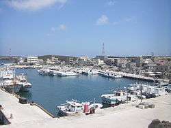 Jiangjyun Village, Wang-an | |
 | |
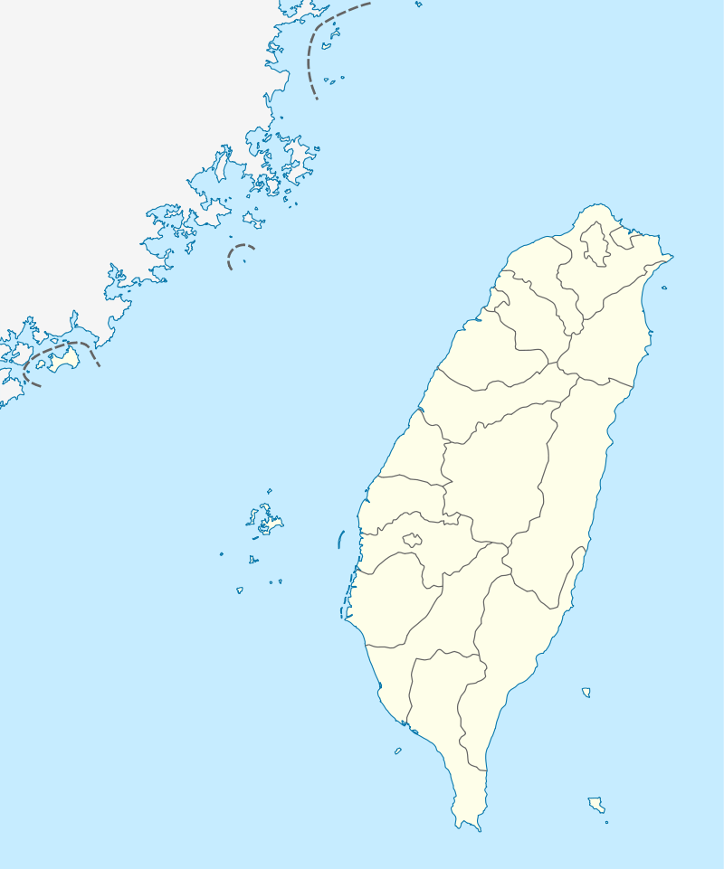 Wang-an Location in the Republic of China | |
| Coordinates: 23°21′25.4″N 119°30′1.2″E / 23.357056°N 119.500333°ECoordinates: 23°21′25.4″N 119°30′1.2″E / 23.357056°N 119.500333°E | |
| Country | Republic of China |
| Region | Taiwan Strait |
| Area | |
| • Total | 13.7824 km2 (5.3214 sq mi) |
| Population (December 2014) | |
| • Total | 5,117 |
| • Density | 370/km2 (960/sq mi) |
| Website | www.wangan.gov.tw |
| Wang'an, Penghu | |||||||
| Traditional Chinese | 望安 | ||||||
|---|---|---|---|---|---|---|---|
| |||||||
Wang-an Township (Chinese: 望安鄉; pinyin: Wàng'ān Xiāng) is a rural township in Penghu County, Taiwan. It is the second smallest township after Qimei Township in Penghu County.
Name
The island was originally known as Bazhao.[1]
Geography
It is located at the southern sea of Penghu. There are nineteen islets with nine villages on six of islets. Four village on the main island while others are on their own islet.
Geology
The northern side of the island has a higher average elevation than the southern side. It consists of wave-cut platforms along its coastline.
Administrative divisions
- Tungan Village
- Xian Village
- Zhongshe Village
- Shuian Village
- Jiangjun Village
- Tungji Village
- Tungping Village
- Xiping Village
- Huayu Village
Tourist attractions
- Budai Port
- Jiangjyun Island
- Jongshe Historic House
- Mao Islet
- Mount Tiantai
- Wangan Green Turtle Tourism and Conservation Center
- Yuanyang Caves
Transportation
Air

The township is served by Wang-an Airport.
Water
The township houses the Tanmen Port.
See also
| Wikimedia Commons has media related to Wang'an Township, Penghu County. |
References
- ↑ "Wangan Island". Penghu Tour Web Site. Retrieved 16 April 2018.
External links
| Kaohsiung |  | |
|---|---|---|
| Kinmen | ||
| Lienchiang1 | ||
| Penghu | ||
| Pingtung | ||
| Taitung | ||
| Yilan | ||
1 Lienchiang County commonly known as Matsu. 2Diaoyutai Islands are controlled by Japan, (called Senkaku Islands). 3Seat of the outlying islands' counties | ||
This article is issued from
Wikipedia.
The text is licensed under Creative Commons - Attribution - Sharealike.
Additional terms may apply for the media files.