Shizi, Pingtung
| Shizi Township 獅子鄉 | |
|---|---|
| Mountain indigenous township | |
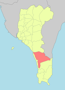 Shizi Township in Pingtung County | |
| Location | Pingtung County, Taiwan |
| Area | |
| • Total | 301 km2 (116 sq mi) |
| Population (July 2018) | |
| • Total | 5,008 |
| • Density | 17/km2 (43/sq mi) |
| Shizi Township |
Shizi Township[1] is a mountain indigenous township in Pingtung County, Taiwan. It is the largest township of the county. The main population is the Paiwan people of the Taiwanese aborigines.
Names
The original Paiwan name for the area was Tjakuvukuvulj (Tjakuvukuvuɬ; historically rendered as Chaobo Obol or in Chinese: 腳歐伯伯). Han Chinese settlers noted a rock outcropping in the shape of a lion's head (Chinese: 獅仔頭山; Pe̍h-ōe-jī: Sai-á-thâu-soaⁿ; literally: "lion-head mountain") and called the village Sai-a-thau-sia (獅仔頭社; Sai-á-thâu-siā; "lion-head village").
Under Kuomintang rule, the name was changed to the current Shizi, though in Taiwanese Hokkien the name Sai-a-thau is still normally used in spoken contexts.[2]
Geography
The terrain of Shizi is mountainous, as the district is located near Taiwan's Central Mountain Range.
Administrative divisions
The township comprises eight villages:
- Caopu (Chinese: 草埔; pinyin: Cǎobù; Pe̍h-ōe-jī: Chháu-po) (Paiwan: Supaw)
- Danlu (丹路; Dānlù; Tan-lō) (Paiwan: Tjakuljakuljai)
- Fenglin (楓林; Fēnglín; Png-lîm)(Paiwan: Kaidi/Naimalipa)
- Nanshi (南世; Nánshì; Lâm-sè) (Paiwan: Nansiku/Tjuladu)
- Neishi (內獅; Nèishī; Lāi-sai) (Paiwan: Kacedas)
- Neiwen (內文; Nèiwén; Lāi-bûn) (Paiwan: Naibun/Tjakuvukuvulj)
- Shizi (獅子; Shīzi; Sai-chú) (Paiwan: Tjaqaciljai)
- Zhukeng (竹坑; Zhúkēng; Tek-kheⁿ) (Paiwan: Tjuruguai)
Economy
Agriculture
Agriculture produce in the township includes mango, bird's-nest fern and watermelon.
Tourist attractions
Places of interest in or around Shizi are Shuangliu Forest Recreation Area, the Cultural Objects Museum, Lilongshan and Neiwen Village.
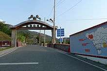
Transportation
Shizi is connected via railway through the TRA South-Link Line. Important stations is Fangshan Station. There are also two highways: Provincial Highway No.1 and Provincial Highway No.9 (South-Link Highway).
References
- ↑ 臺灣地區鄉鎮市區級以上行政區域名稱中英對照表 Archived 2012-03-25 at the Wayback Machine. Glossary of Names for Administrative Divisions. (in Chinese) Accessed at Taiwan Geographic Names Information System website Archived 2013-08-16 at the Wayback Machine. (in English). Ministry of the Interior. 16 June 2011. Retrieved 5 January 2015.
- ↑ 吳秀麗 (1994). 商用台語. Independence Evening Post (in Chinese). Taipei. p. 145. ISBN 9789575963149.
External links
| Wikimedia Commons has media related to Shizi Township, Pingtung County. |
- Shizi Township Office website (in Taiwanese Mandarin)
Cities and townships of Pingtung County | ||
|---|---|---|
| Cities | 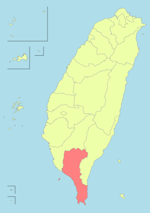 | |
| Urban townships | ||
| Rural townships | ||
| Mountain indigenous townships | ||
| Highland aboriginal Townships and Districts |
|  | ||||||||||||||||||||||||
|---|---|---|---|---|---|---|---|---|---|---|---|---|---|---|---|---|---|---|---|---|---|---|---|---|---|---|
| Plains aboriginal Townships and County-Controlled Cities |
| |||||||||||||||||||||||||
Note: On the map, "Highland aboriginal areas" are in green, and "Plains aboriginal areas" are in tan. | ||||||||||||||||||||||||||
Coordinates: 22°12′06″N 120°42′19″E / 22.2018°N 120.7054°E