Dounan, Yunlin
Coordinates: 23°41′N 120°29′E / 23.683°N 120.483°E
| Dounan Township 斗南鎮 | |
|---|---|
| Urban township | |
 | |
 Dounan Township in Yunlin County | |
| Location | Yunlin County, Taiwan |
| Government | |
| • Mayor | Huang Fu-chung |
| Area | |
| • Total | 48 km2 (19 sq mi) |
| Population (July 2018) | |
| • Total | 44,730 |
| • Density | 930/km2 (2,400/sq mi) |
| Website | www.dounan.gov.tw |
Dounan Township (Chinese: 斗南鎮; pinyin: Dòunán Zhèn) is an urban township in Yunlin County, Taiwan.
History
The original name of Dounan is Taliwu (他里霧), which is named after one of the branches of an aboriginal tribe.[1] The development of Taliwu had started since the Ming Dynasty, when Koxinga came to Taiwan. It is the first place explored by the Han Chinese in the Yunlin area. During the Japanese rule period, Taliwu was rebuilt as an administrative division under the governance of Huwei and renamed to Dounan in 1920. In 1946, it became an independent township.
Geography
Dounan is located on a plain with flat terrain. The elevation of the township is 33 meters above sea level and it inclines from east to west.[2]
Administrative divisions
Tungren, Xiqi, Nanchang, Beiming, Zhongtian, Linzi, Shigui, Shixi, Jingxing, Xinnan, Adan, Jiangjun, Jiushe, Mingchang, Datung, Beima, Xiba, Xinlun, Tungming, Xinguang, Tiantou and Xiaotung Village.
Economy
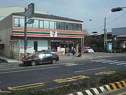
Most of the land use in Dounan is for agriculture, which makes up about 10.4 km2. The majority of the business in the township is low-level service, in which most of them are retail stores.
Tourist attractions
- Dounan Stadium
- Yunlin County Stadium
Transportation
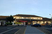
Dounan is the transport center for Yunlin County.
- National Highway No. 1 Dounan Interchange (斗南交流道)
- Taiwan Railway Administration
| Wikimedia Commons has media related to Dounan Township, Yunlin County. |
References
- ↑ History of Dounan, Learning Fueling Station
- ↑ "Dounan Township Office-Geological Environment".
Cities and townships of Yunlin County | ||
|---|---|---|
| Cities | 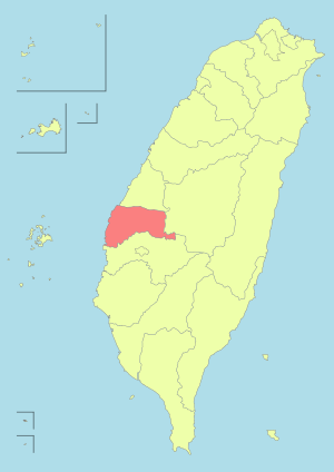 | |
| Urban townships | ||
| Rural townships | ||