Emei, Hsinchu
Coordinates: 24°40′44″N 121°0′0″E / 24.67889°N 121.00000°E
| Emei Township 峨眉鄉 | |
|---|---|
| Rural township | |
 | |
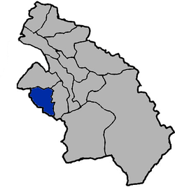 Emei Township in Hsinchu County | |
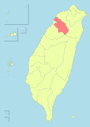
| Location | Hsinchu County, Taiwan |
| Area | |
| • Total | 47 km2 (18 sq mi) |
| Population (July 2018) | |
| • Total | 5,645 |
| • Density | 120/km2 (310/sq mi) |
Emei Township (Chinese: 峨眉鄉; pinyin: Éméi Xiāng) is a rural township in Hsinchu County, Taiwan.
History
Emei Township was originally named Goeh-bai (Chinese: 月眉; Pe̍h-ōe-jī: Goe̍h-bâi), taking the name from the curved crescent moon shape of the Emei Stream (峨眉溪). In 1904, during Japanese rule, the township was renamed to Gabi (峨眉), which is retained as the present Emei.
Geography
Administrative divisions
- Emei Village
- Zhongcheng Village
- Shijing Village
- Qixing Village
- Fuxing Village
- Huguang Village
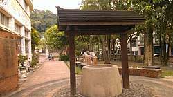
Tourist attractions
- Emei Lake
- Erliao Divien Tree
- Fuxing Old Street
- Mount Shitou
- Qixing Camphor Tree
- Qixing Tree
- Shierliao Leisure Agricultural Region
- Xi Mao Bu Hanging Bridge
Notable natives
- Chiu Ching-chun, Magistrate of Hsinchu County
References
- ↑ "Emei Township Administration Office". Hcomt.gov.tw. 2013-09-03. Retrieved 2014-05-18.
- ↑ 106年1月 新竹縣人口統計報表 [Hsinchu County population table, January 2017]. hsinchu.gov.tw (in Chinese). Hsinchu County Gov't. Retrieved 2017-02-14.
External links
| Wikimedia Commons has media related to Emei Township, Hsinchu County. |
This article is issued from
Wikipedia.
The text is licensed under Creative Commons - Attribution - Sharealike.
Additional terms may apply for the media files.