Hindupur
| Hindupur | |
|---|---|
| City | |
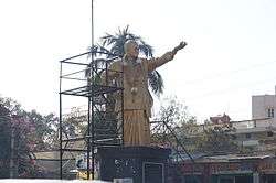 NT Rama Rao statue at Hindupur | |
 Hindupur Location in Andhra Pradesh, India | |
| Coordinates: 13°49′48″N 77°29′24″E / 13.8300°N 77.4900°ECoordinates: 13°49′48″N 77°29′24″E / 13.8300°N 77.4900°E | |
| Country | India |
| State | Andhra Pradesh |
| District | Anantapur |
| Government | |
| • Type | Municipal council |
| • Body | Hindupur Municipality |
| Area[1] | |
| • Total | 38.16 km2 (14.73 sq mi) |
| Area rank | 20th |
| Elevation | 621 m (2,037 ft) |
| Population (2011)[2] | |
| • Total | 151,677 |
| • Rank |
203rd (India) 20th (in state) |
| • Density | 4,000/km2 (10,000/sq mi) |
| Languages | |
| • Official | Telugu |
| Time zone | UTC5:30 (IST) |
| PIN | 515201 |
| Telephone code | 91–8556 |
| Vehicle registration | AP–02 |
| Website |
hindupur |
Hindupur is a town in Anantapur district of the Indian state of Andhra Pradesh. It is the headquarters of Hindupur mandal in Hindupur revenue division.[3][2]
Hindupur Municipality is Special Grade largest ULB in the Anantapur district of A.P it is spread over an area of 38.16 km2 with a population of 151835 (2011 census). The town is prosperous both commercially and industrially. The Hindupur Town is an important Pilgrim place of Sri Ranganath Swamy Temple and near by Lepakshi temple thousand of pilgrims will be visiting for darsanam. The town is connected with railway facilities having railway station situated in banglore- dharmavaram junction under south central railway. Location It is located 625 km from the capital city and 98 km from the district Headquarters. It is established as a 3rd Grade Municipality in the year 1920. The Municipal Town is divided into 30 Revenue Wards and 38 Election Wards.Penukonda-Hindupur stretch can become a counter magnet for pharmaceutical,automobile,IT, tourism industry as it is geographically centre to south India and proximity to Bengaluru
Topography
Geographically it is situated at an latitude of 130 50’ and longitude of 770 30’. The average elevation in Hindupur is about 2000 ft above sea level.
Climate and Rainfall
Hindupur Town, in general, has tropical climate, winters last from November to February, while summer last from March to June. Even in summer season the town experiences lower temperatures compared to rest of the state due to its high elevation. The annual rainfall is 551mm, most of it received during the months of July to August.
Geography
Hindupur is located at 13°50′N 77°29′E / 13.83°N 77.49°E on the banks of Penna River.[4] It has an average elevation of 2,037 feet (621 metres).
Demographics
As of 2011 census of India, the city had a population of 151,677. It had a growth of about 25 thousands compared to the last census in 2001, where it stands at 125,074.[5] The present total population constitute, 76,625 males and 75,210 females —a sex ratio of 982 females per 1000 males, higher than the national average of 940 per 1000.[6] 16,309 children are in the age group of 0–6 years, of which 8,263 are boys and 8,046 are girls. The average literacy rate stands at 76.40% with 103,538 literates, significantly higher than the state average of 67.41%.[2][7] Telugu is the official language and spoken language.
Economy
Hindupur is a prominent and renowned commercial centre in Anantapur District and the Rayalaseema Region. Cloth Business, Mundy Business are the most important businesses here along with the products, Jaggery, Tamarind, Chillies, Ground nuts and pulses. Besides, these, procuring Mulberry cocoons, production of silk threads, silk sarees is gaining momentum as one of the important commercial activity. Recently, some foreign teams from Switzerland and other countries and a team from World Bank visited Muddireddipally area of Hindupur town, where the manufacture of silk sarees is flourishing as a cottage industry and then explored the possibilities to develop the foreign trade of silk sarees and fabrics.
In the realm of Industries also Hindupur is in the process of development. The three efficiently managed Spinning Mills in the private sector are the Kirikera Food Products Ltd, a host of other industrial units in Thumakunta and Industrial Development area, which is 8 km southwards from Hindupur town on both sides of Hindupur Bangalore Highway. The Industrial estate in the Sugur Sadlapalli, and various other medium small & tiny industries and factories are coming up. These industrial units and already existing units such as starch factory, Oil Mills, Beedi and Match Factories, Agarbathi units and various cottage industries have been successful in creating an industrial atmosphere in the town. Hindupur town serves as an outlet for marketing the agricultural and industrial products of the hinterland, which comprises about 80 villages.
The Topographical features greatly influence the quantum of rainfall of any given region in the Monsoon tropics. Hindupur is no exception to the universal dictum. Situated far away from the eastern coast on the one hand, and effectively isolated by the Western Ghats on the other, Hindupur stands to double disadvantage of not receiving either of the monsoons in full. Hindupur receives the bulk of its rainfall between August and October. The annual average rainfall approximates to 55 cm. Rainfall here is not only inadequate but also uncertain and is widely fluctuating from year to year. Failure of monsoons in any year is bound to result in shortage of drinking water, not to speak of agricultural requirements. A good harvest and man’s prosperity and well being depend largely upon the quantum of rainfall with an eye on the sky, the farmer places his hands on the plough here. So much has been the dependence of the people on the monsoon for raising crops. There is no other single group of weather phenomena, which is so far reaching in its effects on man’s economic life, as the rain fall in this region.
Environmental Issues
The Rainfall is sparse and spasmodic. Borewells provide the ray of hope for drinking water purposes. Though there are rivers like Penna and Kumudwathi, they remain dry throughout the year. There are no perennial rivers in the vicinity of Hindupur which results in excess dependence on underground water. Over exploitation of ground water and indiscriminate drilling of bores for the past few years has caused depletion of the ground water table and drying of bore wells in most cases. The poor, despite their low income, are left with no other option, but to purchase two or three pots for drinking purposes, or drink the same ground water with salinity and other impurities. Urban Poor There are 53 poor settlements both notified and un-notified. Of the total population of the town of 1,51,835, the population in the Notified Poor Settlements is 137560 constituting 60% of total population of town as per 2011 census. This shows that most of the poor people are living in the slums. The poorest of the poor live in a state or utter dependency as casual labour and petty artisans, struggling to make both ends meet, barely surviving on the margin of life, sunk neck-deep in the whirlpool of poverty. As a result of low rainfall and recurring droughts, depletion of underground water table and lack of irrigation, poor people living in the surrounding villages migrate to the town in search of a better life. This exodus of poor from villages surround the town in search of better livelihood opportunities resulting in a continuous extension of existing poor settlements and creation of new settlements of the poor. Many poor people inhabit village poramboke sites or farmer villages on the outskirts of the town. The merger of six panchayats in the Municipality and migration of poor people from the surrounding villages in search of some sort of livelihood contributed to the emergence of large number of poor settlements without any basic civic amenities and services, like shelter, drainage, water supply, health, education and livelihood.
Historical & Culture
Hindupur, a renowned business centre in Rayalaseema, in situated in close proximitly to internationally renowned "Lepakshi", a veritable treasure-house an art and sculpture and "Puttaparthi" an adobe of spiritual splendor of a great soul Sri Satya Sai Baba. It appears that the town was at first found by one Sri Hindu Rao,Maratha ruler of Gooty by which name Siddhoji, the father of Morarji Rao of Gooty was known and thus it is names after him. The Hindupur Municipal town is the southernmost Mandal headquarters of the southwestern ceded district, Anantapur, Andhra Pradesh, bordering Karnataka. It was constituted as Municipality in the year 1920 and was upgraded as Special Grade Municipality in 1989. The extent of the town is 38.16 km2 (2637.34 acres) and the population as per 1991 census was 1,04,651 (at present as per 2001 census 1,25,056) Six panchayats (Mothukapalli, Sadlapalli, Kollakunta, Melapuram, Muddireddypalli, and Singireddy palli) were merged into this town in 1987. The town comprises 30 Revenue wards and 38 election wards. Geographically it is situated at an latitude of 130 50’ and longitude of 770 30’. The town is surrounded by River Penna and has four irrigation tanks namely Kotnur Tank (Capacity of Tank:81.51 M.Cft, Area:20:90 M Sqft) on northern side, Hindupur Pedda Cheruvu (Capacity of Tank:25.14 M.Cft, Area: 8.98 M sqft) on southern side and Surappakunta (Capacity of Tank: 15.05 M.Cft, Area: 5.02 M Sqft) located centrally and Srikantapuram Tank (Capacity of tank : 21.71 M.Cft, Area:11.43 Sqft) on the eastern side. The elevation of Hindupur town varies from +620 m to 630 m.
Government and politics
Civic administration
Hindupur municipality was formed in the year 1920. It has an extent of 38.16 km2 (14.73 sq mi).[8]
Transport
The Andhra Pradesh State Road Transport Corporation operates bus services from Hindupur bus station.[9] Hindupur railway station is administered under Bangalore division of South Western Railway zone.[10] It is situated on Guntakal-Bangalore section.
Education
The primary and secondary school education is imparted by government, aided and private schools, under the School Education Department of the state. The town also consists of government aided institutions like Government Polytechnic Hindupur and other private and government degree colleges and many private engineering colleges.[11][12] The medium of instruction followed by different schools are English, Telugu. Government school and private schools: Deepti high school DVDBS Chinmaya Vidyalaya, Balayesu vidhyalaya sri balaji vidhya vihar saraswathi vidya mandhir LRG vidhya mandhir Panchajanya high school
See also
References
- ↑ "Basic Information of Municipality". Commissioner and Directorate of Municipal Administration. Government of Andhra Pradesh. Retrieved 25 February 2015.
- 1 2 3 "District Census Handbook – Hindupur" (PDF). Census of India. p. 14,46. Retrieved 18 January 2015.
- ↑ "Anantapur District Mandals" (PDF). Census of India. pp. 429, 440. Retrieved 19 January 2015.
- ↑ "Maps, Weather, and Airports for Hindupur, India". fallingrain.com.
- ↑ "Alphabetical List of Towns and their Population" (PDF). Census of India. Government of India. p. 2. Retrieved 20 August 2015.
- ↑ "Census of India : Provisional Population Totals : India :Census 2011". censusindia.gov.in. The Registrar General & Census Commissioner, India. Retrieved 2 July 2016.
- ↑ "Chapter–3 (Literates and Literacy rate)" (PDF). Registrar General and Census Commissioner of India. Retrieved 1 September 2014.
- ↑ "Hindupur Municipality". Commissioner and Directorate of Municipal Administration. Government of Andhra Pradesh. Retrieved 25 February 2015.
- ↑ "Bus Stations in Districts". Andhra Pradesh State Road Transport Corporation. Archived from the original on 22 March 2016. Retrieved 9 March 2016.
- ↑ "Hindupur railway station info". India Rail Info. Retrieved 30 July 2014.
- ↑ "School Education Department" (PDF). School Education Department, Government of Andhra Pradesh. Archived from the original (PDF) on 27 December 2015. Retrieved 7 November 2016.
- ↑ "The Department of School Education - Official AP State Government Portal | AP State Portal". www.ap.gov.in. Archived from the original on 7 November 2016. Retrieved 7 November 2016.
External links
| Wikimedia Commons has media related to Hindupur. |