Erramala
| Erramala Hills | |
|---|---|
| The Erramalas | |
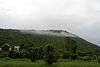
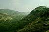
.JPG) The Erramalas during Monsoon | |
| Highest point | |
| Coordinates | 15°12′48″N 77°57′12″E / 15.21333°N 77.95333°ECoordinates: 15°12′48″N 77°57′12″E / 15.21333°N 77.95333°E |
| Geography | |
| Country | India |
| Provinces/States | Andhra Pradesh |
| Geology | |
| Age of rock | Cambrian |
The Erramala (Telugu: ఎఱ్ఱమల) are a range of low hills[1] in southern India, in Kurnool district of Andhra Pradesh state. The Erramala hills lie on the Deccan plateau, running east-west and dividing the basin of the Penner River to the south from the basin of the Krishna River to the north. The Hill range may be extended along the Penner River basin in Kadapa district.
Some Important Visitor Attractions along the Erramala Hills are as follows
- Belum Caves
- Yadiki Caves
- Yaganti
- Gandikota
- Kalva Bugga
- Kolimigundla
- Tadipatri
- Orvakal Rocks
- Kethavaram Rock art site
- Banaganapalli
- Owk
In the east lies the higher Nallamalla Hills.
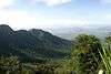
Gallery
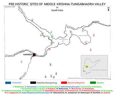 Pre Historic Mid Krishna-Tungabhadra Valley sites are located along the Erramala and Nallamala ranges
.JPG)
References
This article is issued from
Wikipedia.
The text is licensed under Creative Commons - Attribution - Sharealike.
Additional terms may apply for the media files.